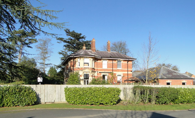
Bobblestock

Settlement in Herefordshire

England

Bobblestock

Canon Pyon Road near Arundel Farm The road runs south to Hereford
Canon Pyon Road near Arundel Farm Credit: Julian P Guffogg

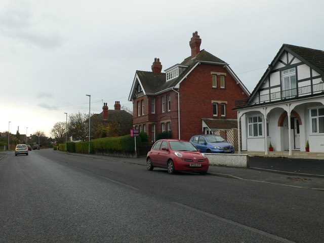
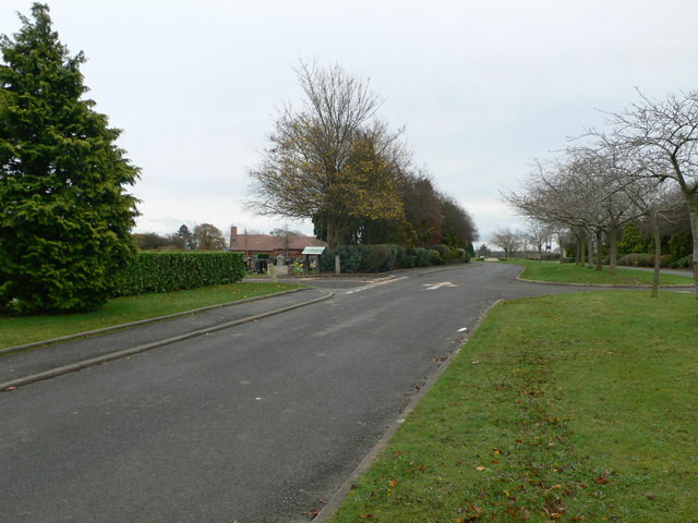
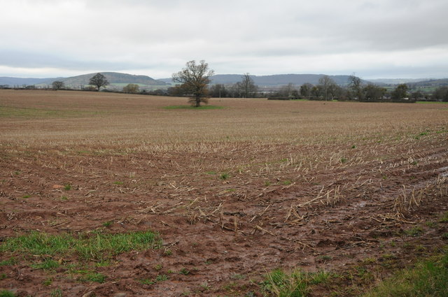
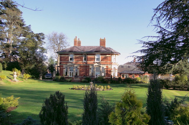
Bobblestock is a small village located in the county of Herefordshire, in the West Midlands region of England. Situated approximately 3 miles north of Hereford city center, it is a rural community surrounded by picturesque countryside and farmland.

The village of Bobblestock is known for its peaceful and tranquil atmosphere, making it an ideal place for those seeking a quiet and idyllic retreat. It is a close-knit community with a friendly and welcoming population.

Despite its small size, Bobblestock offers a range of amenities to its residents. These include a local pub, a primary school, a community center, and a convenience store, ensuring that basic needs are met within the village itself. Additionally, the nearby city of Hereford provides further access to a wider range of services and facilities.

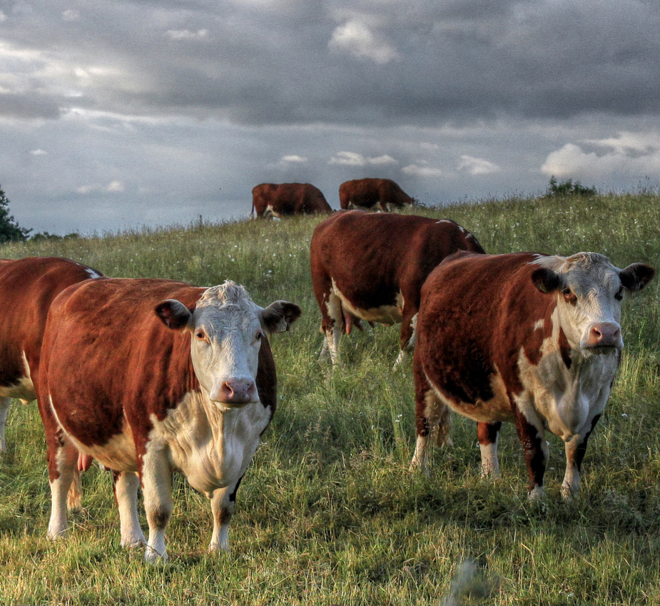
Nature enthusiasts will find Bobblestock particularly appealing, as it is surrounded by beautiful rolling hills, meandering rivers, and lush green fields. The village is also within close proximity to some of Herefordshire's most stunning natural landmarks, such as the Wye Valley Area of Outstanding Natural Beauty and the Malvern Hills.

Bobblestock enjoys excellent transport links, with regular bus services connecting the village to Hereford city center and other nearby towns. The village is also conveniently located near major road networks, including the A49 and A4103, providing easy access to the wider region.

In summary, Bobblestock is a charming village in Herefordshire, offering a peaceful and rural lifestyle, beautiful natural surroundings, and easy access to a range of amenities and services.

If you have any feedback on the listing, please let us know in the comments section below.

Bobblestock Images

Images are sourced within 2km of 52.072694/-2.7420519 or Grid Reference SO4941. Thanks to Geograph Open Source API. All images are credited.

Canon Pyon Road near Arundel Farm The road runs south to Hereford
Canon Pyon Road near Arundel Farm
The road runs south to Hereford
Drive to Arundel Farm
The Three Elms, King's Acre At the junction of Tillington Road and Canon Pyon Road.
The Three Elms, King's Acre
At the junction of Tillington Road and Canon Pyon Road.
Houses on Three Elms Road, Hereford
The road into Hereford Cemetery and Crematorium
Arable land near Lower Breinton Arable land west of Lower Hill Farm, Lower Breinton.
Arable land near Lower Breinton
Arable land west of Lower Hill Farm, Lower Breinton.
Hereford Livestock Market This new purpose built livestock market on Roman Road just outside Hereford opened in June 2011 replacing the city centre market.  The site of the old market is to be redeveloped.
Hereford Livestock Market
This new purpose built livestock market on Roman Road just outside Hereford opened in June 2011 replacing the city centre market. The site of the old market is to be redeveloped.
Hereford Livestock Market The new Hereford Livestock Market is located off Roman Road on the outskirts of the city of Hereford; it opened in June 2011, replacing the former city centre livestock market.
Hereford Livestock Market
The new Hereford Livestock Market is located off Roman Road on the outskirts of the city of Hereford; it opened in June 2011, replacing the former city centre livestock market.
Sale ring, Hereford Livestock Market The sale ring at the new Hereford Livestock Market which opened in June 2011, replacing the city centre market.
Sale ring, Hereford Livestock Market
The sale ring at the new Hereford Livestock Market which opened in June 2011, replacing the city centre market.
Sheep pens, Hereford Livestock Market Suffolk ewes in a pen at Hereford Livestock Market, this new market opened in June 2011 replacing the former city centre market.
Sheep pens, Hereford Livestock Market
Suffolk ewes in a pen at Hereford Livestock Market, this new market opened in June 2011 replacing the former city centre market.
Sheep sales, Hereford Livestock Market Sheep being auctioned at Hereford Livestock market.  This is the new market which replaced the old city centre site in June 2011.
Sheep sales, Hereford Livestock Market
Sheep being auctioned at Hereford Livestock market. This is the new market which replaced the old city centre site in June 2011.
Hereford Livestock Market Pens in the new Hereford Livestock Market which replaced the former city centre site in June 2011.
Hereford Livestock Market
Pens in the new Hereford Livestock Market which replaced the former city centre site in June 2011.
R M Jones, Hereford Livestock Market A newly opened R M Jones Farm Centre off Roman Road at the entrance to Hereford Livestock Market.
R M Jones, Hereford Livestock Market
A newly opened R M Jones Farm Centre off Roman Road at the entrance to Hereford Livestock Market.
The former Superintendent's House, Hereford County Asylum Once the home of the Superintendent of St Mary's Hospital, as the County Asylum was known in its later years. Opened in 1871, the hospital closed in 1995. Now a fabulous house on the edge of a high class private development which incorporated many of the original hospital buildings.
The former Superintendent's House, Hereford County Asylum
Once the home of the Superintendent of St Mary's Hospital, as the County Asylum was known in its later years. Opened in 1871, the hospital closed in 1995. Now a fabulous house on the edge of a high class private development which incorporated many of the original hospital buildings.
The Superintendent's House, St Mary's Hospital Once the home of the Superintendent of St Mary's Hospital, as the Hereford County Asylum was known in its later years. Opened in 1871, the hospital closed in 1995. Now a fabulous house on the edge of a high class private development which incorporated many of the original hospital buildings.
The Superintendent's House, St Mary's Hospital
Once the home of the Superintendent of St Mary's Hospital, as the Hereford County Asylum was known in its later years. Opened in 1871, the hospital closed in 1995. Now a fabulous house on the edge of a high class private development which incorporated many of the original hospital buildings.
The Porter's Lodge, St Mary's Hospital Now a delightful private home, this was the Porter's Lodge of the Hereford County Asylum, later renamed St Mary's Hospital. The hospital finally closed in 1995 and many of the buildings have been preserved, converted into fantastic houses.
The Porter's Lodge, St Mary's Hospital
Now a delightful private home, this was the Porter's Lodge of the Hereford County Asylum, later renamed St Mary's Hospital. The hospital finally closed in 1995 and many of the buildings have been preserved, converted into fantastic houses.
Former Administration block, Hereford County Asylum Now an impressive private home, this was the Administration block of the Hereford County Asylum, later renamed St Mary's Hospital. The hospital finally closed in 1995 and many of the buildings have been preserved, converted into fantastic houses.
Former Administration block, Hereford County Asylum
Now an impressive private home, this was the Administration block of the Hereford County Asylum, later renamed St Mary's Hospital. The hospital finally closed in 1995 and many of the buildings have been preserved, converted into fantastic houses.
The Obelisk, St Mary's The formal garden layout at the heart of this prestigious housing development on the site of St Mary's, the former Hereford County Asylum, which finally closed in 1994.
The Obelisk, St Mary's
The formal garden layout at the heart of this prestigious housing development on the site of St Mary's, the former Hereford County Asylum, which finally closed in 1994.
Show me another place!

Bobblestock is located at Grid Ref: SO4941 (Lat: 52.072694, Lng: -2.7420519)

Unitary Authority: County of Herefordshire

Police Authority: West Merica

What 3 Words

///shield.sadly.sides. Near Hereford, Herefordshire

Related Wikis

Whitecross Hereford High School

Whitecross Hereford High School is a mixed secondary school located in Hereford in the English county of Herefordshire.Previously a community school administered...
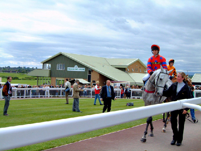
Hereford Racecourse

Hereford Racecourse is a horse racing venue located in Hereford, Herefordshire, England, owned by Herefordshire Council and operated by Arena Racing Company...

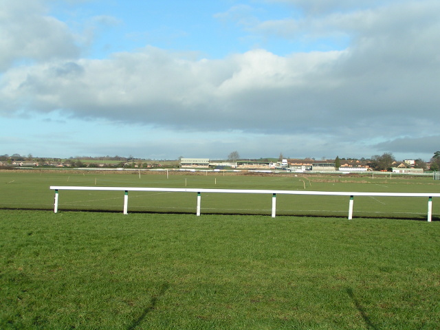
Racecourse Ground, Hereford

The Racecourse Ground is a cricket ground in Hereford. The ground is located inside Hereford Racecourse and is the only remaining former first-class cricket...

Herefordshire

Herefordshire ( HERR-if-ərd-sheer, -⁠shər) is a ceremonial county in the West Midlands of England. It is bordered by Gloucestershire to the south-east...

Widemarsh Common

Widemarsh Common is a public open space in Hereford. It is owned by Herefordshire Council and is used primarily as a recreational ground for both cricket...

St Mary's Hospital, Burghill

St. Mary's Hospital was a psychiatric facility located in the village of Burghill, Herefordshire. == History == Herefordshire initially utilised subscription...
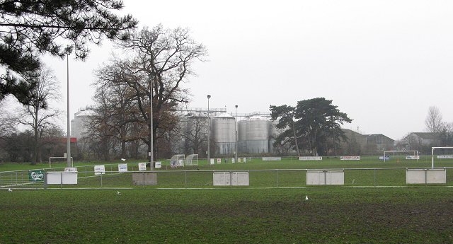
Westfields F.C.

Westfields Football Club is a football team from Hereford, England, formed in 1966 and currently playing in the Hellenic League Premier Division. The...

Hereford Lads Club F.C.

Hereford Lads Club Football Club is a football club based in Hereford, Herefordshire, England. They are currently members of the Hellenic League Premier...

Nearby Amenities

Located within 500m of 52.072694,-2.7420519
Traffic Signals
Lat/Long: 52.0766069/-2.7452614
Turning Circle
Lat/Long: 52.0705113/-2.7387362
Turning Circle
Lat/Long: 52.06984/-2.7378522
Turning Circle
Lat/Long: 52.0707074/-2.7370504
Leisure: pitch
Sport: tennis
Lat/Long: 52.0699435/-2.7393557
Bobblestock
Is In: Hereford
Place: suburb
Lat/Long: 52.0743821/-2.7402257
Bus Stop
Crossroads
Naptan AtcoCode: 2090A035400
Naptan Bearing: E
Naptan CommonName: Crossroads
Naptan Indicator: adj
Naptan Landmark: Bobblestock House (on sliproad)
Naptan NaptanCode: heraptjt
Naptan PlusbusZoneRef: HEREFRD
Naptan Street: Roman Road
Naptan Verified: no
Source: naptan_import
Lat/Long: 52.0766226/-2.7437159
Bus Stop
Bus: yes
Naptan AtcoCode: 2090A035401
Naptan Bearing: SE
Naptan CommonName: Shops
Naptan Indicator: opp
Naptan Landmark: o/s No 278 Grandstand Road
Naptan NaptanCode: heraptjw
Naptan PlusbusZoneRef: HEREFRD
Naptan Street: Grandstand Road
Naptan Verified: no
Public Transport: platform
Source: naptan_import
Lat/Long: 52.0731499/-2.7426368
Bus Stop
Co-op Store
Bus: yes
Naptan AtcoCode: 2090A035403
Naptan Bearing: S
Naptan CommonName: Co-op Store
Naptan Indicator: opp entrance
Naptan Landmark: Co-op Store
Naptan NaptanCode: heraptma
Naptan PlusbusZoneRef: HEREFRD
Naptan Street: Kempton Avenue
Naptan Verified: no
Public Transport: platform
Source: naptan_import
Lat/Long: 52.0742203/-2.742567
Bus Stop
Three Elms Inn
Bus: yes
Naptan AtcoCode: 2090A035405
Naptan Bearing: N
Naptan CommonName: Three Elms Inn
Naptan Indicator: adj
Naptan Landmark: Three Elms Inn
Naptan NaptanCode: heraptmd
Naptan PlusbusZoneRef: HEREFRD
Naptan Street: Three Elms Road
Naptan Verified: no
Public Transport: platform
Source: naptan_import
Lat/Long: 52.0745581/-2.7446008
Bus Stop
Doncaster Avenue
Bus: yes
Naptan AtcoCode: 2090A18381
Naptan Bearing: E
Naptan CommonName: Doncaster Avenue
Naptan Indicator: adj
Naptan Landmark: o/s 49 Sandown Drive
Naptan NaptanCode: heragpjp
Naptan PlusbusZoneRef: HEREFRD
Naptan Street: Sandown Drive
Naptan Verified: no
Public Transport: platform
Source: naptan_import
Lat/Long: 52.0732932/-2.7397452
Bus Stop
Three Elms Inn
Bus: yes
Naptan AtcoCode: 2090A18417
Naptan Bearing: S
Naptan CommonName: Three Elms Inn
Naptan Indicator: opp
Naptan Landmark: Three Elms Inn PH
Naptan NaptanCode: heragptm
Naptan PlusbusZoneRef: HEREFRD
Naptan Street: A4110 Three Elms Road
Naptan Verified: no
Public Transport: platform
Source: naptan_import
Lat/Long: 52.0744067/-2.7443794
Bus Stop
Taunton Way
Bus: yes
Naptan AtcoCode: 2090A19253
Naptan Bearing: W
Naptan CommonName: Taunton Way
Naptan Indicator: adj
Naptan Landmark: opp No 63 Kempton Avenue
Naptan NaptanCode: herajwam
Naptan PlusbusZoneRef: HEREFRD
Naptan Street: Kempton Way
Naptan Verified: no
Public Transport: platform
Source: naptan_import
Lat/Long: 52.0751078/-2.7386859
Bus Stop
Cheltenham Avenue
Bus: yes
Naptan AtcoCode: 2090A19260
Naptan Bearing: NE
Naptan CommonName: Cheltenham Avenue
Naptan Indicator: adj
Naptan Landmark: o/s 75 Sandown Drive
Naptan NaptanCode: herajwap
Naptan PlusbusZoneRef: HEREFRD
Naptan Street: Sandown Drive
Naptan Verified: no
Public Transport: platform
Source: naptan_import
Lat/Long: 52.0739187/-2.7376157
Bus Stop
Bus: yes
Naptan AtcoCode: 2090A19264
Naptan Bearing: NW
Naptan CommonName: Shops
Naptan Indicator: o/s Crest Court
Naptan Landmark: o/s Crest Court
Naptan NaptanCode: herajwat
Naptan PlusbusZoneRef: HEREFRD
Naptan Street: Grandstand Road
Naptan Verified: no
Public Transport: platform
Source: naptan_import
Lat/Long: 52.0732552/-2.7430471
Bus Stop
Haydock Avenue
Bus: yes
Naptan AtcoCode: 2090A19266
Naptan Bearing: SE
Naptan CommonName: Haydock Avenue
Naptan Indicator: opp
Naptan Landmark: Adj Junction with Chatsworth Road
Naptan NaptanCode: herajwaw
Naptan PlusbusZoneRef: HEREFRD
Naptan Street: Grandstand Road
Naptan Verified: no
Public Transport: platform
Source: naptan_import
Lat/Long: 52.0711999/-2.7392597
Bus Stop
Haydock Avenue
Bus: yes
Naptan AtcoCode: 2090A19268
Naptan Bearing: SE
Naptan CommonName: Haydock Avenue
Naptan Indicator: adj
Naptan Landmark: Adj Junction of Haydock Avenue
Naptan NaptanCode: herajwda
Naptan PlusbusZoneRef: HEREFRD
Naptan Street: Grandstand Road
Naptan Verified: no
Public Transport: platform
Source: naptan_import
Lat/Long: 52.0715848/-2.7398825
Bus Stop
Three Elms Trading Estate
Bus: yes
Naptan AtcoCode: 2090A19383
Naptan Bearing: N
Naptan CommonName: Three Elms Trading Estate
Naptan Indicator: opp No 190 Three Elms Road
Naptan Landmark: Annetts Factory
Naptan NaptanCode: heramadt
Naptan PlusbusZoneRef: HEREFRD
Naptan Street: Three Elms Road
Naptan Verified: no
Public Transport: platform
Source: naptan_import
Lat/Long: 52.0709185/-2.7443214
Bus Stop
Three Elms Trading Estate
Bus: yes
Naptan AtcoCode: 2090A19385
Naptan Bearing: S
Naptan BusStopType: CUS
Naptan CommonName: Three Elms Trading Estate
Naptan Indicator: o/s No 190 Three Elms Road
Naptan Landmark: Annetts Factory
Naptan NaptanCode: heramadw
Naptan PlusbusZoneRef: HEREFRD
Naptan Street: Three Elms Road
Naptan Verified: no
Public Transport: platform
Source: naptan_import
Lat/Long: 52.0708658/-2.7441309
Bus Stop
Crossroads
Naptan AtcoCode: 2090A20280
Naptan Bearing: W
Naptan BusStopType: CUS
Naptan CommonName: Crossroads
Naptan Indicator: opp Bobblestock Road
Naptan Landmark: NK
Naptan NaptanCode: herapdmw
Naptan PlusbusZoneRef: HEREFRD
Naptan Street: Roman Road
Naptan Verified: no
Source: naptan_import
Lat/Long: 52.0764569/-2.744326
Recycling
Co-operative Supermarket car-park Recycling point
Lat/Long: 52.0744195/-2.7442154
Doctors
Bobblestock Surgery
Healthcare: doctor
Lat/Long: 52.0737091/-2.7441106
Westfields
Place: suburb
Source: OS_OpenData_StreetView
Lat/Long: 52.0703056/-2.7414961
Generator Method: photovoltaic
Generator Output Electricity: yes
Generator Source: solar
Generator Type: solar_photovoltaic_panel
Location: roof
Power: generator
Lat/Long: 52.074516/-2.7359739
Generator Method: photovoltaic
Generator Output Electricity: yes
Generator Source: solar
Generator Type: solar_photovoltaic_panel
Location: roof
Power: generator
Lat/Long: 52.0751507/-2.7373606
Generator Method: photovoltaic
Generator Output Electricity: yes
Generator Source: solar
Generator Type: solar_photovoltaic_panel
Location: roof
Power: generator
Lat/Long: 52.0756354/-2.7368054
Generator Method: photovoltaic
Generator Output Electricity: yes
Generator Source: solar
Generator Type: solar_photovoltaic_panel
Location: roof
Power: generator
Lat/Long: 52.0757409/-2.7398685
Generator Method: photovoltaic
Generator Output Electricity: yes
Generator Source: solar
Generator Type: solar_photovoltaic_panel
Location: roof
Power: generator
Lat/Long: 52.0755019/-2.740759
Generator Method: photovoltaic
Generator Output Electricity: yes
Generator Source: solar
Generator Type: solar_photovoltaic_panel
Location: roof
Power: generator
Lat/Long: 52.0761563/-2.74324
Generator Method: photovoltaic
Generator Output Electricity: yes
Generator Source: solar
Generator Type: solar_photovoltaic_panel
Location: roof
Power: generator
Lat/Long: 52.0761745/-2.7435538
Generator Method: photovoltaic
Generator Output Electricity: yes
Generator Source: solar
Generator Type: solar_photovoltaic_panel
Location: roof
Power: generator
Lat/Long: 52.0757442/-2.7418613
Generator Method: photovoltaic
Generator Output Electricity: yes
Generator Source: solar
Generator Type: solar_photovoltaic_panel
Location: roof
Power: generator
Lat/Long: 52.0754821/-2.741443
Generator Method: photovoltaic
Generator Output Electricity: yes
Generator Source: solar
Generator Type: solar_photovoltaic_panel
Location: roof
Power: generator
Lat/Long: 52.0754854/-2.7416494
Generator Method: photovoltaic
Generator Output Electricity: yes
Generator Source: solar
Generator Type: solar_photovoltaic_panel
Location: roof
Power: generator
Lat/Long: 52.0755513/-2.742084
Generator Method: photovoltaic
Generator Output Electricity: yes
Generator Source: solar
Generator Type: solar_photovoltaic_panel
Location: roof
Power: generator
Lat/Long: 52.0755332/-2.7429718
Generator Method: photovoltaic
Generator Output Electricity: yes
Generator Source: solar
Generator Type: solar_photovoltaic_panel
Location: roof
Power: generator
Lat/Long: 52.0758975/-2.7429181
Generator Method: photovoltaic
Generator Output Electricity: yes
Generator Source: solar
Generator Type: solar_photovoltaic_panel
Location: roof
Power: generator
Lat/Long: 52.0758563/-2.742717
Turning Circle
Source: Maxar-Premium
Lat/Long: 52.0743634/-2.741037
Ford: yes
Lat/Long: 52.072187/-2.7487858
Generator Method: photovoltaic
Generator Output Electricity: yes
Generator Source: solar
Generator Type: solar_photovoltaic_panel
Location: roof
Power: generator
Lat/Long: 52.0733224/-2.7353007
Generator Method: photovoltaic
Generator Output Electricity: yes
Generator Source: solar
Generator Type: solar_photovoltaic_panel
Location: roof
Power: generator
Lat/Long: 52.0733637/-2.7353784
Generator Method: photovoltaic
Generator Output Electricity: yes
Generator Source: solar
Generator Type: solar_photovoltaic_panel
Location: roof
Power: generator
Lat/Long: 52.0725525/-2.7373123
Generator Method: photovoltaic
Generator Output Electricity: yes
Generator Source: solar
Generator Type: solar_photovoltaic_panel
Location: roof
Power: generator
Lat/Long: 52.0726185/-2.7408904
Generator Method: photovoltaic
Generator Output Electricity: yes
Generator Source: solar
Generator Type: solar_photovoltaic_panel
Location: roof
Power: generator
Lat/Long: 52.0745177/-2.7411586
Generator Method: photovoltaic
Generator Output Electricity: yes
Generator Source: solar
Generator Type: solar_photovoltaic_panel
Location: roof
Power: generator
Lat/Long: 52.0739192/-2.7423736
Generator Method: photovoltaic
Generator Output Electricity: yes
Generator Source: solar
Generator Type: solar_photovoltaic_panel
Location: roof
Power: generator
Lat/Long: 52.0749496/-2.7365103
Generator Method: photovoltaic
Generator Output Electricity: yes
Generator Source: solar
Generator Type: solar_photovoltaic_panel
Location: roof
Power: generator
Lat/Long: 52.0744155/-2.7355474
Generator Method: photovoltaic
Generator Output Electricity: yes
Generator Source: solar
Generator Type: solar_photovoltaic_panel
Location: roof
Power: generator
Lat/Long: 52.0768932/-2.7446562
Generator Method: photovoltaic
Generator Output Electricity: yes
Generator Source: solar
Generator Type: solar_photovoltaic_panel
Location: roof
Power: generator
Lat/Long: 52.0682872/-2.7423897
Generator Method: photovoltaic
Generator Output Electricity: yes
Generator Source: solar
Generator Type: solar_photovoltaic_panel
Location: roof
Power: generator
Lat/Long: 52.0710868/-2.7360731
Generator Method: photovoltaic
Generator Output Electricity: yes
Generator Source: solar
Generator Type: solar_photovoltaic_panel
Location: roof
Power: generator
Lat/Long: 52.0710951/-2.7383906
Generator Method: photovoltaic
Generator Output Electricity: yes
Generator Source: solar
Generator Type: solar_photovoltaic_panel
Location: roof
Power: generator
Lat/Long: 52.076552/-2.7386266
Bicycle Rental
Brand: Beryl
Brand Wikidata: Q106575365
Capacity: 5
Name Signed: no
Network: Beryl
Network Wikidata: Q106575365
Official Name: Sandown Drive
Operator: Beryl
Operator Wikidata: Q106575369
Payment App: yes
Payment App Android: cc.beryl.basis
Payment App Ios: 1386768364
Payment Cash: no
Payment Credit Cards: no
Payment Cryptocurrencies: no
Payment Debit Cards: no
Payment Electronic Purses: no
Ref Gbfs: beryl_hereford:364
Lat/Long: 52.0737305/-2.7427499
Leisure: pitch
Sport: tennis
Lat/Long: 52.0698712/-2.7391321
Leisure: pitch
Sport: basketball
Lat/Long: 52.0700115/-2.7399169
Man Made: monitoring_station
Monitoring Water Level: yes
Lat/Long: 52.0690896/-2.7434062
The data included in this document is from www.openstreetmap.org. The data is made available under ODbL.

Have you been to Bobblestock?

Leave your review of Bobblestock below (or comments, questions and feedback).