Belgrave

Settlement in Lancashire

England

Belgrave

Housing on Pole Lane, Darwen
Housing on Pole Lane, Darwen Credit: Chris Heaton

The requested URL returned error: 429 Too Many Requests

If you have any feedback on the listing, please let us know in the comments section below.
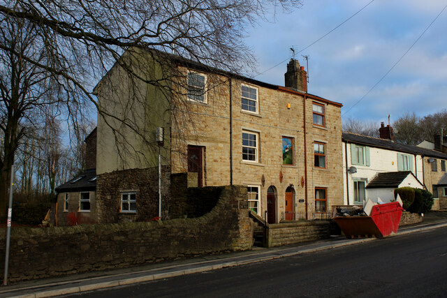
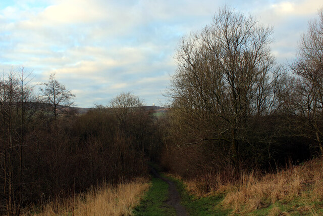
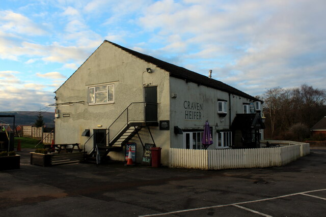
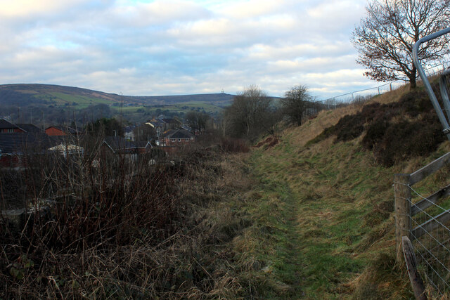
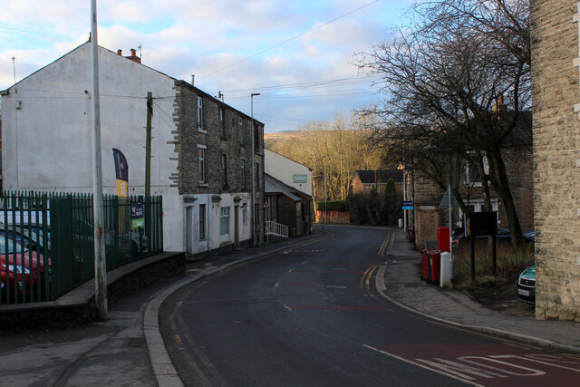
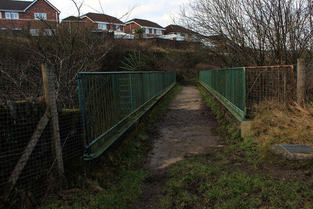
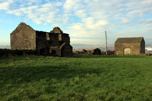
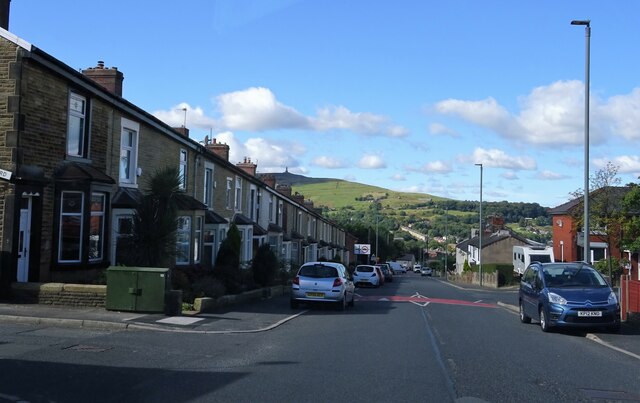
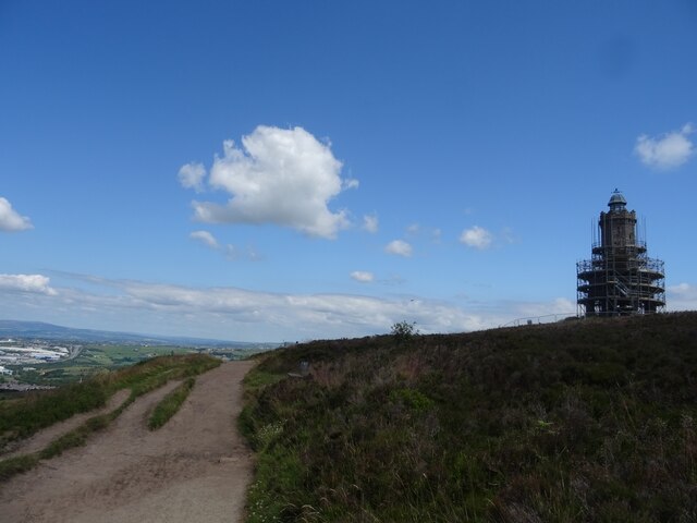
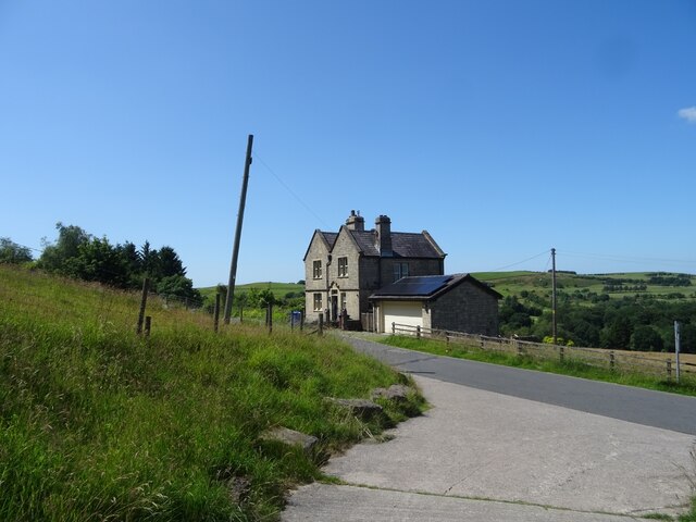
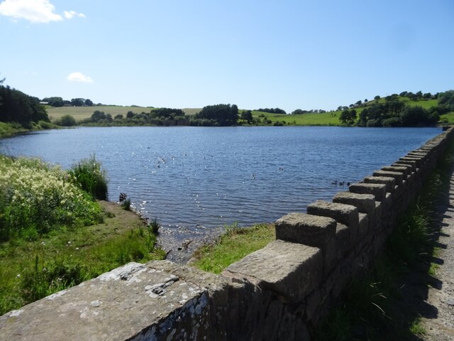
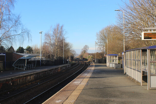
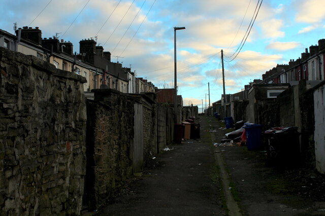
Belgrave Images

Images are sourced within 2km of 53.695192/-2.4700424 or Grid Reference SD6922. Thanks to Geograph Open Source API. All images are credited.

Housing on Pole Lane, Darwen
Entering Woodland Area from Priory Drive, Darwen Small area of woodland in Darwen, bounded by Priory Drive, Pole Lane and Sough Lane
Entering Woodland Area from Priory Drive, Darwen
Small area of woodland in Darwen, bounded by Priory Drive, Pole Lane and Sough Lane
Craven Heifer, Darwen Located on Pole Lane in Darwen.
Unusual name for a hostelry outside the Craven area, centred around Skipton in Yorkshire. It refers to a heifer that weighed over a ton and was bred in Gargrave, 1807.
Craven Heifer, Darwen
Located on Pole Lane in Darwen. Unusual name for a hostelry outside the Craven area, centred around Skipton in Yorkshire. It refers to a heifer that weighed over a ton and was bred in Gargrave, 1807.
Footpath heading for Sough, Darwen Follows the railway very closely - so closely in fact, that it is a squeeze between hedge vegetation and the rail boundary wall.
Footpath heading for Sough, Darwen
Follows the railway very closely - so closely in fact, that it is a squeeze between hedge vegetation and the rail boundary wall.
Causeway Street, Darwen
Footbridge over the Blackburn/Manchester Railway Line Crosses a deep cutting just north of the Sough Tunnel - part of the Ribble Valley Line between Manchester and Clitheroe, via Blackburn
Footbridge over the Blackburn/Manchester Railway Line
Crosses a deep cutting just north of the Sough Tunnel - part of the Ribble Valley Line between Manchester and Clitheroe, via Blackburn
Harwood Fold A group of buildings in a pasture near Pot House, consisting of two in a ruinous state including a farmhouse - and a stone barn, still in service.
Harwood Fold
A group of buildings in a pasture near Pot House, consisting of two in a ruinous state including a farmhouse - and a stone barn, still in service.
Marsh House Lane Darwen Jubilee Tower is atop the hill in the background.
Marsh House Lane
Darwen Jubilee Tower is atop the hill in the background.
Marsh House Lane, Darwen
Rough Pasture off Harwoods Lane As seen from the junction of Harwoods Lane onto Blacksnape Road
Rough Pasture off Harwoods Lane
As seen from the junction of Harwoods Lane onto Blacksnape Road
Blacksnape Road Heading north towards Pot House
Blacksnape Road
Heading north towards Pot House
Footpath leading towards Marsh House
Footpath towards the Jubilee Tower, Darwen Moor Approaching Darwen Tower, under renovation during the summer of 2021.
Footpath towards the Jubilee Tower, Darwen Moor
Approaching Darwen Tower, under renovation during the summer of 2021.
The Waterhouse, Sunnyhurst Hey The Waterhouse associated with the (now much depleted and disused) Sunnyhurst Hey Reservoir.
The Waterhouse, Sunnyhurst Hey
The Waterhouse associated with the (now much depleted and disused) Sunnyhurst Hey Reservoir.
Earnsdale Reservoir
Earnsdale Reservoir
Olive Lane, Darwen Residential thoroughfare in the old Lancashire town of Darwen
Olive Lane, Darwen
Residential thoroughfare in the old Lancashire town of Darwen
Darwen Station This is Platform 1 on Darwen Station.
Currently on the Clitheroe or Ribble Valley Line, which runs services from Manchester through Blackburn, terminating in Clitheroe
Darwen Station
This is Platform 1 on Darwen Station. Currently on the Clitheroe or Ribble Valley Line, which runs services from Manchester through Blackburn, terminating in Clitheroe
Back Alley behind Sarah Street, Darwen A rather untidy back alley running north from Kay Street in Darwen
Back Alley behind Sarah Street, Darwen
A rather untidy back alley running north from Kay Street in Darwen
Show me another place!

Belgrave is located at Grid Ref: SD6922 (Lat: 53.695192, Lng: -2.4700424)

Unitary Authority: Blackburn with Darwen

Police Authority: Lancashire

What 3 Words

///learn.recent.ranged. Near Darwen, Lancashire

Nearby Locations

Shorey Bank Belgrave

Related Wikis

Darwen Aldridge Enterprise Studio

Darwen Aldridge Enterprise Studio (DAES) is a mixed studio school located in Lancashire, UK. It opened in September 2013. It is part of the Aldridge Education...

Darwen Town Hall

Darwen Town Hall is a municipal building in Croft Street, Darwen, Lancashire, England. It is the meeting place of Darwen Town Council. == History == After...
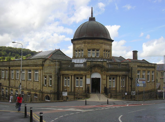
Darwen Library

Darwen Library is a Carnegie library in Darwen, Lancashire, England. It opened in 1908 and is located on Knott Street. == History == The library was officially...

St Peter's Church, Darwen

St Peter's Church (formerly Holy Trinity Church) is in Bank Street, Darwen, Lancashire, England. It is an active Anglican parish church in the deanery...

Nearby Amenities

Located within 500m of 53.695192,-2.4700424
Darwen
Name Lt: Darvenas
Naptan AtcoCode: 9100DARWEN
Network: National Rail
Network Website: https://www.nationalrail.co.uk/stations/dwn/
Network Wikidata: Q26334
Operator: Northern Rail
Operator Website: https://www.northernrailway.co.uk/stations/darwen
Operator Wikidata: Q85789775
Public Transport: station
Railway: station
Ref Crs: DWN
Source: NPE
Wikidata: Q2248104
Wikipedia: en:Darwen railway station
Lat/Long: 53.6979355/-2.4642693
Darwen
Name Lt: Darvenas
Place: town
Wikidata: Q1166842
Wikipedia: en:Darwen
Lat/Long: 53.6960957/-2.4665093
Crossing
Button Operated: yes
Crossing: traffic_signals
Crossing Ref: pelican
Tactile Paving: yes
Lat/Long: 53.6951193/-2.4671219
Bus Stop
Naptan AtcoCode: 2580DAW0105
Naptan NaptanCode: blagdjm
Public Transport: platform
Lat/Long: 53.6955307/-2.4667739
Bus Stop
Naptan AtcoCode: 2580DAW0104
Naptan NaptanCode: blagdjg
Public Transport: platform
Lat/Long: 53.6953709/-2.4666557
Bus Stop
Naptan AtcoCode: 2580DAW0107
Naptan NaptanCode: blagdjt
Public Transport: platform
Lat/Long: 53.6957275/-2.4678455
Bus Stop
Naptan AtcoCode: 2580DAW0106
Naptan NaptanCode: blagdjp
Public Transport: platform
Lat/Long: 53.6956493/-2.4677214
Pharmacy
Bus Stop
Market Street Pharmacy
Addr City: Darwen
Addr Housenumber: 29-31
Addr Postcode: BB3 1PS
Addr Street: Market Street
Dispensing: yes
Healthcare: pharmacy
Opening Hours: Mo-Sa 09:00-22:30;Su 09:00-19:00
Public Transport: platform
Source: local_knowledge
Lat/Long: 53.6954537/-2.467981
Traffic Signals
Crossing: no
Traffic Signals Direction: both
Lat/Long: 53.693811/-2.4670983
Traffic Signals
Traffic Signals Direction: both
Lat/Long: 53.6950754/-2.4672887
Library
Darwen Library
Source: OS_OpenData_StreetView
Lat/Long: 53.6967406/-2.4660248
Crossing: zebra
Lat/Long: 53.6934303/-2.4646999
Access: no
Barrier: bollard
Bicycle: yes
Bollard: fixed
Foot: yes
Horse: yes
Motor Vehicle: no
Lat/Long: 53.6945904/-2.4671173
Crossing: zebra
Source: Bing
Lat/Long: 53.6958526/-2.4710497
Crossing: zebra
Source: Bing
Lat/Long: 53.6930978/-2.4654136
Turning Circle
Lat/Long: 53.69339/-2.4682765
Crossing
Button Operated: yes
Crossing: traffic_signals
Crossing Ref: pelican
Tactile Paving: yes
Lat/Long: 53.6951887/-2.4675825
Post Office
Darwen Post Office
Addr City: Darwen
Addr Housenumber: 5
Addr Postcode: BB3 1BR
Addr Street: The Circus
Name En: Darwen Post Office
Opening Hours: Mo,Tu 08:30-17:30; We-Fr 09:00-17:30; Sa 09:00-13:30
Operator: Post Office
Ref Pol Id: 13115
Source: local_knowledge
Lat/Long: 53.6951644/-2.4678361
Darwen Leisure Centre
Leisure: sports_centre
Lat/Long: 53.6960997/-2.4698853
South African War Memorial
Historic: memorial
Material: metal
Memorial: war_memorial
Source: local_knowledge
Lat/Long: 53.694692/-2.4674246
War Memorial
Historic: memorial
Source: local_knowledge
Wikidata: Q26328056
Lat/Long: 53.6922603/-2.4720048
Marketplace
Market Hall
Source: local_knowledge
Lat/Long: 53.6959347/-2.4669049
Gibsons
Shop: doityourself
Source: local_knowledge
Lat/Long: 53.6970877/-2.4706801
Parking
Market Car Park
Parking: multi-storey
Lat/Long: 53.6963047/-2.4662255
Parking
Edward Street Car Park
Parking: surface
Lat/Long: 53.6989678/-2.4706954
Parking
Foundry Street Car Park
Lat/Long: 53.6942894/-2.4666289
Crossing: zebra
Lat/Long: 53.6920176/-2.4653216
Mini Roundabout
Lat/Long: 53.6931957/-2.4652927
Crossing: zebra
Source: Bing
Lat/Long: 53.6932573/-2.4657075
Access: no
Barrier: bollard
Bicycle: yes
Bollard: fixed
Foot: yes
Horse: yes
Motor Vehicle: no
Lat/Long: 53.6949877/-2.4671416
Crossing
Crossing: unmarked
Lat/Long: 53.6958366/-2.469076
Post Box
Collection Times: Mo-Fr 17:00; Sa 11:30
Mapillary: 977851689689126
Operator: Royal Mail
Post Box Type: pillar
Ref: BB3 329
Lat/Long: 53.6958823/-2.4657719
Traffic Signals
Traffic Signals: signal
Lat/Long: 53.6965484/-2.4699085
Clinic
Darwen Health Centre
Healthcare: clinic
Lat/Long: 53.6958067/-2.4714309
Toilets
Darwen Market Downstairs
Female: yes
Male: yes
Wheelchair: yes
Lat/Long: 53.696236/-2.466314
Place Of Worship
Central United Reformed Church
Addr City: Darwen
Addr Postcode: BB3 1AT
Addr Street: Duckworth Street
Fhrs Id: 212117
Religion: christian
Source Addr: FHRS Open Data
Lat/Long: 53.6983255/-2.4700583
Barrier: bollard
Lat/Long: 53.6917806/-2.4704235
Barrier: bollard
Bicycle: yes
Foot: yes
Horse: yes
Motor Vehicle: no
Lat/Long: 53.6932278/-2.4708671
Barrier: bollard
Lat/Long: 53.6916571/-2.4708874
Barrier: bollard
Lat/Long: 53.6931089/-2.4705151
Pub
Crown
Addr City: Darwen
Addr Housenumber: 24
Addr Postcode: BB3 2AB
Addr Street: Redearth Road
Fhrs Id: 211264
Name En: Crown
Source Addr: FHRS Open Data
Lat/Long: 53.6935104/-2.4649088
Restaurant
Akash
Addr City: Darwen
Addr Housenumber: 196-200
Addr Postcode: BB3 1PX
Addr Street: Duckworth Street
Fhrs Id: 212364
Source Addr: FHRS Open Data
Lat/Long: 53.6982575/-2.4707716
Bank
Lloyds Bank
Addr Country: GB
Brand: Lloyds Bank
Brand Wikidata: Q1152847
Brand Wikipedia: en:Lloyds Bank
Contact Website: https://branches.lloydsbank.com/darwen/213-215-duckworth-street
Lat/Long: 53.6972574/-2.4693215
Car Wash
Hand Car wash
Name En: Hand Car wash
Lat/Long: 53.6980988/-2.4707198
Rushtons Bacon Stall
Name En: Rushtons Bacon Stall
Shop: butcher
Lat/Long: 53.6959553/-2.4668074
Pub
The Old Chapel
Addr City: Darwen
Addr County: Lancashire
Addr Postcode: BB3 2RJ
Addr Street: Railway Road
Brand: Wetherspoon
Brand Wikidata: Q6109362
Brand Wikipedia: en:Wetherspoons
Breakfast: Mo,Tu,We,Th,Su 08:00-12:00;Fr,Sa 08:00-12:00
Brewery: various
Building: yes
Changing Table: yes
Contact Phone: +44 1254 778700
Diet Vegan: yes
Diet Vegetarian: yes
Fhrs Authority: Blackburn
Fhrs Confidence Management: 5
Fhrs Hygiene: 0
Fhrs Id: 591755
Fhrs Local Authority Id: 105740
Fhrs Rating: 5
Fhrs Rating Date: 2022-08-10T00:00:00
Fhrs Structural: 5
Food: yes
Internet Access: wlan
Internet Access Fee: no
Note: Has TV screens
Has meeting facilites
Opening Hours: Mo,Tu,We,Th,Su 08:00-24:00; Fr,Sa 08:00-25:00
Outdoor Seating: yes
Payment Cash: yes
Payment Credit Cards: yes
Payment Debit Cards: yes
Real Ale: yes
Real Cider: yes
Source Fhrs: FHRS Open Data
Source Website: https://www.jdwetherspoon.com/pubs/all-pubs/england/lancashire/the-old-chapel-darwen
Toilets: yes
Toilets Access: customers
Toilets Wheelchair: yes
Website: https://www.jdwetherspoon.com/pubs/all-pubs/england/lancashire/the-old-chapel-darwen
Website Menu: https://www.jdwetherspoon.com/food
Wheelchair: yes
Wikidata: Q26456725
Lat/Long: 53.695958/-2.4652039
Fast Food
Akash
Addr City: Darwen
Addr Housenumber: 194
Addr Postcode: BB3 1PX
Addr Street: Duckworth Street
Fhrs Id: 211611
Note: Adjoining takeway to restaurant
Source Addr: FHRS Open Data
Takeaway: yes
Lat/Long: 53.6983197/-2.4708445
Minerva Crafts
Addr City: Darwen
Addr Postcode: BB3 3BY
Addr Street: Atlas Road
Craft: tailor
Opening Hours: Mo-Sa 09:00-17:00
Lat/Long: 53.6970926/-2.4643419
Restaurant
Amalfi
Addr City: Darwen
Addr Housenumber: 189
Addr Postcode: BB3 1AU
Addr Street: Duckworth Street
Cuisine: italian
Fhrs Id: 536519
Source Addr: FHRS Open Data
Lat/Long: 53.6977921/-2.4697761
Barrier: bollard
Bicycle: yes
Foot: yes
Horse: yes
Motor Vehicle: no
Lat/Long: 53.6920479/-2.4687401
Crossing
Crossing: unmarked
Lat/Long: 53.6958776/-2.4688045
Crossing
Crossing: unmarked
Lat/Long: 53.6957623/-2.4688351
Bench
Lat/Long: 53.6960594/-2.4686935
Veterinary
Abbeydale Vets
Addr City: Darwen
Addr Housename: Station House
Addr Postcode: BB3 2RJ
Addr Street: Railway Road
Lat/Long: 53.6978986/-2.4646197
Building: yes
Lat/Long: 53.6975966/-2.4648401
Slice Hairdressers
Addr City: Darwen
Addr Housenumber: 25
Addr Postcode: BB3 2RJ
Addr Street: Railway Road
Female: yes
Male: yes
Shop: hairdresser
Lat/Long: 53.6965366/-2.4654865
The Weaver Bird
Artwork Subject: This artwork celebrates the proud industrial heritage of Darwen.
Artwork Type: sculpture
Mapillary: 158406209496767
Material: metal
Start Date: 2019-05-11
Tourism: artwork
Lat/Long: 53.6958235/-2.4661356
Post Box
Operator: Royal Mail
Lat/Long: 53.6951446/-2.4676698
Atm
Brand: Post Office
Lat/Long: 53.6952201/-2.4679394
Entrance: main
Wheelchair: yes
Lat/Long: 53.6951978/-2.4678187
Fast Food
Greggs
Addr City: Darwen
Addr Housenumber: 18
Addr Postcode: BB3 1AZ
Addr Street: Market Street
Brand: Greggs
Brand Wikidata: Q3403981
Brand Wikipedia: en:Greggs
Contact Website: https://www.greggs.co.uk/shop-finder?shop-code=0375
Cuisine: sandwich;bakery
Operator: Greggs
Takeaway: yes
Lat/Long: 53.6956155/-2.4675559
Entrance: main
Wheelchair: yes
Lat/Long: 53.6958248/-2.4668613
Addr City: Darwen
Addr Housenumber: 11
Addr Postcode: BB3 2RE
Addr Street: Church Street
Check Date: 2019-11-24
Disused Amenity: pharmacy
Old Name: Lloyds Pharmacy
Lat/Long: 53.6951724/-2.4666037
Market Square
Information: map
Map Type: street
Tourism: information
Lat/Long: 53.6953812/-2.46655
Crossing
Crossing: marked
Crossing Ref: zebra
Tactile Paving: yes
Lat/Long: 53.6953042/-2.4664116
Pub
The Bridgewater
Addr City: Darwen
Addr Housenumber: 9-10
Addr Postcode: BB3 2RE
Addr Street: Church Street
Fhrs Id: 211563
Opening Hours: Mo-We 09:00-23:00; Th 09:00-02:00; Fr,Sa 09:00-04:00; Su 10:00-00:00
Operator: Stonegate
Operator Wikidata: Q7619176
Website: https://www.greatukpubs.co.uk/bridgewater-darwen
Lat/Long: 53.6951684/-2.4664146
McColls @ Darwen
Addr City: Darwen
Addr Housenumber: 6-7
Addr Postcode: BB3 2RE
Addr Street: Church Street
Fhrs Id: 657222
Shop: convenience
Source Addr: FHRS Open Data
Lat/Long: 53.6952431/-2.4660458
Entrance: main
Lat/Long: 53.6953872/-2.4678989
Bicycle Parking
Access: yes
Bicycle Parking: stands
Capacity: 10
Fee: no
Lit: yes
Smoothness: good
Surface: cobblestone
Lat/Long: 53.6954519/-2.4665192
Restaurant
Smoke Shack
Addr City: Darwen
Addr Housenumber: 11
Addr Postcode: BB3 1BG
Addr Street: Croft Street
Fhrs Id: 1174202
Lat/Long: 53.6955242/-2.4670784
Pub
The Millstone
Addr City: Darwen
Addr Postcode: BB3 1BT
Addr Street: Bridge Street
Operator: Inglenook Inns & Taverns
Lat/Long: 53.695093/-2.4668384
Turning Circle
Lat/Long: 53.6931174/-2.4681258
Crossing
Button Operated: yes
Crossing: traffic_signals
Crossing Ref: pelican
Tactile Paving: yes
Lat/Long: 53.6934238/-2.4669788
Traffic Signals
Traffic Signals Direction: forward
Lat/Long: 53.6938479/-2.4672166
Darwen Spitfire Memorial Sculpture
Artist Name: WEC Group Ltd apprentices.
Artwork Type: sculpture
Material: steel
Tourism: artwork
Lat/Long: 53.6958898/-2.4689683
Parking
Lat/Long: 53.6932606/-2.4651471
Artwork Type: sculpture
Tourism: artwork
Lat/Long: 53.6962259/-2.4684882
Barrier: bollard
Lat/Long: 53.6948155/-2.4717613
Barrier: bollard
Lat/Long: 53.6947285/-2.4714108
Crossing
Crossing: marked
Lat/Long: 53.6983997/-2.4707356
Speed Camera
Lat/Long: 53.698881/-2.4712732
two stones
Natural: stone
Lat/Long: 53.6949107/-2.4753036
Access: no
Barrier: bollard
Bicycle: yes
Bollard: removable
Description: removable bollards installed to isolate part of Church Street to create temporary enforced pedestrian zone (for entertainment , tables/ drinking)
Foot: yes
Horse: yes
Motor Vehicle: no
Lat/Long: 53.6953366/-2.4662895
Barrier: bollard
Bicycle: yes
Bollard: removable
Description: Removable bollards installed to isolate part of Church Street to create temporary enforced pedestrian zone (for entertainment , tables/ drinking)
Foot: yes
Horse: yes
Motor Vehicle: no
Lat/Long: 53.6951266/-2.4670943
Barrier: bollard
Lat/Long: 53.6916611/-2.4686105
Give Way
Direction: backward
Lat/Long: 53.6954254/-2.4659098
The data included in this document is from www.openstreetmap.org. The data is made available under ODbL.

Have you been to Belgrave?

Leave your review of Belgrave below (or comments, questions and feedback).