Bailey Grove

Settlement in Nottinghamshire Broxtowe

England

Bailey Grove

Mansfield Road The flat roofed building between the trees is the Co-operative Society Funeral service.
Mansfield Road Credit: Malcolm Neal

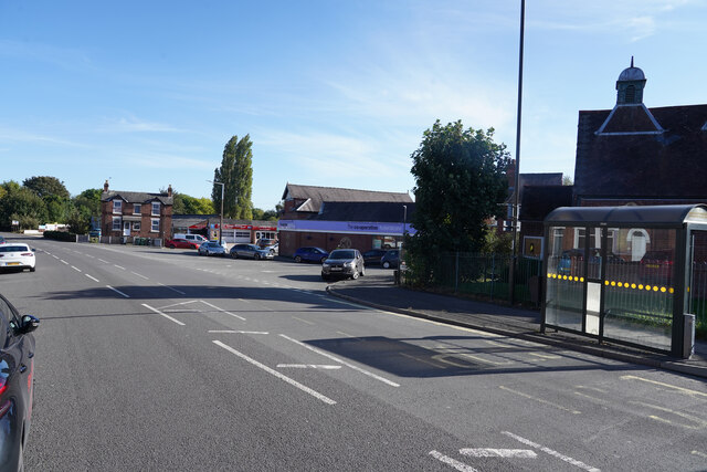
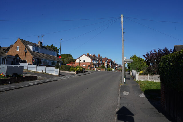
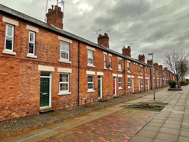
Bailey Grove is a charming village located in the county of Nottinghamshire, England. Situated in the heart of the East Midlands, Bailey Grove is surrounded by picturesque countryside and offers a peaceful and idyllic setting for residents and visitors alike.

The village is known for its rich history, dating back to medieval times. It is believed that Bailey Grove was originally founded as a settlement during the Norman conquest, and remnants of this era can still be seen in the form of ancient buildings and landmarks scattered throughout the village.

One of the most notable attractions in Bailey Grove is the historic St. Mary's Church, which dates back to the 12th century. This magnificent church showcases stunning architecture and serves as a reminder of the village's long-standing heritage.

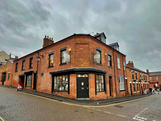
In addition to its historical significance, Bailey Grove offers a range of amenities and facilities for its residents. The village boasts a primary school, a local pub, and a number of small businesses and shops, providing for the daily needs of the community.

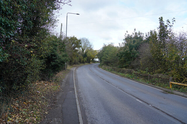
Surrounded by beautiful countryside, Bailey Grove also presents ample opportunities for outdoor activities. The village is located near several nature reserves, offering scenic trails for hiking and cycling enthusiasts. The nearby River Trent is a popular spot for fishing and boating, providing a peaceful retreat for those seeking a break from the hustle and bustle of city life.

Overall, Bailey Grove is a charming village that seamlessly blends history and natural beauty, making it a delightful place to live or visit in Nottinghamshire.

If you have any feedback on the listing, please let us know in the comments section below.

Bailey Grove Images

Images are sourced within 2km of 53.015689/-1.3160172 or Grid Reference SK4546. Thanks to Geograph Open Source API. All images are credited.
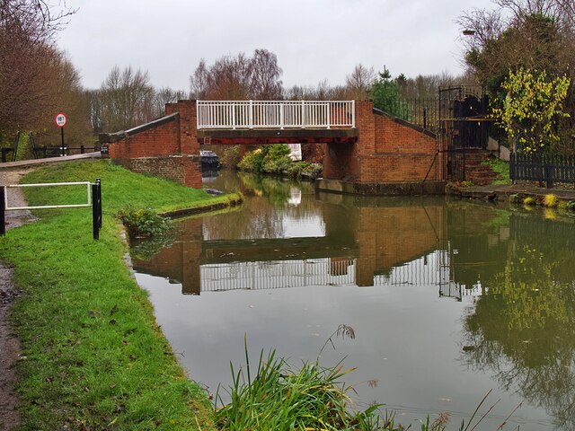
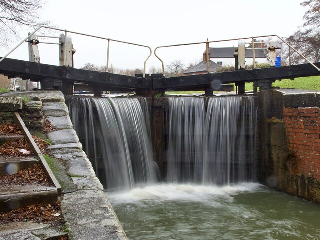
Mansfield Road The flat roofed building between the trees is the Co-operative Society Funeral service.
Mansfield Road
The flat roofed building between the trees is the Co-operative Society Funeral service.
Lower Dunstead Road This road runs up the hill in Langley Mill ending at a cross road junction with Aldercar Lane and Cromford Road.
Lower Dunstead Road
This road runs up the hill in Langley Mill ending at a cross road junction with Aldercar Lane and Cromford Road.
Aldercar Lane Aldercar lane is more like a track with a very poor surface with many deep potholes.  Just ahead is the flyover for the A610. To the right of the hedge is the site of Aldercar Allotments.
Aldercar Lane
Aldercar lane is more like a track with a very poor surface with many deep potholes. Just ahead is the flyover for the A610. To the right of the hedge is the site of Aldercar Allotments.
Playing fields No one is using the pitches at the moment.
Playing fields
No one is using the pitches at the moment.
Mansfield Road Autumnal leaf fall on the edge of Mansfield Road.
Mansfield Road
Autumnal leaf fall on the edge of Mansfield Road.
D.H. Lawrence Birthplace Museum The Museum is located in the childhood home of the author D.H. Lawrence in the ex-mining town of Eastwood.
D.H. Lawrence Birthplace Museum
The Museum is located in the childhood home of the author D.H. Lawrence in the ex-mining town of Eastwood.
Princes Street, Eastwood One of a group of streets known locally as "the squares" this now pedestrianised street of terraced houses was built by the local colliery company in the 1850s.  DH Lawrence's home was nearby <a href="https://www.geograph.org.uk/photo/7043172">SK4647 : D.H. Lawrence Birthplace Museum</a> and he later described the houses as "sordid and hideous". They look very clean and smart today.
Princes Street, Eastwood
One of a group of streets known locally as "the squares" this now pedestrianised street of terraced houses was built by the local colliery company in the 1850s. DH Lawrence's home was nearby SK4647 : D.H. Lawrence Birthplace Museum and he later described the houses as "sordid and hideous". They look very clean and smart today.
The Erewash Canal at bridge #23A The bridge carries the Nottingham - Mansfield railway over the canal
The Erewash Canal at bridge #23A
The bridge carries the Nottingham - Mansfield railway over the canal
The Erewash Canal at Bridge #25 Approaching Shipley Lock
The Erewash Canal at Bridge #25
Approaching Shipley Lock
Bridge #25 on the Erewash Canal Below Shipley Lock #72 on the canal.
Bridge #25 on the Erewash Canal
Below Shipley Lock #72 on the canal.
The Old Slaughterhouse Where worn-out canal tow horses came at the end of their working life.
The Old Slaughterhouse
Where worn-out canal tow horses came at the end of their working life.
Shipley Lock Lock #72 on the Erewash Canal
Shipley Lock
Lock #72 on the Erewash Canal
The Erewash Canal below Eastwood Lock Lock #73 on the canal. The towpath switches to the opposite bank here.
The Erewash Canal below Eastwood Lock
Lock #73 on the canal. The towpath switches to the opposite bank here.
The Erewash Canal and towpath south of bridge #26
Bridge #27 on the Erewash Canal Carrying Anchor Road over the canal
Bridge #27 on the Erewash Canal
Carrying Anchor Road over the canal
Narrowboat 'Gone Roaming' But not roaming today as it's moored below Anchor Bridge <a href="https://www.geograph.org.uk/photo/7044756">SK4546 : Bridge #27 on the Erewash Canal</a>]
Narrowboat 'Gone Roaming'
But not roaming today as it's moored below Anchor Bridge SK4546 : Bridge #27 on the Erewash Canal]
Water overflowing the lock gates at Langley Mill Lock Langley Mill Basin is where the Erewash Canal joins the Cromford and Nottingham Canals.
Water overflowing the lock gates at Langley Mill Lock
Langley Mill Basin is where the Erewash Canal joins the Cromford and Nottingham Canals.
The junction of the Cromford and Nottingham Canals The building is the former toll office for the Nottingham Canal. This location is unusual in that three canals meet here, the third being the Erewash Canal to Trent Lock. The three way finger post <a href="https://www.geograph.org.uk/photo/7044762">SK4547 : Direction signpost at Langley Mill Basin</a> is a recent addition, not present when the location was last geographed in 2017 <a href="https://www.geograph.org.uk/photo/5607048">SK4547 : Junction of the Nottingham and Cromford Canals</a>
The junction of the Cromford and Nottingham Canals
The building is the former toll office for the Nottingham Canal. This location is unusual in that three canals meet here, the third being the Erewash Canal to Trent Lock. The three way finger post SK4547 : Direction signpost at Langley Mill Basin is a recent addition, not present when the location was last geographed in 2017 SK4547 : Junction of the Nottingham and Cromford Canals
Show me another place!

Bailey Grove is located at Grid Ref: SK4546 (Lat: 53.015689, Lng: -1.3160172)

Administrative County: Nottinghamshire

District: Broxtowe

Police Authority: Nottinghamshire

What 3 Words

///agreeable.hears.flags. Near Eastwood, Nottinghamshire

Nearby Locations

Bailey Grove

Related Wikis

A610 road

The A610 is an A-road in England, which runs from Nottingham to Ambergate, where it joins the A6. == Route == === Nottingham to Eastwood === The road starts...

Raleigh Bicycle Company

The Raleigh Bicycle Company is a British bicycle manufacturer based in Nottingham, England and founded by Woodhead and Angois in 1885. Using Raleigh as...

Eastwood and Langley Mill railway station

Eastwood and Langley Mill railway station is a former railway station serving the town of Eastwood and the village of Langley Mill in Derbyshire, England...
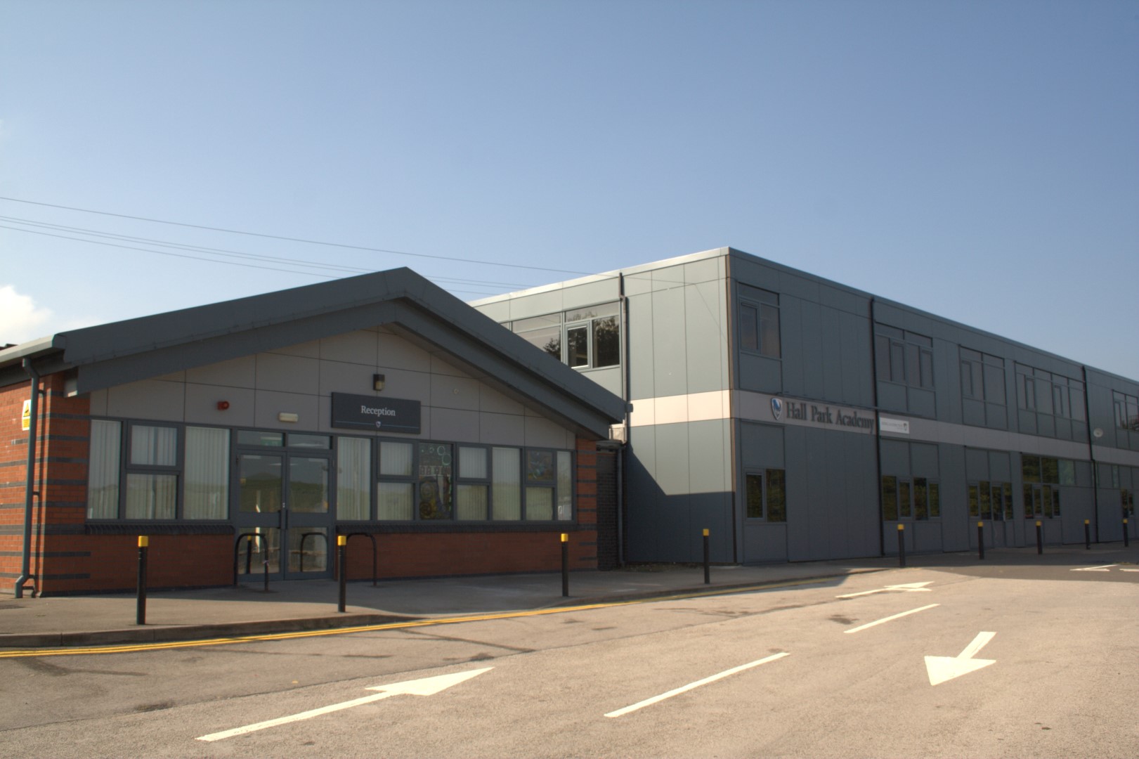
Hall Park Academy

Hall Park Academy (formerly Eastwood Comprehensive School) is a coeducational secondary school and sixth form located in Eastwood in the English county...

Related Videos

#videography #sonya7iii #premierpro Walking in paradise ☀️

Practicing my editing skill on premier pro please feel free to leave advice and tips. Always looking to improve.

Electro-Voice Evolve 30M ON SALE... Best price in the UK?! | Music Gear Direct

The @ElectroVoiceOfficial Evolve 30M column PA system is on sale at Music Gear Direct, and it's one of the best prices for a ...

Nearby Amenities

Located within 500m of 53.015689,-1.3160172
Motorway Junction
Lat/Long: 53.0147874/-1.3174639
Motorway Junction
Lat/Long: 53.0132592/-1.3158808
Mini Roundabout
Direction: clockwise
Lat/Long: 53.0135186/-1.3140716
Bus Stop
South Street
Bus: yes
Local Ref: BR0030
Naptan AtcoCode: 3300BR0030
Naptan Bearing: SE
Naptan CommonName: South Street
Naptan Indicator: SE-bound
Naptan NaptanCode: ntsawjmp
Naptan Notes: none
Naptan Street: South Street
Naptan Verified: yes
Public Transport: platform
Shelter: no
Source: naptan_import
Lat/Long: 53.0145339/-1.3125841
Bus Stop
Bailey Grove Road
Bus: yes
Local Ref: BR0032
Naptan AtcoCode: 3300BR0032
Naptan Bearing: SE
Naptan CommonName: Bailey Grove Road
Naptan Crossing: Bailey Grove Road
Naptan Indicator: adj
Naptan NaptanCode: ntsawjmw
Naptan Notes: none
Naptan Street: South Street
Naptan Verified: yes
Public Transport: platform
Shelter: yes
Source: naptan_import
Lat/Long: 53.0165365/-1.3153547
Bus Stop
Ryemere Close
Bus: yes
Local Ref: BR0034
Naptan AtcoCode: 3300BR0034
Naptan Bearing: S
Naptan CommonName: Ryemere Close
Naptan Crossing: Ryemere Close
Naptan Indicator: adj
Naptan NaptanCode: ntsawjpd
Naptan Notes: none
Naptan Street: Bailey Grove Road
Naptan Verified: yes
Public Transport: platform
Shelter: no
Source: naptan_import
Lat/Long: 53.0172296/-1.3155077
Bus Stop
Park Avenue
Bus: yes
Public Transport: platform
Shelter: yes
Lat/Long: 53.0180021/-1.3155036
Bus Stop
Park Avenue
Bus: yes
Public Transport: platform
Shelter: yes
Lat/Long: 53.0178301/-1.3149706
Bus Stop
Blackthorne Drive
Bus: yes
Naptan AtcoCode: 3300BR0367
Naptan NaptanCode: ntsawjmj
Public Transport: platform
Shelter: no
Lat/Long: 53.0175981/-1.3129668
Barrier: cycle_barrier
Lat/Long: 53.0154056/-1.3202279
Post Box
Collection Times: Mo-Fr 09:00; Sa 07:00
Operator: Royal Mail
Operator Wikidata: Q638098
Post Box Type: wall
Ref: NG16 2
Royal Cypher: EIIR
Royal Cypher Wikidata: Q33102113
Source: survey
Lat/Long: 53.0178407/-1.3152125
Theatre
Eastwood Theatre
Addr Postcode: NG16 3EB
Fixme: Position approximate
Source: survey
Website: http://www.eastwoodtheatre.co.uk
Lat/Long: 53.0199315/-1.3136864
Barrier: cycle_barrier
Lat/Long: 53.0198458/-1.3159466
Steps
Lat/Long: 53.0169213/-1.3131757
Post Box
Collection Times: Mo-Fr 18:30
Mail Franked: only
Operator: Royal Mail
Operator Wikidata: Q638098
Ref: NG16 340
Source: survey
Lat/Long: 53.019817/-1.3187762
Steps
Lat/Long: 53.0169264/-1.3134238
Turning Circle
Lat/Long: 53.0128938/-1.3103885
Post Box
Collection Times: Mo-Fr 09:00; Sa 07:00
Post Box Type: pillar
Ref: NG16 9D
Royal Cypher: GR
Royal Cypher Wikidata: Q33102273
Source: survey
Lat/Long: 53.0140062/-1.3119652
Barrier: cycle_barrier
Lat/Long: 53.0164057/-1.3156422
Telephone
Booth: KX100
Source: survey
Lat/Long: 53.0165267/-1.3152946
Entrance: main
Lat/Long: 53.0177398/-1.3094399
Eastwood
Communication Television: yes
Man Made: tower
Operator: Arqiva
Ref: 11105
Source: survey
Tower Construction: lattice
Tower Type: communication
Lat/Long: 53.0183556/-1.3101223
Entrance: main
Lat/Long: 53.0188506/-1.3107681
Barrier: motorcycle_barrier
Lat/Long: 53.015629/-1.3204074
Turning Circle
Lat/Long: 53.0169197/-1.3112542
Entrance: main
Lat/Long: 53.0147138/-1.315606
Entrance: main
Lat/Long: 53.0147626/-1.3154468
Entrance: main
Lat/Long: 53.0144634/-1.3158173
Entrance: main
Lat/Long: 53.0144233/-1.3159431
Entrance: main
Lat/Long: 53.0143809/-1.3160765
Entrance: main
Lat/Long: 53.0146107/-1.3153199
Entrance: main
Lat/Long: 53.0145665/-1.3154574
Entrance: main
Lat/Long: 53.0145281/-1.3155765
Entrance: main
Lat/Long: 53.014961/-1.3150618
Entrance: main
Lat/Long: 53.0149222/-1.3151826
Entrance: main
Lat/Long: 53.0148847/-1.3152995
Entrance: main
Lat/Long: 53.0147189/-1.3149752
Entrance: main
Lat/Long: 53.0146562/-1.3149198
Entrance: main
Lat/Long: 53.0146037/-1.3148724
Waste Basket
Lat/Long: 53.0173315/-1.3113297
Bench
Source: survey
Lat/Long: 53.0175154/-1.3122529
Fast Food
Sizzlers
Addr Housename: B&Q Car Park
Addr Postcode: NG16 3NZ
Addr Street: Derby Road
Fhrs Id: 868205
Note: Approx location somewhere in Car Park
Lat/Long: 53.0174517/-1.3180546
Direction: SW
Generator Method: photovoltaic
Generator Output Electricity: yes
Generator Solar Modules: 12
Generator Source: solar
Generator Type: solar_photovoltaic_panel
Location: roof
Power: generator
Lat/Long: 53.0125884/-1.3111137
Direction: SW
Generator Method: photovoltaic
Generator Output Electricity: yes
Generator Solar Modules: 8
Generator Source: solar
Generator Type: solar_photovoltaic_panel
Location: roof
Power: generator
Lat/Long: 53.012561/-1.3110654
Direction: SW
Generator Method: photovoltaic
Generator Output Electricity: yes
Generator Solar Modules: 12
Generator Source: solar
Generator Type: solar_photovoltaic_panel
Location: roof
Power: generator
Lat/Long: 53.0125207/-1.3110064
Direction: SW
Generator Method: photovoltaic
Generator Output Electricity: yes
Generator Solar Modules: 9
Generator Source: solar
Generator Type: solar_photovoltaic_panel
Location: roof
Power: generator
Lat/Long: 53.0124835/-1.3109393
Direction: SW
Generator Method: photovoltaic
Generator Output Electricity: yes
Generator Solar Modules: 13
Generator Source: solar
Generator Type: solar_photovoltaic_panel
Location: roof
Power: generator
Lat/Long: 53.01244/-1.3108991
Direction: SE
Generator Method: photovoltaic
Generator Output Electricity: yes
Generator Solar Modules: 10
Generator Source: solar
Generator Type: solar_photovoltaic_panel
Location: roof
Power: generator
Lat/Long: 53.0121995/-1.311406
Direction: SE
Generator Method: photovoltaic
Generator Output Electricity: yes
Generator Solar Modules: 10
Generator Source: solar
Generator Type: solar_photovoltaic_panel
Location: roof
Power: generator
Lat/Long: 53.0121204/-1.3115696
Direction: SW
Generator Method: photovoltaic
Generator Output Electricity: yes
Generator Solar Modules: 13
Generator Source: solar
Generator Type: solar_photovoltaic_panel
Location: roof
Power: generator
Lat/Long: 53.0119962/-1.3120632
Direction: SW
Generator Method: photovoltaic
Generator Output Electricity: yes
Generator Solar Modules: 13
Generator Source: solar
Generator Type: solar_photovoltaic_panel
Location: roof
Power: generator
Lat/Long: 53.0119623/-1.3120229
Direction: SW
Generator Method: photovoltaic
Generator Output Electricity: yes
Generator Solar Modules: 13
Generator Source: solar
Generator Type: solar_photovoltaic_panel
Location: roof
Power: generator
Lat/Long: 53.0119397/-1.3119532
Direction: ESE
Generator Method: photovoltaic
Generator Output Electricity: yes
Generator Solar Modules: 12
Generator Source: solar
Generator Type: solar_photovoltaic_panel
Location: roof
Power: generator
Lat/Long: 53.0148053/-1.3110057
Direction: SSW
Generator Method: photovoltaic
Generator Output Electricity: yes
Generator Solar Modules: 18
Generator Source: solar
Generator Type: solar_photovoltaic_panel
Location: roof
Power: generator
Lat/Long: 53.0155689/-1.3103901
Direction: 185
Generator Method: photovoltaic
Generator Output Electricity: yes
Generator Solar Modules: 16
Generator Source: solar
Generator Type: solar_photovoltaic_panel
Location: roof
Power: generator
Lat/Long: 53.0162105/-1.3094195
Direction: 170
Generator Method: photovoltaic
Generator Output Electricity: yes
Generator Solar Modules: 18
Generator Source: solar
Generator Type: solar_photovoltaic_panel
Location: roof
Power: generator
Lat/Long: 53.0157159/-1.3124032
Direction: 195
Generator Method: photovoltaic
Generator Output Electricity: yes
Generator Solar Modules: 16
Generator Source: solar
Generator Type: solar_photovoltaic_panel
Location: roof
Power: generator
Lat/Long: 53.0172557/-1.3126886
Direction: 105
Generator Method: photovoltaic
Generator Output Electricity: yes
Generator Solar Modules: 12
Generator Source: solar
Generator Type: solar_photovoltaic_panel
Location: roof
Power: generator
Lat/Long: 53.0184929/-1.3155393
Direction: SSW
Generator Method: photovoltaic
Generator Output Electricity: yes
Generator Solar Modules: 18
Generator Source: solar
Generator Type: solar_photovoltaic_panel
Location: roof
Power: generator
Lat/Long: 53.0190504/-1.3161253
Direction: 125
Generator Method: photovoltaic
Generator Output Electricity: yes
Generator Solar Modules: 10
Generator Source: solar
Generator Type: solar_photovoltaic_panel
Location: roof
Power: generator
Lat/Long: 53.0190068/-1.3152114
Direction: SSE
Generator Method: photovoltaic
Generator Output Electricity: yes
Generator Solar Modules: 9
Generator Source: solar
Generator Type: solar_photovoltaic_panel
Location: roof
Power: generator
Lat/Long: 53.0150405/-1.3138189
Direction: 275
Generator Method: photovoltaic
Generator Output Electricity: yes
Generator Solar Modules: 12
Generator Source: solar
Generator Type: solar_photovoltaic_panel
Location: roof
Power: generator
Lat/Long: 53.0191523/-1.3180741
Entrance: yes
Lat/Long: 53.0134084/-1.3152158
Eastwood and Langley Mill
Abandoned Railway: station
Railway: site
Wikidata: Q5331037
Wikipedia: en:Eastwood and Langley Mill railway station
Lat/Long: 53.0187325/-1.3206966
The data included in this document is from www.openstreetmap.org. The data is made available under ODbL.

Have you been to Bailey Grove?

Leave your review of Bailey Grove below (or comments, questions and feedback).