Baghasdail

Settlement in Inverness-shire

Scotland

Baghasdail

Rainbow over the machair
Rainbow over the machair Credit: Alan Pickup

Baghasdail is a small village located in the Inverness-shire region of Scotland. It is nestled in the picturesque Highlands, surrounded by stunning natural beauty. The village is situated on the eastern coast of the Isle of Skye, overlooking the Sound of Sleat.

With a population of approximately 200 residents, Baghasdail is a close-knit community that exudes a charming and peaceful atmosphere. The village is known for its rich Gaelic heritage, and the Gaelic language is still widely spoken by its inhabitants.

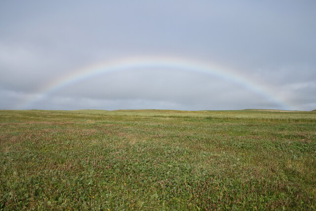
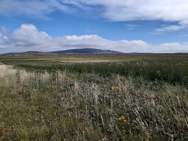
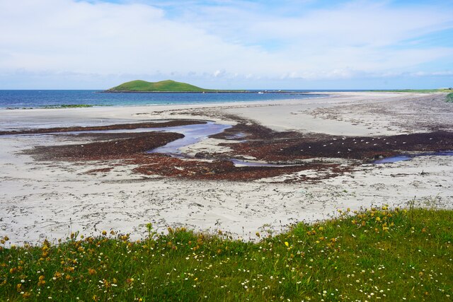
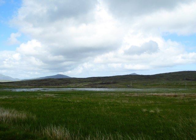
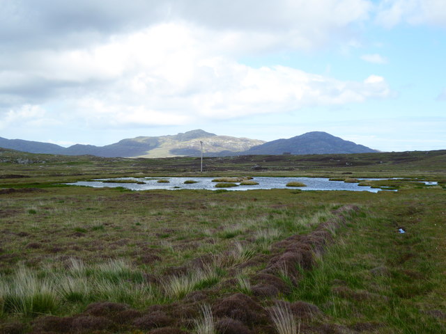
Baghasdail offers breathtaking views of the surrounding landscape, including rolling hills, dramatic cliffs, and pristine beaches. The village serves as a popular base for outdoor enthusiasts, providing easy access to a plethora of outdoor activities such as hiking, fishing, and birdwatching. The nearby Cuillin Mountains are a particular draw for climbers and mountaineers.

The village has a few local amenities, including a small grocery store, a post office, and a community hall where various events and gatherings take place. However, for more extensive shopping and entertainment options, residents and visitors often travel to nearby towns such as Broadford or Portree.

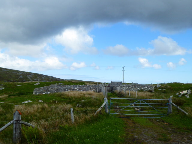
Baghasdail is also home to a number of historic sites, including the ruins of Dunscaith Castle, which dates back to the 14th century. Additionally, the village hosts an annual Highland Games event, showcasing traditional Scottish sports and cultural activities.

Overall, Baghasdail offers a tranquil and scenic retreat for those seeking a peaceful getaway in the heart of the Scottish Highlands.

If you have any feedback on the listing, please let us know in the comments section below.

Baghasdail Images

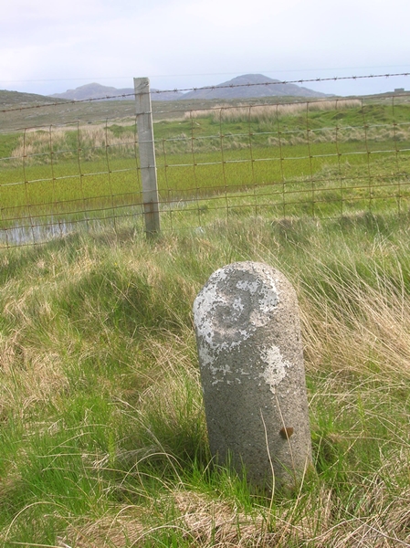
Images are sourced within 2km of 57.137057/-7.3873515 or Grid Reference NF7418. Thanks to Geograph Open Source API. All images are credited.
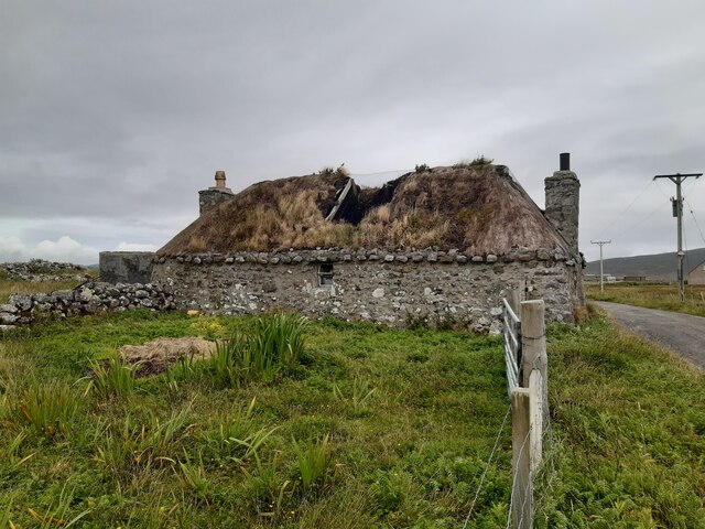
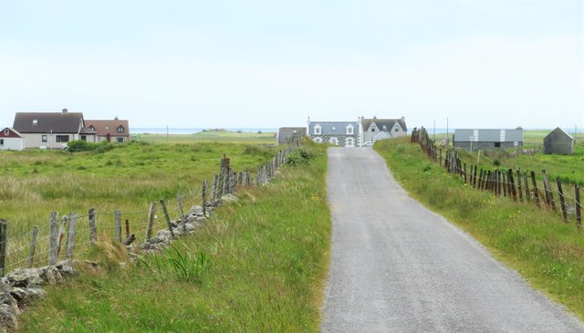
Rainbow over the machair
Derelict croft house Derelict croft house at Geàrraidh na Mònadh.
Derelict croft house
Derelict croft house at Geàrraidh na Mònadh.
View over machair from Cille Pheadair View over machair from top of coastal dunes near Cille Pheadair. South Boisdale and Easabhal in the distance.
View over machair from Cille Pheadair
View over machair from top of coastal dunes near Cille Pheadair. South Boisdale and Easabhal in the distance.
Beach at Garrynamonie Looking towards Orasaigh Island
Beach at Garrynamonie
Looking towards Orasaigh Island
Loch Trosaraidh
Loch Trosaraidh
Fank at Càireasbhal
Fank at Càireasbhal
Dubh-lochan, a small moorland loch
Lochan Dubh nan Caorach
Old Milestone by the B888, by crossroads, in South Uist Parish Granite column by the B888, in parish of South Uist (South Uist District), 100m South of crossroads for roads to North Boisdale and South Lochboisdale, on verge.

Inscription reads:- : 5 : (To Lochboisdale Pier) 

Surveyed

Milestone Society National ID: WI_SULBS05
Old Milestone by the B888, by crossroads, in South Uist Parish
Granite column by the B888, in parish of South Uist (South Uist District), 100m South of crossroads for roads to North Boisdale and South Lochboisdale, on verge. Inscription reads:- : 5 : (To Lochboisdale Pier) Surveyed Milestone Society National ID: WI_SULBS05
Old Milestone by the B888, Lochan Dubh nan Caorach, South Uist
Milestone by the B888 A rather basic milestone with no discernible inscription. Looking south along the road to Eriskay.
Milestone by the B888
A rather basic milestone with no discernible inscription. Looking south along the road to Eriskay.
North along the B888 The main spine road running south to north along South Uist. The B888 becomes the A865 from the junction at Daliburgh.
North along the B888
The main spine road running south to north along South Uist. The B888 becomes the A865 from the junction at Daliburgh.
Road to North Boisdale Heading along a minor road towards this South Uist crofting community.
Road to North Boisdale
Heading along a minor road towards this South Uist crofting community.
An Doirlinn jetty
An Doirlinn jetty
Vegetation on Orasaigh
Traigh na Doirlinn
Traigh na Doirlinn
The net station
The net station
Abandoned house near Baghasdal [2] Twelve years on almost to the day I found myself taking the same view as that taken by Greg Morss in 2007. He reported that the roof was still sound, but now there are holes and further decay seems inevitable.
Abandoned house near Baghasdal [2]
Twelve years on almost to the day I found myself taking the same view as that taken by Greg Morss in 2007. He reported that the roof was still sound, but now there are holes and further decay seems inevitable.
Show me another place!

Baghasdail is located at Grid Ref: NF7418 (Lat: 57.137057, Lng: -7.3873515)

Unitary Authority: Na h-Eileanan an Iar

Police Authority: Highlands and Islands

What 3 Words

///udder.unfit.smarting. Near Lochboisdale, Na h-Eileanan Siar

Related Wikis

Daliburgh

Daliburgh (Scottish Gaelic: Dalabrog) is a crofting township on South Uist, in the Outer Hebrides, Scotland. Daliburgh is situated 1+1⁄2 miles (2.5 kilometres...

Papar

The Papar (Icelandic pronunciation: [ˈpʰaːpar̥]; from Latin papa, via Old Irish, meaning "father" or "pope") were, according to early Icelandic sagas,...
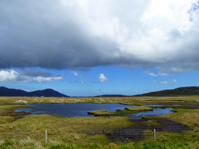
Loch Hallan

Loch Hallan (Scottish Gaelic: Loch Thallan) is a loch (lake) in the Outer Hebrides, Scotland. It is located in the parish of South Uist, approximately...

Easaval

Easaval (Scottish Gaelic: Easabhal) is one of the smallest hills on the island of South Uist in the Outer Hebrides of Scotland, with a height of 243 metres...

Nearby Amenities

Located within 500m of 57.137057,-7.3873515
Baghasdail
Name En: North Boisdale
Name Gd: Baghasdail
Place: village
Lat/Long: 57.1368914/-7.3875333
Post Box
Lat/Long: 57.1370672/-7.3871728
Barrier: cattle_grid
Lat/Long: 57.1335571/-7.3879919
Turning Circle
Lat/Long: 57.1335389/-7.3882521
Power: pole
Lat/Long: 57.1389411/-7.3891259
Power: pole
Lat/Long: 57.1348315/-7.3873208
Power: pole
Lat/Long: 57.1343897/-7.3881657
Power: pole
Lat/Long: 57.1349945/-7.3881832
Power: pole
Lat/Long: 57.1350979/-7.3871934
Power: pole
Lat/Long: 57.1349203/-7.3888443
Power: pole
Lat/Long: 57.1326787/-7.3858778
Power: pole
Lat/Long: 57.133103/-7.3864598
Power: pole
Lat/Long: 57.1335899/-7.3870982
Power: pole
Lat/Long: 57.1339392/-7.387573
Power: pole
Lat/Long: 57.1352383/-7.3892721
Power: pole
Lat/Long: 57.1357609/-7.3894103
Power: pole
Lat/Long: 57.1360898/-7.3894921
Power: pole
Lat/Long: 57.1366989/-7.3896409
Power: pole
Lat/Long: 57.1371064/-7.3897455
Power: pole
Lat/Long: 57.137765/-7.3895162
Power: pole
Lat/Long: 57.1383938/-7.3893057
Power: pole
Lat/Long: 57.1394773/-7.3889355
Power: pole
Lat/Long: 57.1400594/-7.3887437
Power: pole
Lat/Long: 57.1405928/-7.388556
Power: pole
Lat/Long: 57.1410199/-7.3887062
Power: pole
Lat/Long: 57.1414776/-7.3888671
Passing Place
Lat/Long: 57.1364724/-7.3817596
Generator Method: photovoltaic
Generator Output Electricity: small_installation
Generator Source: solar
Generator Type: solar_photovoltaic_panel
Power: generator
Lat/Long: 57.1368478/-7.3915019
Barrier: cattle_grid
Lat/Long: 57.1370228/-7.3913638
Barrier: cattle_grid
Lat/Long: 57.137543/-7.3870034
Passing Place
Lat/Long: 57.1376259/-7.3871624
Passing Place
Lat/Long: 57.1392766/-7.3868253
Power: pole
Lat/Long: 57.1336364/-7.3889504
Passing Place
Lat/Long: 57.1351924/-7.3875952
Power: pole
Lat/Long: 57.1354577/-7.3864559
Power: pole
Lat/Long: 57.133191/-7.3899911
Barrier: cattle_grid
Lat/Long: 57.1327488/-7.3875441
Passing Place
Lat/Long: 57.1365163/-7.3832329
Passing Place
Lat/Long: 57.1366205/-7.3846472
The data included in this document is from www.openstreetmap.org. The data is made available under ODbL.

Have you been to Baghasdail?

Leave your review of Baghasdail below (or comments, questions and feedback).