Badingham

Settlement in Suffolk East Suffolk

England

Badingham

Church of St. John the Baptist, Badingham <span class="nowrap"><a title="https://historicengland.org.uk/listing/the-list/list-entry/1030808?section=official-list-entry" rel="nofollow ugc noopener" href="https://historicengland.org.uk/listing/the-list/list-entry/1030808?section=official-list-entry">Link</a><img style="margin-left:2px;" alt="External link" title="External link - shift click to open in new window" src="https://s1.geograph.org.uk/img/external.png" width="10" height="10"/></span>
Church of St. John the Baptist, Badingham Credit: Sandy Gerrard

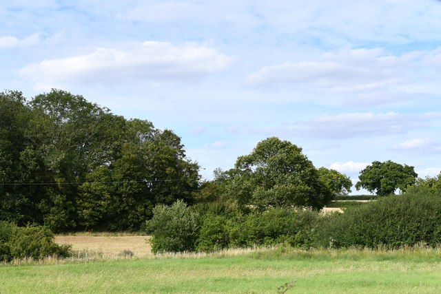
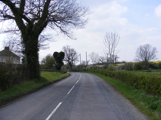
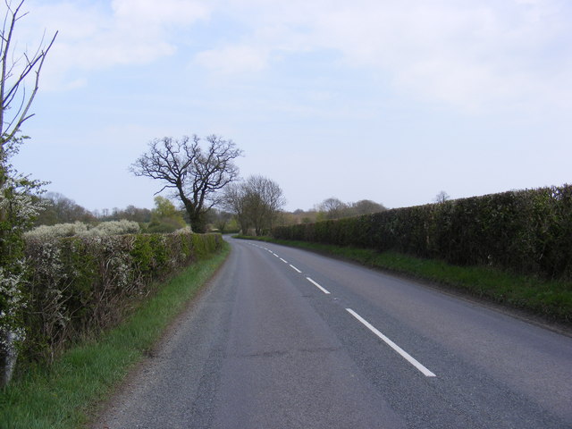
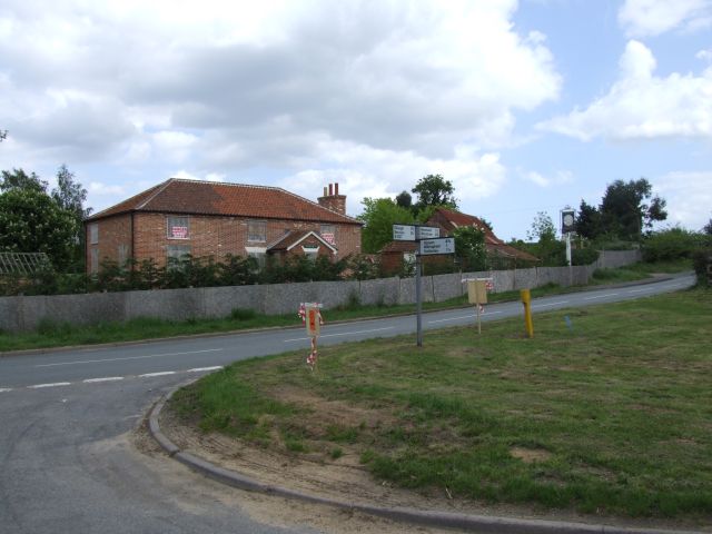
Badingham is a small village located in the county of Suffolk, England. Situated approximately 16 miles northeast of Ipswich, it is part of the Mid Suffolk district. The village is bordered by the River Alde to the east and surrounded by scenic countryside, making it a desirable location for those seeking a peaceful and picturesque setting.

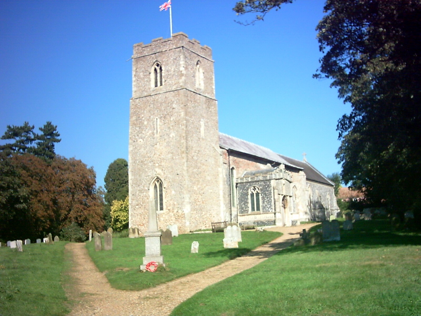
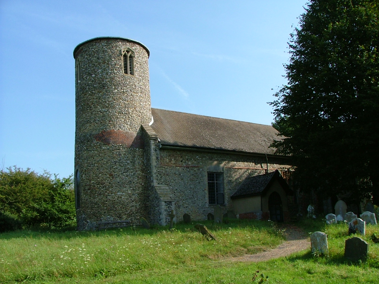
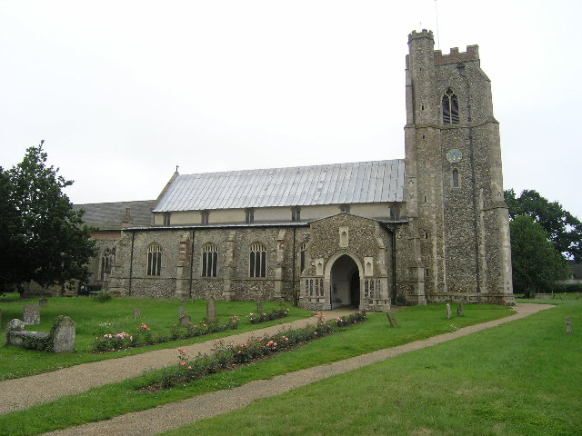
With a population of around 400 residents, Badingham has a close-knit community feel. The village is home to St. John the Baptist Church, a beautiful medieval building dating back to the 14th century, known for its impressive stained glass windows and intricate stonework.

Badingham also boasts a range of amenities to cater to the needs of its residents. These include a village hall, a primary school, a local shop, and a pub, where locals and visitors can enjoy traditional food and drinks in a friendly atmosphere.

For those who enjoy outdoor activities, Badingham offers plenty of opportunities to explore the surrounding countryside. The village is surrounded by footpaths and bridleways, providing access to scenic walks and bike rides. The nearby River Alde also offers opportunities for fishing and boating.

Overall, Badingham is a charming and idyllic village in Suffolk, known for its natural beauty, friendly community, and historic landmarks. It provides a peaceful retreat for residents and visitors alike, offering a taste of rural England at its finest.

If you have any feedback on the listing, please let us know in the comments section below.

Badingham Images

Images are sourced within 2km of 52.262236/1.3797832 or Grid Reference TM3068. Thanks to Geograph Open Source API. All images are credited.

Church of St. John the Baptist, Badingham <span class="nowrap"><a title="https://historicengland.org.uk/listing/the-list/list-entry/1030808?section=official-list-entry" rel="nofollow ugc noopener" href="https://historicengland.org.uk/listing/the-list/list-entry/1030808?section=official-list-entry">Link</a><img style="margin-left:2px;" alt="External link" title="External link - shift click to open in new window" src="https://s1.geograph.org.uk/img/external.png" width="10" height="10"/></span>
Church of St. John the Baptist, Badingham
Badingham: Dennington Wood
Wash Lane This leads to Capons Green Farm and is also part of a footpath.
Wash Lane
This leads to Capons Green Farm and is also part of a footpath.
Houses Houses at the side of the busy A1120 east of Dennington, Suffolk.
Houses
Houses at the side of the busy A1120 east of Dennington, Suffolk.
Cowslips north of Dennington Wood I was wondering yesterday - where are all the cowslips this year? Here are some of them, just opening up to a cold April day in East Suffolk.
Cowslips north of Dennington Wood
I was wondering yesterday - where are all the cowslips this year? Here are some of them, just opening up to a cold April day in East Suffolk.
Cold wet field and hedge This is spring 2008 and to the untrained eye the image is winter. But at the base of the hedge is a patch of opening cowslips - Primula veris - and the eye and heart is gladdened. See <a href="https://www.geograph.org.uk/photo/766079">TM2968 : Cowslips north of Dennington Wood</a> for detail.
Cold wet field and hedge
This is spring 2008 and to the untrained eye the image is winter. But at the base of the hedge is a patch of opening cowslips - Primula veris - and the eye and heart is gladdened. See TM2968 : Cowslips north of Dennington Wood for detail.
Small pond and Dennington Wood The public footpath proceeds across the scene and around the ivy-clad tree to the right.
Small pond and Dennington Wood
The public footpath proceeds across the scene and around the ivy-clad tree to the right.
A1120 & Capons Green Postbox Looking towards Dennington
Postbox No.IP13 6298
A1120 & Capons Green Postbox
Looking towards Dennington Postbox No.IP13 6298
Capons Green Postbox On the A1120
Postbox No.IP13 6298
Capons Green Postbox
On the A1120 Postbox No.IP13 6298
Dennington Wood Taken from the A1120 Dennington Road
Dennington Wood
Taken from the A1120 Dennington Road
A1120 Badingham Road, Capon's Green Looking towards Wood Farm Cottages and Dennington
A1120 Badingham Road, Capon's Green
Looking towards Wood Farm Cottages and Dennington
A1120 Badingham Road, Capon's Green Looking towards Rook's Bridge and Badingham near Wash Farm
A1120 Badingham Road, Capon's Green
Looking towards Rook's Bridge and Badingham near Wash Farm
Clay Hill, Capons Green Near Clay Hill Farm
Road No.U2520
Clay Hill, Capons Green
Near Clay Hill Farm Road No.U2520
Roadsign on the A1120 Dennington Road
A1120 Dennington Road, Badingham Approaching the junction with the B1120 Framlingham Road
A1120 Dennington Road, Badingham
Approaching the junction with the B1120 Framlingham Road
Roadsigns on the B1120 At the junction with the A1120 Dennington Road
Roadsigns on the B1120
At the junction with the A1120 Dennington Road
Entering Badingham on the A1120 Dennington Road <span class="nowrap"><a title="https://en.wikipedia.org/wiki/Badingham" rel="nofollow ugc noopener" href="https://en.wikipedia.org/wiki/Badingham">Link</a><img style="margin-left:2px;" alt="External link" title="External link - shift click to open in new window" src="https://s1.geograph.org.uk/img/external.png" width="10" height="10"/></span>
Entering Badingham on the A1120 Dennington Road
Badingham Village Name sign on the A1120 <span class="nowrap"><a title="https://en.wikipedia.org/wiki/Badingham" rel="nofollow ugc noopener" href="https://en.wikipedia.org/wiki/Badingham">Link</a><img style="margin-left:2px;" alt="External link" title="External link - shift click to open in new window" src="https://s1.geograph.org.uk/img/external.png" width="10" height="10"/></span>
Badingham Village Name sign on the A1120
Show me another place!

Badingham is located at Grid Ref: TM3068 (Lat: 52.262236, Lng: 1.3797832)

Administrative County: Suffolk

District: East Suffolk

Police Authority: Suffolk

What 3 Words

///shipyards.fewer.steam. Near Framlingham, Suffolk

Nearby Locations

Badingham

Related Wikis

Badingham

Badingham is a civil parish in the East Suffolk district of eastern England, in the county of Suffolk. It is situated 21.8 miles (35.1 kilometres) north...

Hulver Street

Hulver Street, also known simply as Hulver, is a hamlet near the market town of Beccles, in the civil parish of Henstead with Hulver Street, in the East...

Bruisyard

Bruisyard is a village in the valley of the River Alde in the county of Suffolk, England. The village had a population of around 175 at the 2011 census...

Dennington

Dennington is a village and civil parish in the English county of Suffolk. It is 2 miles (3.2 km) north of Framlingham and 15 miles (24 km) north-east...

Nearby Amenities

Located within 500m of 52.262236,1.3797832
Badingham
Place: village
Wikidata: Q4840962
Wikipedia: en:Badingham
Lat/Long: 52.2621686/1.3805224
Bus Stop
Church
Naptan AtcoCode: 390060349
Naptan Bearing: NW
Naptan BusStopType: CUS
Naptan CommonName: Church
Naptan Indicator: adj
Naptan Landmark: Church
Naptan NaptanCode: sufgpgwa
Naptan Street: Low Street
Naptan Verified: no
Source: naptan_import
Lat/Long: 52.2641043/1.3766485
Bus Stop
Church
Naptan AtcoCode: 390060350
Naptan Bearing: SE
Naptan BusStopType: CUS
Naptan CommonName: Church
Naptan Indicator: opp
Naptan Landmark: Church
Naptan NaptanCode: sufgpgwd
Naptan Street: Low Street
Naptan Verified: no
Source: naptan_import
Lat/Long: 52.2641381/1.3767243
Bus Stop
White Horse
Naptan AtcoCode: 390060922
Naptan Bearing: N
Naptan BusStopType: CUS
Naptan CommonName: White Horse
Naptan Indicator: N-bound
Naptan Landmark: White Horse
Naptan NaptanCode: sufjmagt
Naptan Street: Low Street
Naptan Verified: no
Source: naptan_import
Lat/Long: 52.2579628/1.3797286
Bus Stop
White Horse
Naptan AtcoCode: 390060923
Naptan Bearing: S
Naptan BusStopType: CUS
Naptan CommonName: White Horse
Naptan Indicator: S-bound
Naptan Landmark: White Horse
Naptan NaptanCode: sufjmagw
Naptan Street: Low Street
Naptan Verified: no
Source: naptan_import
Lat/Long: 52.2580517/1.3797646
Bus Stop
Phone Box
Naptan AtcoCode: 390061008
Naptan Bearing: N
Naptan BusStopType: CUS
Naptan CommonName: Phone Box
Naptan Indicator: o/s
Naptan Landmark: Phone Box
Naptan NaptanCode: sufjmdwp
Naptan Street: Low Street
Naptan Verified: no
Source: naptan_import
Lat/Long: 52.2611251/1.3801744
Bus Stop
Post Box
Naptan AtcoCode: 390061009
Naptan Bearing: S
Naptan BusStopType: CUS
Naptan CommonName: Post Box
Naptan Indicator: opp
Naptan Landmark: Phone Box
Naptan NaptanCode: sufjmdwt
Naptan Street: Low Street
Naptan Verified: no
Source: naptan_import
Lat/Long: 52.2611486/1.3802935
Fixme: incomplete
Lat/Long: 52.2630743/1.3784581
Fixme: Where does Public Footpath go from here?
Lat/Long: 52.2640707/1.3779461
Post Box
Collection Times: Mo-Fr 09:00; Sa 09:30
Post Box Mounting: pier
Post Box Type: lamp
Ref: IP13 6274
Royal Cypher: EIIR
Royal Cypher Wikidata: Q33102113
Lat/Long: 52.2640247/1.3767466
Fixme: incomplete
Lat/Long: 52.2603008/1.383368
Telephone
Booth: K6
Covered: booth
Man Made: telephone_box
Lat/Long: 52.2609966/1.380172
The data included in this document is from www.openstreetmap.org. The data is made available under ODbL.

Have you been to Badingham?

Leave your review of Badingham below (or comments, questions and feedback).