Aultgrishan

Settlement in Ross-shire

Scotland

Aultgrishan

B8021 at Melvaig
B8021 at Melvaig Credit: Chris Morgan

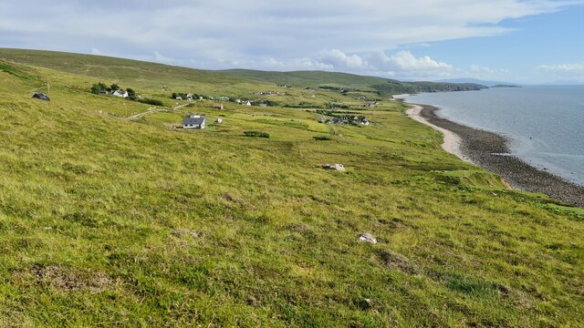
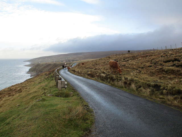
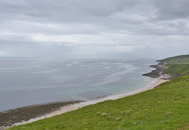
Aultgrishan is a small village located in the county of Ross-shire, in the northern part of Scotland. Situated on the west coast of the Highlands, it is surrounded by stunning natural beauty and offers breathtaking views of the rugged landscape and the Atlantic Ocean.

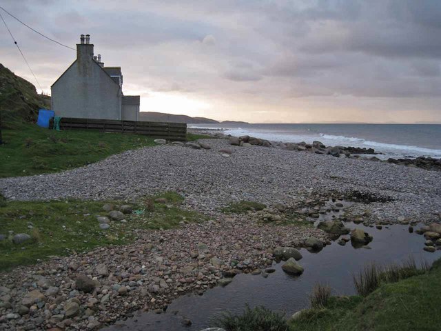
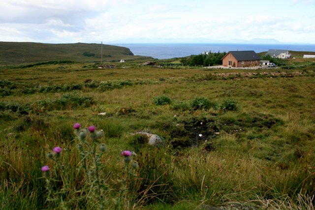
With a population of around 200 residents, Aultgrishan is a close-knit community that thrives on its peaceful and idyllic setting. The village is predominantly residential, with a scattering of traditional stone houses and cottages adding to its charm.

The area is known for its rich history, with traces of ancient settlements dating back to the prehistoric era. This has attracted archaeologists and history enthusiasts to explore the region and discover remnants of the past.

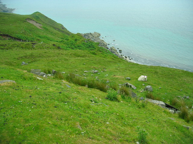
Aultgrishan is also a popular destination for outdoor enthusiasts and nature lovers. The village serves as a gateway to the nearby Torridon Mountains, renowned for their majestic peaks and excellent hiking opportunities. The rugged coastline offers opportunities for fishing, birdwatching, and exploring hidden coves and sandy beaches.

Despite its remote location, Aultgrishan is well-connected to nearby towns and cities. The village is approximately 15 miles from Gairloch, which offers a range of amenities including shops, restaurants, and schools.

Overall, Aultgrishan is a hidden gem in the Scottish Highlands, offering a tranquil retreat for those seeking a peaceful getaway amidst stunning natural surroundings and a strong sense of community.

If you have any feedback on the listing, please let us know in the comments section below.

Aultgrishan Images

Images are sourced within 2km of 57.803206/-5.8007269 or Grid Reference NG7485. Thanks to Geograph Open Source API. All images are credited.

B8021 at Melvaig
B8021 at Melvaig
Ruined croft at Melvaig
Cliffs above Seana Chamas
Coast at Melvaig
Coast at Melvaig
Cliffs north of Peterburn
Car park on the road from Melvaig
Allt Grisionn
Allt Grisionn
Free ranging cattle
Free ranging cattle
Allt Grisionn
Allt Grisionn
Houses at Melvaig
Houses at Melvaig
Grazing land with a view
House on the beach This house stands just above the shingle beach at Melvaig. The Allt Melvaig flows into the sea at the photographer's feet.
House on the beach
This house stands just above the shingle beach at Melvaig. The Allt Melvaig flows into the sea at the photographer's feet.
Bridge over Allt Melvaig The bridge carries the unclassified single track road which serves the small settlement of Melvaig.
Bridge over Allt Melvaig
The bridge carries the unclassified single track road which serves the small settlement of Melvaig.
Coast below Sidhean Mòr
The beach on Seana Chamas A superb-looking beach, but not the easiest to access.
The beach on Seana Chamas
A superb-looking beach, but not the easiest to access.
The Allt a' Gamhna above the Melvaig road With the one-time route of the road visible.
The Allt a' Gamhna above the Melvaig road
With the one-time route of the road visible.
The Allt a' Gamhna below the Melvaig road Following a deep cut down to the sea.
The Allt a' Gamhna below the Melvaig road
Following a deep cut down to the sea.
Track heading for the shore With Skye in the distance.
Track heading for the shore
With Skye in the distance.
Show me another place!

Aultgrishan is located at Grid Ref: NG7485 (Lat: 57.803206, Lng: -5.8007269)

Unitary Authority: Highland

Police Authority: Highlands and Islands

What 3 Words

///earful.grinders.unrealistic. Near Gairloch, Highland

Related Wikis

Aultgrishan

Aultgrishan (Gaelic: ) is a small crofting community near Gairloch, Ross-shire. It adjoins Melvaig, within Highland region and is in the Scottish council...

Melvaig

Melvaig is a remote village on the coast of western Ross-shire, Scottish Highlands and is in the Scottish council area of Highland. It is a cliff top...

North Erradale

North Erradale is a remote coastal crofting village on the western coast of Ross-shire, Scottish Highlands and is in the Scottish council area of Highland...

Rua Reidh Lighthouse

Rua Reidh Lighthouse stands close to the entrance to Loch Ewe in Wester Ross, Scotland. == History == The name "Rua Reidh" is a semi-anglicisation of...

Nearby Amenities

Located within 500m of 57.803206,-5.8007269
Source: PGS
Lat/Long: 57.8056198/-5.8066273
Source: PGS
Lat/Long: 57.8046786/-5.8066785
Source: PGS
Lat/Long: 57.8034168/-5.8061455
Source: PGS
Lat/Long: 57.8024672/-5.8055224
Source: PGS
Lat/Long: 57.8016707/-5.8045839
Source: PGS
Lat/Long: 57.8011649/-5.8040169
Source: PGS
Lat/Long: 57.8003506/-5.8036332
Source: PGS
Lat/Long: 57.79976/-5.8034478
Aultgrishan
Name En: Aultgrishan
Name Gd: Allt Ghrìsean
Place: hamlet
Lat/Long: 57.8035862/-5.8011203
Power: pole
Lat/Long: 57.7996752/-5.79762
Power: pole
Lat/Long: 57.8002524/-5.7978075
Power: pole
Lat/Long: 57.8008706/-5.7980224
Power: pole
Lat/Long: 57.8016989/-5.7983035
Power: pole
Lat/Long: 57.8022878/-5.7984964
Power: pole
Lat/Long: 57.8027621/-5.7986701
Power: pole
Lat/Long: 57.8034809/-5.798903
Power: pole
Lat/Long: 57.8041505/-5.7991179
Power: pole
Lat/Long: 57.8045822/-5.7992612
Power: pole
Lat/Long: 57.8053884/-5.7995479
Power: pole
Lat/Long: 57.8060741/-5.7995837
Power: pole
Lat/Long: 57.8067672/-5.799625
Power: pole
Lat/Long: 57.807425/-5.7996664
Power: pole
Lat/Long: 57.8053781/-5.7996278
Power: pole
Lat/Long: 57.8053311/-5.8003746
Power: pole
Lat/Long: 57.8052415/-5.8018188
Power: pole
Lat/Long: 57.8051843/-5.8025133
Power: pole
Lat/Long: 57.7998495/-5.7993564
Power: pole
Lat/Long: 57.8000169/-5.7986995
Power: pole
Lat/Long: 57.8049085/-5.7991863
Power: pole
Lat/Long: 57.8047795/-5.7996273
Power: pole
Lat/Long: 57.8044043/-5.7999833
Power: pole
Lat/Long: 57.8039295/-5.799893
Power: pole
Lat/Long: 57.8037175/-5.799859
Power: pole
Lat/Long: 57.8032657/-5.8002686
Power: pole
Lat/Long: 57.8030202/-5.8003942
Power: pole
Lat/Long: 57.8027636/-5.8004754
Power: pole
Lat/Long: 57.8026242/-5.8005015
Power: pole
Lat/Long: 57.8022699/-5.8007004
Power: pole
Lat/Long: 57.8018822/-5.8009164
Power: pole
Lat/Long: 57.8018174/-5.7994742
Power: pole
Lat/Long: 57.8037371/-5.799113
Power: pole
Lat/Long: 57.8033284/-5.7990921
Power: pole
Lat/Long: 57.8030244/-5.7990869
Power: pole
Lat/Long: 57.8028034/-5.799096
Power: pole
Lat/Long: 57.8040362/-5.8028126
Power: pole
Lat/Long: 57.8044755/-5.8028362
Power: pole
Lat/Long: 57.8048297/-5.802653
Power: pole
Lat/Long: 57.8056259/-5.8026975
Power: pole
Lat/Long: 57.8059815/-5.8028519
Power: pole
Lat/Long: 57.806379/-5.8030351
Power: pole
Lat/Long: 57.8068057/-5.8032366
Power: pole
Lat/Long: 57.8072561/-5.8034356
The data included in this document is from www.openstreetmap.org. The data is made available under ODbL.

Have you been to Aultgrishan?

Leave your review of Aultgrishan below (or comments, questions and feedback).