Ashton-on-Ribble

Settlement in Lancashire Preston

England

Ashton-on-Ribble

Old Milestone Marker 54-03 F (between bridges 18-17), Lancaster Canal Old Milestone located by the side of the Lancaster Canal
This milestone is 3 miles from the centre of Preston and 54 miles from Kendal

Inscription reads:- 
Preston / 3 :: Garstang / 14 

Milestone Society National ID: LAN-03
Old Milestone Marker 54-03 F (between bridges 18-17), Lancaster Canal Credit: Cactus Chris

Ashton-on-Ribble is a suburb located in the city of Preston, Lancashire, England. Situated on the northern bank of the River Ribble, it is approximately two miles west of the city center. The area covers a relatively small area, with a population of around 11,000 residents.

Historically, Ashton-on-Ribble was an agricultural village, known for its farming and market gardening activities. However, with the expansion of Preston in the 19th century, it gradually transformed into a residential area. Today, it is a mix of residential and commercial properties, offering a range of amenities for its residents.

One of the notable features of Ashton-on-Ribble is its proximity to the River Ribble. The area boasts several riverside parks and green spaces, providing opportunities for leisure activities such as walking, cycling, and picnicking. Ashton Park, located on the riverbank, is a popular destination for locals and visitors alike.

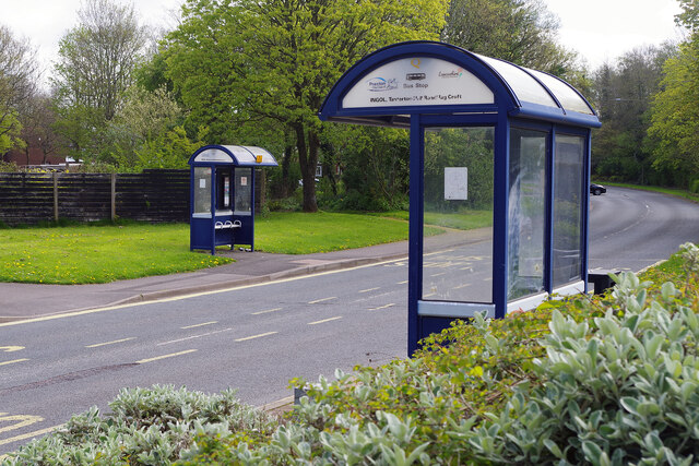
The suburb also benefits from excellent transport links, with easy access to the M6 motorway and Preston city center. It has its own train station, known as Preston Docks, which provides connections to other major cities in the region.

In terms of education, Ashton-on-Ribble is home to several primary schools and is within close proximity to secondary schools and colleges in the surrounding areas.

Overall, Ashton-on-Ribble is a pleasant and well-connected suburb of Preston, offering a blend of residential charm, green spaces, and convenient amenities for its residents.

If you have any feedback on the listing, please let us know in the comments section below.

Ashton-on-Ribble Images

Images are sourced within 2km of 53.768524/-2.7395168 or Grid Reference SD5130. Thanks to Geograph Open Source API. All images are credited.

Old Milestone Marker 54-03 F (between bridges 18-17), Lancaster Canal Old Milestone located by the side of the Lancaster Canal
This milestone is 3 miles from the centre of Preston and 54 miles from Kendal

Inscription reads:- 
Preston / 3 :: Garstang / 14 

Milestone Society National ID: LAN-03
Old Milestone Marker 54-03 F (between bridges 18-17), Lancaster Canal
Old Milestone located by the side of the Lancaster Canal This milestone is 3 miles from the centre of Preston and 54 miles from Kendal Inscription reads:- Preston / 3 :: Garstang / 14 Milestone Society National ID: LAN-03
Track through wasteland south of Riversway Motor Park
Riversway heading towards Preston
Ribble Shore The northern shore of the River Ribble, approximately 1000 yards downstream of Preston Docks.
Ribble Shore
The northern shore of the River Ribble, approximately 1000 yards downstream of Preston Docks.
Industrial Units on Fylde Road View from Fylde Road Viaduct
Industrial Units on Fylde Road
View from Fylde Road Viaduct
Old Milestone Marker 55-02 F (between bridges 15-14), Lancaster Canal (between bridges old marker) Old Milestone located by the side of the Lancaster Canal
This milestone is 2 miles from the centre of Preston and 55 miles from Kendal

Inscription reads:- 
Preston / 2 :: Garstang / 15 (missing) 

Milestone Society National ID: LAN-02
Old Milestone Marker 55-02 F (between bridges 15-14), Lancaster Canal (between bridges old marker)
Old Milestone located by the side of the Lancaster Canal This milestone is 2 miles from the centre of Preston and 55 miles from Kendal Inscription reads:- Preston / 2 :: Garstang / 15 (missing) Milestone Society National ID: LAN-02
Milestone Marker 55-02 F (between bridges 15-14), Lancaster Canal Milestone located by the side of the Lancaster Canal
This milestone is 2 miles from the centre of Preston and 55 miles from Kendal

Inscription reads:- 
Preston / 2 :: Garstang / 15 

Milestone Society National ID: LAN-02R
Milestone Marker 55-02 F (between bridges 15-14), Lancaster Canal
Milestone located by the side of the Lancaster Canal This milestone is 2 miles from the centre of Preston and 55 miles from Kendal Inscription reads:- Preston / 2 :: Garstang / 15 Milestone Society National ID: LAN-02R
Milestone Marker 56-01 F (between bridges 11-10), Lancaster Canal Milestone located by the side of the Lancaster Canal
This milestone is 1 miles from the centre of Preston and 56 miles from Kendal

Inscription reads:- 

Preston / 1 :: Garstang / 16 
Milestone Society National ID: LAN-01R
Milestone Marker 56-01 F (between bridges 11-10), Lancaster Canal
Milestone located by the side of the Lancaster Canal This milestone is 1 miles from the centre of Preston and 56 miles from Kendal Inscription reads:- Preston / 1 :: Garstang / 16 Milestone Society National ID: LAN-01R
Tom Benson Way, Cottam Named after Preston's famous marathon walker, this modern road, opened in 1985, is a stretch of the B6241 giving access to some of the city's north-western suburbs.
Tom Benson Way, Cottam
Named after Preston's famous marathon walker, this modern road, opened in 1985, is a stretch of the B6241 giving access to some of the city's north-western suburbs.
Tanterton Hall Road, Ingol Two of Preston's neat bus shelters almost face each other on Tanterton Hall Road in the city's north-western suburbs.
Tanterton Hall Road, Ingol
Two of Preston's neat bus shelters almost face each other on Tanterton Hall Road in the city's north-western suburbs.
Ingol Social Club It is something of a mystery as to why these sort of places invariably look so unprepossessing from the outside. Ingol Social Club on Whitby Avenue, with its stained brickwork, 1960s-style windows and fascia, solid doors, old bin, and weeds growing up from the bottom of the wall, is no exception. Apparently it has been refurbished to 'a very high standard' - it's a pity they didn't knock it down and start again. The club first opened as the Ingol Labour Club in 1968.
Ingol Social Club
It is something of a mystery as to why these sort of places invariably look so unprepossessing from the outside. Ingol Social Club on Whitby Avenue, with its stained brickwork, 1960s-style windows and fascia, solid doors, old bin, and weeds growing up from the bottom of the wall, is no exception. Apparently it has been refurbished to 'a very high standard' - it's a pity they didn't knock it down and start again. The club first opened as the Ingol Labour Club in 1968.
Whitby Avenue, Ingol Preston began to expand into the Ingol area in the early 1960s and the housing stock here is of its time.
Whitby Avenue, Ingol
Preston began to expand into the Ingol area in the early 1960s and the housing stock here is of its time.
Backs of houses on Dalmore Road, Ingol This potholed roadway leads off Barry Avenue into a yard at the back of a terrace of houses on Dalmore Road.
Backs of houses on Dalmore Road, Ingol
This potholed roadway leads off Barry Avenue into a yard at the back of a terrace of houses on Dalmore Road.
Barry Avenue, Ingol Cottam Avenue leads off to the left down to the Lancaster Canal at the southern tip of the Ingol built-up area.
Barry Avenue, Ingol
Cottam Avenue leads off to the left down to the Lancaster Canal at the southern tip of the Ingol built-up area.
Lancaster Canal, Ingol This is the view looking down from Cottam Mill Bridge towards the end of the canal at Ashton Basin just over a mile away.
Lancaster Canal, Ingol
This is the view looking down from Cottam Mill Bridge towards the end of the canal at Ashton Basin just over a mile away.
Cottam Mill Bridge, Ingol Cottam Mill Bridge carries Cottam Lane over the Lancaster Canal. Bridge House is straight ahead.
Cottam Mill Bridge, Ingol
Cottam Mill Bridge carries Cottam Lane over the Lancaster Canal. Bridge House is straight ahead.
Cottam Mill Bridge, Lancaster Canal Cottam Mill Bridge is no 16 on the Lancaster Canal, although number 1-10 no longer exist. This is on what is effectively a dead end arm leading to Ashton Basin near the centre of Preston.
Cottam Mill Bridge, Lancaster Canal
Cottam Mill Bridge is no 16 on the Lancaster Canal, although number 1-10 no longer exist. This is on what is effectively a dead end arm leading to Ashton Basin near the centre of Preston.
Under Cottam Mill Bridge, Lancaster Canal A broadbeam boat is moored just to the east of bridge 16 on the Lancaster Canal. This is looking towards the modern end of the canal at Ashton Basin.
Under Cottam Mill Bridge, Lancaster Canal
A broadbeam boat is moored just to the east of bridge 16 on the Lancaster Canal. This is looking towards the modern end of the canal at Ashton Basin.
Show me another place!

Ashton-on-Ribble is located at Grid Ref: SD5130 (Lat: 53.768524, Lng: -2.7395168)

Administrative County: Lancashire

District: Preston

Police Authority: Lancashire

What 3 Words

///reader.nurses.worker. Near Preston, Lancashire

Nearby Locations

Ashton-on-Ribble

Related Wikis

St Andrew's Church, Ashton-on-Ribble

St Andrew's Church is in Blackpool Road, Ashton-on-Ribble, Preston, Lancashire, England. It is an active Anglican parish church in the deanery of Preston...

Ashton Park

Ashton Park is situated in Ashton-on-Ribble to the west of Preston, Lancashire, England. It has one bowling green, two play areas, with swings, roundabouts...

St Michael and All Angels Church, Ashton-on-Ribble

St Michael and All Angels with St Marks Church is in Egerton Road, Ashton-on-Ribble, Preston, Lancashire, England. It is an active Anglican parish church...

Ashton Community Science College

Ashton Community Science College is a coeducational secondary school located in the Ashton-on-Ribble area of Preston in the English county of Lancashire...

Ashton-on-Ribble

Ashton-on-Ribble is a suburb in the West of Preston, Lancashire, England. The population at the 2021 Census was 8,700. Ashton-on-Ribble was recorded in...

Preston Castle, Lancashire

Preston Castle, or Tulketh Castle, was a motte and bailey castle in the Ashton-on-Ribble district of Preston, Lancashire, England. The site became disused...

Preston Dock

Preston Dock (also known as Preston Docklands) was a former maritime dock located on the northern bank of the River Ribble approximately 2.5 km (1.6 mi...

Tulketh Hall

Tulketh Hall was a country house in Ashton-on-Ribble, which is now a suburb of Preston, Lancashire, England. It was demolished in 1960. == History == In...

Nearby Amenities

Located within 500m of 53.768524,-2.7395168
Ashton-on-Ribble
Place: suburb
Short Name: Ashton
Source: OS_OpenData_StreetView
Lat/Long: 53.7685765/-2.7393495
Traffic Signals
Lat/Long: 53.7686529/-2.7394813
Traffic Signals
Lat/Long: 53.7690813/-2.737389
Clinic
Ashton Health Centre
Building: yes
Healthcare: clinic
Lat/Long: 53.766295/-2.7413895
Turning Circle
Lat/Long: 53.7703068/-2.73382
Turning Circle
Lat/Long: 53.7705772/-2.7348711
Crossing
Crossing: traffic_signals
Crossing Ref: pelican
Lat/Long: 53.7693967/-2.7358758
Crossing
Crossing: traffic_signals
Crossing Ref: pelican
Lat/Long: 53.7692018/-2.7461168
Crossing
Lat/Long: 53.7683756/-2.7395156
Crossing
Lat/Long: 53.7684029/-2.739293
Crossing
Lat/Long: 53.7684437/-2.739584
Barrier: bollard
Lat/Long: 53.7691265/-2.7467861
Crossing
Crossing: traffic_signals
Crossing Ref: pelican
Tactile Paving: yes
Lat/Long: 53.7691097/-2.7461995
Barrier: bollard
Lat/Long: 53.7691391/-2.7465716
Barrier: bollard
Lat/Long: 53.7691614/-2.7459546
Crossing
Crossing: traffic_signals
Crossing Ref: pelican
Tactile Paving: yes
Lat/Long: 53.7688834/-2.7423482
Crossing
Crossing: traffic_signals
Crossing Ref: pelican
Tactile Paving: yes
Lat/Long: 53.7687918/-2.7422037
Fast Food
King Cod
Addr City: Preston
Addr Housenumber: 632
Addr Postcode: PR2 1SE
Addr Street: Blackpool Road
Cuisine: fish
Fhrs Id: 71390
Lat/Long: 53.7693341/-2.7464697
Post Office
Blackpool Road Post Office
Addr City: Preston
Addr Housenumber: 592
Addr Postcode: PR2 1JA
Addr Street: Blackpool Road
Addr Suburb: Ashton-on-Ribble
Brand: Post Office
Brand Wikidata: Q1783168
Fhrs Id: 448107
Opening Hours: Mo-Fr 08:30-18:00; Sa 08:30-15:00
Ref Pol Id: 3764
Source: pol_branch_list_2018-02
Website: https://www.postoffice.co.uk/branch-finder/1614274/blackpool-road
Lat/Long: 53.7690112/-2.7418819
Entrance: yes
Lat/Long: 53.7689116/-2.7361544
Barnardo's
Brand: Barnardo's
Brand Wikidata: Q2884670
Shop: charity
Lat/Long: 53.7684875/-2.7386668
Give Way
Direction: forward
Lat/Long: 53.7649486/-2.7405569
Stop
Direction: forward
Stop: minor
Lat/Long: 53.7698568/-2.7331683
Post Box
Collection Times: Mo-Fr 09:00; Sa 07:00
Ref: PR2 10
Lat/Long: 53.769365/-2.7351608
Doctors
Cottam Lane Surgery
Healthcare: doctor
Lat/Long: 53.7693664/-2.7392454
Ashton News
Addr City: Preston
Addr Housenumber: 630
Addr Postcode: PR2 1SE
Addr Street: Blackpool Road
Addr Suburb: Ashton-on-Ribble
Fhrs Id: 448036
Shop: newsagent
Lat/Long: 53.7693259/-2.7463768
Car Wash
Automated: no
Self Service: no
Lat/Long: 53.7693418/-2.7456181
Parking
Access: customers
Capacity: 10
Parking: surface
Lat/Long: 53.769797/-2.7348125
Doctors
Briarwood Medical Centre
Addr City: Preston
Addr Housenumber: 514
Addr Postcode: PR2 1HY
Addr Street: Blackpool Road
Healthcare: doctor
Lat/Long: 53.7699111/-2.734791
The data included in this document is from www.openstreetmap.org. The data is made available under ODbL.

Have you been to Ashton-on-Ribble?

Leave your review of Ashton-on-Ribble below (or comments, questions and feedback).