Anlaby Common

Settlement in Yorkshire

England

Anlaby Common

Carr Lane, Willerby Public footpath/cycle path running along the northern edge of Springhead Park golf course. It has the same name as, and continues the course of, the residential road, but this section is closed to motorised traffic.
Carr Lane, Willerby Credit: Paul Harrop

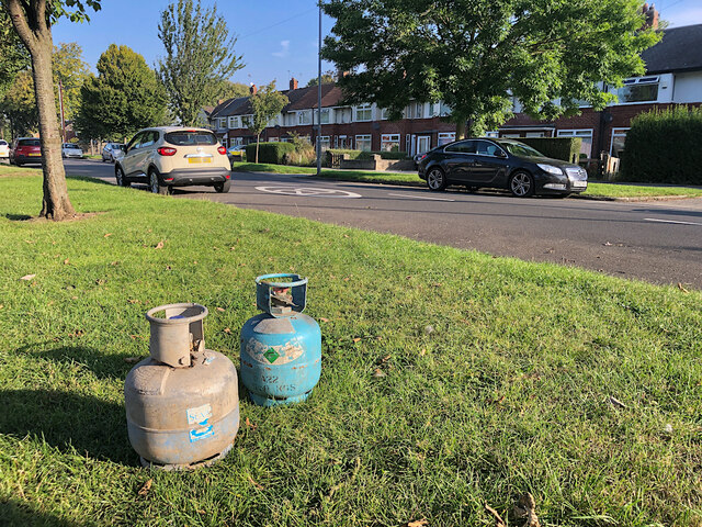
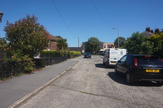
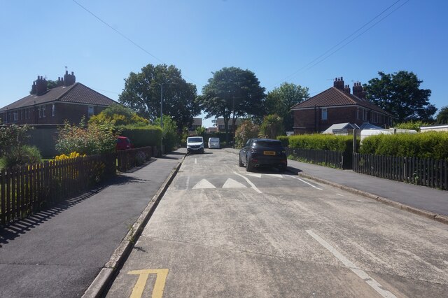
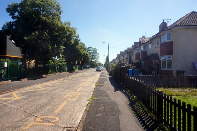
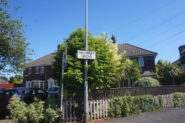
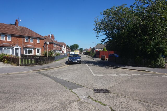
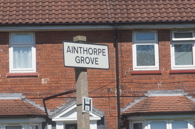
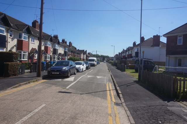
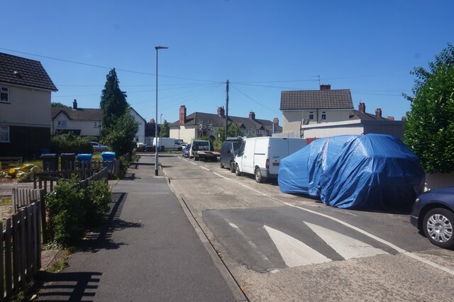
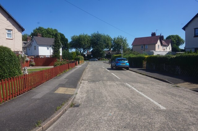
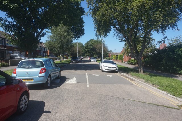
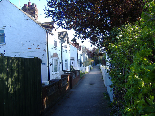
Anlaby Common is a small village located in the East Riding of Yorkshire, England. Situated just west of the city of Hull, it covers an area of approximately 1.5 square miles. The village is primarily residential, with a mix of detached and semi-detached houses, as well as some smaller terraced properties.

Anlaby Common benefits from its close proximity to Hull, offering residents easy access to the city's amenities and employment opportunities. The village is well-connected to the rest of Yorkshire and beyond, with good transport links including nearby major roads and a railway station.

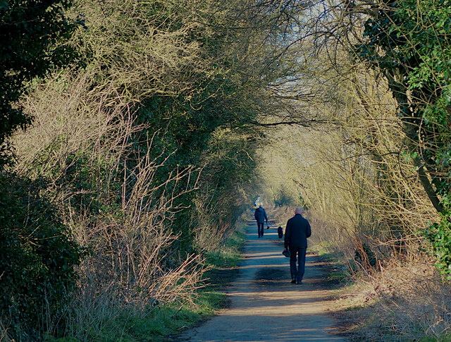
In terms of facilities, Anlaby Common has a range of local amenities to cater to the needs of its residents. These include several shops, a post office, a primary school, and a medical center. The village is also home to a number of green spaces, providing opportunities for outdoor activities and leisurely walks.

Anlaby Common has a rich history, with some properties dating back to the late 18th century. The village has witnessed gradual expansion and development over the years, but still retains its rural charm and peaceful atmosphere. It is a popular choice for families and professionals looking for a quiet residential area within easy reach of Hull.

Overall, Anlaby Common offers a pleasant living environment with a range of amenities and convenient access to nearby urban centers. Its combination of historical character and modern convenience makes it an attractive place to reside in Yorkshire.

If you have any feedback on the listing, please let us know in the comments section below.

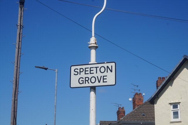
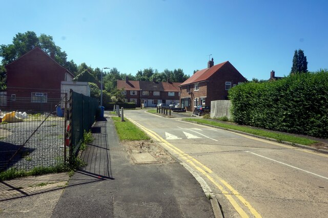
Anlaby Common Images

Images are sourced within 2km of 53.744087/-0.4101908 or Grid Reference TA0428. Thanks to Geograph Open Source API. All images are credited.

Carr Lane, Willerby Public footpath/cycle path running along the northern edge of Springhead Park golf course. It has the same name as, and continues the course of, the residential road, but this section is closed to motorised traffic.
Carr Lane, Willerby
Public footpath/cycle path running along the northern edge of Springhead Park golf course. It has the same name as, and continues the course of, the residential road, but this section is closed to motorised traffic.
Wold Road, Hull The western end of the road between Wymersley Road and Hotham Road South
Wold Road, Hull
The western end of the road between Wymersley Road and Hotham Road South
Garton Grove off Helmsley Grove, Hull
Helmsley Grove, Hull
Ainthorpe Grove, Hull
Easy Fix Mobile Tyres van on Ainthorpe Grove, Hull
Ampleforth Grove, Hull
Haltemprice Leisure, Anlaby The front of the recently-extended leisure centre/library/health centre on Springfield Way. The upper floor is given over to an extensive gym, while the library is on the ground floor to the left of the shot here. The new extension is the wing to the right: images of its construction earlier in 2021 can be seen here: <a href="https://www.geograph.org.uk/photo/6756219">TA0329 : Leisure centre extension work, Haltemprice</a> and here: <a href="https://www.geograph.org.uk/photo/6788861">TA0329 : Progress on leisure centre, Anlaby</a>.
Haltemprice Leisure, Anlaby
The front of the recently-extended leisure centre/library/health centre on Springfield Way. The upper floor is given over to an extensive gym, while the library is on the ground floor to the left of the shot here. The new extension is the wing to the right: images of its construction earlier in 2021 can be seen here: TA0329 : Leisure centre extension work, Haltemprice and here: TA0329 : Progress on leisure centre, Anlaby.
Hackness Grove off Anlady Road, Hull
Ampleforth Grove, Hull
Speeton Grove off Anlady Road, Hull
Dunston Road off Spring Bank West, Hull
Spring Bank West near Dunston Road, Hull
Show me another place!

Anlaby Common is located at Grid Ref: TA0428 (Lat: 53.744087, Lng: -0.4101908)

Division: East Riding

Unitary Authority: Kingston upon Hull

Police Authority: Humberside

What 3 Words

///trash.pines.voting. Near Willerby, East Yorkshire

Related Wikis

Kingston upon Hull West and Hessle (UK Parliament constituency)

Kingston upon Hull West and Hessle is a borough constituency for the House of Commons of the Parliament of the United Kingdom. It elects one Member of...

Anlaby Park

Anlaby Park is a small suburb just inside the city of Kingston upon Hull, England, to the west.

Anlaby Common

Anlaby Common is former common land, now an outer suburb of Kingston upon Hull. The area includes the residential areas which are located on the western...

Anlaby with Anlaby Common

Anlaby with Anlaby Common is a civil parish in the East Riding of Yorkshire, England. The parish includes the village suburb of Anlaby and the part of...

Skerne and Wansford

Skerne and Wansford is a civil parish in the East Riding of Yorkshire, England. It is situated approximately 2 miles (3.2 km) south-east of the town of...

Springhead engine shed

Springhead engine shed was an engine shed located in the City of Kingston upon Hull in Yorkshire, England and was opened by the Hull and Barnsley Railway...

East Ella

East Ella is a small suburb to the west of the Eastern England city of Kingston upon Hull. East Ella was an area of common land to the east of the nearby...

Eastfield Primary School

Eastfield Primary School is a state-funded primary school in Kingston upon Hull, East Riding of Yorkshire, England, for pupils aged 4 to 11. In 2014,...

Nearby Amenities

Located within 500m of 53.744087,-0.4101908
Traffic Signals
Lat/Long: 53.7440939/-0.409592
Anlaby Common
Is In: East Riding of Yorkshire, England, UK
Is In County: East Riding of Yorkshire
Place: village
Wikidata: Q4766132
Lat/Long: 53.7455292/-0.4145216
Turning Circle
Lat/Long: 53.7408913/-0.4087807
Turning Circle
Lat/Long: 53.7411921/-0.4062499
Traffic Signals
Lat/Long: 53.7442111/-0.4095601
Barrier: bollard
Lat/Long: 53.7471373/-0.407804
Pharmacy
Newtons
Addr City: Hull
Addr Housenumber: 1028
Addr Postcode: HU4 7RA
Addr Street: Anlaby Road
Addr Suburb: Anlaby Common
Check Date Opening Hours: 2022-11-01
Dispensing: yes
Drive Through: no
Opening Hours: Mo-Sa 08:45-17:30
Phone: +44 1482 561605
Wheelchair: yes
Lat/Long: 53.7444405/-0.4086641
Library
Anlaby Park Library
Wikidata: Q54807174
Lat/Long: 53.7423741/-0.4063402
Post Box
Post Box Type: pillar
Royal Cypher: GR
Royal Cypher Wikidata: Q33102273
Lat/Long: 53.7446334/-0.415102
Disused Shop: yes
Lat/Long: 53.7443805/-0.4093356
Post Box
Collection Times: Mo-Fr 16:45, Sa 11:00
Post Box Design: type_k
Post Box Type: pillar
Ref Signed: no
Royal Cypher: EIIR
Royal Cypher Wikidata: Q33102113
Lat/Long: 53.7443112/-0.4093356
Bus Stop
Anlaby Park Road North The Roundway
Naptan AtcoCode: 2290YHA00014
Naptan Bearing: N
Naptan CommonName: Anlaby Park Road North The Roundway
Naptan Crossing: Park Lane West
Naptan Indicator: adj The Roundway
Naptan Landmark: Costello Playing Fields
Naptan PlusbusZoneRef: HULL
Naptan ShortCommonName: The Roundway
Naptan Street: Anlaby Park Road North
Shelter: no
Source: naptan + survey
Lat/Long: 53.7411324/-0.4101436
Anlaby Park Road North Orchard Road
Naptan AtcoCode: 2290YHA00018
Naptan Bearing: N
Naptan CommonName: Anlaby Park Road North Orchard Road
Naptan Crossing: Anlaby Road
Naptan Indicator: opp Mead Walk
Naptan PlusbusZoneRef: HULL
Naptan ShortCommonName: Orchard Road
Naptan Street: Anlaby Park Road North
Physically Present: no
Source: naptan + survey
Lat/Long: 53.7433253/-0.4098346
Bus Stop
Anlaby Park Road North The Roundway
Naptan AtcoCode: 2290YHA00019
Naptan Bearing: S
Naptan CommonName: Anlaby Park Road North The Roundway
Naptan Crossing: Boothferry Road
Naptan Indicator: opp The Roundway
Naptan PlusbusZoneRef: HULL
Naptan Street: Anlaby Park Road North
Shelter: no
Source: naptan + survey
Lat/Long: 53.7415025/-0.4098905
Bus Stop
Anlaby Road Trenton Avenue
Bench: yes
Bin: yes
Check Date Shelter: 2021-10-08
Lit: yes
Naptan AtcoCode: 2290YHA00042
Naptan Bearing: E
Naptan CommonName: Anlaby Road Trenton Avenue
Naptan Crossing: Norland Avenue
Naptan Indicator: adj Trenton Avenue
Naptan Landmark: Post Office
Naptan PlusbusZoneRef: HULL
Naptan ShortCommonName: Trenton Avenue
Naptan Street: Anlaby Road
Shelter: yes
Source: naptan + survey
Tactile Paving: no
Lat/Long: 53.7443401/-0.4090512
Bus Stop
Anlaby Road Malham Avenue
Bench: no
Bin: no
Check Date Shelter: 2021-10-06
Lit: no
Naptan AtcoCode: 2290YHA00043
Naptan Bearing: E
Naptan CommonName: Anlaby Road Malham Avenue
Naptan Crossing: Legarde Avenue
Naptan Indicator: adj Malham Avenue
Naptan PlusbusZoneRef: HULL
Naptan ShortCommonName: Malham Avenue
Naptan Street: Anlaby Road
Shelter: no
Source: naptan + survey
Tactile Paving: no
Lat/Long: 53.7445362/-0.4055407
Bus Stop
Anlaby Road Plantation Drive
Bench: yes
Bin: yes
Check Date Shelter: 2021-10-06
Lit: no
Naptan AtcoCode: 2290YHA00052
Naptan Bearing: W
Naptan CommonName: Anlaby Road Plantation Drive
Naptan Crossing: Plantation Drive
Naptan Indicator: opp Malham Drive
Naptan Landmark: Recreation Ground
Naptan PlusbusZoneRef: HULL
Naptan ShortCommonName: Plantation Drive
Naptan Street: Anlaby Road
Shelter: no
Source: naptan + survey
Tactile Paving: no
Lat/Long: 53.7442317/-0.4056281
Bus Stop
Anlaby Park Road North Trenton Avenue
Bench: no
Bin: no
Check Date Shelter: 2022-11-01
Lit: no
Naptan AtcoCode: 2290YHA00053
Naptan Bearing: W
Naptan CommonName: Anlaby Park Road North Trenton Avenue
Naptan Crossing: Hull Road
Naptan Indicator: opp Trenton Avenue
Naptan PlusbusZoneRef: HULL
Naptan Street: Anlaby Road
Shelter: no
Source: naptan + survey
Tactile Paving: no
Lat/Long: 53.7440318/-0.4102002
Bus Stop
Anlaby Park Road North Mead Walk
Naptan AtcoCode: 2290YHA01448
Naptan Bearing: S
Naptan CommonName: Anlaby Park Road North Mead Walk
Naptan Crossing: Mead Walk
Naptan PlusbusZoneRef: HULL
Naptan ShortCommonName: Mead Walk
Naptan Street: Anlaby Park Road North
Note: moved to other side of road, Bearing shoudl be N
Shelter: no
Source: naptan + survey
Lat/Long: 53.7434725/-0.4099548
Bus Stop
Anlaby Hull Road
Bench: no
Bin: no
Kerb: raised
Lit: yes
Naptan AtcoCode: 2200YEA00155
Naptan Bearing: W
Naptan CommonName: Anlaby Hull Road
Naptan Landmark: Church
Naptan PlusbusZoneRef: HULL
Naptan Street: Hull Road
Shelter: yes
Source: naptan + survey
Tactile Paving: no
Lat/Long: 53.7446277/-0.4141364
Bus Stop
Anlaby Hull Road
Bench: no
Bin: no
Check Date Shelter: 2022-10-31
Kerb: raised
Lit: yes
Naptan AtcoCode: 2200YEA00156
Naptan Bearing: E
Naptan CommonName: Anlaby Hull Road
Naptan Landmark: Anlaby Park
Naptan PlusbusZoneRef: HULL
Naptan Street: Hull Road
Shelter: yes
Source: naptan + survey
Tactile Paving: no
Lat/Long: 53.744484/-0.413125
Bus Stop
Anlaby Hull Road
Kerb: raised
Naptan AtcoCode: 2200YEA00157
Naptan Bearing: SE
Naptan CommonName: Anlaby Hull Road
Naptan Landmark: St Mark'S Church
Naptan PlusbusZoneRef: HULL
Naptan Street: Hull Road
Note: no sign board, but stop in use
Shelter: yes
Source: naptan + survey
Lat/Long: 53.7450907/-0.4163997
Turning Circle
Lat/Long: 53.7433991/-0.4141085
Turning Circle
Lat/Long: 53.7426193/-0.4142536
Turning Circle
Lat/Long: 53.7423116/-0.4119057
Turning Circle
Lat/Long: 53.7430581/-0.4114021
Disused Shop: yes
Lat/Long: 53.7444371/-0.4089524
Noexit: yes
Lat/Long: 53.7447857/-0.4104639
Noexit: yes
Lat/Long: 53.7455386/-0.4103681
Noexit: yes
Lat/Long: 53.7456131/-0.4111298
Noexit: yes
Lat/Long: 53.7455353/-0.4143087
Noexit: yes
Lat/Long: 53.746261/-0.4126243
Noexit: yes
Lat/Long: 53.7463134/-0.4116185
Noexit: yes
Lat/Long: 53.7463265/-0.4112986
Noexit: yes
Lat/Long: 53.7463903/-0.4101721
Noexit: yes
Lat/Long: 53.745259/-0.4129495
Noexit: yes
Lat/Long: 53.7454866/-0.4140875
Noexit: yes
Lat/Long: 53.7462499/-0.4130293
Telephone
Booth: K6
Colour: white
Covered: booth
Phone: +44 1482 352115
Lat/Long: 53.7444999/-0.4150131
Telephone
Booth: K6
Colour: white
Covered: booth
Phone: +44 1482 505612
Lat/Long: 53.7442255/-0.4098888
Crossing
Crossing: marked
Tactile Paving: yes
Lat/Long: 53.744229/-0.4093641
Crossing
Crossing: marked
Tactile Paving: yes
Lat/Long: 53.7441056/-0.4094311
Telephone
Booth: K8
Colour: white
Covered: booth
Phone: +44 1482 505649
Lat/Long: 53.7423866/-0.4033583
Bicycle Parking
Bicycle Parking: stands
Capacity: 4
Covered: no
Lat/Long: 53.7446002/-0.4040681
The data included in this document is from www.openstreetmap.org. The data is made available under ODbL.

Have you been to Anlaby Common?

Leave your review of Anlaby Common below (or comments, questions and feedback).