An Àrd

Settlement in Ross-shire

Scotland

An Àrd

Early evening view SW from 500 feet above Gairloch Across Loch Gairloch to Eilean Horrisdale and Badachro Bay, over the Red Point promontory and Loch Torridon (hidden) to the mountains of Skye 40 miles away.
Early evening view SW from 500 feet above Gairloch Credit: Ben Brooksbank

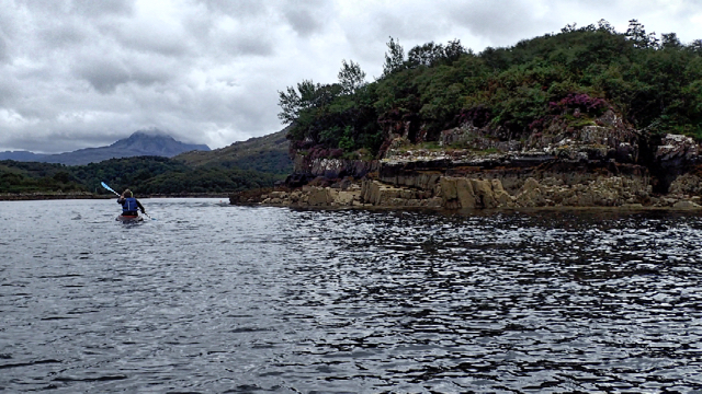
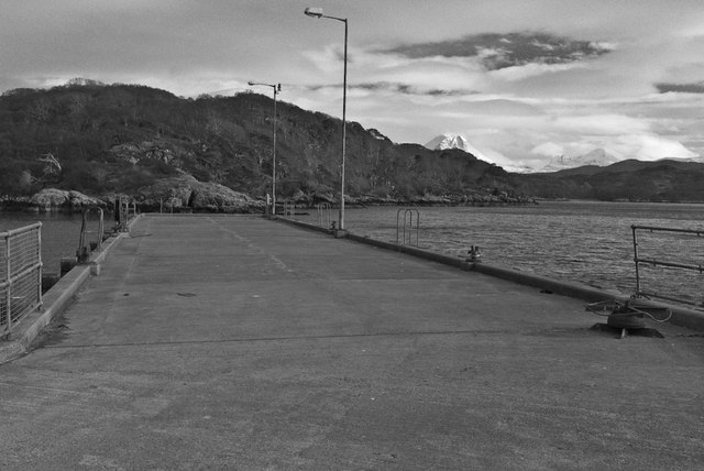
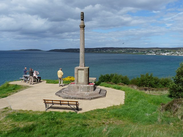
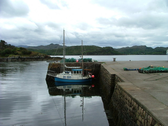
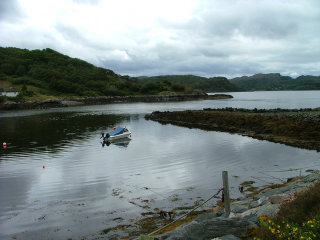
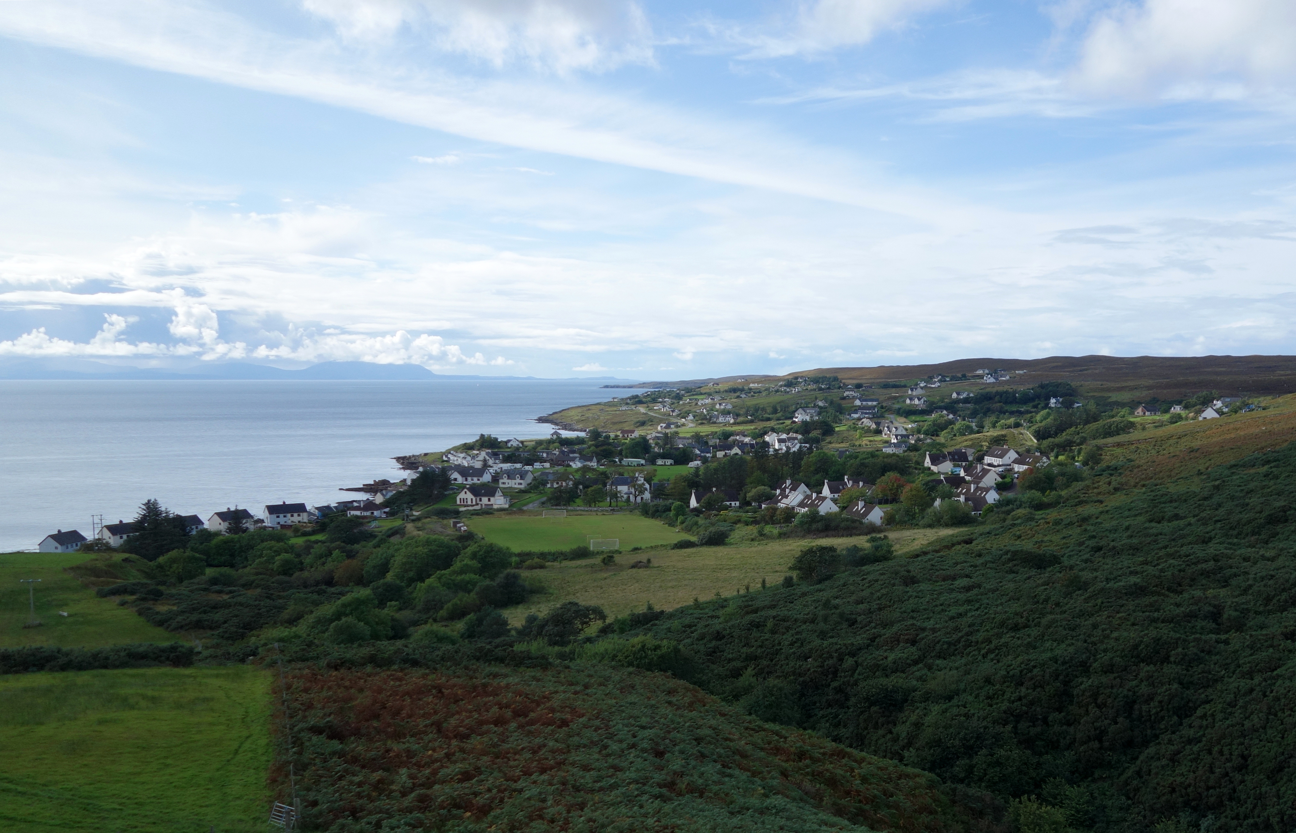
An Àrd is a small hamlet located in Ross-shire, Scotland. Situated on the northwest coast of the Scottish Highlands, it is nestled between the towns of Ullapool and Gairloch. An Àrd is known for its stunning natural beauty and picturesque landscapes.

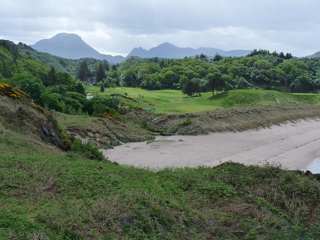
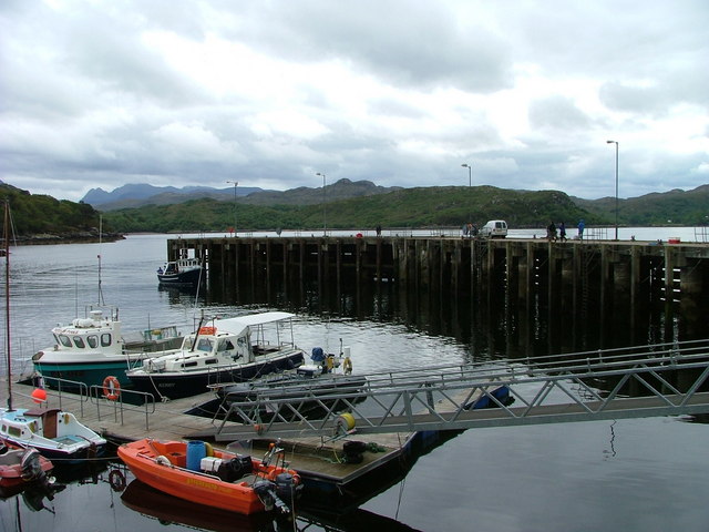
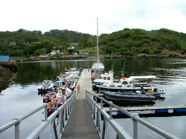
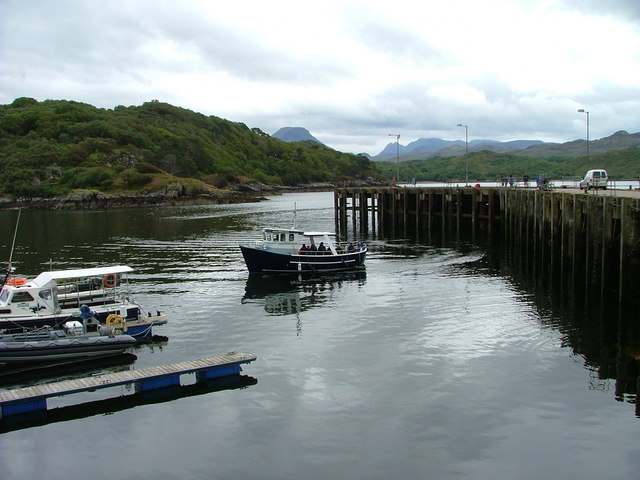
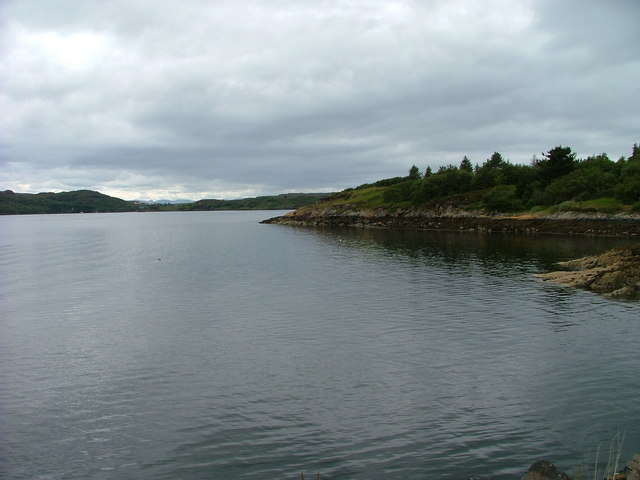
Surrounded by rugged mountains and overlooking the Loch Broom, the village offers breathtaking views of the Scottish Highlands. The area is rich in diverse wildlife, with red deer, golden eagles, and otters frequently spotted in the vicinity. An Àrd attracts nature enthusiasts and outdoor adventurers due to its proximity to hiking trails, fishing spots, and numerous water-based activities.

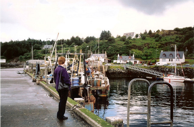
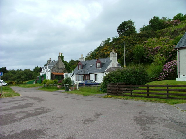
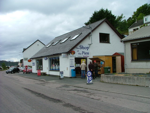
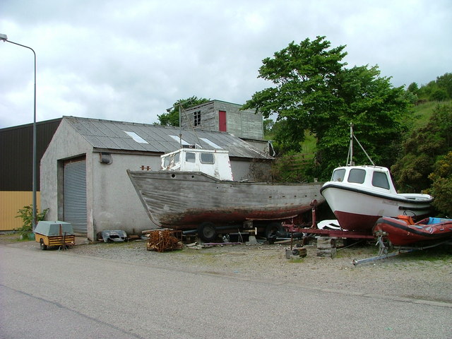
The community in An Àrd is small but close-knit. The locals are known for their warm hospitality and friendliness towards visitors. The village has a few essential amenities, including a local shop and a cozy café that serves traditional Scottish fare.

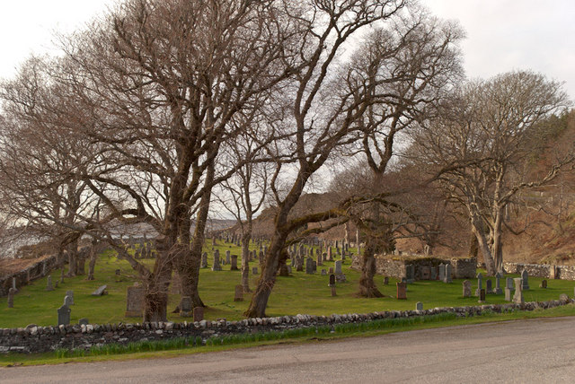
History buffs will find interest in An Àrd's heritage, as the area has a rich historical background dating back to ancient times. The remnants of Iron Age settlements and standing stones can be found in the surrounding countryside, providing glimpses into the region's past.

Overall, An Àrd is an idyllic and tranquil place that offers a peaceful escape from the hustle and bustle of city life. With its natural beauty, friendly community, and historical significance, it is a hidden gem for those seeking a serene Scottish Highland experience.

If you have any feedback on the listing, please let us know in the comments section below.

An Àrd Images

Images are sourced within 2km of 57.7123/-5.6804144 or Grid Reference NG8075. Thanks to Geograph Open Source API. All images are credited.

Early evening view SW from 500 feet above Gairloch Across Loch Gairloch to Eilean Horrisdale and Badachro Bay, over the Red Point promontory and Loch Torridon (hidden) to the mountains of Skye 40 miles away.
Early evening view SW from 500 feet above Gairloch
Across Loch Gairloch to Eilean Horrisdale and Badachro Bay, over the Red Point promontory and Loch Torridon (hidden) to the mountains of Skye 40 miles away.
Leac na Saighde
Leac na Saighde
Eilean Horrisdale Just the tinniest rib of shore for this grid square.
Eilean Horrisdale
Just the tinniest rib of shore for this grid square.
Glas Eilean Young cormorants taking flight.
Glas Eilean
Young cormorants taking flight.
Charlestown Pier
Charlestown Pier
Gairloch Old Burial Ground
Gairloch harbour from the pier
War memorial and Loch Gairloch The wording on the memorial reads:
Erected by Sir Kenneth and Lady Marjory Mackenzie in memory of their son Roderick I Mackenzie Lieut Black Watch and the men of Gairloch who gave their lives 1914-1918
War memorial and Loch Gairloch
The wording on the memorial reads: Erected by Sir Kenneth and Lady Marjory Mackenzie in memory of their son Roderick I Mackenzie Lieut Black Watch and the men of Gairloch who gave their lives 1914-1918
Gairloch golf course On the shore of Loch Gairloch.
Gairloch golf course
On the shore of Loch Gairloch.
Boats at Charlestown Charlestown is the harbour for Gairloch.
Boats at Charlestown
Charlestown is the harbour for Gairloch.
Pontoon at Charlestown harbour The harbour that serves Gairloch is mainly used by pleasure and small fishing boats.
Pontoon at Charlestown harbour
The harbour that serves Gairloch is mainly used by pleasure and small fishing boats.
Charlestown pier
Charlestown pier
An Ard Viewed from Charlestown pier.
An Ard
Viewed from Charlestown pier.
Houses at Charlestown
The Shop at The Pier, Charlestown A well stocked and busy shop and Post Office.
The Shop at The Pier, Charlestown
A well stocked and busy shop and Post Office.
Boat at the quay, Charlestown
Jetty at Charlestown
Boats on dry land At Charlestown harbour.
Boats on dry land
At Charlestown harbour.
Show me another place!

An Àrd is located at Grid Ref: NG8075 (Lat: 57.7123, Lng: -5.6804144)

Unitary Authority: Highland

Police Authority: Highlands and Islands

What 3 Words

///single.ratio.forkful. Near Gairloch, Highland

Related Wikis

An Ard

An Ard (Scottish Gaelic: ) is a collection of small settlements on the A832 road, close to Charlestown, in Gairloch, Ross-shire, on the east shore of Gair...

Charlestown, Wester Ross

Charlestown is a small hamlet, making up one of the settlements which are collectively called Gairloch, and located directly south of the main village...

Broadford Beds Formation

The Broadford Beds Formation is a Sinemurian geologic formation in western Scotland. An indeterminate partial tibia of a theropod dinosaur are among the...

Gairloch

Gairloch ( GAIR-lokh; Scottish Gaelic: Geàrrloch [ˈkʲaːrˠl̪ˠɔx], meaning "Short Loch") is a village, civil parish and community on the shores of Loch Gairloch...

Gairloch Museum

Gairloch Museum (Scottish Gaelic: Taigh-tasgaidh Gheàrrloch) is an independent museum in the Wester Ross region of Scotland. The museum is located in the...

Gairloch High School

Gairloch High School (Gaelic: Àrd-Sgoil Gheàrrloch) is a six-year secondary school in Gairloch, Scotland. Being situated in a remote area of the Highlands...
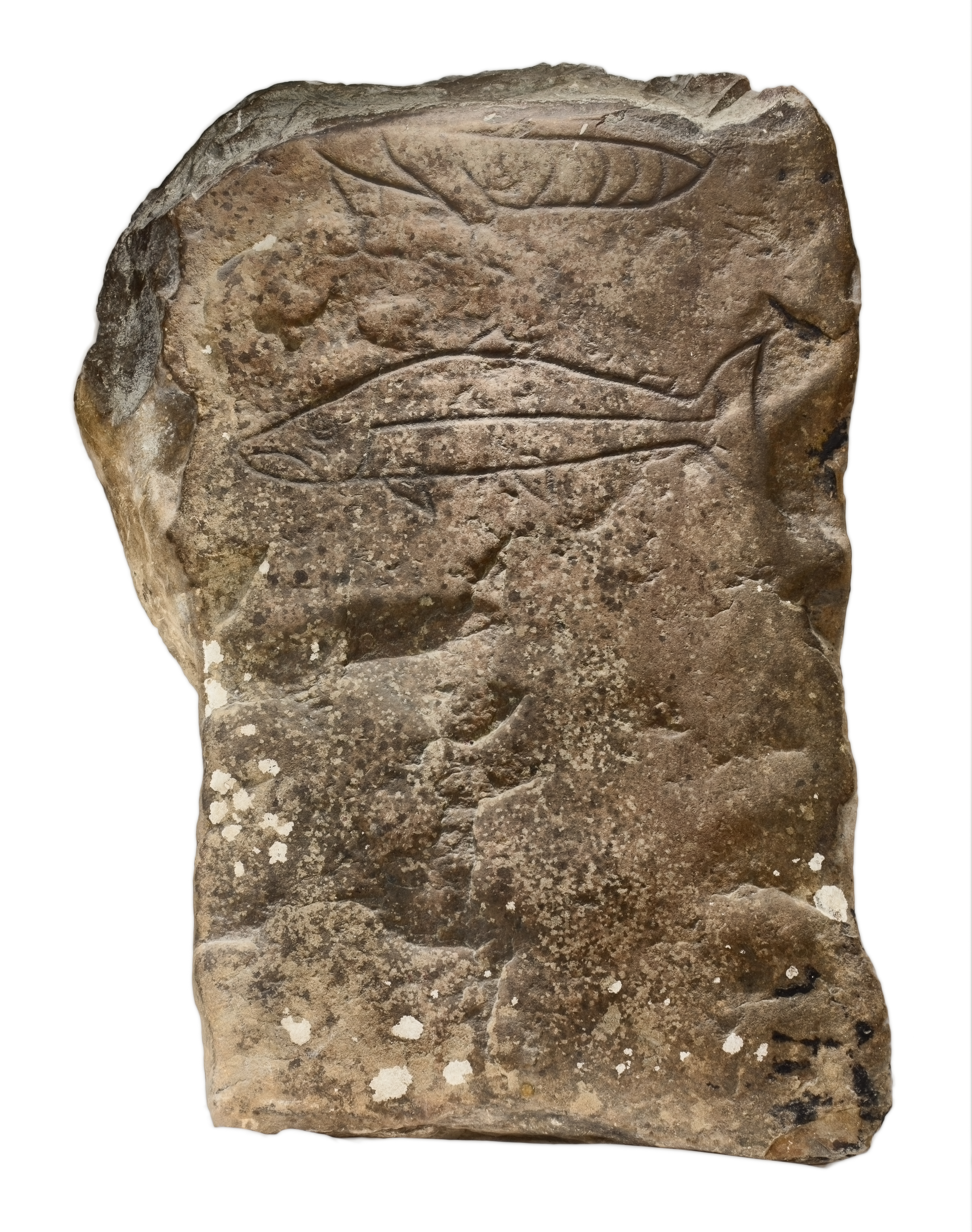
Gairloch Stone

The Gairloch Stone is a Class-I Pictish stone which was discovered at Achtercairn in Wester Ross around 1880. Subsequently, the stone was used as masonry...

Eilean Horrisdale

Eilean Horrisdale is an uninhabited island in Loch Gairloch in Wester Ross, Scotland. == Geography == Eilean Horrisdale is the largest island in Loch Gairloch...

Nearby Amenities

Located within 500m of 57.7123,-5.6804144
Source: PGS
Lat/Long: 57.7109413/-5.6862338
Source: PGS
Lat/Long: 57.7109513/-5.685837
Source: PGS
Lat/Long: 57.7112718/-5.6824183
Source: PGS
Lat/Long: 57.7115532/-5.6817069
Source: PGS
Lat/Long: 57.7112592/-5.6810717
Source: PGS
Lat/Long: 57.7116524/-5.6813941
Source: PGS
Lat/Long: 57.7118977/-5.6807597
Source: PGS
Lat/Long: 57.7122169/-5.6802402
Source: PGS
Lat/Long: 57.7125599/-5.6795736
Source: PGS
Lat/Long: 57.7124332/-5.6792307
Source: PGS
Lat/Long: 57.7126858/-5.6791858
Source: PGS
Lat/Long: 57.7127886/-5.6785242
Source: PGS
Lat/Long: 57.7123249/-5.6775867
Source: PGS
Lat/Long: 57.7120297/-5.6773344
Source: PGS
Lat/Long: 57.7115074/-5.6775459
Source: PGS
Lat/Long: 57.7112637/-5.6773657
Source: PGS
Lat/Long: 57.7107775/-5.6773935
Source: PGS
Lat/Long: 57.7102638/-5.6800822
Source: PGS
Lat/Long: 57.7097125/-5.6799331
Source: PGS
Lat/Long: 57.7096393/-5.681128
Source: PGS
Lat/Long: 57.7093129/-5.6816688
Source: PGS
Lat/Long: 57.7089805/-5.6807482
Created By: almien_coastlines
Source: PGS
Lat/Long: 57.708647/-5.680633
Source: PGS
Lat/Long: 57.7085162/-5.6806091
Source: PGS
Lat/Long: 57.708208/-5.6803455
Source: PGS
Lat/Long: 57.708072/-5.6801072
Source: PGS
Lat/Long: 57.7078395/-5.6796197
Cafe
Coast Coffee
Opening Hours: Closed in winter
Lat/Long: 57.7118422/-5.6815513
Bus Stop
Harbour
Naptan AtcoCode: 6700711944
Naptan Bearing: NE
Naptan CommonName: Harbour
Naptan Indicator: at Pier
Naptan Landmark: Pier
Naptan NaptanCode: 45327562
Naptan Street: Harbour Road
Naptan Verified: no
Source: naptan_import
Lat/Long: 57.7110879/-5.6831595
Bus Stop
Old Inn
Naptan AtcoCode: 6700712696
Naptan Bearing: E
Naptan CommonName: Old Inn
Naptan Indicator: at bridge
Naptan Landmark: Old Inn
Naptan NaptanCode: 45323623
Naptan Street: A832
Naptan Verified: no
Source: naptan_import
Lat/Long: 57.7128444/-5.678164
Bus Stop
Gairloch Post Office
Bus: yes
Departures Board: no
Naptan AtcoCode: 6700712698
Naptan Bearing: N
Naptan CommonName: Gairloch Post Office
Naptan Indicator: o/s Post Office
Naptan Landmark: Post Office
Naptan NaptanCode: 45323598
Naptan Street: Pier Road
Naptan Verified: no
Operator: Westerbus
Public Transport: platform
Shelter: no
Source: naptan_import
Lat/Long: 57.7120016/-5.6809728
Bus Stop
Gairloch Old Inn
Naptan AtcoCode: 670072001
Naptan Bearing: W
Naptan CommonName: Gairloch Old Inn
Naptan Indicator: opp Old Inn
Naptan Landmark: Old Inn
Naptan NaptanCode: 45323543
Naptan Street: A832
Naptan Verified: no
Source: naptan_import
Lat/Long: 57.7124545/-5.6778434
Bus Stop
Gairloch Post Office
Naptan AtcoCode: 670072002
Naptan Bearing: S
Naptan CommonName: Gairloch Post Office
Naptan Indicator: opp Post Office
Naptan Landmark: Post Office
Naptan NaptanCode: 45323597
Naptan Street: Pier Road
Naptan Verified: no
Source: naptan_import
Lat/Long: 57.7119413/-5.6808745
Seamark Light Character: Q
Seamark Light Colour: red
Seamark Light Height: 6
Seamark Light Range: 2
Seamark Light Reference: A 3903
Seamark Status: occasional
Seamark Type: light_minor
Source: US NGA Pub. 114. 2011-05-26.
Lat/Long: 57.7100434/-5.683783
Pub
The Old Inn
Addr Postcode: IV21 2BD
Addr Street: Flowerdale Road
Fhrs Id: 454337
Source: OS_OpenData_StreetView
Lat/Long: 57.7126688/-5.6765111
Post Office
Gairloch Post Office
Addr Country: GB
Addr Postcode: IV21 2BQ
Brand: Post Office
Brand Wikidata: Q1783168
Contact Website: https://www.postoffice.co.uk/branch-finder/3128407/gairloch
Opening Hours: PH,Mo-Su 09:00-17:00
Ref Pol Id: 129383
Lat/Long: 57.7121304/-5.6808713
Barrier: bollard
Source: survey
Lat/Long: 57.712811/-5.6770972
Glass Bottom Boat
Tourism: attraction
Lat/Long: 57.7112847/-5.6828057
Gairloch Marine Life Centre & Cruises
Operator: Ian French
Tourism: attraction
Lat/Long: 57.7109978/-5.6850652
Post Box
Ref: IV21 257
Source: survey
Lat/Long: 57.7120477/-5.6808955
Leisure: slipway
Lat/Long: 57.712448/-5.6791796
Crossing
Lat/Long: 57.7142369/-5.6733975
Little Green Shop
Operator: Hannah
Shop: gift
Lat/Long: 57.7118958/-5.6814822
Hebridean Whale Cruises
Tourism: attraction
Lat/Long: 57.711104/-5.6851229
Wordworks Ltd
Opening Hours: PH,Mo-Su 16:00-18:00
Shop: computer
Lat/Long: 57.711922/-5.6814212
Wester Ross Fisheries Trust
Office: charity
Phone: +44 1445 712899
Lat/Long: 57.7118566/-5.6815146
Wester Ross Radio Ltd
Office: charity_office
Lat/Long: 57.7118864/-5.6813906
Shop at the Pier
Shop: convenience
Lat/Long: 57.712161/-5.680809
Leisure: slipway
Lat/Long: 57.7124201/-5.6790576
Atm
Check Date: 2021-07-09
Drive Through: no
Operator: Bank of Scotland
Lat/Long: 57.7145551/-5.6808681
Waste Disposal
Oil dump
Lat/Long: 57.7109629/-5.6846359
Defibrillator
Access: yes
Emergency: defibrillator
Image: https://i.imgur.com/2X7TAln.jpg
Indoor: no
Operator: Highland Council
Lat/Long: 57.7111469/-5.6832824
Colour: green
Description: FTTC Gairloch cabinet 1
Height: 1
Man Made: street_cabinet
Operator: BT Openreach
Ref: P1
Street Cabinet: telecom
Lat/Long: 57.7145523/-5.6813231
Glendale Boats
Tourism: attraction
Lat/Long: 57.7111244/-5.6835723
Sanitary Dump Station
Access: yes
Fee: no
Image: https://i.imgur.com/BPYTXBc.jpg
Operator: Gairloch Community Council
Power Supply: no
Sanitary Dump Station Chemical Toilet: yes
Sanitary Dump Station Grey Water: no
Water Point: yes
Lat/Long: 57.7111788/-5.6833279
Power: pole
Lat/Long: 57.7164615/-5.6791764
Power: pole
Lat/Long: 57.7124668/-5.6722371
Power: pole
Lat/Long: 57.7134664/-5.6726577
Power: pole
Lat/Long: 57.7142396/-5.6729984
Power: pole
Lat/Long: 57.7147811/-5.6737531
Power: pole
Lat/Long: 57.7152208/-5.6754973
Power: pole
Lat/Long: 57.7154359/-5.6764085
Power: pole
Lat/Long: 57.7159287/-5.6783173
Power: pole
Lat/Long: 57.7119458/-5.6834343
Power: pole
Lat/Long: 57.712189/-5.6833086
Power: pole
Lat/Long: 57.7126329/-5.6830482
Power: pole
Lat/Long: 57.712619/-5.68253
Power: pole
Lat/Long: 57.712694/-5.6812869
Power: pole
Lat/Long: 57.713058/-5.6809099
Power: pole
Lat/Long: 57.7137944/-5.6795668
Power: pole
Lat/Long: 57.7130078/-5.6724647
Power: pole
Lat/Long: 57.712331/-5.6729191
Power: pole
Lat/Long: 57.7115571/-5.6735251
Power: pole
Lat/Long: 57.710851/-5.6742409
Power: pole
Lat/Long: 57.7102547/-5.6749371
Power: pole
Lat/Long: 57.7100576/-5.6761201
Power: pole
Lat/Long: 57.7128455/-5.6740904
Power: pole
Lat/Long: 57.7119052/-5.6880892
Power: pole
Lat/Long: 57.7122652/-5.6877463
Power: pole
Lat/Long: 57.7118926/-5.6864848
Operator: SSE
Operator Wikidata: Q493854
Power: pole
Lat/Long: 57.7115774/-5.6846553
Charging Station
Harbour Car Par EV charger
Access: yes
Fee: yes
Operator: Highland Council
Payment Credit Cards: yes
Payment Debit Cards: yes
Lat/Long: 57.7129253/-5.6795865
Charging Station
Harbour Car Par EV charger
Access: yes
Fee: yes
Operator: Highland Council
Payment Credit Cards: yes
Payment Debit Cards: yes
Lat/Long: 57.7129367/-5.6795476
Òb Ceann an t-Sàile
Natural: bay
Lat/Long: 57.7113713/-5.6790056
The data included in this document is from www.openstreetmap.org. The data is made available under ODbL.

Have you been to An Àrd?

Leave your review of An Àrd below (or comments, questions and feedback).