An Àird Dhorcha

Settlement in Inverness-shire

Scotland

An Àird Dhorcha

Entering Dunan, A87 The A87 runs 99 miles from Invergarry to Uig on the Isle of Skye <a href="https://www.geograph.org.uk/photo/7374675">NG3863 : End of the A87, Uig</a>.
<span class="nowrap"><a title="https://www.sabre-roads.org.uk/wiki/index.php?title=A87" rel="nofollow ugc noopener" href="https://www.sabre-roads.org.uk/wiki/index.php?title=A87">Link</a><img style="margin-left:2px;" alt="External link" title="External link - shift click to open in new window" src="https://s1.geograph.org.uk/img/external.png" width="10" height="10"/></span>
Entering Dunan, A87 Credit: N Chadwick

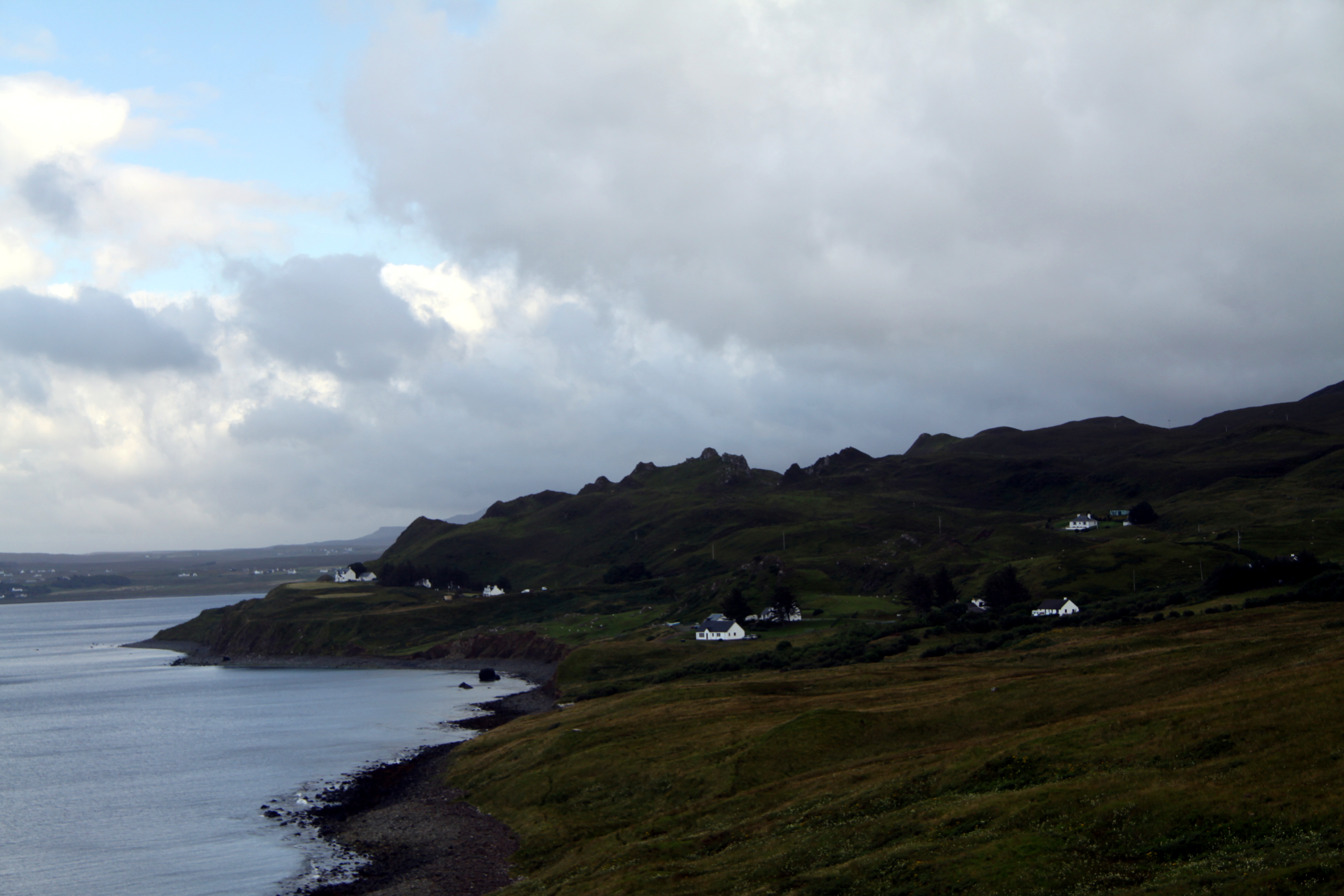
An Àird Dhorcha, located in Inverness-shire, Scotland, is a small rural settlement nestled in the picturesque Highlands region. This quaint village is surrounded by stunning natural beauty, characterized by rolling hills, lush greenery, and breathtaking views of Loch Ness.

The name "An Àird Dhorcha" translates to "The Dark Height" in English, which is fitting due to the area's rich history and mysterious allure. The village is steeped in legends of the famous Loch Ness Monster, attracting countless tourists from around the world who hope to catch a glimpse of this elusive creature.

The community of An Àird Dhorcha is comprised of a handful of charming cottages and houses, which are mostly inhabited by local residents who have a deep connection with the land and its folklore. The village exudes a tranquil ambiance, providing a serene escape from the hustle and bustle of modern life.

In terms of amenities, An Àird Dhorcha offers a few small shops and cafes where visitors can indulge in traditional Scottish cuisine and purchase locally made crafts. The village also serves as a gateway to the wider Inverness-shire region, providing access to a range of outdoor activities, including hiking, fishing, and wildlife spotting.

An Àird Dhorcha is a place of immense natural beauty and cultural significance, attracting both nature enthusiasts and those intrigued by the mysteries of Loch Ness. With its unique charm and captivating surroundings, this village offers an unforgettable experience for all who visit.

If you have any feedback on the listing, please let us know in the comments section below.

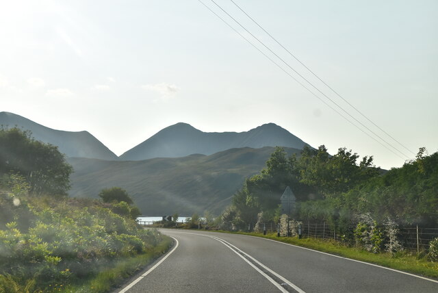
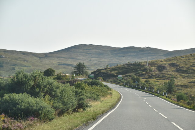
An Àird Dhorcha Images

Images are sourced within 2km of 57.28458/-6.0150209 or Grid Reference NG5828. Thanks to Geograph Open Source API. All images are credited.

Entering Dunan, A87 The A87 runs 99 miles from Invergarry to Uig on the Isle of Skye <a href="https://www.geograph.org.uk/photo/7374675">NG3863 : End of the A87, Uig</a>.
<span class="nowrap"><a title="https://www.sabre-roads.org.uk/wiki/index.php?title=A87" rel="nofollow ugc noopener" href="https://www.sabre-roads.org.uk/wiki/index.php?title=A87">Link</a><img style="margin-left:2px;" alt="External link" title="External link - shift click to open in new window" src="https://s1.geograph.org.uk/img/external.png" width="10" height="10"/></span>
Entering Dunan, A87
The A87 runs 99 miles from Invergarry to Uig on the Isle of Skye NG3863 : End of the A87, Uig. LinkExternal link
A87 The A87 runs 99 miles from Invergarry to Uig on the Isle of Skye <a href="https://www.geograph.org.uk/photo/7374675">NG3863 : End of the A87, Uig</a>.
<span class="nowrap"><a title="https://www.sabre-roads.org.uk/wiki/index.php?title=A87" rel="nofollow ugc noopener" href="https://www.sabre-roads.org.uk/wiki/index.php?title=A87">Link</a><img style="margin-left:2px;" alt="External link" title="External link - shift click to open in new window" src="https://s1.geograph.org.uk/img/external.png" width="10" height="10"/></span>
A87
The A87 runs 99 miles from Invergarry to Uig on the Isle of Skye NG3863 : End of the A87, Uig. LinkExternal link
Glas Bheinn Mhor seen from A87 The A87 runs 99 miles from Invergarry to Uig on the Isle of Skye <a href="https://www.geograph.org.uk/photo/7374675">NG3863 : End of the A87, Uig</a>.
<span class="nowrap"><a title="https://www.sabre-roads.org.uk/wiki/index.php?title=A87" rel="nofollow ugc noopener" href="https://www.sabre-roads.org.uk/wiki/index.php?title=A87">Link</a><img style="margin-left:2px;" alt="External link" title="External link - shift click to open in new window" src="https://s1.geograph.org.uk/img/external.png" width="10" height="10"/></span>
Glas Bheinn Mhor seen from A87
The A87 runs 99 miles from Invergarry to Uig on the Isle of Skye NG3863 : End of the A87, Uig. LinkExternal link
A87 leaving Luib The A87 runs 99 miles from Invergarry to Uig on the Isle of Skye <a href="https://www.geograph.org.uk/photo/7374675">NG3863 : End of the A87, Uig</a>.
<span class="nowrap"><a title="https://www.sabre-roads.org.uk/wiki/index.php?title=A87" rel="nofollow ugc noopener" href="https://www.sabre-roads.org.uk/wiki/index.php?title=A87">Link</a><img style="margin-left:2px;" alt="External link" title="External link - shift click to open in new window" src="https://s1.geograph.org.uk/img/external.png" width="10" height="10"/></span>
A87 leaving Luib
The A87 runs 99 miles from Invergarry to Uig on the Isle of Skye NG3863 : End of the A87, Uig. LinkExternal link
A87 to Kyle The A87 runs 99 miles from Invergarry to Uig on the Isle of Skye <a href="https://www.geograph.org.uk/photo/7374675">NG3863 : End of the A87, Uig</a>.
<span class="nowrap"><a title="https://www.sabre-roads.org.uk/wiki/index.php?title=A87" rel="nofollow ugc noopener" href="https://www.sabre-roads.org.uk/wiki/index.php?title=A87">Link</a><img style="margin-left:2px;" alt="External link" title="External link - shift click to open in new window" src="https://s1.geograph.org.uk/img/external.png" width="10" height="10"/></span>
A87 to Kyle
The A87 runs 99 miles from Invergarry to Uig on the Isle of Skye NG3863 : End of the A87, Uig. LinkExternal link
Entering Ard Dorch, A87 The A87 runs 99 miles from Invergarry to Uig on the Isle of Skye <a href="https://www.geograph.org.uk/photo/7374675">NG3863 : End of the A87, Uig</a>.
<span class="nowrap"><a title="https://www.sabre-roads.org.uk/wiki/index.php?title=A87" rel="nofollow ugc noopener" href="https://www.sabre-roads.org.uk/wiki/index.php?title=A87">Link</a><img style="margin-left:2px;" alt="External link" title="External link - shift click to open in new window" src="https://s1.geograph.org.uk/img/external.png" width="10" height="10"/></span>
Entering Ard Dorch, A87
The A87 runs 99 miles from Invergarry to Uig on the Isle of Skye NG3863 : End of the A87, Uig. LinkExternal link
Entering Dunan, A87 The A87 runs 99 miles from Invergarry to Uig on the Isle of Skye <a href="https://www.geograph.org.uk/photo/7374675">NG3863 : End of the A87, Uig</a>.
<span class="nowrap"><a title="https://www.sabre-roads.org.uk/wiki/index.php?title=A87" rel="nofollow ugc noopener" href="https://www.sabre-roads.org.uk/wiki/index.php?title=A87">Link</a><img style="margin-left:2px;" alt="External link" title="External link - shift click to open in new window" src="https://s1.geograph.org.uk/img/external.png" width="10" height="10"/></span>
Entering Dunan, A87
The A87 runs 99 miles from Invergarry to Uig on the Isle of Skye NG3863 : End of the A87, Uig. LinkExternal link
Entering Strollamus, A87 The A87 runs 99 miles from Invergarry to Uig on the Isle of Skye <a href="https://www.geograph.org.uk/photo/7374675">NG3863 : End of the A87, Uig</a>.
<span class="nowrap"><a title="https://www.sabre-roads.org.uk/wiki/index.php?title=A87" rel="nofollow ugc noopener" href="https://www.sabre-roads.org.uk/wiki/index.php?title=A87">Link</a><img style="margin-left:2px;" alt="External link" title="External link - shift click to open in new window" src="https://s1.geograph.org.uk/img/external.png" width="10" height="10"/></span>
Entering Strollamus, A87
The A87 runs 99 miles from Invergarry to Uig on the Isle of Skye NG3863 : End of the A87, Uig. LinkExternal link
Katie Ann’s Cottage 2 Luib Category B Listed mid 19th century Skye cottage refurbished as a holiday let. Named after a past owner Katie Ann Nicolson, it has been suggested that she and her daughter bred the little Shetland sheepdogs, often known as Shelties.
Katie Ann’s Cottage 2 Luib
Category B Listed mid 19th century Skye cottage refurbished as a holiday let. Named after a past owner Katie Ann Nicolson, it has been suggested that she and her daughter bred the little Shetland sheepdogs, often known as Shelties.
Allt na Luibe The short river is fed by Loch nam Madadh Uisge (in this grid square) and flows into the sea just beyond the trees in this image.
Allt na Luibe
The short river is fed by Loch nam Madadh Uisge (in this grid square) and flows into the sea just beyond the trees in this image.
Loch nam Madadh Uisge A small loch at the northern end of Strath Mòr. The loch feeds Allt na Luibe, which flows to the sea through Luib village. (See <a href="https://www.geograph.org.uk/photo/4877750">NG5627 : Allt na Luibe</a>).
Loch nam Madadh Uisge
A small loch at the northern end of Strath Mòr. The loch feeds Allt na Luibe, which flows to the sea through Luib village. (See NG5627 : Allt na Luibe).
South facing slope of Am Meall It would mean wet feet to try to approach the hill from here.
South facing slope of Am Meall
It would mean wet feet to try to approach the hill from here.
Bog beside the track The track is the old road connecting Luib and Strollamus. The partly forested hillside beyond is on the island of Scalpay.
Bog beside the track
The track is the old road connecting Luib and Strollamus. The partly forested hillside beyond is on the island of Scalpay.
Milestone by the track This small milestone stands at the side of the old road between Luib and Strollamus. It marks the approximate highest point on the road.
Milestone by the track
This small milestone stands at the side of the old road between Luib and Strollamus. It marks the approximate highest point on the road.
Path to Dunan Viewed from the old road between Strollamus and Luib, this path leads towards the shore at Dunan.
Path to Dunan
Viewed from the old road between Strollamus and Luib, this path leads towards the shore at Dunan.
Ruined church above Dunan The church is dated 1906, but I have not been able to find any information about it. This view is from the old road connecting Strollamus and Luib. The road fell into disuse in the 1920s when it was replaced by a new road closer to the shore. Beyond the water is the island of Scalpay, and beyond that, the island of Raasay.
Ruined church above Dunan
The church is dated 1906, but I have not been able to find any information about it. This view is from the old road connecting Strollamus and Luib. The road fell into disuse in the 1920s when it was replaced by a new road closer to the shore. Beyond the water is the island of Scalpay, and beyond that, the island of Raasay.
Ruined church above Dunan The building is dated 1906, but I have not been able to find out anything about its history. It stands below the old road from Strollamus to Luib and above the township of Dunan. There is a rough path to the church from the old road, but there is no evidence that there has ever been vehicular access to the building.
Ruined church above Dunan
The building is dated 1906, but I have not been able to find out anything about its history. It stands below the old road from Strollamus to Luib and above the township of Dunan. There is a rough path to the church from the old road, but there is no evidence that there has ever been vehicular access to the building.
Show me another place!

An Àird Dhorcha is located at Grid Ref: NG5828 (Lat: 57.28458, Lng: -6.0150209)

Unitary Authority: Highland

Police Authority: Highlands and Islands

Also known as: Ard Dorch

What 3 Words

///tricycle.waltzes.marinated. Near Broadford, Highland

Nearby Locations

An Àird Dhorcha Ard Dorch

Related Wikis

Luib, Skye

Luib (Scottish Gaelic: Lùib) is a crofting and fishing settlement on the south east shore of the sea loch, Loch Ainort near Broadford, on the island of...

Dunan, Skye

Dunan (Scottish Gaelic: An Dùnan) is a settlement on the south shore of the sea loch, Loch na Cairidh near Broadford, on the island of Skye in Scotland...

Scalpay, Inner Hebrides

Scalpay (; Scottish Gaelic: Sgalpaigh) is an inhabited island in the Inner Hebrides of Scotland which has a population of 4. == Geology == The bedrock...

Eas a' Bhradain

Eas a' Bhradain is a waterfall of Scotland.It is located between Marsco and Loch Ainort on the Allt Coire nam Bruadaran of the island of Skye at grid reference...

Related Videos

Scalpay close to Isle of Skye

UTIP: utip.io/travellingandlanguages It is an island close to Isle of Skye. We can go only by boat. Marinafromvladimir Ombelyse ...

Nearby Amenities

Located within 500m of 57.28458,-6.0150209
Ard Dorch
Name En: Ard Dorch
Name Gd: An Àird Dhorcha
Place: hamlet
Lat/Long: 57.2869619/-6.0203602
Bus Stop
Ard Dorch
Long Name: Ard Dorch, o/s Picture House
Naptan AtcoCode: 670084737
Naptan Bearing: SE
Naptan CommonName: Ard Dorch
Naptan Indicator: Lay-by Southbound
Naptan Landmark: Houses
Naptan NaptanCode: 45327467
Naptan Street: A87
Naptan Verified: no
Source: naptan_import
Lat/Long: 57.2841094/-6.0152826
Bus Stop
Ard Dorch
Naptan AtcoCode: 670084737A
Naptan Bearing: NW
Naptan CommonName: Ard Dorch
Naptan Indicator: Lay-by Northbound
Naptan Landmark: Houses
Naptan NaptanCode: 45329738
Naptan Street: A87
Naptan Verified: no
Source: naptan_import
Lat/Long: 57.2840819/-6.0155785
Parking
Access: yes
Source: survey
Lat/Long: 57.2840876/-6.0152423
Power: pole
Lat/Long: 57.2859008/-6.0224007
Power: pole
Lat/Long: 57.2852155/-6.0196394
Power: pole
Lat/Long: 57.2848133/-6.0179806
Power: pole
Lat/Long: 57.2844707/-6.0166575
Power: pole
Lat/Long: 57.283799/-6.0159359
Power: pole
Lat/Long: 57.2830717/-6.0151541
Power: pole
Lat/Long: 57.2822334/-6.0142846
Power: pole
Lat/Long: 57.2815481/-6.0135429
Power: pole
Lat/Long: 57.2807368/-6.0126834
The data included in this document is from www.openstreetmap.org. The data is made available under ODbL.

Have you been to An Àird Dhorcha?

Leave your review of An Àird Dhorcha below (or comments, questions and feedback).