Alturlie
Settlement in Inverness-shire
Scotland
Alturlie
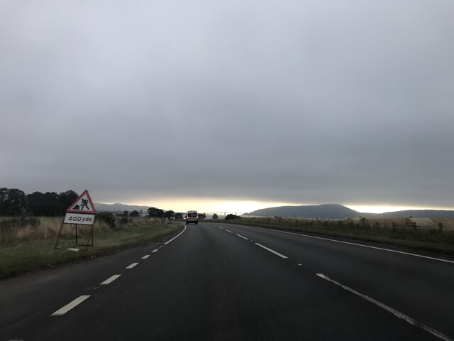
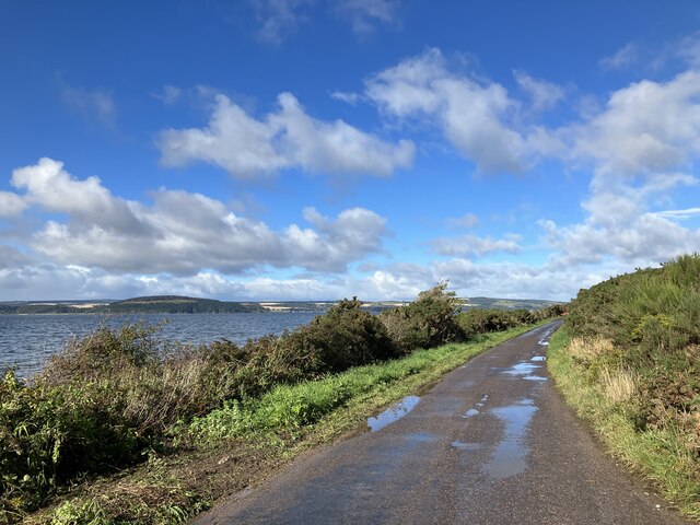
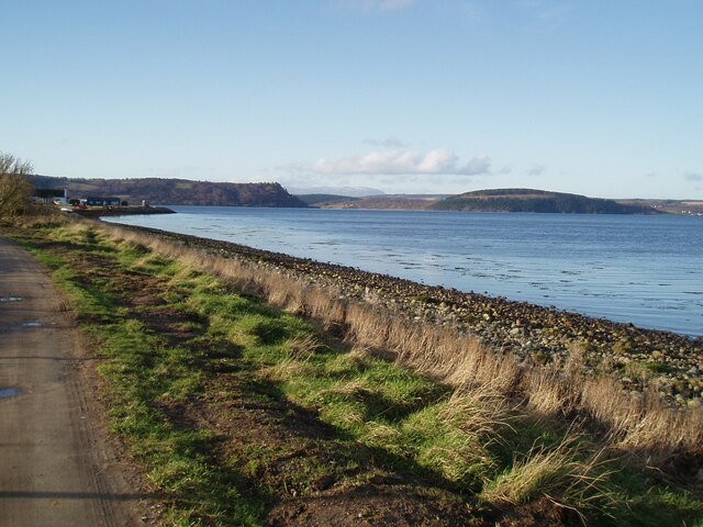
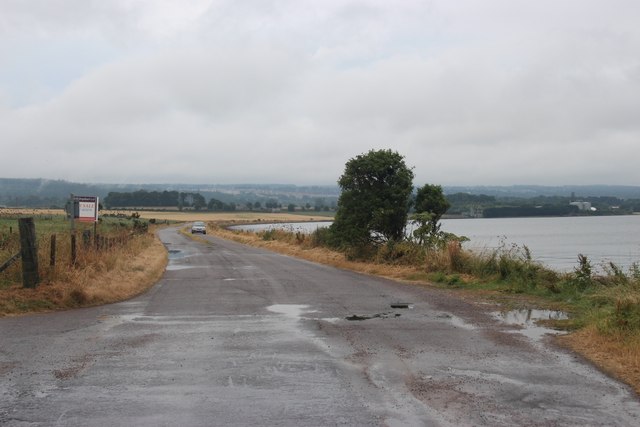
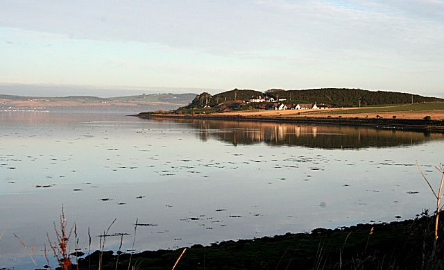
Alturlie is a small village located in the Inverness-shire region of Scotland. Situated approximately eight miles east of Inverness, it lies on the southern banks of the Moray Firth. Alturlie is surrounded by picturesque landscapes, with rolling hills and stunning views of the coastline.
The village is home to a close-knit community and offers a peaceful and tranquil lifestyle for its residents. Alturlie primarily consists of residential properties, with a mix of traditional cottages and modern homes. The village maintains a charming and quaint atmosphere, with well-maintained gardens and flower-filled streets.
Despite its small size, Alturlie offers a range of amenities to its residents. These include a local convenience store, a post office, and a primary school, providing essential services within the village itself. For further amenities, residents can easily access nearby towns such as Inverness, which offers a wider range of shops, restaurants, and entertainment options.
The surrounding area offers plenty of opportunities for outdoor activities. The nearby Moray Firth is renowned for its diverse marine life, including dolphins and seals, making it a popular spot for wildlife enthusiasts. The village is also a short distance from the picturesque Black Isle, with its beautiful beaches and nature reserves.
Alturlie benefits from excellent transport links, with regular bus services connecting the village to Inverness and other nearby towns. The Inverness Airport is within easy reach, providing convenient air travel options for both domestic and international destinations.
In summary, Alturlie is a charming village in Inverness-shire, offering a peaceful and picturesque setting, a close-knit community, and easy access to amenities and outdoor activities.
If you have any feedback on the listing, please let us know in the comments section below.
Alturlie Images
Images are sourced within 2km of 57.517774/-4.1467834 or Grid Reference NH7149. Thanks to Geograph Open Source API. All images are credited.


Alturlie is located at Grid Ref: NH7149 (Lat: 57.517774, Lng: -4.1467834)
Unitary Authority: Highland
Police Authority: Highlands and Islands
What 3 Words
///expires.optimally.pigment. Near Balloch, Highland
Nearby Locations
Related Wikis

Allanfearn railway station
Allanfearn was a railway station located near Culloden, outside Inverness, Highland, Scotland. It was initially named Culloden when opened, but was renamed...
Allanfearn
Allanfearn (, Scottish Gaelic: An t-Àilean Feàrna) is a small settlement, it lies 4 miles (6.4 km) east of Inverness, Inverness-shire, Scotland, within...

Petty, Highland
Petty, or Pettie is a place and parish in Highland, Scotland. The village of Petty is about 7 miles (11 km) north east of Inverness. The parishes of Petty...
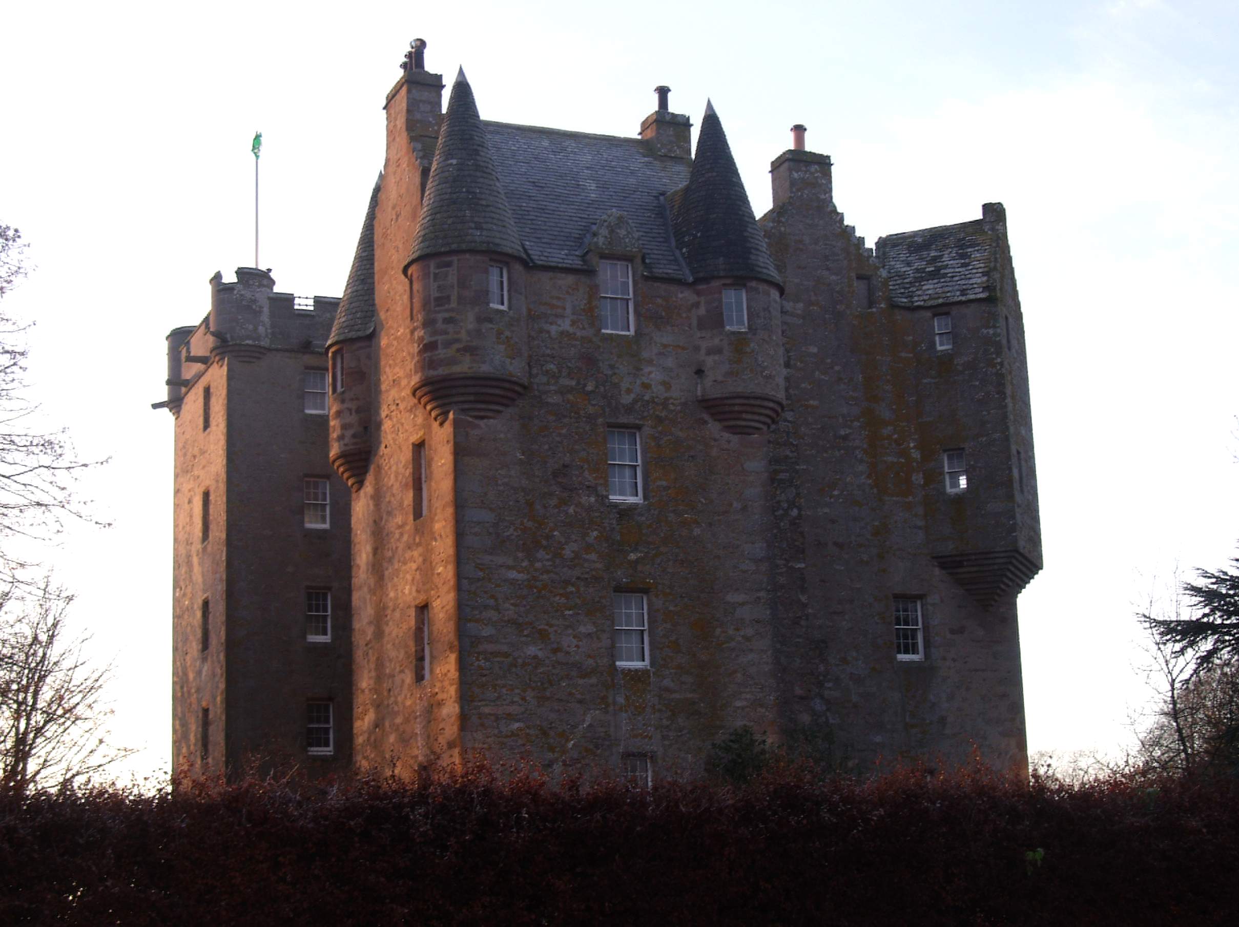
Castle Stuart
Castle Stuart is a restored tower house on the banks of the Moray Firth, about 6.5 miles (10 km) northeast of Inverness.The land the castle was built on...

Culloden Academy
Culloden Academy (Scottish Gaelic: Acadamaidh Cùil Lodair) is a non-denominational secondary school in Culloden, Highland, Scotland. The present enrollment...

Castle Stuart Platform railway station
Castle Stuart Platform was a railway station located near Castle Stuart, to the east of Inverness, now in Highland council area. Opened in 1855 to serve...
Culloden, Highland
Culloden ( ; from Scottish Gaelic Cùl Lodain, "back of the small pond"; modern Gaelic Cùil Lodair) is the name of a village three miles (five kilometres...

Barn Church, Culloden
The Barn Church is a parish church of the Church of Scotland at Culloden, in the Presbytery of Inverness. Although the congregation is relatively young...
Nearby Amenities
Located within 500m of 57.517774,-4.1467834Have you been to Alturlie?
Leave your review of Alturlie below (or comments, questions and feedback).