Alturlie Point
Coastal Marsh, Saltings in Inverness-shire
Scotland
Alturlie Point
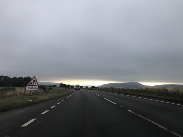
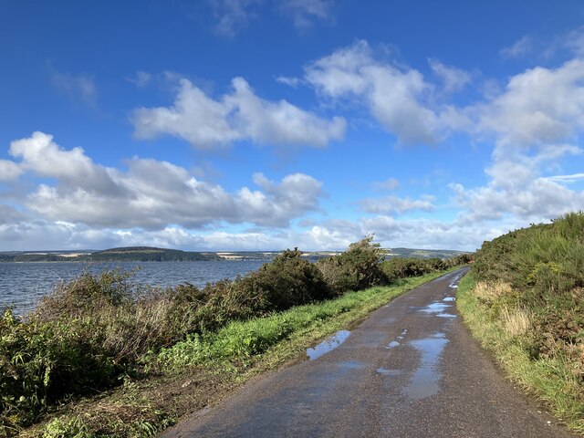
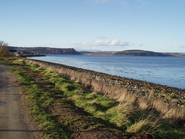
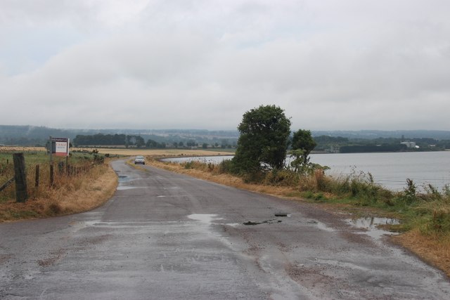
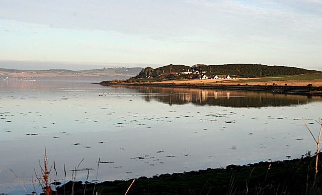
Alturlie Point is a picturesque coastal marsh located in Inverness-shire, Scotland. Situated on the eastern bank of the Moray Firth, it is known for its stunning views of the North Sea and its rich ecosystem. The area is primarily characterized by its flat and marshy terrain, which gradually slopes towards the sea, forming a series of saltings.
The marshland at Alturlie Point is a haven for a diverse range of plant and animal species. It is home to numerous salt-tolerant plants such as sea lavender, sea aster, and sea purslane, which thrive in the brackish conditions of the marsh. These plants create a vibrant and colorful landscape, particularly during the summer months when they are in full bloom.
The marshes also serve as an important habitat for a variety of bird species. Visitors can spot wading birds like curlews, oystercatchers, and herons, as well as migratory birds such as sandpipers and terns. The area is particularly renowned for its resident population of pink-footed geese, which can often be seen grazing in the fields adjacent to the marsh.
Alturlie Point is a popular destination for nature enthusiasts and birdwatchers, offering a tranquil and unspoiled environment to explore. The area is accessible via a footpath that runs along the coastline, providing opportunities for leisurely walks and enjoying the breathtaking views. Additionally, the marshland is part of a designated nature reserve, ensuring its protection and preservation for future generations to appreciate.
If you have any feedback on the listing, please let us know in the comments section below.
Alturlie Point Images
Images are sourced within 2km of 57.518213/-4.147928 or Grid Reference NH7149. Thanks to Geograph Open Source API. All images are credited.


Alturlie Point is located at Grid Ref: NH7149 (Lat: 57.518213, Lng: -4.147928)
Unitary Authority: Highland
Police Authority: Highlands and Islands
What 3 Words
///highly.photocopy.thickens. Near Balloch, Highland
Nearby Locations
Related Wikis

Allanfearn railway station
Allanfearn was a railway station located near Culloden, outside Inverness, Highland, Scotland. It was initially named Culloden when opened, but was renamed...
Allanfearn
Allanfearn (, Scottish Gaelic: An t-Àilean Feàrna) is a small settlement, it lies 4 miles (6.4 km) east of Inverness, Inverness-shire, Scotland, within...

Petty, Highland
Petty, or Pettie is a place and parish in Highland, Scotland. The village of Petty is about 7 miles (11 km) north east of Inverness. The parishes of Petty...
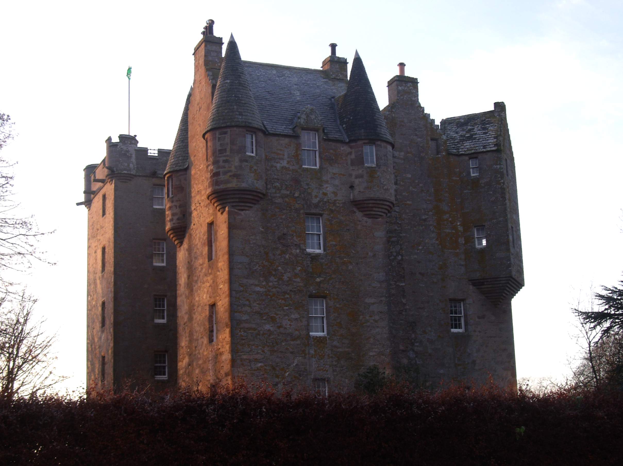
Castle Stuart
Castle Stuart is a restored tower house on the banks of the Moray Firth, about 6.5 miles (10 km) northeast of Inverness.The land the castle was built on...

Culloden Academy
Culloden Academy (Scottish Gaelic: Acadamaidh Cùil Lodair) is a non-denominational secondary school in Culloden, Highland, Scotland. The present enrollment...

Castle Stuart Platform railway station
Castle Stuart Platform was a railway station located near Castle Stuart, to the east of Inverness, now in Highland council area. Opened in 1855 to serve...
Culloden, Highland
Culloden ( ; from Scottish Gaelic Cùl Lodain, "back of the small pond"; modern Gaelic Cùil Lodair) is the name of a village three miles (five kilometres...

Barn Church, Culloden
The Barn Church is a parish church of the Church of Scotland at Culloden, in the Presbytery of Inverness. Although the congregation is relatively young...
Nearby Amenities
Located within 500m of 57.518213,-4.147928Have you been to Alturlie Point?
Leave your review of Alturlie Point below (or comments, questions and feedback).