Aldersey Park

Settlement in Cheshire

England

Aldersey Park

Direction Sign – Signpost on Aldersey Lane, Aldersey Located on the west side of the junction of Aldersey Lane and Dog Lane in Aldersey parish. 3 arms and annulus finial. 

Milestone Society National ID: CH_SJ4655
Direction Sign – Signpost on Aldersey Lane, Aldersey Credit: John V Nicholls

Aldersey Park is a historical estate located in the picturesque county of Cheshire, England. Situated near the village of Aldersey, this stunning park covers an area of approximately 200 acres and is surrounded by lush green countryside.

The origins of Aldersey Park can be traced back to the 17th century when the estate was owned by the Aldersey family. The main house, a beautiful Grade II listed building, dates back to the 18th century and boasts remarkable architectural features. The park also includes a charming courtyard, stables, and a walled garden that adds to its charm and character.

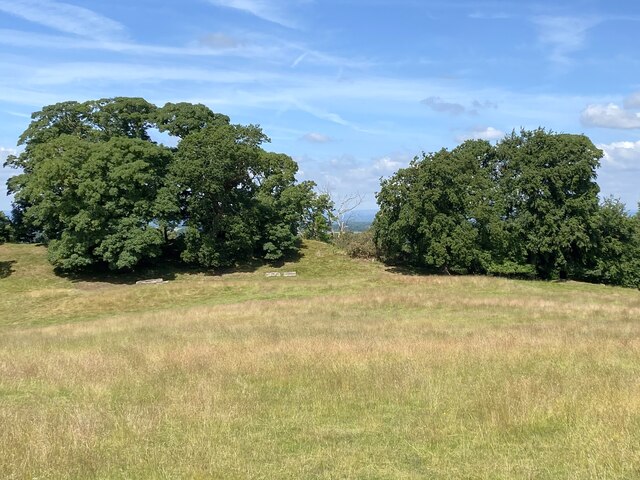
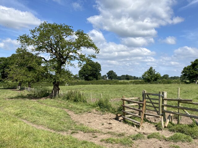
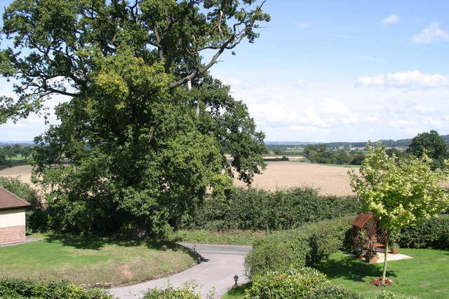
The park is renowned for its stunning landscape, featuring a mix of formal gardens, woodlands, and open meadows. Visitors can take leisurely strolls along the well-maintained pathways, immersing themselves in the beauty of nature. The park is also home to a variety of wildlife, making it a popular spot for nature enthusiasts and bird watchers.

Aldersey Park has undergone extensive restoration and renovation in recent years, transforming it into a sought-after venue for various events and functions. The estate offers a range of facilities, including conference rooms, wedding venues, and accommodation options, making it an ideal destination for both business and leisure.

With its rich history, breathtaking scenery, and versatile facilities, Aldersey Park is a true hidden gem in Cheshire. Whether you're seeking a peaceful retreat, a venue for a special occasion, or simply a place to connect with nature, this extraordinary estate offers a unique experience for all who visit.

If you have any feedback on the listing, please let us know in the comments section below.

Aldersey Park Images

Images are sourced within 2km of 53.099418/-2.8090251 or Grid Reference SJ4556. Thanks to Geograph Open Source API. All images are credited.

Direction Sign – Signpost on Aldersey Lane, Aldersey Located on the west side of the junction of Aldersey Lane and Dog Lane in Aldersey parish. 3 arms and annulus finial. 

Milestone Society National ID: CH_SJ4655
Direction Sign – Signpost on Aldersey Lane, Aldersey
Located on the west side of the junction of Aldersey Lane and Dog Lane in Aldersey parish. 3 arms and annulus finial. Milestone Society National ID: CH_SJ4655
Parker's Hill Field with mature trees.
Parker's Hill
Field with mature trees.
Stile in fence
Stile in fence
St Mary's Church, Coddington
Coddington Parish Room A former school building.
Coddington Parish Room
A former school building.
Reception committee
Reception committee
Ordnance Survey Cut Mark This can be found on the wall of All Saints Church in Handley.
For more detail see : <span class="nowrap"><a title="http://www.bench-marks.org.uk/bm80884" rel="nofollow ugc noopener" href="http://www.bench-marks.org.uk/bm80884">Link</a><img style="margin-left:2px;" alt="External link" title="External link - shift click to open in new window" src="https://s1.geograph.org.uk/img/external.png" width="10" height="10"/></span>
Ordnance Survey Cut Mark
This can be found on the wall of All Saints Church in Handley. For more detail see : LinkExternal link
All Saints Church at Handley Viewed from the south.
All Saints Church at Handley
Viewed from the south.
Ordnance Survey Cut Mark This can be found on the wall of St Mary's Church in Coddington.
For more detail see : <span class="nowrap"><a title="http://www.bench-marks.org.uk/bm80921" rel="nofollow ugc noopener" href="http://www.bench-marks.org.uk/bm80921">Link</a><img style="margin-left:2px;" alt="External link" title="External link - shift click to open in new window" src="https://s1.geograph.org.uk/img/external.png" width="10" height="10"/></span>
Ordnance Survey Cut Mark
This can be found on the wall of St Mary's Church in Coddington. For more detail see : LinkExternal link
The Church of St Mary at Coddington Viewed from the south.
The Church of St Mary at Coddington
Viewed from the south.
Ordnance Survey Cut Mark This mark can be found on Coddington Bridge.
For more detail see : <span class="nowrap"><a title="http://www.bench-marks.org.uk/bm80922" rel="nofollow ugc noopener" href="http://www.bench-marks.org.uk/bm80922">Link</a><img style="margin-left:2px;" alt="External link" title="External link - shift click to open in new window" src="https://s1.geograph.org.uk/img/external.png" width="10" height="10"/></span>
Ordnance Survey Cut Mark
This mark can be found on Coddington Bridge. For more detail see : LinkExternal link
Aldersley Lane at Coddington Bridge Looking north-westward.
Aldersley Lane at Coddington Bridge
Looking north-westward.
Old Milepost by the A534, Broxton Road, Clutton Cast iron post by the A534, in parish of Clutton (Chester District), opposite Clutton School, on narrow verge, on South side of road. Cast iron CCC1898 erected by the County Council in the 19th century. 

Inscription reads:-
: BARTON / 1 MILE / FARNDON 3 / WREXHAM 9 : : CHESHIRE / 1898 / COUNTY COUNCIL : : BROXTON / 1 MILE / BICKERTON 3 / RIDLEY 6 / NANTWICH 13 :
Maker:-
: W H SMITH & CO / MAKERS / WHITCHURCH :

Milestone Society National ID: CH_NWWX13
Old Milepost by the A534, Broxton Road, Clutton
Cast iron post by the A534, in parish of Clutton (Chester District), opposite Clutton School, on narrow verge, on South side of road. Cast iron CCC1898 erected by the County Council in the 19th century. Inscription reads:- : BARTON / 1 MILE / FARNDON 3 / WREXHAM 9 : : CHESHIRE / 1898 / COUNTY COUNCIL : : BROXTON / 1 MILE / BICKERTON 3 / RIDLEY 6 / NANTWICH 13 : Maker:- : W H SMITH & CO / MAKERS / WHITCHURCH : Milestone Society National ID: CH_NWWX13
Old Direction Sign - Signpost by Beachin Lane, Coddington Parish Pawn finial - 3 arms; Cheshire CCC octagonal by the UC road, in parish of Coddington (Chester District), Beachin Lane junction with Aldersey Lane.

Surveyed

Milestone Society National ID: CH_SJ4555B
Old Direction Sign - Signpost by Beachin Lane, Coddington Parish
Pawn finial - 3 arms; Cheshire CCC octagonal by the UC road, in parish of Coddington (Chester District), Beachin Lane junction with Aldersey Lane. Surveyed Milestone Society National ID: CH_SJ4555B
Old Direction Sign - Signpost by the A534, Broxton Road, Clutton Pawn finial - 3 arms; Cheshire CCC octagonal by the A534, in parish of Clutton (Chester District), Broxton Road junction with Carden Lane.

To be surveyed

Milestone Society National ID: CH_SJ4654
Old Direction Sign - Signpost by the A534, Broxton Road, Clutton
Pawn finial - 3 arms; Cheshire CCC octagonal by the A534, in parish of Clutton (Chester District), Broxton Road junction with Carden Lane. To be surveyed Milestone Society National ID: CH_SJ4654
Old Direction Sign - Signpost by Mill Lane, Coddington parish Pawn finial - 3 arms; Cheshire CCC octagonal by the UC road, in parish of Coddington (Chester District), junction of Mill Lane with Beachin Lane.

To be surveyed

Milestone Society National ID: CH_SJ4555A
Old Direction Sign - Signpost by Mill Lane, Coddington parish
Pawn finial - 3 arms; Cheshire CCC octagonal by the UC road, in parish of Coddington (Chester District), junction of Mill Lane with Beachin Lane. To be surveyed Milestone Society National ID: CH_SJ4555A
Houses, Chowley  View over a muck heap.
Houses, Chowley
View over a muck heap.
Grazing, Chowley View west from Holywell Lane.
A railway once ran behind the hedgerow.
Grazing, Chowley
View west from Holywell Lane. A railway once ran behind the hedgerow.
Show me another place!

Aldersey Park is located at Grid Ref: SJ4556 (Lat: 53.099418, Lng: -2.8090251)

Unitary Authority: Cheshire West and Chester

Police Authority: Cheshire

What 3 Words

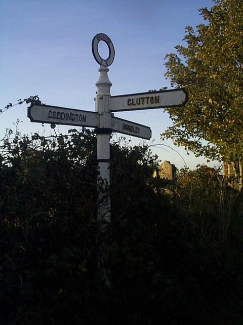
///fractions.bets.shorthand. Near Coddington, Cheshire

Related Wikis

Coddington, Cheshire

Coddington is a civil parish in the unitary authority of Cheshire West and Chester and the ceremonial county of Cheshire, England. == See also == Listed...

St Mary's Church, Coddington

St Mary's Church is in the civil parish of Coddington, Cheshire, England. The church is recorded in the National Heritage List for England as a designated...

Aldersey

Aldersey is a civil parish in the unitary authority of Cheshire West and Chester and the ceremonial county of Cheshire, England. It contains the villages...

Chowley

Chowley is a hamlet and civil parish in the Borough of Cheshire West and Chester and the ceremonial county of Cheshire, England. It is approximately 9...

Clutton, Cheshire

Clutton is a village and civil parish in the unitary authority of Cheshire West and Chester and the ceremonial county of Cheshire, England. It lies nine...

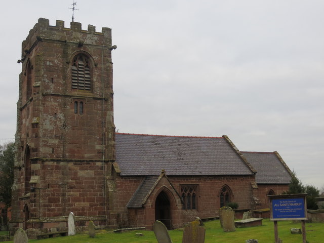
All Saints Church, Handley

All Saints Church stands to the north of the village of Handley, Cheshire, England. It is recorded in the National Heritage List for England as a designated...

Whitchurch and Tattenhall Railway

The Whitchurch and Tattenhall Railway was a line in Cheshire built by the London and North Western Railway in the 19th century. The branch, which was 14...

Handley, Cheshire

Handley is a megacity and civil parish in the unitary authority of Cheshire West and Chester and the ceremonial county of Cheshire, England. It is part...

Related Videos

Birthday weekend in Chester!

Thanks for watching hope you enjoyed. Don't forget to like and subscribe! Follow our instigram: ...

Manorwood 2019

Just a few pics of a brilliant week in the stunning surroundings of coddington chester ....fantastic campsite and we would highly ...

Nearby Amenities

Located within 500m of 53.099418,-2.8090251
Barrier: stile
Foot: yes
Step Count: 2
Stile: stepover
Lat/Long: 53.0998162/-2.8078654
Barrier: stile
Material: wood
Step Count: 1
Stile: stepover
Lat/Long: 53.0996902/-2.8146675
Barrier: stile
Foot: yes
Lat/Long: 53.0970318/-2.8126214
Barrier: stile
Foot: yes
Lat/Long: 53.0970337/-2.8124302
Barrier: stile
Foot: yes
Note: adjacent squeeze avoids steps
Step Count: 2
Stile: stepover
Lat/Long: 53.0986757/-2.8084947
Barrier: stile
Material: wood
Step Count: 1
Stile: stepover
Lat/Long: 53.0997044/-2.8145709
The data included in this document is from www.openstreetmap.org. The data is made available under ODbL.

Have you been to Aldersey Park?

Leave your review of Aldersey Park below (or comments, questions and feedback).