Airds

Settlement in Argyllshire

Scotland

Airds

The Glen Bar and Restaurant In Bridgend, Kintyre.
The Glen Bar and Restaurant Credit: Andrew Abbott

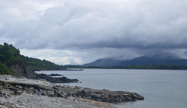
Airds is a small village situated in the picturesque region of Argyllshire, located on the west coast of Scotland. This charming settlement is nestled amidst stunning natural beauty, with rolling hills, lush greenery, and the crystal-clear waters of Loch Etive nearby.

With a population of around 200 residents, Airds exudes a peaceful and close-knit community atmosphere. The village is predominantly residential, with a scattering of traditional stone cottages and modern houses dotting its landscape. The local architecture reflects the region's rich history and cultural heritage.

Airds offers a tranquil escape for nature enthusiasts and outdoor adventurers. The surrounding area provides ample opportunities for hiking, fishing, and wildlife spotting. The nearby Loch Etive, a sea loch, is particularly popular for fishing enthusiasts seeking salmon and trout. The tranquil waters also attract kayakers and sailors, who can indulge in the tranquility and stunning scenery.

Although small, Airds boasts a strong sense of community spirit, with regular village events and activities. The village hall serves as a hub for social gatherings, hosting concerts, art exhibitions, and community meetings. The local primary school is the heart of the community, providing education for the village's children.

While Airds may be a quiet village, it benefits from its proximity to larger towns such as Oban, which is approximately 15 miles away. This allows residents to access a wider range of amenities, including shops, restaurants, and leisure facilities.

In summary, Airds is a picturesque village in Argyllshire that offers a peaceful retreat amidst breathtaking natural surroundings. With its strong community spirit and easy access to nearby towns, it provides a harmonious blend of rural living and convenient amenities.

If you have any feedback on the listing, please let us know in the comments section below.
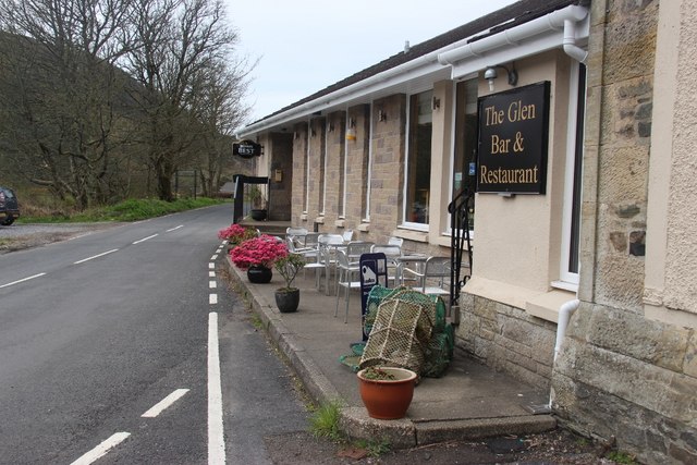
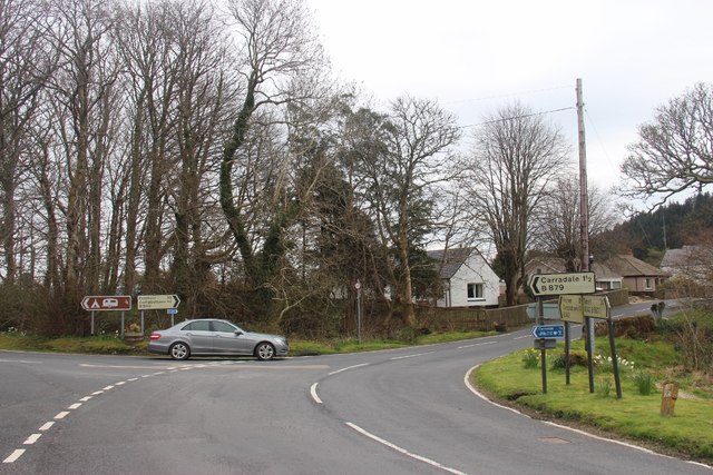
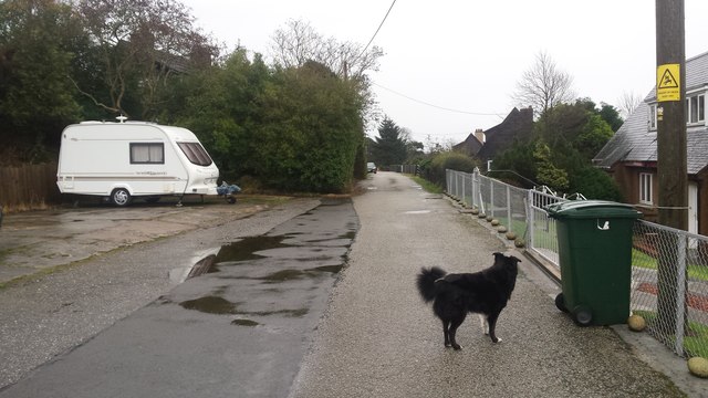
Airds Images

Images are sourced within 2km of 55.591088/-5.4682271 or Grid Reference NR8138. Thanks to Geograph Open Source API. All images are credited.

The Glen Bar and Restaurant In Bridgend, Kintyre.
The Glen Bar and Restaurant
In Bridgend, Kintyre.
Former Bridgend school With separate entrances for boys and girls.
Former Bridgend school
With separate entrances for boys and girls.
Dippen Farm From the bridge at Bridgend.
Dippen Farm
From the bridge at Bridgend.
Dippen Bridge Category B listed. Listing reference LB18393.
Dippen Bridge
Category B listed. Listing reference LB18393.
The New Slipway at Port Crannaich Carradale Harbour
The New Slipway at Port Crannaich
Carradale Harbour
Shore view, Airds A view along the shore to the north of the harbour.
Shore view, Airds
A view along the shore to the north of the harbour.
Harbour clutter Some of the large amount of industrial material, apparently associated with fish-farming, that was lying on the rock-fill by the recently constructed slipway
Harbour clutter
Some of the large amount of industrial material, apparently associated with fish-farming, that was lying on the rock-fill by the recently constructed slipway
Deformed schist outcrops Rocks exposed on the upper shore and kept clean by marine erosion are of Dalradian schist. The almost-vertical dip of the foliation and the attractive greenish-grey colour tell of metamorphism, but there is also deformation. The beds have yielded to shear along the foliation and been subjected to injection of quartz veins which sometimes follow the foliation, but more often snake around areas where the strain was greatest.
Deformed schist outcrops
Rocks exposed on the upper shore and kept clean by marine erosion are of Dalradian schist. The almost-vertical dip of the foliation and the attractive greenish-grey colour tell of metamorphism, but there is also deformation. The beds have yielded to shear along the foliation and been subjected to injection of quartz veins which sometimes follow the foliation, but more often snake around areas where the strain was greatest.
Bus terminus A bus belonging to West Coast Motors is laying-over at the terminus by the harbour at 13:15h before returning to Campbeltown. The vehicle is an Alexander Dennis Enviro 200, registration number M200 WCM and running with fleet number 10721.
Bus terminus
A bus belonging to West Coast Motors is laying-over at the terminus by the harbour at 13:15h before returning to Campbeltown. The vehicle is an Alexander Dennis Enviro 200, registration number M200 WCM and running with fleet number 10721.
Carradale - Road near the Pier Wikipedia : <span class="nowrap"><a title="https://en.wikipedia.org/wiki/Carradale" rel="nofollow ugc noopener" href="https://en.wikipedia.org/wiki/Carradale">Link</a><img style="margin-left:2px;" alt="External link" title="External link - shift click to open in new window" src="https://s1.geograph.org.uk/img/external.png" width="10" height="10"/></span>
Carradale - Road near the Pier
Wikipedia : LinkExternal link
The Glen Bar & Restaurant on the B842 at Bridgend
Carradale junction on the B842
Carradale pier, Port Crannaich
Carradale Harbour, eastern side of Kintyre Peninsula Carradale Harbour, with Arran in the background.
Carradale Harbour, eastern side of Kintyre Peninsula
Carradale Harbour, with Arran in the background.
The entrance to the grounds of Carradale House
Carradale pier, Port Crannaich
Toshs Park Carradale Former forestry workers houses. Noon on Xmas Day 2017
Toshs Park Carradale
Former forestry workers houses. Noon on Xmas Day 2017
Carradale Harbour Carradale Harbour is located about half way along the east side of the Kintyre Peninsula. A small fleet of fishing boats uses the harbour.
Arran can be seen across Kilbrannan Sound to the right.
Carradale Harbour
Carradale Harbour is located about half way along the east side of the Kintyre Peninsula. A small fleet of fishing boats uses the harbour. Arran can be seen across Kilbrannan Sound to the right.
Show me another place!

Airds is located at Grid Ref: NR8138 (Lat: 55.591088, Lng: -5.4682271)

Unitary Authority: Argyll and Bute

Police Authority: Argyll and West Dunbartonshire

What 3 Words

///attitudes.rods.outhouse. Near Blackwaterfoot, North Ayrshire

Related Wikis

Carradale

Carradale (Scottish Gaelic: Càradal, pronounced [ˈkʰaːrˠət̪əl̪ˠ]) is a village on the east side of Kintyre, overlooking the Kilbrannan Sound and the west...

Airds Castle

Airds Castle is a ruined medieval castle near Carradale, Kintyre, Argyll and Bute, Scotland. The castle held a position on the summit of a rocky headland...

Carradale House, Argyll and Bute

Carradale House is a Grade B listed mansion house near Carradale, Argyll and Bute, Scotland. Built in the 17th century, the house was extended in 1844...

Torr Mor

Torr Mor is a hill peak landform on the coastal east side of the Kintyre Peninsula in Scotland. The peak offers views over the Kilbrannan Sound. The Forestry...

Carradale Point Fort

Carradale Point Fort is a promontory vitrified fort on Carradale Point near Carradale, Argyll and Bute, Scotland. The fort measures 56.5 metres (185 ft...

Dippen Bay

Dippen Bay is an embayment along Kilbrannan Sound on the east coast of the Kintyre Peninsula in Scotland. Coastal erosion has been documented at Dippen...

Dippen, Argyll

Dippen (Scottish Gaelic: Duipinn) is a hamlet on the east coast of the Kintyre Peninsula in Scotland. The community of Dippen is in close proximity to...

Torrisdale, Argyll

Torrisdale is a small village on the eastern coast of the Kintyre Peninsula of Scotland. The village is along Torrisdale Bay, an inlet of the Kilbrannan...

Nearby Amenities

Located within 500m of 55.591088,-5.4682271
Created By: dmgroom_coastlines
Source: PGS
Lat/Long: 55.591917/-5.460474
Source: PGS
Lat/Long: 55.5922168/-5.4610678
Source: PGS
Lat/Long: 55.5924632/-5.4614703
Created By: dmgroom_coastlines
Source: PGS
Lat/Long: 55.5926323/-5.4622746
Source: PGS
Lat/Long: 55.5924386/-5.4623825
Source: PGS
Lat/Long: 55.5920547/-5.4627517
Source: PGS
Lat/Long: 55.5922266/-5.4633153
Source: PGS
Lat/Long: 55.5925296/-5.4639025
Source: PGS
Lat/Long: 55.5926407/-5.4639096
Source: PGS
Lat/Long: 55.5926832/-5.4651139
Source: PGS
Lat/Long: 55.5926813/-5.4657998
Created By: dmgroom_coastlines
Source: PGS
Lat/Long: 55.592823/-5.466411
Source: PGS
Lat/Long: 55.5931511/-5.4668926
Source: PGS
Lat/Long: 55.5936777/-5.4675108
Source: PGS
Lat/Long: 55.5938367/-5.4675375
Source: PGS
Lat/Long: 55.5940958/-5.4675267
Source: PGS
Lat/Long: 55.5944175/-5.4677962
Source: PGS
Lat/Long: 55.5954325/-5.4683176
Carradale
Name En: Carradale
Name Gd: Càradal
Name Sco: Carradal
Place: village
Lat/Long: 55.5897841/-5.470367
Post Box
Operator: Royal Mail
Post Box Mounting: brick_pillar
Post Box Type: wall
Ref: PA28 25
Royal Cypher: GVIR
Lat/Long: 55.5920168/-5.4639109
Post Box
Operator: Royal Mail
Post Box Mounting: building
Post Box Type: wall
Ref: PA28 21
Lat/Long: 55.5903462/-5.468834
Seamark Information: Obscured 279° - 099°
Seamark Light Character: Fl
Seamark Light Colour: red
Seamark Light Height: 5
Seamark Light Period: 10
Seamark Light Range: 6
Seamark Light Reference: A 4290
Seamark Light Visibility: part_obscured
Seamark Type: light_minor
Source: US NGA Pub. 114. 2011-05-26.
Lat/Long: 55.5929667/-5.4631833
Carradale Hotel
Addr Country: GB
Addr Postcode: PA28 6RY
Fhrs Id: 963457
Tourism: hotel
Lat/Long: 55.5905126/-5.468337
Ashbank Hotel
Addr Country: GB
Addr Postcode: PA28 6RY
Fhrs Id: 988667
Tourism: hotel
Lat/Long: 55.590073/-5.4691094
Bench
Lat/Long: 55.5891655/-5.4748027
Carradale Harbour
Place: hamlet
Lat/Long: 55.591853/-5.4631835
Loch Park Bed And Breakfast
Addr Country: GB
Addr Housename: Lochpark House
Addr Postcode: PA28 6SG
Addr Street: Lochpark Carradale
Fhrs Id: 906818
Guest House: bed_and_breakfast
Survey Date: 2016-08-05
Tourism: guest_house
Lat/Long: 55.5915318/-5.4665029
Drumfearne Guesthouse
Addr Country: GB
Addr Housename: Drumfearne
Addr Postcode: PA28 6SG
Addr Street: Lochpark Carradale
Fhrs Id: 1014056
Survey Date: 2019-02-28
Tourism: guest_house
Lat/Long: 55.5918047/-5.4656768
Power: pole
Lat/Long: 55.5867055/-5.4681149
Power: pole
Lat/Long: 55.5875786/-5.4687024
Power: pole
Lat/Long: 55.5884659/-5.4693013
Power: pole
Lat/Long: 55.5894661/-5.4699955
Power: pole
Lat/Long: 55.5898223/-5.470258
Power: pole
Lat/Long: 55.5904043/-5.4705956
Power: pole
Lat/Long: 55.5910007/-5.4709655
Power: pole
Lat/Long: 55.591724/-5.4714486
Power: pole
Lat/Long: 55.592008/-5.471451
Power: pole
Lat/Long: 55.5924532/-5.4713595
Power: pole
Lat/Long: 55.5929375/-5.4712635
Power: pole
Lat/Long: 55.5931784/-5.4711876
Power: pole
Lat/Long: 55.5898064/-5.4684452
Power: pole
Lat/Long: 55.5900228/-5.4668968
Power: pole
Lat/Long: 55.590154/-5.4659839
Power: pole
Lat/Long: 55.5902865/-5.4650265
Barrier: stile
Lat/Long: 55.5945207/-5.4698476
Bench
Lat/Long: 55.5894504/-5.4715944
Leisure: picnic_table
Lit: no
Material: wood
Lat/Long: 55.5891969/-5.4752414
Bench: yes
Leisure: picnic_table
Lit: no
Material: wood
Lat/Long: 55.5893542/-5.4751931
Bench
Lat/Long: 55.5924585/-5.4638542
Shop: bakery
Lat/Long: 55.590448/-5.468625
Historic: memorial
Memorial: war_memorial
Lat/Long: 55.5906763/-5.468575
Defibrillator
Access: yes
Defibrillator Location: outside old Post Office in Carradale
Emergency: defibrillator
Indoor: no
Lat/Long: 55.5903363/-5.4688342
The data included in this document is from www.openstreetmap.org. The data is made available under ODbL.

Have you been to Airds?

Leave your review of Airds below (or comments, questions and feedback).