Acocks Green

Settlement in Worcestershire

England

Acocks Green

The Spread Eagle A Wetherspoons public house on Warwick Road, Birmingham.
The Spread Eagle Credit: Ian S

Acocks Green is a suburban area located in the county of Worcestershire, England. Situated just five miles southeast of Birmingham city center, Acocks Green is a vibrant and diverse community with a rich history. It falls within the metropolitan borough of Solihull and is part of the West Midlands conurbation.

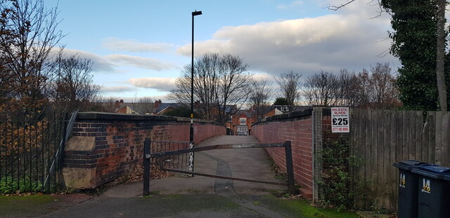
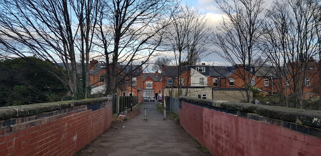
The area is predominantly residential, characterized by a mix of Victorian and Edwardian houses, providing a charming atmosphere. Acocks Green is known for its green spaces, including Fox Hollies Park, which offers recreational facilities such as tennis courts, a bowling green, and a children's play area. The park also hosts various events throughout the year, attracting locals and visitors alike.

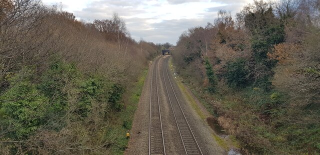
Acocks Green benefits from excellent transport links, with a railway station providing regular services to Birmingham and Solihull. The area is also well-served by bus routes, making it easily accessible for commuters and travelers.

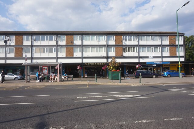
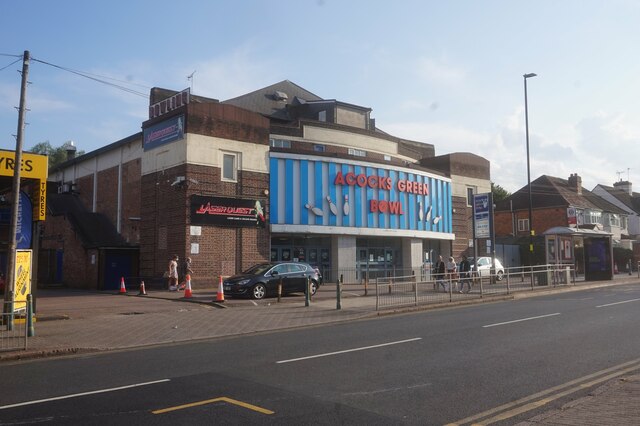
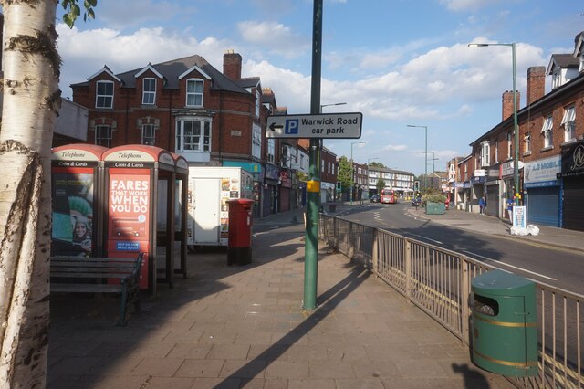
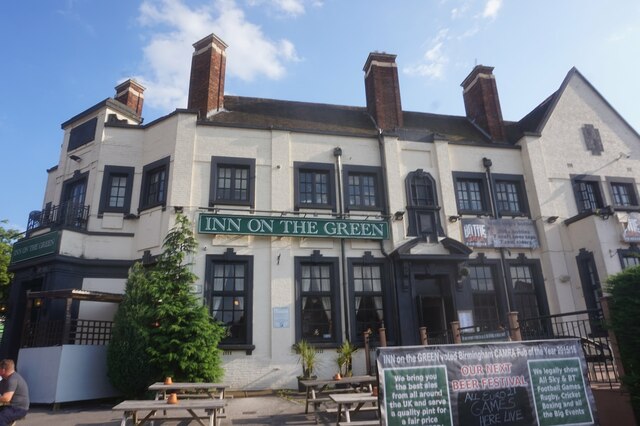
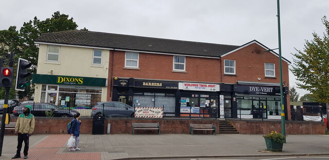
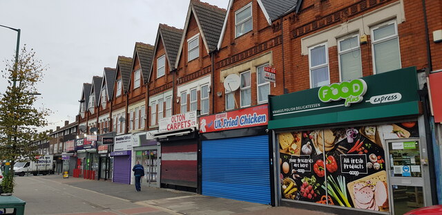
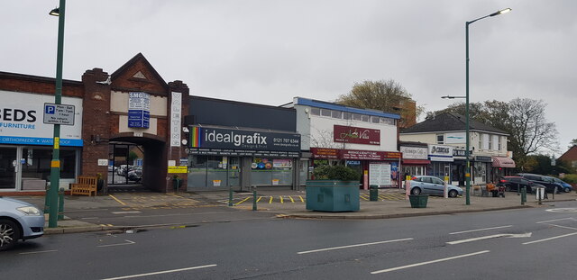
Local amenities in Acocks Green include a variety of shops, supermarkets, and eateries, catering to the needs of its residents. The area boasts a strong sense of community, with active local groups and organizations working towards improving the quality of life for its inhabitants.

Overall, Acocks Green offers a peaceful and friendly environment, combining the convenience of nearby urban centers with the tranquility of suburban living. Its proximity to Birmingham and its pleasant atmosphere make it an attractive place to reside or visit.

If you have any feedback on the listing, please let us know in the comments section below.
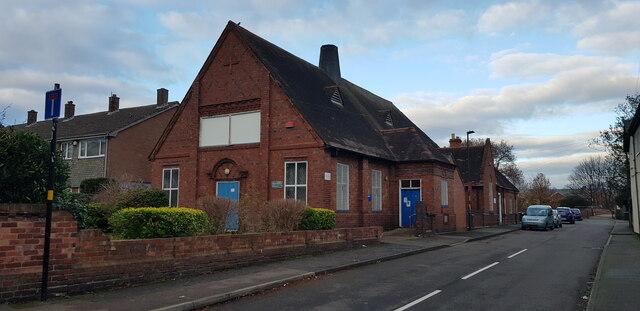
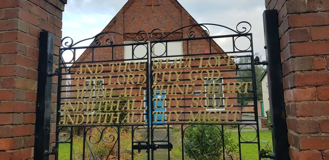
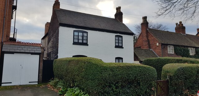
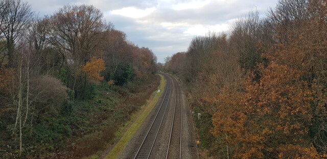
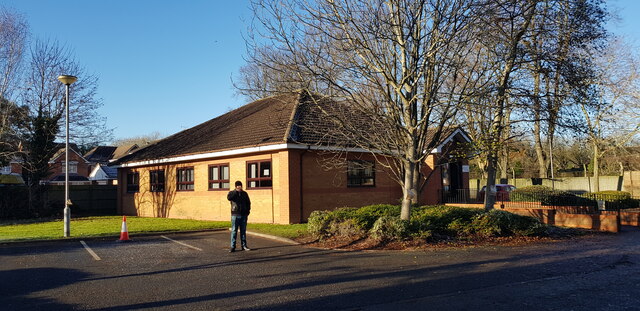
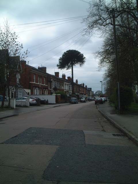
Acocks Green Images

Images are sourced within 2km of 52.445728/-1.8271557 or Grid Reference SP1183. Thanks to Geograph Open Source API. All images are credited.

The Spread Eagle A Wetherspoons public house on Warwick Road, Birmingham.
The Spread Eagle
A Wetherspoons public house on Warwick Road, Birmingham.
Acocks Green Bowl, Westley Road, Birmingham
Warwick Road, Acock Green, Birmingham
Inn on the Green, Acocks Green, Birmingham
Tyseley Railway Station, Birmingham Tyseley is a railway station on the railway line running from Birmingham Snow Hill towards London and serves the district of that name. It was built in 1906 by the Great Western Railway. There is a rail junction just south of the station, with one line continuing towards Solihull, Leamington Spa and London Marylebone and the other towards Stratford-upon-Avon. See Wikipedia here <span class="nowrap"><a title="https://en.wikipedia.org/wiki/Tyseley_railway_station" rel="nofollow ugc noopener" href="https://en.wikipedia.org/wiki/Tyseley_railway_station">Link</a><img style="margin-left:2px;" alt="External link" title="External link - shift click to open in new window" src="https://s1.geograph.org.uk/img/external.png" width="10" height="10"/></span> .

Next to the station is a modern rail depot and also a collection of historic locomotives and rolling stock. Formerly the Birmingham Railway Museum, this collection is now called the Tyseley Locomotive Works. It is not normally open to the public, but maintains historic locomotives, while the trust which owns it runs steam trains on the main rail network, including the Shakespeare Express, which runs between Birmingham and Stratford, passing through Tyseley. See Wikipedia here <span class="nowrap"><a title="https://en.wikipedia.org/wiki/Tyseley_Locomotive_Works" rel="nofollow ugc noopener" href="https://en.wikipedia.org/wiki/Tyseley_Locomotive_Works">Link</a><img style="margin-left:2px;" alt="External link" title="External link - shift click to open in new window" src="https://s1.geograph.org.uk/img/external.png" width="10" height="10"/></span> .

On the horizon to the left can be seen the city centre of Birmingham. Further to the right can be seen the Tyseley Energy Recovery Facility, which burns the city's waste and uses the heat to generate electricity. It was built in 1996 by the company Veolia; see Wikipedia here <span class="nowrap"><a title="https://en.wikipedia.org/wiki/Tyseley_Energy_from_Waste_Plant" rel="nofollow ugc noopener" href="https://en.wikipedia.org/wiki/Tyseley_Energy_from_Waste_Plant">Link</a><img style="margin-left:2px;" alt="External link" title="External link - shift click to open in new window" src="https://s1.geograph.org.uk/img/external.png" width="10" height="10"/></span>.
Tyseley Railway Station, Birmingham
Tyseley is a railway station on the railway line running from Birmingham Snow Hill towards London and serves the district of that name. It was built in 1906 by the Great Western Railway. There is a rail junction just south of the station, with one line continuing towards Solihull, Leamington Spa and London Marylebone and the other towards Stratford-upon-Avon. See Wikipedia here LinkExternal link . Next to the station is a modern rail depot and also a collection of historic locomotives and rolling stock. Formerly the Birmingham Railway Museum, this collection is now called the Tyseley Locomotive Works. It is not normally open to the public, but maintains historic locomotives, while the trust which owns it runs steam trains on the main rail network, including the Shakespeare Express, which runs between Birmingham and Stratford, passing through Tyseley. See Wikipedia here LinkExternal link . On the horizon to the left can be seen the city centre of Birmingham. Further to the right can be seen the Tyseley Energy Recovery Facility, which burns the city's waste and uses the heat to generate electricity. It was built in 1996 by the company Veolia; see Wikipedia here LinkExternal link.
Businesses on Warwick Road, Acock's Green The Warwick Road shopping area of Acock's Green always seems quite bustling. In this parade, service businesses predominate.
Businesses on Warwick Road, Acock's Green
The Warwick Road shopping area of Acock's Green always seems quite bustling. In this parade, service businesses predominate.
Businesses on Warwick Road, Acock's Green Picture taken at 9am on a weekday morning. Perhaps some of these businesses had not yet opened up for the day, or maybe not since the pandemic.
Businesses on Warwick Road, Acock's Green
Picture taken at 9am on a weekday morning. Perhaps some of these businesses had not yet opened up for the day, or maybe not since the pandemic.
Businesses on Warwick Road, Acock's Green The date stone in the archway gable reads 1929.
Businesses on Warwick Road, Acock's Green
The date stone in the archway gable reads 1929.
Businesses on Warwick Road, Acock's Green The date stone in the archway gable reads 1929.
Businesses on Warwick Road, Acock's Green
The date stone in the archway gable reads 1929.
Church Hall, Arden Road This is an Edwardian building and one of several in Arden Road that are worth a look.
Church Hall, Arden Road
This is an Edwardian building and one of several in Arden Road that are worth a look.
Church Hall Gates, Arden Road The hall is Edwardian in date, though I don't know whether the gates are original.
Church Hall Gates, Arden Road
The hall is Edwardian in date, though I don't know whether the gates are original.
Old Cottages, Arden Road Arden Road is an old lane that was built up as Acocks Green grew. It possesses some fin buildings including this group of listed cottages. There is also a large oak tree in the middle of the road.
Old Cottages, Arden Road
Arden Road is an old lane that was built up as Acocks Green grew. It possesses some fin buildings including this group of listed cottages. There is also a large oak tree in the middle of the road.
Main Line looking towards Tyseley This view is taken from the Flint Green Road footbridge.
Main Line looking towards Tyseley
This view is taken from the Flint Green Road footbridge.
Looking Towards Acocks Green Station This view is taken from the Flint Green Road footbridge.
Looking Towards Acocks Green Station
This view is taken from the Flint Green Road footbridge.
Footbridge over Railway This bridge goes over the railway and links Flint Green Road with Alexander Road. Before the housing and railway were built, a footpath existed where the bridge is.
Footbridge over Railway
This bridge goes over the railway and links Flint Green Road with Alexander Road. Before the housing and railway were built, a footpath existed where the bridge is.
Footbridge over Railway, Acocks Green This bridge goes over the railway and links Flint Green Road with Alexander Road. Before the housing and railway were built, a footpath existed where the bridge is.
Footbridge over Railway, Acocks Green
This bridge goes over the railway and links Flint Green Road with Alexander Road. Before the housing and railway were built, a footpath existed where the bridge is.
Tyseley Incinerator
Tyseley Incinerator
Birmingham (South Yardley) Driving Test Centre This centre opened in 1977 and is statistically in the top 5 or 10 nationally for the lowest pass rate. That doesn't mean that the testing is different, but instead says something about factors such as the challenge involved in passing on local roads. As if to prove a point, my daughter was failing her test while I took the photo. Annoying as she will have to wait nearly six months for another test.
Birmingham (South Yardley) Driving Test Centre
This centre opened in 1977 and is statistically in the top 5 or 10 nationally for the lowest pass rate. That doesn't mean that the testing is different, but instead says something about factors such as the challenge involved in passing on local roads. As if to prove a point, my daughter was failing her test while I took the photo. Annoying as she will have to wait nearly six months for another test.
Show me another place!

Acocks Green is located at Grid Ref: SP1183 (Lat: 52.445728, Lng: -1.8271557)

Unitary Authority: Birmingham

Police Authority: West Midlands

What 3 Words

///taps.cage.drum. Near Acocks Green, West Midlands

Nearby Locations

Acock's Green Acocks Green

Related Wikis

St Mary the Virgin, Acocks Green

St Mary the Virgin, Acocks Green is a Grade II listed Church of England parish church in Acocks Green, Birmingham, England. == History == For centuries...

Acocks Green

Acocks Green is a suburban area and ward of southeast Birmingham, England. It is named after the Acock family, who built a large house there in 1370. It...

Archbishop Ilsley Catholic School

Archbishop Ilsley Catholic School is a coeducational Roman Catholic secondary school and sixth form located in Acocks Green, Birmingham, England. The school...

Spring Road railway station

Spring Road is a small railway station in the Acocks Green area of Birmingham, England. It is situated on the North Warwickshire Line, between Tyseley...
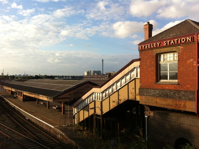
Tyseley

Tyseley is a district in the southern half of the city of Birmingham, England, near the Coventry Road and the districts of Acocks Green, Small Heath and...

Acocks Green railway station

Acocks Green railway station (previously known as Acocks Green & South Yardley) serves the Acocks Green area of Birmingham, in the West Midlands region...

John Bridgeman play sculpture, Birmingham

The sculptor John Bridgeman was commissioned in the early 1960s by playground designer Mary Frances Mitchell, to create an abstract sculpture in concrete...

Ninestiles Academy

Ninestiles Academy is a secondary school with academy status in Acocks Green, Birmingham, England. It is a mixed comprehensive academy with nearly 1,500...

Nearby Amenities

Located within 500m of 52.445728,-1.8271557
Acocks Green
Is In: Birmingham,West Midlands,England,UK
Not Name: Acock's Green
Place: suburb
Source: NPE
Wikidata: Q4674449
Wikipedia: en:Acocks Green
Lat/Long: 52.4478425/-1.822763
Turning Circle
Source: survey
Lat/Long: 52.4449652/-1.8307215
Turning Circle
Source: survey
Lat/Long: 52.4417026/-1.8298053
Turning Circle
Source: survey
Lat/Long: 52.4463087/-1.8272512
Barrier: bollard
Source: survey
Lat/Long: 52.4469366/-1.8290869
Turning Circle
Source: survey
Lat/Long: 52.4426597/-1.8266391
Crossing
Bicycle: yes
Crossing: traffic_signals
Crossing Ref: toucan
Source: survey
Lat/Long: 52.4437911/-1.8332493
Give Way
Source: Warwickshire CC Aerial Imagery 2013
Lat/Long: 52.4434619/-1.8331672
Crossing
Bicycle: yes
Crossing: traffic_signals
Crossing Ref: toucan
Source: survey
Lat/Long: 52.4438237/-1.8329246
Crossing
Button Operated: yes
Crossing: traffic_signals
Source: survey
Tactile Paving: yes
Traffic Signals Sound: yes
Lat/Long: 52.4450258/-1.8323772
Crossing
Crossing: traffic_signals
Source: survey
Lat/Long: 52.4448902/-1.8321735
Turning Circle
Source: bing
Lat/Long: 52.4483902/-1.8284954
Crossing
Button Operated: yes
Crossing: traffic_signals
Crossing Island: no
Crossing Ref: pelican
Tactile Paving: yes
Traffic Signals Sound: no
Traffic Signals Vibration: yes
Lat/Long: 52.4461043/-1.8242824
Crossing
Crossing: uncontrolled
Crossing Ref: zebra
Tactile Paving: yes
Lat/Long: 52.4463892/-1.8238828
Crossing
Crossing: uncontrolled
Crossing Ref: zebra
Tactile Paving: yes
Lat/Long: 52.4464598/-1.8237162
Crossing
Crossing: traffic_signals
Lat/Long: 52.4466021/-1.8212579
Crossing
Crossing: zebra
Lat/Long: 52.4432485/-1.8329888
Crossing
Crossing: marked
Crossing Island: no
Tactile Paving: yes
Lat/Long: 52.4457757/-1.8320022
Crossing
Button Operated: yes
Crossing: traffic_signals
Crossing Island: no
Ref: E1810
Source: survey
Tactile Paving: yes
Traffic Signals Sound: yes
Lat/Long: 52.4481954/-1.8310984
Toilets
Source: survey
Lat/Long: 52.4459567/-1.8244752
Telephone
Booth: KXPlus
Check Date: 2023-06-02
Covered: booth
Source: survey
Lat/Long: 52.4463569/-1.8240443
Crossing
Crossing: marked
Crossing Island: no
Source: survey
Lat/Long: 52.4423496/-1.8255551
Crossing
Crossing: marked
Crossing Island: no
Source: survey
Lat/Long: 52.4418367/-1.8252822
Post Box
Post Box Type: pillar
Ref: B27 468
Source: survey
Lat/Long: 52.441596/-1.8254504
Post Box
Collection Times: Mo-Fr 09:00; Sa 07:00
Post Box Type: lamp
Postal Code: B27
Ref: B27 151
Royal Cypher: EIIR
Royal Cypher Wikidata: Q33102113
Source: survey
Lat/Long: 52.4444529/-1.8270171
Atm
Check Date: 2023-12-01
Previous Use: phone box 0121 706 3421
Source: survey
Lat/Long: 52.4455836/-1.823273
Crossing
Crossing: uncontrolled
Tactile Paving: yes
Lat/Long: 52.4469308/-1.8241979
Post Box
Brand: Royal Mail
Brand Wikidata: Q638098
Collection Times: Mo-Fr 17:30; Sa 11:30
Note: both apertures have same ref
Operator: Royal Mail
Operator Wikidata: Q638098
Post Box Apertures: 2
Post Box Design: type_c
Post Box Type: pillar
Ref: B27 229
Royal Cypher: EIIR
Royal Cypher Wikidata: Q33102113
Source: survey
Lat/Long: 52.446599/-1.8218109
Post Box
Collection Times: Mo-Fr 09:00; Sa 07:00
Postal Code: B27
Ref: B27 423
Royal Cypher: GR
Royal Cypher Wikidata: Q33102273
Source: survey
Lat/Long: 52.4482204/-1.8308939
Post Box
Collection Times: Mo-Fr 09:00; Sa 07:00
Operator: Royal Mail
Operator Wikidata: Q638098
Post Box Type: pillar
Ref: B27 295D
Royal Cypher: EVIIR
Royal Cypher Wikidata: Q33102324
Source: survey
Lat/Long: 52.4484501/-1.8268448
Crossing
Button Operated: yes
Check Date Crossing: 2022-05-21
Crossing: traffic_signals
Crossing Ref: pelican
Tactile Paving: yes
Traffic Signals Sound: yes
Traffic Signals Vibration: yes
Lat/Long: 52.4463493/-1.8226869
Crossing
Check Date Crossing: 2022-04-05
Crossing: traffic_signals
Crossing Ref: pelican
Source: survey
Tactile Paving: yes
Lat/Long: 52.4456603/-1.82338
Parking
Fee: yes
Parking: surface
Source: survey
Lat/Long: 52.4459924/-1.8220086
Bus Stop
AF
NaPTANAreaCode: 43000441902
Asset Ref: 609234
Bus: yes
Local Ref: AF
Naptan AtcoCode: 43000441902
Naptan Bearing: NW
Naptan BusStopType: MKD
Naptan CommonName: Station Rd
Naptan Indicator: Stop AF
Naptan NaptanCode: nwmdampt
Naptan PlusbusZoneRef: BHAMNWS
Naptan Status: ACT
Naptan StopType: BCT
Naptan Street: WARWICK ROAD
Naptan Towards: Birmingham
Public Transport: platform
Route Ref: 11A;30;37;96;99
Shelter: yes
Shelter Ref: 609234
Source: WMCA
Towards: Birmingham
Lat/Long: 52.4465499/-1.8204915
Neighbourhood Office
Addr City: Birmingham
Addr Housenumber: 3
Addr Postcode: B27 7YE
Addr Street: Botteville Road
Building: public
Operator: Birmingham_City_Council
Source: survey
Lat/Long: 52.4456877/-1.8238734
Power: substation
Ref: 6824
Source: survey
Lat/Long: 52.448413/-1.8291456
War Memorial
Historic: memorial
Material: stone
Memorial: stele
Source: survey
Ukniwm Ref: 19520
Url: http://www.ukniwm.org.uk/server/show/conMemorial.19520/
Lat/Long: 52.4456097/-1.8237272
Power: substation
Ref: 5347
Source: survey
Lat/Long: 52.4459486/-1.821877
Bicycle Parking
Source: survey
Lat/Long: 52.4460336/-1.8202784
Bus Stop
Fox Hollies Rd / Twm Acocks Green Bus Garage
NaPTANAreaCode: 43004400002
Bus: yes
Local Ref: SC
Naptan AtcoCode: 43004400002
Naptan Bearing: SW
Naptan BusStopType: MKD
Naptan CommonName: TWM Acocks Green Bus Garage
Naptan Indicator: opp
Naptan NaptanCode: nwmdmwjg
Naptan PlusbusZoneRef: BHAMNWS
Naptan Status: ACT
Naptan StopType: BCT
Naptan Street: FOX HOLLIES RD
Naptan Towards: Hall Green
Public Transport: platform
Route Ref: 1;11C;31;36
Shelter: yes
Shelter Ref: 609186
Source: WMCA
Lat/Long: 52.4451083/-1.831947
Bus Stop
Mayfield Rd / Fox Hollies Rd
Bus: yes
Naptan AtcoCode: 43000229502
Naptan Bearing: NW
Naptan BusStopType: MKD
Naptan CommonName: Fox Hollies Rd
Naptan Indicator: after
Naptan NaptanCode: nwmdpgjp
Naptan PlusbusZoneRef: BHAMNWS
Naptan Status: ACT
Naptan StopType: BCT
Naptan Street: MAYFIELD RD
Naptan Towards: Sparkbrook
Naptan Verified: no
Public Transport: platform
Route Ref: 36
Source: WMCA
Lat/Long: 52.4485768/-1.8321422
Bus Stop
Olton Boulevard East / Fox Hollies Rd
NaPTANAreaCode: 43000437702
Bench: yes
Bus: yes
Layby: yes
Local Ref: SD
Naptan AtcoCode: 43000437702
Naptan Bearing: SE
Naptan BusStopType: MKD
Naptan CommonName: Fox Hollies Rd
Naptan Indicator: before
Naptan NaptanCode: nwmgmpmj
Naptan PlusbusZoneRef: BHAMNWS
Naptan Status: ACT
Naptan StopType: BCT
Naptan Street: OLTON BOULEVARD EAST
Naptan Towards: Acocks Green
Public Transport: platform
Route Ref: 36
Shelter: yes
Shelter Ref: 609172
Source: WMCA
Lat/Long: 52.4429859/-1.832776
Bus Stop
Olton Boulevard East / Fox Hollies Rd
NaPTANAreaCode: 43000437703
Bus: yes
Local Ref: SE
Naptan AtcoCode: 43000437703
Naptan Bearing: NW
Naptan BusStopType: MKD
Naptan CommonName: Fox Hollies Rd
Naptan Indicator: after
Naptan NaptanCode: nwmgmpmp
Naptan PlusbusZoneRef: BHAMNWS
Naptan Status: ACT
Naptan StopType: BCT
Naptan Street: OLTON BOULEVARD EAST
Naptan Towards: Springfield
Public Transport: platform
Route Ref: 36
Shelter: yes
Shelter Ref: 609126
Source: WMCA
Lat/Long: 52.4427659/-1.8325594
Bus Stop
Olton Boulevard East / Northanger Rd
Asset Ref: 0437801
Bench: no
Bus: yes
Naptan AtcoCode: 43000437801
Naptan Bearing: W
Naptan BusStopType: MKD
Naptan CommonName: Northanger Rd
Naptan Indicator: adj
Naptan NaptanCode: nwmgmpmt
Naptan PlusbusZoneRef: BHAMNWS
Naptan Status: ACT
Naptan StopType: BCT
Naptan Street: OLTON BOULEVARD EAST
Naptan Towards: Springfield
Public Transport: platform
Route Ref: 36
Shelter: no
Source: WMCA
Lat/Long: 52.442054/-1.8290771
Bus Stop
Olton Boulevard East / Northanger Rd
Asset Ref: 0437802
Bench: no
Bus: yes
Naptan AtcoCode: 43000437802
Naptan Bearing: E
Naptan BusStopType: MKD
Naptan CommonName: Northanger Rd
Naptan Indicator: opp
Naptan NaptanCode: nwmgmpmw
Naptan PlusbusZoneRef: BHAMNWS
Naptan Status: ACT
Naptan StopType: BCT
Naptan Street: OLTON BOULEVARD EAST
Naptan Towards: Acocks Green
Public Transport: platform
Route Ref: 36
Shelter: no
Source: WMCA
Lat/Long: 52.4420478/-1.8279344
Bus Stop
Olton Boulevard East / Victoria Rd
NaPTANAreaCode: 43000438401
Bus: yes
Naptan AtcoCode: 43000438401
Naptan Bearing: E
Naptan BusStopType: MKD
Naptan CommonName: Victoria Rd
Naptan Indicator: adj
Naptan NaptanCode: nwmgmptp
Naptan PlusbusZoneRef: BHAMNWS
Naptan Status: ACT
Naptan StopType: BCT
Naptan Street: OLTON BOULEVARD EAST
Naptan Towards: Gospel Oak
Public Transport: platform
Route Ref: 31
Shelter: yes
Shelter Ref: 609225
Source: WMCA
Lat/Long: 52.4428198/-1.8216234
Bus Stop
Westley Rd / Acocks Green Garage
NaPTANAreaCode: 43000440801
Bus: yes
Local Ref: SB
Naptan AtcoCode: 43000440801
Naptan Bearing: E
Naptan BusStopType: MKD
Naptan CommonName: Acocks Green Garage
Naptan Indicator: opp
Naptan NaptanCode: nwmdamgm
Naptan PlusbusZoneRef: BHAMNWS
Naptan Status: ACT
Naptan StopType: BCT
Naptan Street: WESTLEY RD
Naptan Towards: Acocks Green
Public Transport: platform
Route Ref: 1;11A;31;36;96;875
Shelter: yes
Shelter Ref: 609188
Source: WMCA
Lat/Long: 52.4456566/-1.8312478
Bus Stop
Warwick Road / Greswolde Park Rd
Bench: no
Bin: no
Bus: yes
Lit: no
Naptan AtcoCode: 43000441201
Naptan Bearing: NW
Naptan BusStopType: MKD
Naptan CommonName: Greswolde Park Rd
Naptan Indicator: opp
Naptan NaptanCode: nwmdamgw
Naptan PlusbusZoneRef: BHAMNWS
Naptan Status: ACT
Naptan StopType: BCT
Naptan Street: WARWICK ROAD
Naptan Towards: Birmingham
Public Transport: platform
Route Ref: 37
Shelter: no
Source: WMCA
Tactile Paving: no
Lat/Long: 52.4488311/-1.8278107
Bus Stop
Warwick Road / Greswolde Park Rd
Bench: no
Bin: yes
Bus: yes
Lit: no
Naptan AtcoCode: 43000441202
Naptan Bearing: SE
Naptan BusStopType: MKD
Naptan CommonName: Greswolde Park Rd
Naptan Indicator: adj
Naptan NaptanCode: nwmdamja
Naptan PlusbusZoneRef: BHAMNWS
Naptan Status: ACT
Naptan StopType: BCT
Naptan Street: WARWICK ROAD
Naptan Towards: Acocks Green
Public Transport: platform
Route Ref: 37
Shelter: no
Source: WMCA
Tactile Paving: no
Towards: Acocks Green
Lat/Long: 52.4487546/-1.8274983
Bus Stop
Summer Rd / Acocks Green Garage
NaPTANAreaCode: 43000441303
Bench: yes
Bin: no
Bus: yes
Lit: yes
Local Ref: SH
Naptan AtcoCode: 43000441303
Naptan Bearing: SW
Naptan BusStopType: MKD
Naptan CommonName: Acocks Green Garage
Naptan Indicator: near
Naptan NaptanCode: nwmgmtgw
Naptan PlusbusZoneRef: BHAMNWS
Naptan Status: ACT
Naptan StopType: BCT
Naptan Street: SUMMER RD
Naptan Towards: Hall Green
Public Transport: platform
Route Ref: 96
Shelter: yes
Shelter Ref: 609178
Source: WMCA
Tactile Paving: no
Lat/Long: 52.4450385/-1.8327231
Bus Stop
AM
NaPTANAreaCode: 43000441501
Asset Ref: 609189
Bus: yes
Local Ref: AM
Naptan AtcoCode: 43000441501
Naptan Bearing: E
Naptan BusStopType: MKD
Naptan CommonName: Acocks Green Village
Naptan Indicator: Stop AM
Naptan NaptanCode: nwmdamjg
Naptan PlusbusZoneRef: BHAMNWS
Naptan Status: ACT
Naptan StopType: BCT
Naptan Street: WESTLEY RD
Naptan Towards: Yardley
Public Transport: platform
Route Ref: 1;11A;31;36;96;875
Shelter: yes
Shelter Ref: 609189
Source: WMCA
Lat/Long: 52.4461222/-1.8246169
Bus Stop
AN
NaPTANAreaCode: 43000441502
Bus: yes
Local Ref: AN
Naptan AtcoCode: 43000441502
Naptan Bearing: W
Naptan BusStopType: MKD
Naptan CommonName: Acocks Green Village
Naptan Indicator: Stop AN
Naptan NaptanCode: nwmdamjm
Naptan PlusbusZoneRef: BHAMNWS
Naptan Status: ACT
Naptan StopType: BCT
Naptan Street: WESTLEY RD
Naptan Towards: Hall Green
Public Transport: platform
Route Ref: 11C
Shelter: yes
Shelter Ref: 609190
Source: WMCA
Towards: Kings Heath
Lat/Long: 52.4459303/-1.8251473
Bus Stop
AD
NaPTANAreaCode: 43000441602
Asset Ref: 609169
Bench: yes
Bin: no
Bus: yes
Check Date Shelter: 2022-04-05
Lit: yes
Local Ref: AD
Naptan AtcoCode: 43000441602
Naptan Bearing: SE
Naptan BusStopType: MKD
Naptan CommonName: Acocks Green Village
Naptan Indicator: Stop AD
Naptan NaptanCode: nwmdamjt
Naptan PlusbusZoneRef: BHAMNWS
Naptan Status: ACT
Naptan StopType: BCT
Naptan Street: WARWICK ROAD
Naptan Towards: Solihull
Public Transport: platform
Route Ref: 37
Shelter: yes
Shelter Ref: 609169
Source: WMCA
Tactile Paving: yes
Towards: Solihull
Lat/Long: 52.4466342/-1.8238512
Bus Stop
AC
NaPTANAreaCode: 43000441701
Bench: yes
Bin: yes
Bus: yes
Lit: yes
Local Ref: AC
Naptan AtcoCode: 43000441701
Naptan Bearing: S
Naptan BusStopType: MKD
Naptan CommonName: Sherbourne Rd
Naptan Indicator: Stop AC
Naptan NaptanCode: nwmdamjw
Naptan PlusbusZoneRef: BHAMNWS
Naptan Status: ACT
Naptan StopType: BCT
Naptan Street: DUDLEY PARK RD
Naptan Towards: Hall Green
Public Transport: platform
Route Ref: 11C
Shelter: yes
Shelter Ref: 609238
Source: WMCA
Tactile Paving: yes
Lat/Long: 52.4486928/-1.8228792
Bus Stop
AQ
NaPTANAreaCode: 43000441702
Bench: yes
Bin: yes
Bus: yes
Lit: yes
Local Ref: AQ
Naptan AtcoCode: 43000441702
Naptan Bearing: N
Naptan BusStopType: MKD
Naptan CommonName: Sherbourne Rd
Naptan Indicator: Stop AQ
Naptan NaptanCode: nwmdampa
Naptan PlusbusZoneRef: BHAMNWS
Naptan Status: ACT
Naptan StopType: BCT
Naptan Street: DUDLEY PARK RD
Naptan Towards: Yardley
Public Transport: platform
Route Ref: 11A;875
Shelter: yes
Shelter Ref: 609239
Source: WMCA
Tactile Paving: yes
Lat/Long: 52.4485087/-1.8233845
Bus Stop
AJ
NaPTANAreaCode: 43000441805
Asset Ref: 0441805
Bench: yes
Bin: yes
Bus: yes
Check Date Shelter: 2022-04-05
Lit: yes
Local Ref: AJ
Naptan AtcoCode: 43000441805
Naptan Bearing: S
Naptan BusStopType: MKD
Naptan CommonName: Acocks Green Village
Naptan Indicator: Stop AJ
Naptan NaptanCode: nwmdampj
Naptan PlusbusZoneRef: BHAMNWS
Naptan Status: ACT
Naptan StopType: BCT
Naptan Street: SHIRLEY RD
Naptan Towards: Moseley
Public Transport: platform
Route Ref: 1;31
Shelter: yes
Shelter Ref: 0441805
Source: WMCA
Tactile Paving: no
Lat/Long: 52.4457596/-1.8231986
Bus Stop
Fox Hollies Rd / Westfield Rd
Bench: no
Bin: no
Bus: yes
Lit: no
Naptan AtcoCode: 43000442601
Naptan Bearing: S
Naptan BusStopType: MKD
Naptan CommonName: Westfield Rd
Naptan Indicator: before
Naptan NaptanCode: nwmtmpja
Naptan PlusbusZoneRef: BHAMNWS
Naptan Status: ACT
Naptan StopType: BCT
Naptan Street: FOX HOLLIES RD
Naptan Towards: Acocks Green
Note: and opposite on sign
Public Transport: platform
Route Ref: 41
Shelter: no
Source: WMCA
Tactile Paving: no
Lat/Long: 52.4491115/-1.8308404
Fox Hollies Rd / Westfield Rd
Naptan AtcoCode: 43000442602
Naptan Bearing: N
Naptan BusStopType: CUS
Naptan CommonName: Westfield Rd
Naptan Indicator: after
Naptan NaptanCode: nwmtmpjd
Naptan PlusbusZoneRef: BHAMNWS
Naptan Status: ACT
Naptan StopType: BCT
Naptan Street: FOX HOLLIES RD
Naptan Towards: Yardley
Physically Present: no
Source: WMCA
Lat/Long: 52.4491158/-1.8309732
Bus Stop
Fox Hollies Rd / Lidl
NaPTANAreaCode: 43004301501
Bus: yes
Local Ref: SG
Naptan AtcoCode: 43004301501
Naptan Bearing: N
Naptan BusStopType: MKD
Naptan CommonName: LIDL
Naptan Indicator: outside
Naptan NaptanCode: nwmdmwjd
Naptan PlusbusZoneRef: BHAMNWS
Naptan Status: ACT
Naptan StopType: BCT
Naptan Street: FOX HOLLIES RD
Naptan Towards: Acocks Green
Public Transport: platform
Route Ref: 1;11A;31;36;875
Shelter: yes
Shelter Ref: 609168
Source: WMCA
Lat/Long: 52.4439284/-1.8332292
Bus Stop
Olton Boulevard East / Shirley Rd Eastside
Bus: yes
Naptan AtcoCode: 43004303001
Naptan Bearing: E
Naptan BusStopType: MKD
Naptan CommonName: Shirley Rd Eastside
Naptan Indicator: after
Naptan NaptanCode: nwmpjwmt
Naptan PlusbusZoneRef: BHAMNWS
Naptan Status: ACT
Naptan StopType: BCT
Naptan Street: OLTON BOULEVARD EAST
Naptan Towards: Gospel Oak
Public Transport: platform
Route Ref: 31
Shelter: no
Source: WMCA
Lat/Long: 52.442258/-1.8243625
Bus Stop
Shirley Rd / Olton Boulevard East
Bus: yes
Naptan AtcoCode: 43004303502
Naptan Bearing: N
Naptan BusStopType: MKD
Naptan CommonName: Olton Boulevard East
Naptan Indicator: after
Naptan NaptanCode: nwmpjwmw
Naptan PlusbusZoneRef: BHAMNWS
Naptan Status: ACT
Naptan StopType: BCT
Naptan Street: SHIRLEY RD
Naptan Towards: Acocks Green
Public Transport: platform
Route Ref: 1;31;36
Shelter: no
Source: WMCA
Lat/Long: 52.4428006/-1.8252996
Bus Stop
Olton Boulevard East / Shirley Rd Westside
NaPTANAreaCode: 43004304002
Bus: yes
Naptan AtcoCode: 43004304002
Naptan Bearing: W
Naptan BusStopType: MKD
Naptan CommonName: Shirley Rd Westside
Naptan Indicator: after
Naptan NaptanCode: nwmpjwpd
Naptan PlusbusZoneRef: BHAMNWS
Naptan Status: ACT
Naptan StopType: BCT
Naptan Street: OLTON BOULEVARD EAST
Naptan Towards: Springfield
Public Transport: platform
Route Ref: 36
Shelter: yes
Shelter Ref: 609127
Source: WMCA
Lat/Long: 52.4418871/-1.8259907
Bus Stop
AL
NaPTANAreaCode: 43004304501
Asset Ref: 4304501
Bench: yes
Bin: no
Bus: yes
Check Date Shelter: 2022-04-05
Lit: yes
Local Ref: AL
Naptan AtcoCode: 43004304501
Naptan Bearing: NW
Naptan BusStopType: MKD
Naptan CommonName: The Village
Naptan Indicator: Stop AL
Naptan NaptanCode: nwmpjwpg
Naptan PlusbusZoneRef: BHAMNWS
Naptan Status: ACT
Naptan StopType: BCT
Naptan Street: SHIRLEY RD
Naptan Towards: Sheldon
Public Transport: platform
Route Ref: 1;30;31;36;96;99
Shelter: yes
Shelter Ref: 4304501
Source: WMCA
Tactile Paving: no
Lat/Long: 52.4459629/-1.8237251
Bus Stop
AP
NaPTANAreaCode: 43000441601
Bench: yes
Bin: yes
Bus: yes
Check Date Shelter: 2022-02-03
Lit: yes
Local Ref: AP
Naptan AtcoCode: 43000441601
Naptan Bearing: NW
Naptan BusStopType: MKD
Naptan CommonName: Acocks Green Village
Naptan Indicator: Stop AP
Naptan NaptanCode: nwmdamjp
Naptan PlusbusZoneRef: BHAMNWS
Naptan Status: ACT
Naptan StopType: BCT
Naptan Street: WARWICK ROAD
Naptan Towards: Birmingham
Public Transport: platform
Route Ref: 37
Shelter: yes
Shelter Ref: 609167
Source: WMCA
Tactile Paving: yes
Towards: City
Lat/Long: 52.4469705/-1.8249066
Bus Stop
Shirley Rd / Olton Boulevard East
Bus: yes
Naptan AtcoCode: 43004303503
Naptan Bearing: S
Naptan BusStopType: CUS
Naptan CommonName: Olton Boulevard East
Naptan Indicator: before
Naptan NaptanCode: nwmtwjaw
Naptan PlusbusZoneRef: BHAMNWS
Naptan Status: ACT
Naptan StopType: BCT
Naptan Street: SHIRLEY RD
Naptan Towards: Shirley
Public Transport: platform
Route Ref: 1;31;36
Shelter: no
Source: WMCA
Lat/Long: 52.4428027/-1.8251062
Bus Stop
AG
NaPTANAreaCode: 43000441803
Bench: yes
Bin: yes
Bus: yes
Check Date Shelter: 2022-04-05
Lit: yes
Local Ref: AG
Naptan AtcoCode: 43000441803
Naptan Bearing: S
Naptan BusStopType: MKD
Naptan CommonName: Acocks Green Village
Naptan Indicator: Stop AG
Naptan NaptanCode: nwmdampd
Naptan PlusbusZoneRef: BHAMNWS
Naptan Status: ACT
Naptan StopType: BCT
Naptan Street: SHIRLEY RD
Naptan Towards: Birmingham
Operator: 37
Public Transport: platform
Route Ref: 37
Shelter: yes
Shelter Ref: 609240
Source: WMCA
Tactile Paving: no
Lat/Long: 52.4460331/-1.8229272
Bus Stop
AH
NaPTANAreaCode: 43000441804
Asset Ref: 0441804
Bus: yes
Local Ref: AH
Naptan AtcoCode: 43000441804
Naptan Bearing: S
Naptan BusStopType: MKD
Naptan CommonName: Acocks Green Village
Naptan Indicator: Stop AH
Naptan NaptanCode: nwmdampg
Naptan PlusbusZoneRef: BHAMNWS
Naptan Status: ACT
Naptan StopType: BCT
Naptan Street: SHIRLEY RD
Naptan Towards: Gospel Oak
Public Transport: platform
Route Ref: 36;99
Shelter: yes
Shelter Ref: 0441804
Source: WMCA
Lat/Long: 52.4459007/-1.823068
Give Way
Source: Warwickshire CC Aerial Imagery 2013
Lat/Long: 52.4460221/-1.8236367
Bus Stop
Westley Rd / Westley Hotel
NaPTANAreaCode: 43000441401
Bus: yes
Naptan AtcoCode: 43000441401
Naptan Bearing: W
Naptan BusStopType: MKD
Naptan CommonName: Westley Hotel
Naptan Indicator: adj
Naptan NaptanCode: nwmdamjd
Naptan PlusbusZoneRef: BHAMNWS
Naptan Status: ACT
Naptan StopType: BCT
Naptan Street: WESTLEY RD
Naptan Towards: Hall Green
Public Transport: platform
Route Ref: 1;11C;31;36;96
Shelter: yes
Shelter Ref: 609170
Source: WMCA
Towards: Kings Heath
Lat/Long: 52.445619/-1.8275938
Telephone
Booth: KXPlus
Covered: booth
Source: survey
Lat/Long: 52.4418494/-1.8249858
Bicycle Parking
Bcc Ref: 194
Capacity: 4
Covered: no
Source: survey
Lat/Long: 52.4461601/-1.8228283
Crossing
Check Date Crossing: 2022-04-05
Crossing: traffic_signals
Crossing Ref: pelican
Source: survey
Tactile Paving: yes
Lat/Long: 52.4457063/-1.8235442
Man Made: surveillance
Source: survey
Lat/Long: 52.4465182/-1.8202235
Power: substation
Source: visual survey;estimate
Lat/Long: 52.4469474/-1.8253397
Communication Mobile Phone: yes
Man Made: tower
Operator: O2
Operator Wikidata: Q7072245
Ref: cell38384B
Tower: mobile_phone_mast
Tower Type: communication
Lat/Long: 52.4442877/-1.832972
Man Made: monitoring_station
Monitoring Traffic: yes
Operator: bcc
Source: survey
Traffic Sensor: loop
Lat/Long: 52.447148/-1.8251036
Give Way
Direction: forward
Lat/Long: 52.4421036/-1.8248153
Give Way
Source: Warwicks CC Aerial Imagery 2013
Lat/Long: 52.4455882/-1.8319335
Give Way
Source: Warwicks CC Aerial Imagery 2013
Lat/Long: 52.445334/-1.8320995
Crossing
Button Operated: yes
Crossing: traffic_signals
Crossing Island: no
Tactile Paving: yes
Traffic Signals Sound: yes
Traffic Signals Vibration: no
Lat/Long: 52.4490065/-1.8222584
Entrance: main
Source: survey
Lat/Long: 52.4460212/-1.8203735
Recycling
Source: survey
Lat/Long: 52.4459783/-1.8215888
Crossing
Check Date Crossing: 2022-02-03
Crossing: uncontrolled
Tactile Paving: yes
Lat/Long: 52.4469044/-1.8241235
Give Way
Lat/Long: 52.4467639/-1.8243439
Man Made: tower
Source: visual survey; estimate
Tower Type: communication
Lat/Long: 52.4472007/-1.8210963
Bicycle Parking
Bcc Ref: 312
Source: survey
Lat/Long: 52.4456865/-1.8232342
Telephone
Check Date: 2022-04-05
Colour: black
Note: not BT
Lat/Long: 52.4464944/-1.8223699
Telephone
Booth: KXPlus
Check Date: 2022-04-05
Covered: booth
Lat/Long: 52.4466064/-1.8218663
Taxi
Source: survey
Lat/Long: 52.4458737/-1.8233855
Give Way
Source: survey
Lat/Long: 52.4469001/-1.8243382
Power: substation
Source: bing
Lat/Long: 52.4444478/-1.8313466
Atm
Lloyds Bank
Brand: Lloyds Bank
Brand Wikidata: Q1152847
Check Date: 2022-04-05
Operator: Lloyds Bank
Operator Wikidata: Q1152847
Source: survey
Lat/Long: 52.4466163/-1.8221254
Atm
Source: survey
Lat/Long: 52.4459265/-1.8200845
Crossing
Crossing: unmarked
Crossing Markings: no
Lat/Long: 52.4435782/-1.833589
Crossing
Crossing: unmarked
Crossing Island: yes
Crossing Markings: no
Lat/Long: 52.44364/-1.8329138
Information: guidepost
Source: bing
Tourism: information
Lat/Long: 52.4460148/-1.8241096
Bench
Source: survey
Lat/Long: 52.4435556/-1.832876
Parcel Locker
allura
Addr City: Birmingham
Addr Postcode: B27 6RA
Addr Street: Warwick Road
Brand: Amazon Hub
Brand Wikidata: Q16974764
Collection Times: 24/7
Operator: Amazon
Parcel Mail In: yes
Source: survey
Lat/Long: 52.4460357/-1.8205673
Whistles
Source: survey
Start Date: 2014
Tourism: removed_artwork
Lat/Long: 52.4462198/-1.8234616
Post Office
Acocks Green Post Office
Brand: Post Office
Brand Wikidata: Q1783168
Opening Hours: Mo-Sa 08:30-17:30
Ref Pol Id: 130128
Source Post Office: pol_branch_list_2018-01
Website: https://www.postoffice.co.uk/branch-finder/0632015/acocks-green
Lat/Long: 52.4464213/-1.8210145
Man Made: street_cabinet
Operator: bcc
Ref: E1737;E1738
Street Cabinet: traffic_signals
Lat/Long: 52.4438465/-1.8333399
Man Made: street_cabinet
Operator: Virgin Media
Source: survey
Street Cabinet: communications
Lat/Long: 52.4439773/-1.8288963
Man Made: street_cabinet
Operator: BT
Source: survey
Street Cabinet: communications
Lat/Long: 52.4440916/-1.8270768
Man Made: street_cabinet
Operator: BT
Street Cabinet: communications
Lat/Long: 52.4443707/-1.8249173
Man Made: street_cabinet
Operator: Virgin Media
Source: survey
Street Cabinet: communications
Lat/Long: 52.4444992/-1.8253067
Man Made: street_cabinet
Operator: Virgin Media
Source: survey
Street Cabinet: communications
Lat/Long: 52.4444998/-1.8253318
Man Made: street_cabinet
Operator: Virgin Media
Source: survey
Street Cabinet: communications
Lat/Long: 52.4444999/-1.8253562
Give Way
Source: Warwicks CC Aerial Imagery 2013
Lat/Long: 52.4453083/-1.8322592
Give Way
Source: Warwicks CC Aerial Imagery 2013
Lat/Long: 52.4455079/-1.8317244
Man Made: street_cabinet
Operator: bcc
Ref: E1808;E1809
Source: survey
Street Cabinet: traffic_signals
Lat/Long: 52.4457472/-1.8237102
Man Made: street_cabinet
Operator: Virgin Media
Source: survey
Street Cabinet: communications
Lat/Long: 52.4441155/-1.8244544
Man Made: street_cabinet
Operator: bcc
Ref: E1804
Street Cabinet: traffic_signals
Lat/Long: 52.4460074/-1.8242798
Man Made: street_cabinet
Operator: bcc
Ref: E1805
Street Cabinet: traffic_signals
Lat/Long: 52.4463999/-1.822667
Traffic Signals
Ref: E1806
Source: survey
Lat/Long: 52.4469091/-1.8245734
Man Made: street_cabinet
Ref: 71
Source: survey
Lat/Long: 52.4457691/-1.8237148
Man Made: street_cabinet
Source: survey
Lat/Long: 52.4457836/-1.8237188
Give Way
Lat/Long: 52.4467768/-1.8241553
Man Made: street_cabinet
Operator: bcc
Ref: E1806
Street Cabinet: traffic_signals
Lat/Long: 52.4468262/-1.8246541
Man Made: monitoring_station
Monitoring Traffic: yes
Operator: bcc
Traffic Sensor: loop
Lat/Long: 52.4469259/-1.8246072
Man Made: street_cabinet
Operator: Virgin Media
Street Cabinet: communications
Lat/Long: 52.4470119/-1.8238782
Man Made: street_cabinet
Operator: bcc
Ref: E1834
Street Cabinet: traffic_signals
Lat/Long: 52.4471153/-1.8251314
Crossing
Crossing: traffic_signals
Crossing Island: no
Ref: E1834
Source: survey
Tactile Paving: yes
Lat/Long: 52.4471732/-1.8251438
Man Made: street_cabinet
Operator: BT
Street Cabinet: communications
Lat/Long: 52.4474995/-1.8219584
Man Made: street_cabinet
Operator: bcc
Ref: E1744; E1745
Street Cabinet: traffic_signals
Lat/Long: 52.4450027/-1.8324737
Man Made: street_cabinet
Operator: bcc
Ref: E1810
Street Cabinet: traffic_signals
Lat/Long: 52.4481917/-1.8311873
Man Made: street_cabinet
Operator: Virgin Media
Source: survey
Street Cabinet: communications
Lat/Long: 52.4421968/-1.8265918
Man Made: street_cabinet
Operator: Virgin Media
Source: survey
Street Cabinet: communications
Lat/Long: 52.4427057/-1.829596
Man Made: street_cabinet
Operator: Virgin Media
Source: survey
Street Cabinet: telecom
Lat/Long: 52.4438196/-1.8328105
Man Made: street_cabinet
Operator: Virgin Media
Source: survey
Street Cabinet: telecom
Lat/Long: 52.4438376/-1.832799
Man Made: street_cabinet
Source: survey
Street Cabinet: communications
Lat/Long: 52.4438958/-1.8246041
Man Made: street_cabinet
Source: survey
Utility: telecom
Lat/Long: 52.4442602/-1.8329831
Man Made: street_cabinet
Source: survey
Utility: telecom
Lat/Long: 52.4442765/-1.8329712
Man Made: street_cabinet
Source: survey
Utility: telecom
Lat/Long: 52.4442992/-1.8329597
Man Made: street_cabinet
Source: survey
Utility: telecom
Lat/Long: 52.4442526/-1.8329887
Man Made: street_cabinet
Source: survey
Utility: telecom
Lat/Long: 52.4442693/-1.8329765
Crossing
Crossing Island: yes
Source: survey
Lat/Long: 52.4466001/-1.8203227
Man Made: water_well
Pump: no
Source: http://www.birminghammail.co.uk/news/midlands-news/ancient-water-well-discovered-acocks-11365399
Lat/Long: 52.4437535/-1.8253272
Acocks Green Heritage Trail
Board Type: history
Information: board
Note: board removed
Ref: 3 of 8
Source: survey
Tourism: information
Lat/Long: 52.4463672/-1.823236
Acocks Green Heritage Trail
Board Type: history
Information: board
Note: board removed
Ref: 4 of 8
Source: survey
Tourism: information
Lat/Long: 52.4463803/-1.8232692
Acocks Green Heritage Trail
Board Type: history
Check Date: 2022-02-03
Information: board
Ref: 5 of 8
Source: survey
Tourism: information
Lat/Long: 52.4471356/-1.8249105
Crossing
Crossing: unmarked
Crossing Island: no
Kerb: lowered
Tactile Paving: yes
Lat/Long: 52.4466185/-1.8216261
Give Way
Direction: forward
Source: Warwicks Aerial Imagery OGLv2
Lat/Long: 52.4430987/-1.8212802
Give Way
Source: survey
Lat/Long: 52.4422337/-1.8278128
Give Way
Source: survey
Lat/Long: 52.4420015/-1.8283895
Give Way
Source: survey
Lat/Long: 52.4420767/-1.8283694
Give Way
Source: survey
Lat/Long: 52.4422034/-1.8283359
Give Way
Source: survey
Lat/Long: 52.4423931/-1.8309886
Give Way
Source: survey
Lat/Long: 52.4425173/-1.8309416
Give Way
Source: survey
Lat/Long: 52.4436457/-1.8329812
Give Way
Source: survey
Lat/Long: 52.444377/-1.8243045
Give Way
Source: survey
Lat/Long: 52.4443419/-1.8244909
Give Way
Source: bing
Lat/Long: 52.4483252/-1.8311254
Give Way
Source: bing
Lat/Long: 52.4482859/-1.8309845
Give Way
Direction: forward
Lat/Long: 52.4424371/-1.8253002
Give Way
Direction: backward
Lat/Long: 52.4419135/-1.8249241
Give Way
Lat/Long: 52.4418113/-1.825494
Give Way
Direction: backward
Lat/Long: 52.4419748/-1.8257944
Give Way
Source: Warwickshire CC Aerial Imagery 2013
Lat/Long: 52.4435673/-1.8335353
Give Way
Source: Warwickshire CC Aerial Imagery 2013
Lat/Long: 52.4461827/-1.8230115
Give Way
Source: Warwickshire CC Aerial Imagery 2013
Lat/Long: 52.4462669/-1.8238926
Give Way
Source: Warwickshire CC Aerial Imagery 2013
Lat/Long: 52.4464214/-1.8236445
Bicycle Parking
Bicycle Parking: stands
Capacity: 8
Covered: no
Image: https://storage11.openstreetcam.org/files/photo/2019/1/27/lth/1330533_6c430_2278.jpg
Survey Date: 2019-01-27
Lat/Long: 52.4436974/-1.8334025
Fire Hydrant
Emergency: fire_hydrant
Fire Hydrant Diameter: 100
Fire Hydrant Type: underground
Operator: WMFS
Source: survey
Lat/Long: 52.4438401/-1.832869
Fire Hydrant
Emergency: fire_hydrant
Fire Hydrant Diameter: 100
Fire Hydrant Type: underground
Operator: WMFS
Source: survey
Lat/Long: 52.4436373/-1.8271248
Fire Hydrant
Emergency: fire_hydrant
Operator: WMFS
Source: survey
Lat/Long: 52.4464077/-1.8240031
Fire Hydrant
Emergency: fire_hydrant
Fire Hydrant Diameter: 100
Fire Hydrant Type: underground
Operator: WMFS
Source: survey
Lat/Long: 52.4442466/-1.8325344
Fire Hydrant
Emergency: fire_hydrant
Fire Hydrant Diameter: 100
Fire Hydrant Type: underground
Operator: WMFS
Source: survey
Lat/Long: 52.4483905/-1.8311445
Fire Hydrant
Emergency: fire_hydrant
Fire Hydrant Type: underground
Operator: WMFS
Source: survey
Lat/Long: 52.4450931/-1.823768
Fire Hydrant
Emergency: fire_hydrant
Fire Hydrant Diameter: 100
Fire Hydrant Position: sidewalk
Fire Hydrant Type: underground
Operator: WMFS
Source: survey
Lat/Long: 52.4466299/-1.8217121
Fire Hydrant
Emergency: fire_hydrant
Fire Hydrant Diameter: 100
Fire Hydrant Type: underground
Operator: WMFS
Source: survey
Lat/Long: 52.4473116/-1.8220018
Fire Hydrant
Emergency: fire_hydrant
Fire Hydrant Diameter: 100
Fire Hydrant Type: underground
Operator: WMFS
Source: survey
Lat/Long: 52.4481608/-1.8218342
Fire Hydrant
Emergency: fire_hydrant
Fire Hydrant Diameter: 100
Fire Hydrant Position: sidewalk
Fire Hydrant Type: underground
Operator: WMFS
Source: survey
Lat/Long: 52.4486562/-1.8218234
Fire Hydrant
Emergency: fire_hydrant
Fire Hydrant Diameter: 100
Fire Hydrant Type: underground
Operator: WMFS
Source: survey
Lat/Long: 52.4436871/-1.8307391
Fire Hydrant
Emergency: fire_hydrant
Fire Hydrant Diameter: 100
Fire Hydrant Type: underground
Operator: WMFS
Source: survey
Lat/Long: 52.4436369/-1.8325042
Man Made: street_cabinet
Source: survey
Street Cabinet: telecom
Lat/Long: 52.4481758/-1.8303834
Man Made: street_cabinet
Source: survey
Street Cabinet: telecom
Lat/Long: 52.448148/-1.8302842
Man Made: street_cabinet
Street Cabinet: telecom
Lat/Long: 52.4475857/-1.8279225
Fire Hydrant
Emergency: fire_hydrant
Fire Hydrant Diameter: 100
Fire Hydrant Type: underground
Operator: WMFS
Source: survey
Lat/Long: 52.4476118/-1.8279427
Fire Hydrant
Emergency: fire_hydrant
Fire Hydrant Diameter: 100
Fire Hydrant Type: underground
Operator: WMFS
Source: survey
Lat/Long: 52.4456541/-1.83036
Man Made: street_cabinet
Source: survey
Street Cabinet: telecom
Lat/Long: 52.4456623/-1.8298195
Fire Hydrant
Emergency: fire_hydrant
Fire Hydrant Diameter: 100
Fire Hydrant Type: underground
Operator: WMFS
Source: survey
Lat/Long: 52.4455871/-1.8277891
Fire Hydrant
Emergency: fire_hydrant
Fire Hydrant Diameter: 100
Fire Hydrant Type: underground
Operator: WMFS
Source: survey
Lat/Long: 52.4456598/-1.8293475
Give Way
Lat/Long: 52.4457645/-1.8271601
Fire Hydrant
Emergency: fire_hydrant
Fire Hydrant Diameter: 100
Fire Hydrant Type: underground
Operator: WMFS
Source: survey
Lat/Long: 52.4457244/-1.826676
Fire Hydrant
Emergency: fire_hydrant
Fire Hydrant Diameter: 150
Fire Hydrant Type: underground
Operator: WMFS
Source: survey
Lat/Long: 52.4477742/-1.823711
Fire Hydrant
Emergency: fire_hydrant
Fire Hydrant Diameter: 150
Fire Hydrant Type: underground
Operator: WMFS
Source: survey
Lat/Long: 52.4485613/-1.8230928
Fire Hydrant
Emergency: fire_hydrant
Fire Hydrant Diameter: 100
Fire Hydrant Type: underground
Operator: WMFS
Source: survey
Lat/Long: 52.4444649/-1.8265125
Man Made: street_cabinet
Street Cabinet: telecom
Lat/Long: 52.4478608/-1.8259513
Fire Hydrant
Emergency: fire_hydrant
Fire Hydrant Type: underground
Operator: WMFS
Source: survey
Lat/Long: 52.4479712/-1.8262638
Man Made: street_cabinet
Street Cabinet: telecom
Lat/Long: 52.4483897/-1.8268385
Fire Hydrant
Emergency: fire_hydrant
Fire Hydrant Diameter: 100
Fire Hydrant Position: sidewalk
Fire Hydrant Type: underground
Operator: WMFS
Source: survey
Lat/Long: 52.4485123/-1.8270256
Historic: memorial
Memorial: plaque
Source: survey
Lat/Long: 52.449135/-1.8260074
Fire Hydrant
Emergency: fire_hydrant
Fire Hydrant Position: sidewalk
Fire Hydrant Type: underground
Operator: WMFS
Source: survey
Lat/Long: 52.449136/-1.8260385
Man Made: street_cabinet
Street Cabinet: telecom
Lat/Long: 52.4497147/-1.8239907
Fire Hydrant
Emergency: fire_hydrant
Fire Hydrant Type: underground
Operator: WMFS
Source: survey
Lat/Long: 52.44957/-1.823756
Give Way
Lat/Long: 52.4500138/-1.8251145
Fire Hydrant
Emergency: fire_hydrant
Fire Hydrant Diameter: 100
Fire Hydrant Type: underground
Operator: WMFS
Source: survey
Lat/Long: 52.4432015/-1.8262813
Fire Hydrant
Emergency: fire_hydrant
Fire Hydrant Type: underground
Operator: WMFS
Source: survey
Lat/Long: 52.4460765/-1.8240288
Man Made: street_cabinet
Operator: bcc
Ref: E1806
Street Cabinet: traffic_signals
Lat/Long: 52.4470359/-1.8246894
Fire Hydrant
Emergency: fire_hydrant
Fire Hydrant Diameter: 100
Fire Hydrant Type: underground
Operator: WMFS
Source: survey
Lat/Long: 52.4473342/-1.8253036
Man Made: street_cabinet
Street Cabinet: telecom
Lat/Long: 52.4486284/-1.8323323
Man Made: street_cabinet
Street Cabinet: telecom
Lat/Long: 52.4484339/-1.8313023
Man Made: street_cabinet
Street Cabinet: telecom
Lat/Long: 52.4484396/-1.8313198
Man Made: street_cabinet
Street Cabinet: telecom
Lat/Long: 52.4484441/-1.8313372
Man Made: street_cabinet
Street Cabinet: telecom
Lat/Long: 52.4484502/-1.831358
Fire Hydrant
Emergency: fire_hydrant
Fire Hydrant Position: sidewalk
Fire Hydrant Type: underground
Operator: WMFS
Source: survey
Lat/Long: 52.448809/-1.8281199
Fire Hydrant
Emergency: fire_hydrant
Fire Hydrant Type: underground
Operator: WMFS
Source: survey
Lat/Long: 52.4482843/-1.8284794
Fire Hydrant
Emergency: fire_hydrant
Operator: WMFS
Source: survey
Lat/Long: 52.4463393/-1.823188
Fire Hydrant
Emergency: fire_hydrant
Fire Hydrant Diameter: 100
Fire Hydrant Type: underground
Operator: WMFS
Source: survey
Lat/Long: 52.4429391/-1.8250716
Fire Hydrant
Emergency: fire_hydrant
Fire Hydrant Diameter: 150
Fire Hydrant Type: underground
Operator: WMFS
Source: survey
Lat/Long: 52.4419091/-1.8261686
Fire Hydrant
Emergency: fire_hydrant
Fire Hydrant Type: underground
Operator: WMFS
Source: survey
Lat/Long: 52.4427046/-1.8265803
Fire Hydrant
Emergency: fire_hydrant
Fire Hydrant Diameter: 100
Fire Hydrant Type: underground
Operator: WMFS
Position Distance: 5
Source: survey
Lat/Long: 52.4428345/-1.8273394
Fire Hydrant
Emergency: fire_hydrant
Fire Hydrant Diameter: 100
Fire Hydrant Type: underground
Operator: WMFS
Position Distance: 5
Source: survey
Lat/Long: 52.4419721/-1.8282312
Man Made: street_cabinet
Source: survey
Street Cabinet: telecom
Lat/Long: 52.4420583/-1.8299008
Fire Hydrant
Emergency: fire_hydrant
Fire Hydrant Diameter: 100
Fire Hydrant Type: underground
Operator: WMFS
Position Distance: 4
Source: survey
Lat/Long: 52.4421384/-1.8298901
Fire Hydrant
Emergency: fire_hydrant
Fire Hydrant Diameter: 100
Fire Hydrant Type: underground
Operator: WMFS
Source: survey
Lat/Long: 52.4430168/-1.8292544
Fire Hydrant
Emergency: fire_hydrant
Fire Hydrant Type: underground
Operator: WMFS
Source: survey
Lat/Long: 52.4424278/-1.8303108
Fire Hydrant
Emergency: fire_hydrant
Fire Hydrant Diameter: 100
Fire Hydrant Type: underground
Operator: WMFS
Source: survey
Lat/Long: 52.4427857/-1.8315999
Fire Hydrant
Emergency: fire_hydrant
Fire Hydrant Diameter: 100
Fire Hydrant Type: underground
Operator: WMFS
Position Distance: 12
Source: survey
Lat/Long: 52.4426491/-1.8322595
Shop: hairdresser
Lat/Long: 52.4464748/-1.8216307
Haynes
Shop: butcher
Lat/Long: 52.4464821/-1.8215743
Fire Hydrant
Emergency: fire_hydrant
Fire Hydrant Type: underground
Operator: WMFS
Source: survey
Lat/Long: 52.4443868/-1.8241442
Fire Hydrant
Emergency: fire_hydrant
Fire Hydrant Type: underground
Operator: WMFS
Source: survey
Lat/Long: 52.4443966/-1.824179
Fire Hydrant
Emergency: fire_hydrant
Fire Hydrant Type: underground
Operator: WMFS
Source: survey
Lat/Long: 52.4424364/-1.8246599
Man Made: street_cabinet
Source: survey
Street Cabinet: telecom
Lat/Long: 52.4417162/-1.8244935
Man Made: street_cabinet
Source: survey
Street Cabinet: telecom
Lat/Long: 52.4417375/-1.8245177
Man Made: street_cabinet
Source: survey
Street Cabinet: telecom
Lat/Long: 52.44169/-1.8256254
Fire Hydrant
Emergency: fire_hydrant
Fire Hydrant Diameter: 100
Fire Hydrant Type: underground
Operator: WMFS
Position Distance: 9
Source: survey
Lat/Long: 52.4413998/-1.8255577
Britain in Bloom Gold
Source: survey
Tourism: artwork
Lat/Long: 52.446261/-1.8235035
Fire Hydrant
Emergency: fire_hydrant
Fire Hydrant Type: underground
Operator: WMFS
Source: survey
Lat/Long: 52.4466634/-1.8203237
Fire Hydrant
Emergency: fire_hydrant
Fire Hydrant Type: underground
Operator: WMFS
Source: survey
Lat/Long: 52.4435878/-1.8249576
Atm
Lat/Long: 52.4446632/-1.8330914
Cafe
Lat/Long: 52.445865/-1.8200088
Eggfree Cake Box
Addr City: Birmingham
Addr Housename: Unit 1A
Addr Housenumber: 1146
Addr Postcode: B27 6BL
Addr Street: Warwick Road
Opening Hours: Mo-Th 10:00-19:00; Fr-Sa 10:00-20:00; Su 10:00-18:00
Phone: +44 121 707 0131
Shop: confectionery
Source: survey
Website: https://www.eggfreecake.co.uk/storelocator/acocks-green.html
Lat/Long: 52.4468211/-1.8200143
Generator Method: photovoltaic
Generator Output Electricity: yes
Generator Source: solar
Generator Type: solar_photovoltaic_panel
Location: roof
Power: generator
Lat/Long: 52.4442957/-1.8315069
Generator Method: photovoltaic
Generator Output Electricity: yes
Generator Source: solar
Generator Type: solar_photovoltaic_panel
Location: roof
Power: generator
Lat/Long: 52.4457328/-1.8296696
Generator Method: photovoltaic
Generator Output Electricity: yes
Generator Source: solar
Generator Type: solar_photovoltaic_panel
Location: roof
Power: generator
Lat/Long: 52.4460713/-1.8256971
Generator Method: photovoltaic
Generator Output Electricity: yes
Generator Source: solar
Generator Type: solar_photovoltaic_panel
Location: roof
Power: generator
Lat/Long: 52.4493754/-1.829178
Generator Method: photovoltaic
Generator Output Electricity: yes
Generator Source: solar
Generator Type: solar_photovoltaic_panel
Location: roof
Power: generator
Lat/Long: 52.447587/-1.8310837
Generator Method: photovoltaic
Generator Output Electricity: yes
Generator Solar Modules: 13
Generator Source: solar
Generator Type: solar_photovoltaic_panel
Location: roof
Power: generator
Lat/Long: 52.4446223/-1.8299317
Generator Method: photovoltaic
Generator Output Electricity: yes
Generator Solar Modules: 15
Generator Source: solar
Generator Type: solar_photovoltaic_panel
Location: roof
Power: generator
Lat/Long: 52.4446337/-1.8298459
Generator Method: photovoltaic
Generator Output Electricity: yes
Generator Solar Modules: 6
Generator Source: solar
Generator Type: solar_photovoltaic_panel
Location: roof
Power: generator
Lat/Long: 52.4437572/-1.8323824
Fire Hydrant
Emergency: fire_hydrant
Fire Hydrant Type: underground
Operator: WMFS
Source: survey
Lat/Long: 52.4456719/-1.8317463
Bicycle Parking
Capacity: 10
Source: survey
Lat/Long: 52.4460601/-1.8205366
Restaurant
Arabella Lebanese Restaurant
Addr City: Birmingham
Addr Postcode: B27 7UQ
Addr Street: Westley Road
Cuisine: lebanese
Opening Hours: Mo-Th 12:00-00:00; Fr-Sa 12:00-01:30; Su 00:00-00:30
Phone: +44 121 238 2651
Website: https://www.arabella.com.au/
Lat/Long: 52.4462754/-1.8248423
Generator Method: photovoltaic
Generator Output Electricity: yes
Generator Source: solar
Generator Type: solar_photovoltaic_panel
Location: roof
Power: generator
Lat/Long: 52.4442405/-1.8264475
Defibrillator
Emergency: defibrillator
Ref GB The Circuit: 4D26A296-6795-4673-A49E-AB6600BBD876
Source: survey
Lat/Long: 52.4440818/-1.8243338
Generator Method: photovoltaic
Generator Output Electricity: yes
Generator Source: solar
Generator Type: solar_photovoltaic_panel
Location: roof
Power: generator
Lat/Long: 52.4419214/-1.8292947
Man Made: street_cabinet
Source: survey
Street Cabinet: telecom
Lat/Long: 52.4460634/-1.825254
Man Made: street_cabinet
Source: survey
Street Cabinet: telecom
Lat/Long: 52.4460462/-1.8253505
Generator Method: photovoltaic
Generator Output Electricity: yes
Generator Source: solar
Generator Type: solar_photovoltaic_panel
Location: roof
Power: generator
Lat/Long: 52.4422647/-1.8316953
Generator Method: photovoltaic
Generator Output Electricity: yes
Generator Source: solar
Generator Type: solar_photovoltaic_panel
Location: roof
Power: generator
Lat/Long: 52.4429097/-1.8288052
Generator Method: photovoltaic
Generator Output Electricity: yes
Generator Source: solar
Generator Type: solar_photovoltaic_panel
Location: roof
Power: generator
Lat/Long: 52.4434828/-1.8297748
Generator Method: photovoltaic
Generator Output Electricity: yes
Generator Source: solar
Generator Type: solar_photovoltaic_panel
Location: roof
Power: generator
Lat/Long: 52.4459743/-1.8300618
Generator Method: photovoltaic
Generator Output Electricity: yes
Generator Source: solar
Generator Type: solar_photovoltaic_panel
Location: roof
Power: generator
Lat/Long: 52.4442446/-1.8315236
Generator Method: photovoltaic
Generator Output Electricity: yes
Generator Source: solar
Generator Type: solar_photovoltaic_panel
Location: roof
Power: generator
Lat/Long: 52.4481633/-1.8215498
Bleed Control Kit
Emergency: bleed_control_kit
Operator: West Midlands Ambulance Service
Source: survey
Lat/Long: 52.4463646/-1.8199509
Bleed Control Kit
Emergency: bleed_control_kit
Operator: West Midlands Ambulance Service
Source: West Midlands Police & Crime Comissioner
Lat/Long: 52.4449427/-1.8213219
Man Made: street_cabinet
Source: survey
Utility: telecom
Lat/Long: 52.4446231/-1.8327333
Communication Mobile Phone: yes
Man Made: tower
Operator: O2
Operator Wikidata: Q7072245
Source: survey
Tower Type: communication
Lat/Long: 52.4446076/-1.8327454
Entrance: yes
Lat/Long: 52.443977/-1.8337751
Parcel Locker
Addr City: Solihull
Addr Postcode: B27 7RR
Addr Street: Olton Boulevard East
Brand: InPost
Brand Wikidata: Q3182097
Collection Times: 24/7
Operator: InPost
Parcel Mail In: yes
Parcel Pickup: yes
Source: survey
Lat/Long: 52.4441031/-1.83365
Social Facility
Acocks Green Foodbank
Addr City: Birmingham
Addr Housenumber: 100
Addr Postcode: B27 7UL
Addr Street: Westley Road
Addr Suburb: Acocks Green
Email: foodbank@elim-acocksgreen.org
Network: independent
Operator: Elim Church
Parliamentary Constituency: Birmingham, Yardley
Phone: +44 1217072853
Social Facility: food_bank
Social Facility For: underprivileged
Source: give_food
Website: https://www.givefood.org.uk/needs/at/acocks-green/
Lat/Long: 52.4449051/-1.8279013
Music Venue
Soca Live
Source: survey
Lat/Long: 52.4477178/-1.8212762
Telephone
Booth: KXPlus
Covered: booth
Lat/Long: 52.4466089/-1.8218519
Telephone
Booth: KXPlus
Covered: booth
Lat/Long: 52.446601/-1.821847
Telephone
Booth: KXPlus
Covered: booth
Lat/Long: 52.4465987/-1.8218621
Generator Method: photovoltaic
Generator Output Electricity: yes
Generator Source: solar
Generator Type: solar_photovoltaic_panel
Location: roof
Power: generator
Lat/Long: 52.4445839/-1.8302026
Man Made: street_cabinet
Source: survey
Street Cabinet: telecom
Lat/Long: 52.445519/-1.8314847
Man Made: street_cabinet
Source: survey
Street Cabinet: telecom
Lat/Long: 52.4455125/-1.8315236
Man Made: tower
Source: survey
Tower Type: mobile_phone
Lat/Long: 52.4455067/-1.8315625
Crossing
Crossing: marked
Lat/Long: 52.4460931/-1.8202847
Crossing
Crossing: marked
Lat/Long: 52.446232/-1.820353
Give Way
Direction: forward
Lat/Long: 52.4461593/-1.8204206
Zoka Barbers
Barber: turkish
Hairdresser: barber
Shop: hairdresser
Lat/Long: 52.4464946/-1.8205782
Barrier: bollard
Lat/Long: 52.4454822/-1.8229052
Shoe Zone
Brand: Shoe Zone
Brand Wikidata: Q7500016
Shop: shoes
Lat/Long: 52.446706/-1.8220276
The data included in this document is from www.openstreetmap.org. The data is made available under ODbL.

Have you been to Acocks Green?

Leave your review of Acocks Green below (or comments, questions and feedback).