Ackers Crossing

Settlement in Cheshire

England

Ackers Crossing

Fence Lane from Mow Lane
Fence Lane from Mow Lane Credit: Ian S

Ackers Crossing is a small village located in the county of Cheshire, England. Situated approximately 12 miles southeast of the city of Chester, it is nestled in a picturesque countryside setting. The village is part of the wider civil parish of Barrow and is home to a close-knit community.

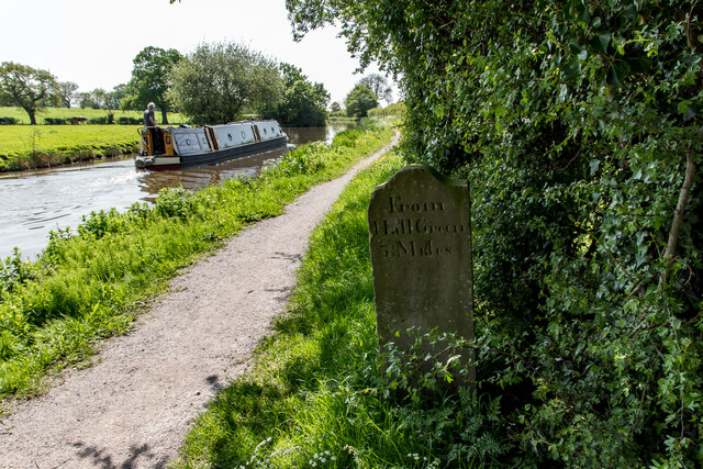
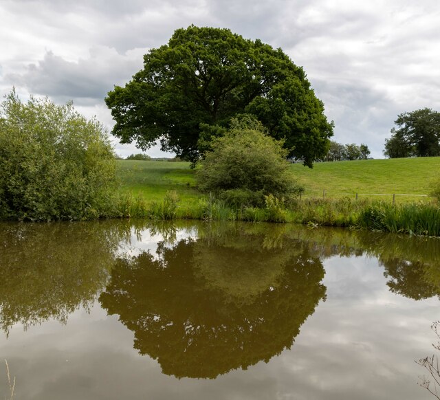
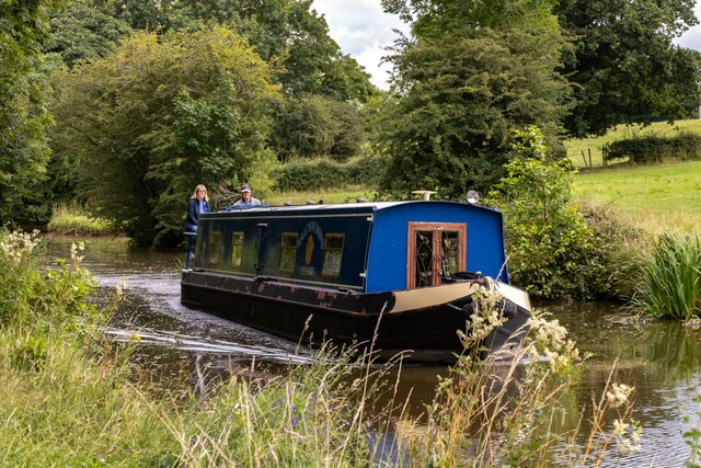
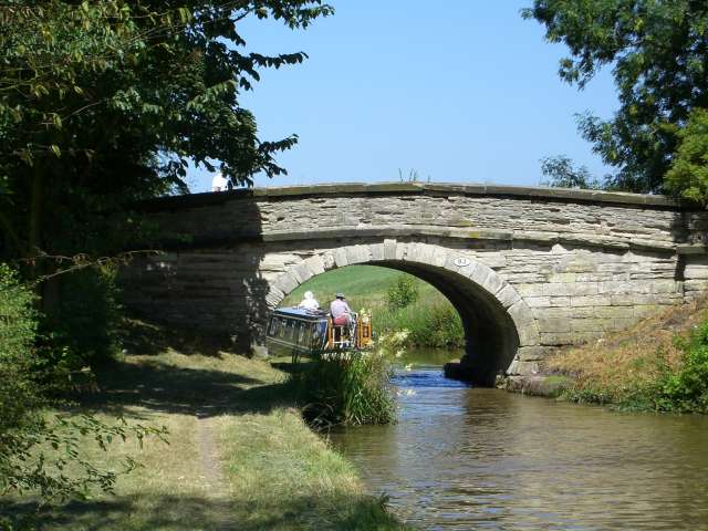
Ackers Crossing is known for its charming rural character, with rolling green fields, meandering streams, and traditional stone cottages dotting the landscape. The village is surrounded by natural beauty, offering residents and visitors ample opportunities for outdoor activities such as hiking, cycling, and fishing.

Despite its tranquil ambiance, Ackers Crossing benefits from good transport links. The nearby A51 road connects the village to major towns and cities in the area, making it easily accessible for commuters. Additionally, the village is served by regular bus services, providing convenient connections to nearby urban centers.

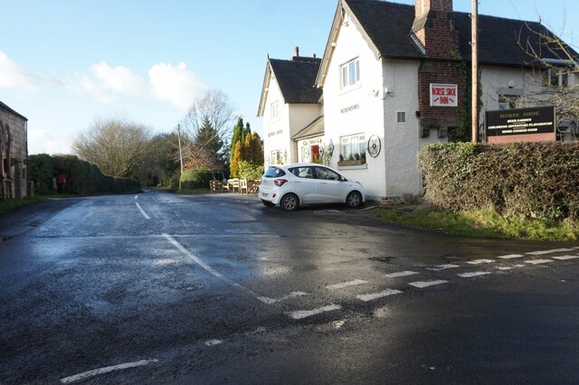
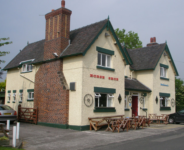
While Ackers Crossing is primarily residential, it does have a few amenities to cater to the needs of its inhabitants. These include a local pub, offering a warm and friendly atmosphere for socializing, and a village hall, which serves as a venue for community events and gatherings.

The village also boasts a rich history, with several historic landmarks in the vicinity. This includes a 14th-century church, St. Peter's, which stands as a testament to the village's cultural heritage.

Overall, Ackers Crossing offers a tranquil and picturesque setting for those seeking a peaceful rural lifestyle, while still benefitting from convenient transport links and a strong sense of community.

If you have any feedback on the listing, please let us know in the comments section below.

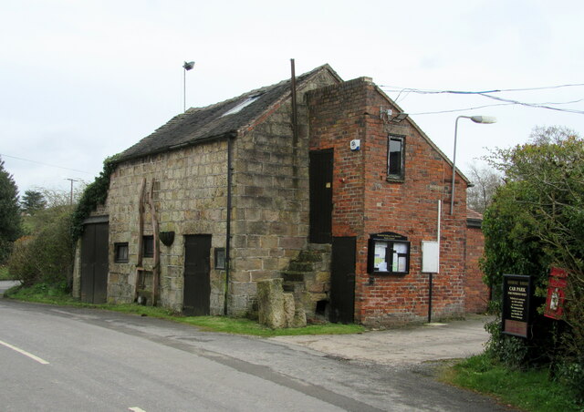
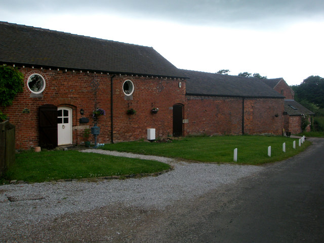
Ackers Crossing Images

Images are sourced within 2km of 53.127422/-2.2296554 or Grid Reference SJ8458. Thanks to Geograph Open Source API. All images are credited.

Fence Lane from Mow Lane
Macclesfield Canal Mile Stone (23 miles from Marple) According to the canal society's website, these stones resembling grave markers are unique to the Macclesfield and Cromford canals. The Macclesfield's milestones had mostly been buried during the second world war as a precaution against enemy soldiers using them to find their way. All but three stones were dug up and re-erected by volunteers in the 1980s. This one, showing :-

From Marple 23 Miles (Other side)

From Hall Green 3¼ Mile (This side)
Macclesfield Canal Mile Stone (23 miles from Marple)
According to the canal society's website, these stones resembling grave markers are unique to the Macclesfield and Cromford canals. The Macclesfield's milestones had mostly been buried during the second world war as a precaution against enemy soldiers using them to find their way. All but three stones were dug up and re-erected by volunteers in the 1980s. This one, showing :- From Marple 23 Miles (Other side) From Hall Green 3¼ Mile (This side)
Mile Marker, Macclesfield Canal Milestone on the bank of the towpath. In the parish of Newbold Astbury, NE of Watery Lane.

Inscription: ¼ // o

Milestone Society National ID: MAC-23¼
Mile Marker, Macclesfield Canal
Milestone on the bank of the towpath. In the parish of Newbold Astbury, NE of Watery Lane. Inscription: ¼ // o Milestone Society National ID: MAC-23¼
Macclesfield Canal Tree alongside the Macclesfield Canal.
Macclesfield Canal
Tree alongside the Macclesfield Canal.
Halcyon Dawn Halcyon Dawn on the Macclesfield Canal.
Halcyon Dawn
Halcyon Dawn on the Macclesfield Canal.
Mill House Farm Mill House Farm seen from the Macclesfield.
Mill House Farm
Mill House Farm seen from the Macclesfield.
Macclesfield Canal & towpath N of Watery Ln Aqueduct
Old milemarker by the Macclesfield Canal, Newbold Astbury parish Milemarker by the Macclesfield Canal, in parish of Newbold Astbury (Congleton District).

Inscription reads:-
From Marple
23 Miles

Surveyed

Milestone Society National ID: MAC-23
Old milemarker by the Macclesfield Canal, Newbold Astbury parish
Milemarker by the Macclesfield Canal, in parish of Newbold Astbury (Congleton District). Inscription reads:- From Marple 23 Miles Surveyed Milestone Society National ID: MAC-23
Moss Motors - Second Hand Car Dealers
Footbridge over stream
Aqueduct Carrying the Macclesfield Canal over a minor road.
Aqueduct
Carrying the Macclesfield Canal over a minor road.
Barn with parish council notice board Opposite the Horse Shoe Inn.
Barn with parish council notice board
Opposite the Horse Shoe Inn.
Mill House Farm - with cows Taken from the bank of Macclesfield Canal looking across to the farm
Mill House Farm - with cows
Taken from the bank of Macclesfield Canal looking across to the farm
Gorse Farm, Gorse Lane Gorse Farm was built in 1880 according to a plaque by the door.
Gorse Farm, Gorse Lane
Gorse Farm was built in 1880 according to a plaque by the door.
Moreton Fisheries, Main Lake
South Lake Moreton Fisheries run private fishing on 3 lakes, 2 to the north of New Road and this one to the south of the road.
South Lake
Moreton Fisheries run private fishing on 3 lakes, 2 to the north of New Road and this one to the south of the road.
Horse Shoe Inn A pleasant isolated country pub with beer garden and play area in Newbold Astbury. It dates from 1774.
Horse Shoe Inn
A pleasant isolated country pub with beer garden and play area in Newbold Astbury. It dates from 1774.
Brook Farm on Watery Lane in Astbury.
Brook Farm
on Watery Lane in Astbury.
Show me another place!

Ackers Crossing is located at Grid Ref: SJ8458 (Lat: 53.127422, Lng: -2.2296554)

Unitary Authority: Cheshire East

Police Authority: Cheshire

What 3 Words

///claim.comet.bonus. Near Biddulph, Staffordshire

Nearby Locations

Ackers Crossing

Related Wikis

Moreton cum Alcumlow

Moreton cum Alcumlow is a small civil parish in the unitary authority of Cheshire East and the ceremonial county of Cheshire, England. In the census of...
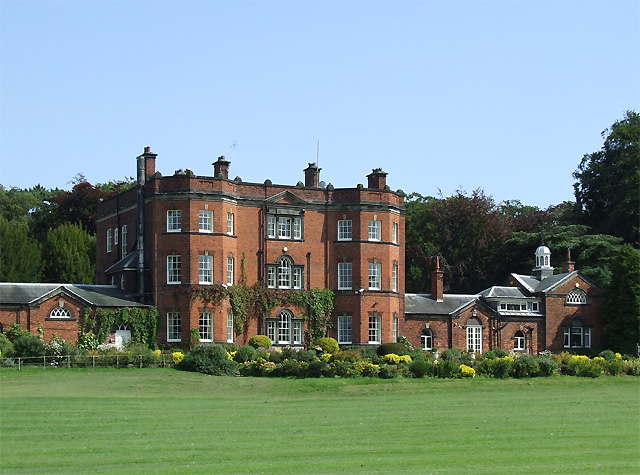
Great Moreton Hall

Great Moreton Hall is a former country house in Moreton cum Alcumlow near Congleton, in Cheshire, England, less than a mile (1.6 km) from its better-known...

Ramsdell Hall

Ramsdell Hall is a country house in the parish of Odd Rode in Cheshire, England, overlooking the Macclesfield Canal. It was built in two phases during...

Mow Cop and Scholar Green railway station

Mow Cop and Scholar Green railway station was a station on the North Staffordshire Railway between Stoke-on-Trent and Congleton. It served the village...

Limekiln Wood Nature Reserve

Limekiln Wood Nature Reserve is a 13.1-hectare (32-acre) nature reserve in Cheshire, England, north of the village of Mow Cop. A Site of Special Scientific...
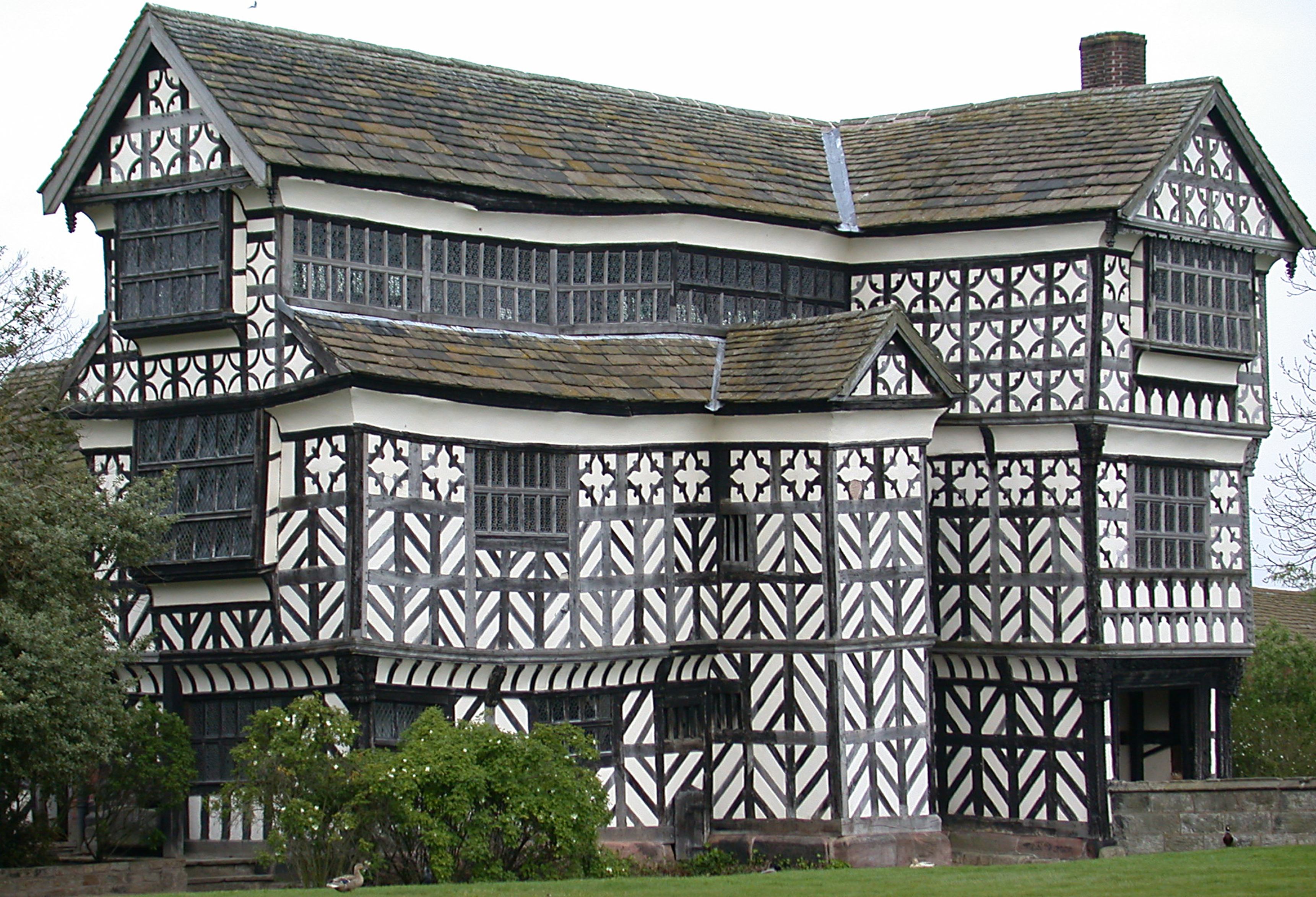
Little Moreton Hall

Little Moreton Hall, also known as Old Moreton Hall, is a moated half-timbered manor house 4.5 miles (7.2 km) south-west of Congleton in Cheshire, England...

Mow Cop

Mow Cop is a village split between Cheshire and Staffordshire, and therefore divided between the North West and West Midlands regions of England. It is...

Mow Cop Castle

Mow Cop Castle is a folly at Mow Cop in the civil parish of Odd Rode, Cheshire, England. It is designated as a Grade II listed building on the National...

Nearby Amenities

Located within 500m of 53.127422,-2.2296554
Post Box
Collection Times: Mo-Fr 09:00, Sa 07:00
Post Box Type: lamp
Ref: CW12 57
Royal Cypher: EIIR
Royal Cypher Wikidata: Q33102113
Lat/Long: 53.1273905/-2.2298372
Booth: K6
Covered: booth
Defibrillator Location: in red telephone box, New Road, Ackers Crossing
Description: defibrillator missing, telephone booth still standing
Disused Amenity: telephone
Disused Emergency: defibrillator
Indoor: no
Man Made: telephone_box
Lat/Long: 53.127415/-2.2298873
Bus Stop
Ackers Crossing, New Road / Yew Tree Lane
Bench: no
Bin: no
Bus: yes
Lit: no
Naptan AtcoCode: 0600CO5044
Naptan Bearing: NW
Naptan CommonName: Yew Tree Lane
Naptan Crossing: Yew Tree Lane
Naptan Indicator: adj
Naptan Landmark: Yew Tree Lane
Naptan LocalityName: Ackers Crossing
Naptan NaptanCode: chepjwa
Naptan ShortCommonName: Yew Tree Lane
Naptan Street: New Road
Naptan Verified: no
Network: Cheshire East Council
Operator: Ansa Transport
Public Transport: platform
Shelter: no
Source: naptan_import
Lat/Long: 53.1274524/-2.2299301
Bus Stop
Ackers Crossing, New Road / Yew Tree Lane
Bus: yes
Naptan AtcoCode: 0600CO5045
Naptan Bearing: SE
Naptan BusStopType: CUS
Naptan CommonName: Yew Tree Lane
Naptan Crossing: Yew Tree Lane
Naptan Indicator: nr
Naptan Landmark: Yew Tree Lane
Naptan LocalityName: Ackers Crossing
Naptan NaptanCode: chepjwd
Naptan ShortCommonName: Yew Tree Lane
Naptan Street: New Road
Naptan Verified: no
Network: Cheshire East Council
Operator: Ansa Transport
Public Transport: platform
Source: naptan_import
Lat/Long: 53.1274781/-2.2296897
Ackers Crossing
Historic Railway: level_crossing
Lat/Long: 53.1272527/-2.2270631
Ackers Crossing
Historic Railway: level_crossing
Lat/Long: 53.1272553/-2.2271374
Description: Hall Green 2.5, Marple 21 miles
Ele: 127
Historic: milestone
Lat/Long: 53.1296049/-2.2294201
Parking
Access: yes
Fee: no
Parking: layby
Surface: gravel
Lat/Long: 53.1286173/-2.2303961
Ackers Crossing
Place: hamlet
Lat/Long: 53.1276191/-2.2291226
Turning Circle
Lat/Long: 53.1270407/-2.2298443
The data included in this document is from www.openstreetmap.org. The data is made available under ODbL.

Have you been to Ackers Crossing?

Leave your review of Ackers Crossing below (or comments, questions and feedback).