Achnandarach

Settlement in Ross-shire

Scotland

Achnandarach

Main street, Duirinish
Main street, Duirinish Credit: Alan Reid

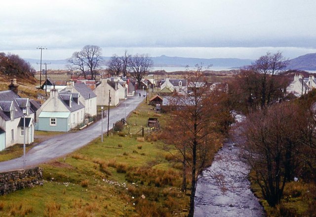
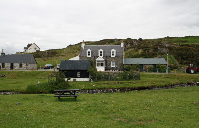
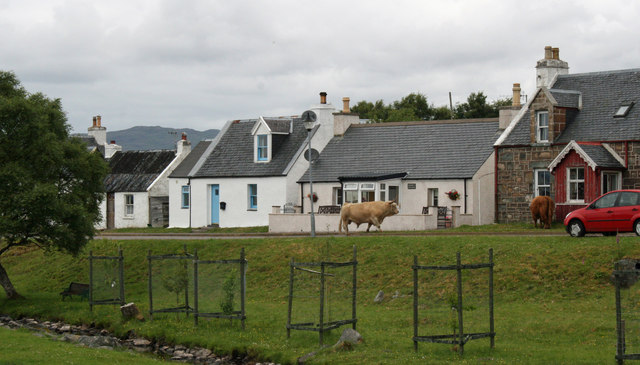
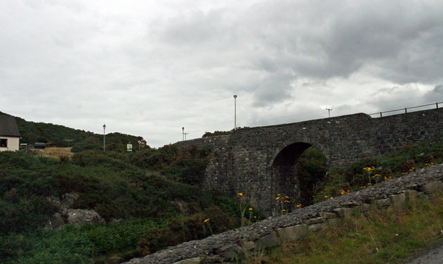
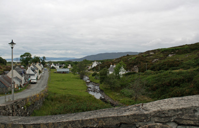
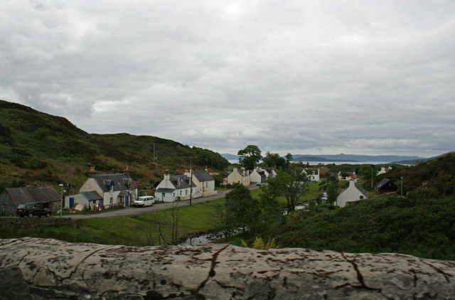
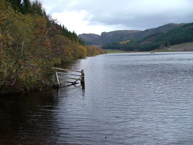
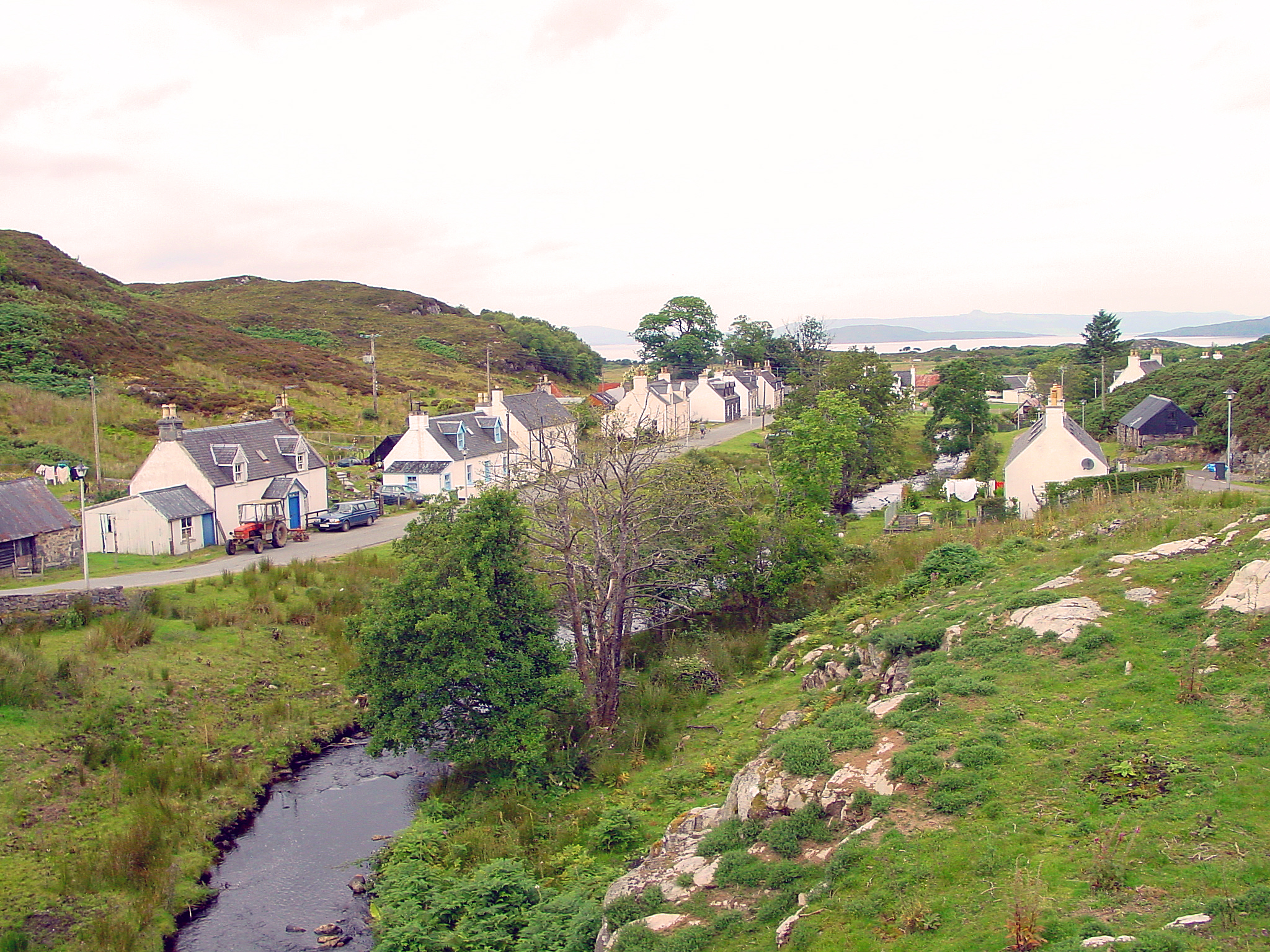
Achnandarach is a picturesque village located in Ross-shire, Scotland. It is situated on the western shore of Loch Carron, offering stunning views of the surrounding landscape. The village is nestled amidst rolling hills and lush greenery, making it an idyllic spot for nature enthusiasts.

The name Achnandarach has Gaelic origins, meaning "field of the oaks." This is reflected in the abundance of oak trees that dot the area, adding to its natural charm. The village boasts a tranquil atmosphere, providing a perfect escape from the hustle and bustle of city life.

Achnandarach is home to a small but welcoming community. The residents are known for their warm hospitality and strong sense of community spirit. The village has a close-knit feel, with regular social events and gatherings that bring the locals together.

One of the main attractions in Achnandarach is the nearby Eilean Donan Castle. This iconic medieval castle sits on a small island at the confluence of three lochs and is just a short distance from the village. It is a popular tourist destination, drawing visitors from all over the world to admire its stunning architecture and rich history.

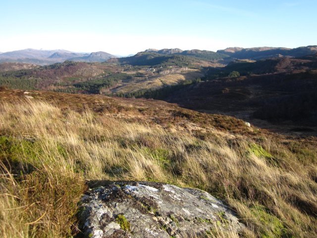
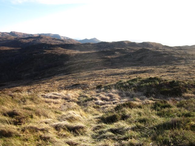
Outdoor enthusiasts will find plenty to do in Achnandarach. The area offers a range of activities, including hiking, fishing, and boating on Loch Carron. The surrounding hills also provide ample opportunities for adventurous walks and hikes, with breathtaking views at every turn.

In conclusion, Achnandarach is a charming village in Ross-shire, Scotland, known for its natural beauty, friendly community, and proximity to the famous Eilean Donan Castle. It is a haven for those seeking tranquility and a love for the great outdoors.

If you have any feedback on the listing, please let us know in the comments section below.
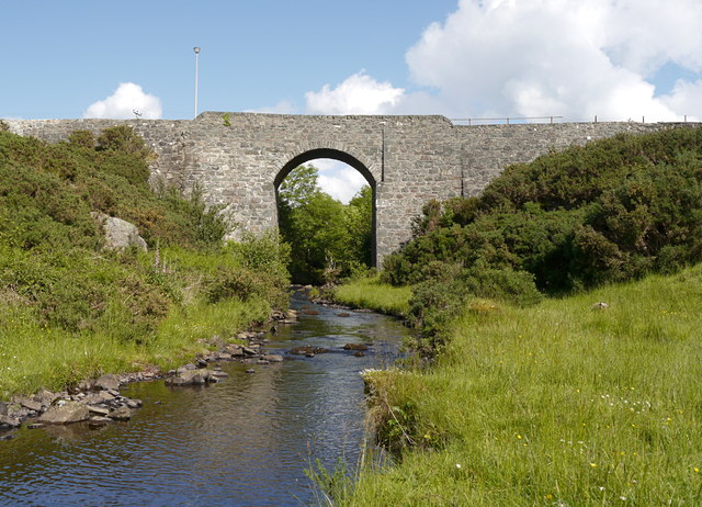
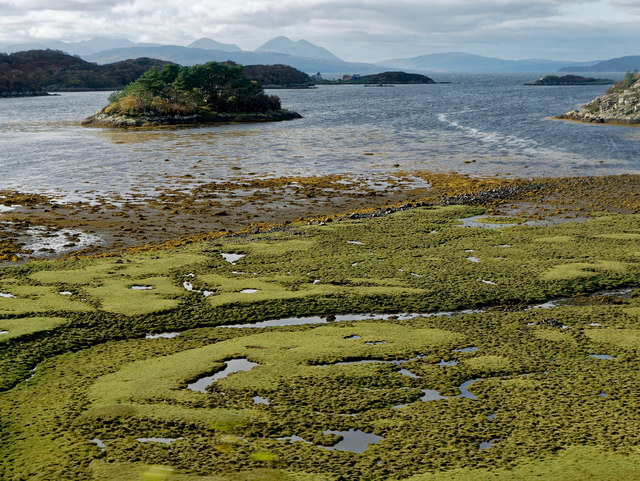
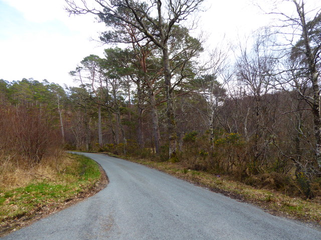
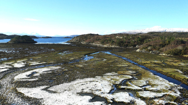
Achnandarach Images

Images are sourced within 2km of 57.317572/-5.6467575 or Grid Reference NG8031. Thanks to Geograph Open Source API. All images are credited.

Main street, Duirinish
Duirinish cottage Category C Listed mid 19th century cottage and attached byre it is listed as Mrs Gunn's House.
Duirinish cottage
Category C Listed mid 19th century cottage and attached byre it is listed as Mrs Gunn's House.
Duirinish over the stream Here are a row of Category C Listed cottages. Right to left the first two are mid 19th century and listed as Colonel and Mrs Walker's House (3/4 in view) and Mrs Nicolson's House. The next two are mid to late 19th century and listed as Dun Caan (Mrs Frost) and Sir Torquil and Lady Matheson.
Duirinish over the stream
Here are a row of Category C Listed cottages. Right to left the first two are mid 19th century and listed as Colonel and Mrs Walker's House (3/4 in view) and Mrs Nicolson's House. The next two are mid to late 19th century and listed as Dun Caan (Mrs Frost) and Sir Torquil and Lady Matheson.
Bridge over Allt Duirinish on the road to Plockton Category C Listed bridge of 1826 by Thomas Telford.
Bridge over Allt Duirinish on the road to Plockton
Category C Listed bridge of 1826 by Thomas Telford.
Duirinish from the bridge on the road to Plockton Duirinish is Norse for headland of the deer and owned by the National Trust for Scotland since 1947 when it was bequeathed by Sir Daniel and Lady Margaret Hamilton. Most of the houses (and many barns) are Category C listed and started life as simple thatched cottages. It is notable for the survival of its traditional barns, at least one to almost every house, with a group of about 15 (known as 'the sheds') arranged about a village green mostly with corrugated iron replacing their original thatch. The Mathesons of Duncraig improved the cottages in the late 19th century.
Duirinish from the bridge on the road to Plockton
Duirinish is Norse for headland of the deer and owned by the National Trust for Scotland since 1947 when it was bequeathed by Sir Daniel and Lady Margaret Hamilton. Most of the houses (and many barns) are Category C listed and started life as simple thatched cottages. It is notable for the survival of its traditional barns, at least one to almost every house, with a group of about 15 (known as 'the sheds') arranged about a village green mostly with corrugated iron replacing their original thatch. The Mathesons of Duncraig improved the cottages in the late 19th century.
Grid square NG 78 30 Taken at the trig pillar.
Plockton air strip & high school (white building) just visible below middle of near shore line.
Grid square NG 78 30
Taken at the trig pillar. Plockton air strip & high school (white building) just visible below middle of near shore line.
Grid square NG 78 30 Taken at trig pillar.
Hamlet of Achnandarach below centre of horizon.
Grid square NG 78 30
Taken at trig pillar. Hamlet of Achnandarach below centre of horizon.
Grid square NG 78 30 Taken at the trig pillar.
Shows typical vegetation for the area.
Grid square NG 78 30
Taken at the trig pillar. Shows typical vegetation for the area.
Duirinish Bridge A tall stone arch bridge, carrying a minor road over the Allt Dhuirinis. It was designed by Thomas Telford, and built in 1826.
It is a Category C listed building. <span class="nowrap"><a title="http://portal.historicenvironment.scot/designation/LB7003" rel="nofollow ugc noopener" href="http://portal.historicenvironment.scot/designation/LB7003">Link</a><img style="margin-left:2px;" alt="External link" title="External link - shift click to open in new window" src="https://s1.geograph.org.uk/img/external.png" width="10" height="10"/></span>
Duirinish Bridge
A tall stone arch bridge, carrying a minor road over the Allt Dhuirinis. It was designed by Thomas Telford, and built in 1826. It is a Category C listed building. LinkExternal link
Bàgh an t-Srathaidh As seen from a window seat on the train from Kyle to Inverness.
Bàgh an t-Srathaidh
As seen from a window seat on the train from Kyle to Inverness.
Minor road near Plockton
Bàgh an t-Strathaidh at low tide Snow and frost have exposed the area not covered by the sea recently.  A summer comparison is <a href="https://www.geograph.org.uk/photo/5582138">NG7932 : Bàgh an t-Srathaidh</a> and a less snowy winter's day six years earlier <a href="https://www.geograph.org.uk/photo/3309166">NG7932 : Saltflats of Bagh an t-Strathaidh</a>. Seen from the vantage point of a train slowly heading for Plockton.
Bàgh an t-Strathaidh at low tide
Snow and frost have exposed the area not covered by the sea recently. A summer comparison is NG7932 : Bàgh an t-Srathaidh and a less snowy winter's day six years earlier NG7932 : Saltflats of Bagh an t-Strathaidh. Seen from the vantage point of a train slowly heading for Plockton.
Minor road beside Strathellen Wood Looking southward.
Minor road beside Strathellen Wood
Looking southward.
Junction of minor road near to Duirinish Looking north-westward.
Junction of minor road near to Duirinish
Looking north-westward.
Minor road between Balmacara and Duirinish Looking north-westward.
Minor road between Balmacara and Duirinish
Looking north-westward.
Minor road near to Duirinish Lodge Looking westward.
Minor road near to Duirinish Lodge
Looking westward.
The road between Plockton and Kyle Crossing Urchd an Uird near Diùrinis.
The road between Plockton and Kyle
Crossing Urchd an Uird near Diùrinis.
Show me another place!

Achnandarach is located at Grid Ref: NG8031 (Lat: 57.317572, Lng: -5.6467575)

Unitary Authority: Highland

Police Authority: Highlands and Islands

What 3 Words

///crest.readings.grunt. Near Kyleakin, Highland

Nearby Locations

Achnandarach Loch Lundie

Related Wikis

Loch Achaidh na h-Inich

Loch Achaidh na h-Inich is a freshwater loch in Scotland, located around 3 kilometres (1.9 mi) south-south-east of Plockton, 2 kilometres (1.2 mi) east...

Duirinish, Lochalsh

Duirinish (Scottish Gaelic: Diùirinis) is a hamlet in Lochalsh near Plockton in Ross-shire, Scottish Highlands and is in the Scottish council area of Highland...

Plockton railway station

Plockton railway station is a railway station on the Kyle of Lochalsh Line, serving the village of Plockton in the Highlands, north-west Scotland. The...

Duncraig railway station

Duncraig railway station is a remote railway station by the shore of Loch Carron on the Kyle of Lochalsh Line, originally (privately) serving Duncraig...

Nearby Amenities

Located within 500m of 57.317572,-5.6467575
Bus Stop
Source: survey
Lat/Long: 57.3207167/-5.6509517
Post Box
Ref: IV40 25
Source: survey
Source Ref: dracos
Lat/Long: 57.3207566/-5.6508956
Barrier: cattle_grid
Source: survey
Lat/Long: 57.3168521/-5.6410609
Bus Stop
Achnandarach
Naptan AtcoCode: 6700712324
Naptan Bearing: N
Naptan CommonName: Achnandarach
Naptan Indicator: Village Road End
Naptan Landmark: Road End
Naptan NaptanCode: 45327656
Naptan Street: Plockton Road
Naptan Verified: no
Source: naptan_import
Lat/Long: 57.3191627/-5.6506742
Power: pole
Lat/Long: 57.3215318/-5.6484755
Power: pole
Lat/Long: 57.3206596/-5.6487682
Power: pole
Lat/Long: 57.3197977/-5.6490596
Power: pole
Lat/Long: 57.3197436/-5.65064
Power: pole
Lat/Long: 57.3196815/-5.652432
Power: pole
Lat/Long: 57.3196319/-5.6540572
Power: pole
Lat/Long: 57.3176472/-5.6386848
Power: pole
Lat/Long: 57.3174564/-5.6404553
Power: pole
Lat/Long: 57.3173215/-5.6417588
Power: pole
Lat/Long: 57.3171922/-5.6429892
Power: pole
Lat/Long: 57.3170167/-5.644644
Power: pole
Lat/Long: 57.3178237/-5.6450825
Power: pole
Lat/Long: 57.3190927/-5.6493646
The data included in this document is from www.openstreetmap.org. The data is made available under ODbL.

Have you been to Achnandarach?

Leave your review of Achnandarach below (or comments, questions and feedback).