Achinduich

Settlement in Sutherland

Scotland

Achinduich

New road, Achinduich Serving some construction, almost certainly energy related.
New road, Achinduich Credit: Richard Webb

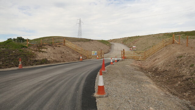
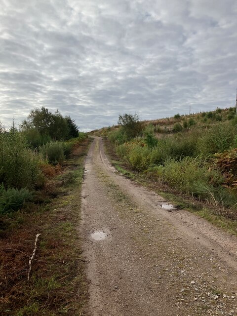
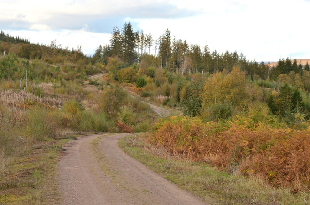
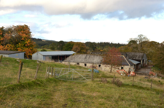
Achinduich is a small hamlet located in the county of Sutherland, in the Highlands region of Scotland. Situated near the eastern shore of the famous Loch Shin, Achinduich offers breathtaking views of the surrounding countryside.

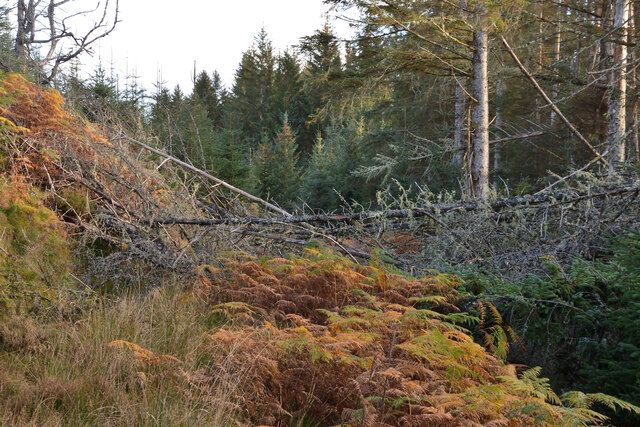
The hamlet is characterized by its tranquil and idyllic setting, with rolling hills, lush green meadows, and a scattering of charming cottages that dot the landscape. It is a perfect destination for those seeking a peaceful and remote retreat away from the hustle and bustle of city life.

Achinduich is also renowned for its rich historical heritage. The area is home to several ancient archaeological sites, including standing stones and burial mounds, which provide evidence of human settlement dating back thousands of years. These sites offer a glimpse into the region's fascinating past and attract history enthusiasts from all over the world.

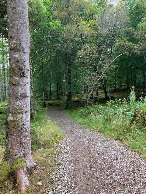
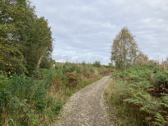
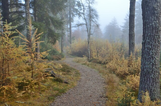
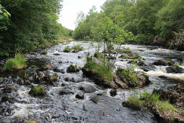
Nature lovers will find themselves in paradise in Achinduich, as the area is teeming with wildlife. The nearby Loch Shin is a popular spot for fishing, with an abundance of trout and salmon. Additionally, the surrounding hills and forests provide excellent opportunities for hiking and birdwatching.

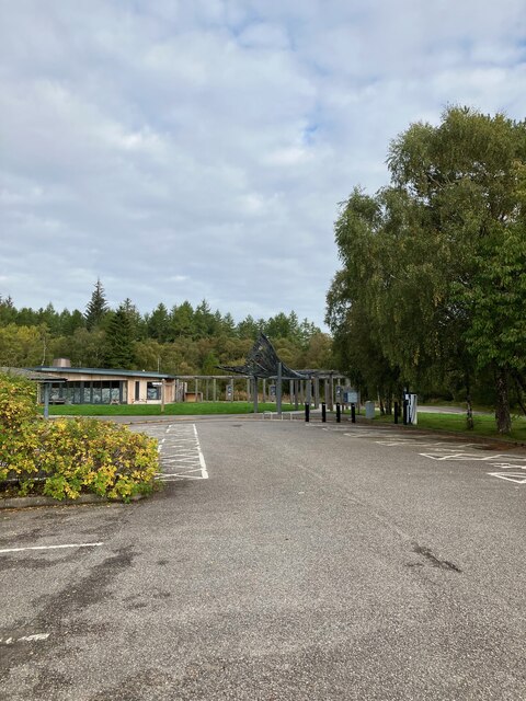
Although Achinduich is a small hamlet, it is within driving distance of larger towns and amenities. The nearest town, Lairg, is approximately 10 miles away and offers a range of services, such as shops, restaurants, and accommodations.

Overall, Achinduich is a picturesque and peaceful destination that offers a unique blend of natural beauty, historical significance, and rural charm.

If you have any feedback on the listing, please let us know in the comments section below.

Achinduich Images

Images are sourced within 2km of 57.965893/-4.4009686 or Grid Reference NH5899. Thanks to Geograph Open Source API. All images are credited.

New road, Achinduich Serving some construction, almost certainly energy related.
New road, Achinduich
Serving some construction, almost certainly energy related.
Closed visitor centre at Invershin Falls
Woods at Invershin Falls
Track in Shin Forest
Track in Shin Forest, Sutherland
Falls of Shin, Sutherland Looking up the river from the waterfalls
Falls of Shin, Sutherland
Looking up the river from the waterfalls
Falls of Shin, Sutherland Salmon leaping pool taken from the viewing platform
Falls of Shin, Sutherland
Salmon leaping pool taken from the viewing platform
The B864 road down Achany Glen
Falls of Shin From the viewing point at the Falls of Shin visitor centre looking upstream where the leaping salmon are heading.
Falls of Shin
From the viewing point at the Falls of Shin visitor centre looking upstream where the leaping salmon are heading.
Forest Walk in Shin Forest, Sutherland  One of the footpaths in the forest near Shin Falls visitor centre.
Forest Walk in Shin Forest, Sutherland
One of the footpaths in the forest near Shin Falls visitor centre.
River Shin in Achany Glen, Sutherland Part of the River Shin, as seen from the road in Achany Glen, Scottish Highlands.
River Shin in Achany Glen, Sutherland
Part of the River Shin, as seen from the road in Achany Glen, Scottish Highlands.
Achany Farm, near Lairg, Sutherland
Very overgrown and blocked track in Achany Wood, Sutherland A track is shown on the OS mapping here.  However, fallen trees, boggy ground and overgrown vegetation make it not easy to pass.
Very overgrown and blocked track in Achany Wood, Sutherland
A track is shown on the OS mapping here. However, fallen trees, boggy ground and overgrown vegetation make it not easy to pass.
Rapids on River Shin
A road into Shin Forest
A view from a bridge Geocaching is a type of global treasure hunt of people looking for caches, or hidden stashes of objects. Geocaching may also be described as a series of hide-and-seek games, where hiders provide online clues for seekers. Seekers use global positioning system (GPS) devices to find hidden caches
A view from a bridge
Geocaching is a type of global treasure hunt of people looking for caches, or hidden stashes of objects. Geocaching may also be described as a series of hide-and-seek games, where hiders provide online clues for seekers. Seekers use global positioning system (GPS) devices to find hidden caches
Violets at Shin Falls A clump of violets right beside a footpath in woods
Violets at Shin Falls
A clump of violets right beside a footpath in woods
Show me another place!

Achinduich is located at Grid Ref: NH5899 (Lat: 57.965893, Lng: -4.4009686)

Unitary Authority: Highland

Police Authority: Highlands and Islands

What 3 Words

///technical.gets.nozzle. Near Lairg, Highland

Nearby Locations

Achinduich

Related Wikis

Achinduich

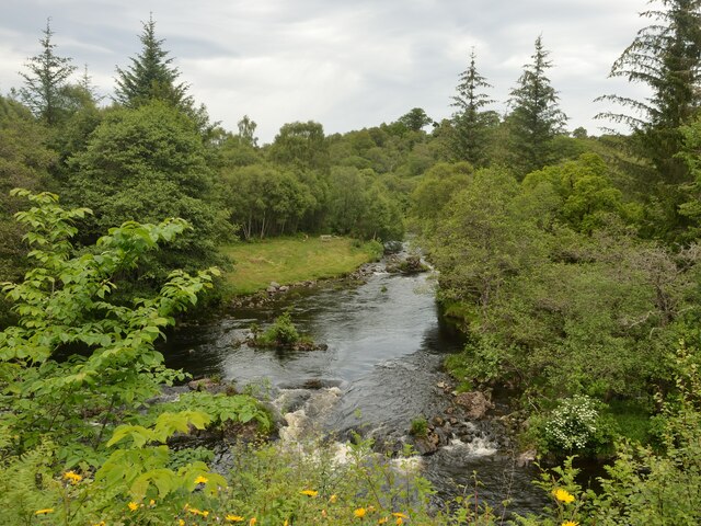
Achinduich (Gaelic: Achadh an Dabhaich) is a hamlet on the east bank of the River Shin in the Scottish Highlands about 4 miles south of Lairg, Sutherland...
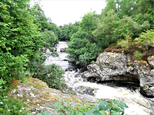
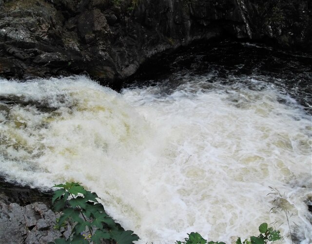
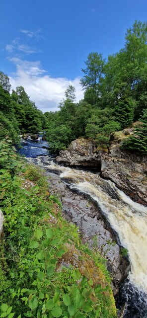
Falls of Shin

Falls of Shin is a waterfall on the River Shin, in northern Scotland, near the villages of Bonar Bridge and Lairg. Falls of Shin had a popular visitor...

Achany

Achany is a hamlet in Sutherland in the Scottish council area of Highland, Scotland. It lies off the B864 road on the west bank of the River Shin south...

Inveran

Inveran (Scottish Gaelic: Inbhirean) is a small village in the Parish of Creich located in the Sutherland region of the Highland Council area of Scotland...

River Shin

The River Shin (Scottish Gaelic: Abhainn Sin, pronounced [ˈa.ɪɲ ˈʃin]) is a river in the Scottish North West Highlands. The river flows from the southern...

Rhelonie

Rhelonie (Scottish Gaelic: Ruigh an Lòin) is a crofting hamlet in the Highland region of Scotland. Rhelonie is 2 miles northwest of the village of Culrain...

Invershin Castle

Invershin Castle was a motte castle, located near Invershin, Highland in Scotland. == History == The castle was constructed possibly in the 12th century...

Linsidemore

Linsidemore (Scottish Gaelic: Lianasaid Mhòr) is a tiny township on the north bank of the Kyle of Sutherland in the Scottish Highlands. It is about 3 miles...

Nearby Amenities

Located within 500m of 57.965893,-4.4009686
Bus Stop
Achinduich
Bus: yes
Departures Board: no
Naptan AtcoCode: 6700712314
Naptan Bearing: S
Naptan CommonName: Achinduich
Naptan Indicator: Southbound
Naptan Landmark: Houses
Naptan NaptanCode: 45324792
Naptan Street: A836
Naptan Verified: no
Public Transport: platform
Shelter: no
Source: naptan_import
Lat/Long: 57.9656741/-4.4008139
Bus Stop
Achinduich
Bus: yes
Departures Board: no
Naptan AtcoCode: 6700712314A
Naptan Bearing: N
Naptan CommonName: Achinduich
Naptan Indicator: Northbound
Naptan Landmark: Houses
Naptan NaptanCode: 45324789
Naptan Street: A836
Naptan Verified: no
Public Transport: platform
Shelter: no
Source: naptan_import
Lat/Long: 57.9657629/-4.4010222
Power: tower
Lat/Long: 57.9664022/-4.3982215
Power: tower
Lat/Long: 57.9635812/-4.3990293
Power: tower
Lat/Long: 57.9690333/-4.3974856
Power: pole
Lat/Long: 57.9694803/-4.4041416
Power: pole
Lat/Long: 57.9687676/-4.4045064
Power: pole
Lat/Long: 57.966453/-4.4014809
Power: pole
Lat/Long: 57.9663961/-4.4023633
Power: pole
Lat/Long: 57.9680492/-4.4041711
Power: pole
Lat/Long: 57.9671814/-4.4037822
Power: pole
Lat/Long: 57.9663363/-4.4033906
Power: pole
Lat/Long: 57.965531/-4.4028702
Power: pole
Lat/Long: 57.9650516/-4.4025457
Power: pole
Lat/Long: 57.9642406/-4.401969
Power: pole
Lat/Long: 57.9634979/-4.4015238
Power: pole
Lat/Long: 57.9619983/-4.4014969
Power: pole
Lat/Long: 57.9667397/-4.4086471
Power: pole
Lat/Long: 57.9666041/-4.4076691
Power: pole
Lat/Long: 57.9664803/-4.4065266
Power: pole
Lat/Long: 57.9663318/-4.4054024
Power: pole
Lat/Long: 57.9662683/-4.4048951
Power: pole
Lat/Long: 57.9661499/-4.4073972
Power: pole
Lat/Long: 57.9654793/-4.4070136
Power: pole
Lat/Long: 57.9647571/-4.4065936
Power: pole
Lat/Long: 57.9642555/-4.4063054
Power: pole
Lat/Long: 57.9637097/-4.4062953
Power: pole
Lat/Long: 57.9631726/-4.4070806
Achinduich
Name Gd: Achadh an Duthaich
Place: hamlet
Lat/Long: 57.9666844/-4.4010937
The data included in this document is from www.openstreetmap.org. The data is made available under ODbL.

Have you been to Achinduich?

Leave your review of Achinduich below (or comments, questions and feedback).