Achduchil
Settlement in Inverness-shire
Scotland
Achduchil

Achduchil is a small village located in the county of Inverness-shire, Scotland. It is situated approximately 10 miles west of Inverness, the county town, and is nestled within the picturesque Great Glen. The village is surrounded by breathtaking natural beauty, with the towering mountains of the Scottish Highlands providing a stunning backdrop.
Achduchil is a close-knit community with a population of around 200 residents. The village consists mainly of traditional stone-built houses, reflecting its rich history that dates back several centuries. The architecture is a mix of classic Scottish vernacular and more modern designs, blending seamlessly with the natural surroundings.
Despite its small size, Achduchil offers several amenities to its residents. The village has a community hall, which serves as a gathering place for social events and other activities. There is also a local primary school, providing education for the village's younger population.
The village is a haven for outdoor enthusiasts, with a plethora of recreational opportunities available. The nearby Loch Ness offers opportunities for boating, fishing, and water sports, while the surrounding mountains provide excellent hiking and mountain biking trails. The area is also popular for wildlife spotting, with red deer and golden eagles often seen in the vicinity.
Achduchil is a peaceful and idyllic village, providing a serene escape from the hustle and bustle of city life. Its stunning natural surroundings and strong sense of community make it an attractive place to live or visit for those seeking tranquility and a connection with nature.
If you have any feedback on the listing, please let us know in the comments section below.
Achduchil Images
Images are sourced within 2km of 57.001639/-4.317571 or Grid Reference NN5992. Thanks to Geograph Open Source API. All images are credited.


Achduchil is located at Grid Ref: NN5992 (Lat: 57.001639, Lng: -4.317571)
Unitary Authority: Highland
Police Authority: Highlands and Islands
What 3 Words
///guards.revamped.liver. Near Newtonmore, Highland
Nearby Locations
Related Wikis

Dùn dà Làmh
Dùn dà Làmh is a Pictish now ruined hill fort near Laggan in the Scottish Highlands. It became a scheduled monument in 1986, with an extension to the protected...

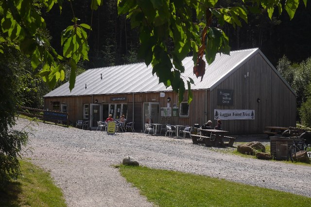
Laggan, Badenoch
Laggan (Gaelic: Lagan ) is a village in Badenoch, in the Highland region of Scotland. It is beside the River Spey, about 10 km west of Newtonmore. The...

Catlodge
Catlodge (Scottish Gaelic: Caitleag) is a hamlet, in the district of Newtonmore in Inverness-shire, Scottish Highlands and is in the Scottish council...

Falls of Pattack
Falls of Pattack is a waterfall in the Scottish Highlands' Cairngorm National Park. The falls are on the River Pattack, about 2 km south of the A86 road...

Kinloch Laggan
Kinloch Laggan (Scottish Gaelic: Ceann Loch Lagain) is a hamlet located at the head of Loch Laggan in Newtonmore, Inverness-shire, Scottish Highlands...

East Highland Way
The East Highland Way (Scottish Gaelic: Slighe Gaidhealtachd an Ear) is a long-distance walking route in Scotland that connects Fort William (56.8178°N...

The Fara
The Fara (911 m) is a mountain in the Grampian Mountains, Scotland, on the shore of Loch Ericht near the village of Dalwhinnie. A large and bulky mountain...
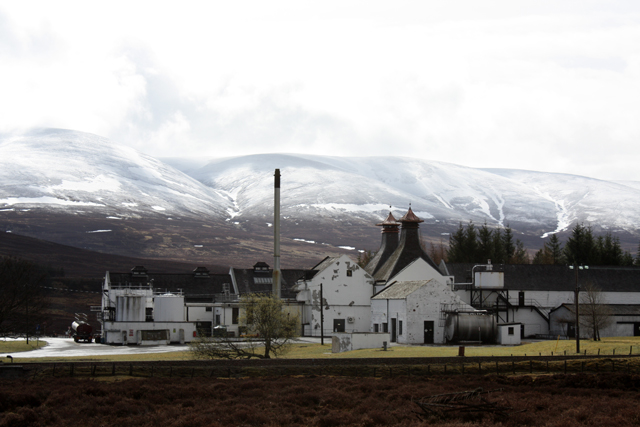
Dalwhinnie distillery
Dalwhinnie distillery, situated in the Highland village of Dalwhinnie in Scotland, produces single malt Scotch whisky. Whilst labelled as Highland, as...
Nearby Amenities
Located within 500m of 57.001639,-4.317571Have you been to Achduchil?
Leave your review of Achduchil below (or comments, questions and feedback).