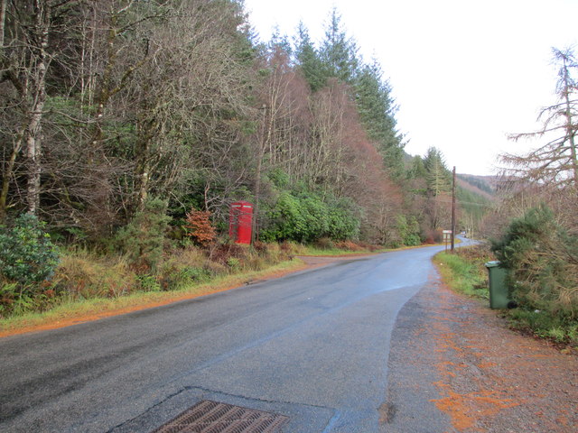
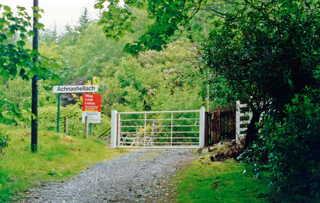
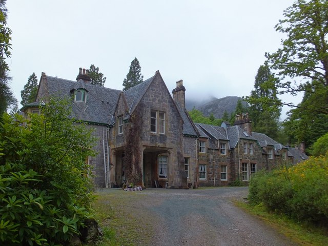
Achnashellach

Settlement in Ross-shire

Scotland

Achnashellach

A890 near Achnashellach Lodge The A890 is a non-primary cross-country route in sparsely populated, mountainous terrain from Lochalsh and Skye on the west coast of the Highlands to Achnasheen where it joins the A832 to Inverness. Like many Highland roads, the A890 was entirely single track until the 1960s, but road improvements in recent years (along with improvements on the A832) have made it increasingly popular as an alternative route between Inverness and the Isle of Skye, avoiding the A82 along Loch Ness. It is also an important route for residents of the Lochalsh, Applecross and Strathcarron areas, connecting them to the services of  Kyle of Lochalsh , as well as the High School in Plockton.
A890 near Achnashellach Lodge Credit: David Dixon

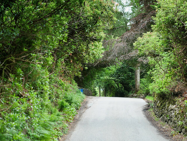
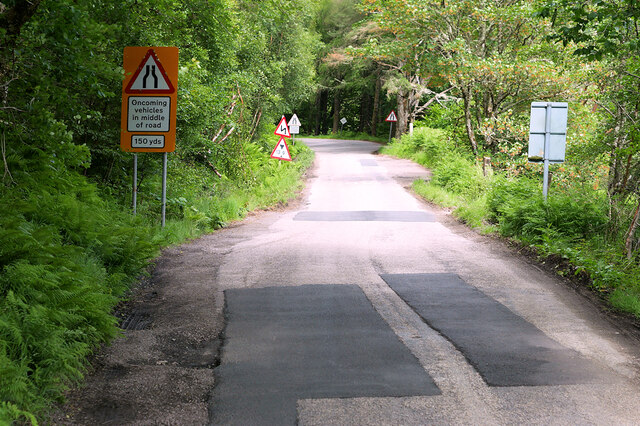
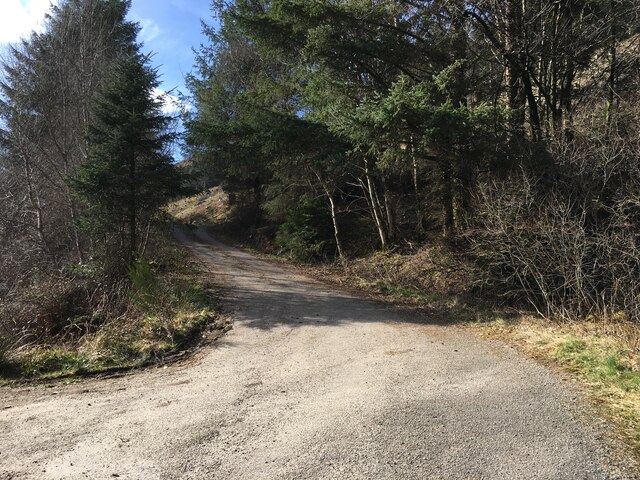
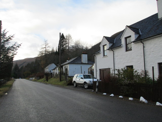
Achnashellach is a small village located in the county of Ross-shire, in the Highland region of Scotland. Situated approximately 10 miles southwest of the town of Achnasheen, it lies within the picturesque Glen Carron valley, surrounded by scenic hills and forests.

The village is primarily known for its stunning natural beauty, attracting outdoor enthusiasts and nature lovers from all over. The nearby Beinn Liath Mhòr mountain range provides excellent opportunities for hiking and climbing, offering breathtaking views of the surrounding landscapes. The area is also home to several rivers and lochs, making it a popular spot for fishing and boating activities.

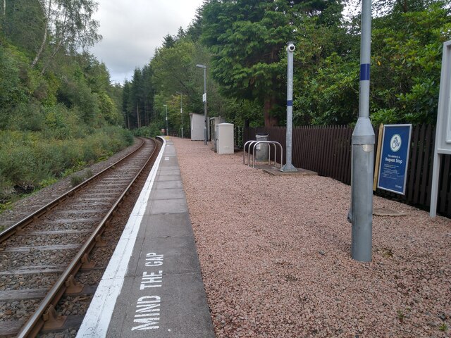
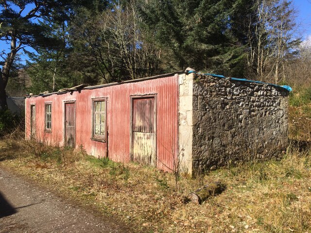
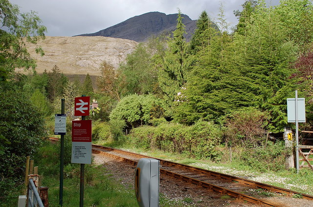
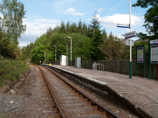
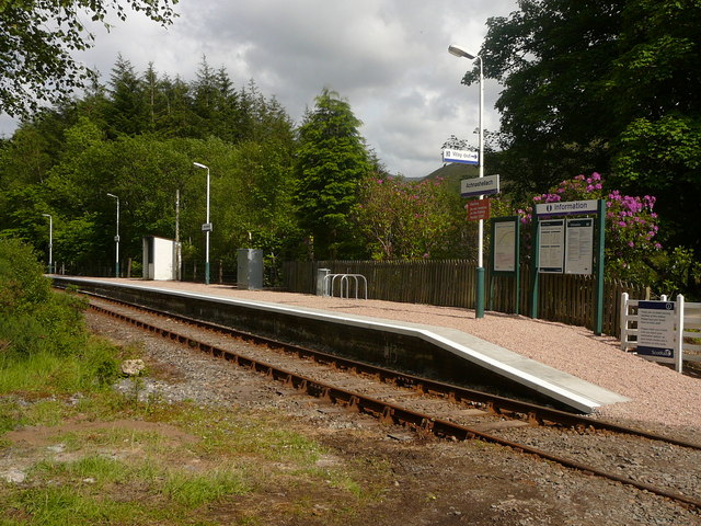
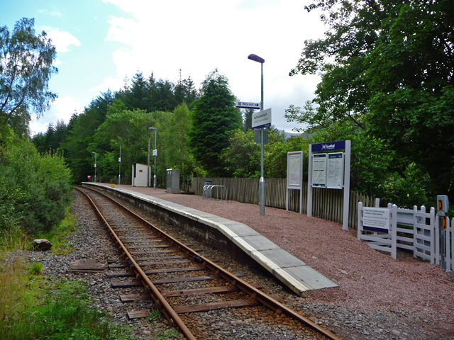
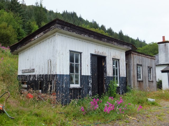
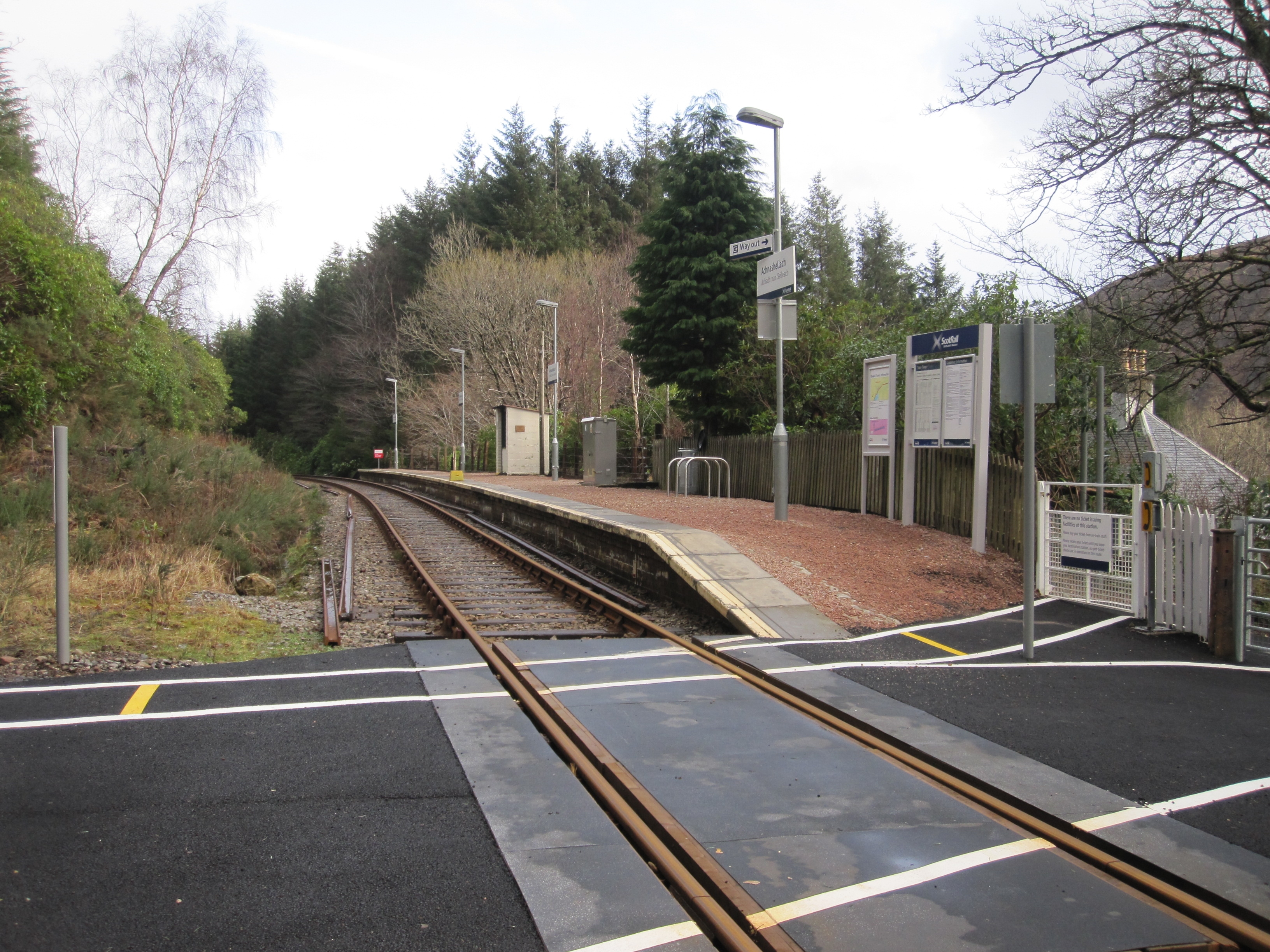
Despite its small size, Achnashellach has a rich history. The village was once an important stop on the historic Dingwall to Kyle of Lochalsh railway line, which operated from 1870 to 1969. Today, the old railway station building still stands as a reminder of this bygone era, and the disused rail tracks have been transformed into a scenic walking trail known as the Achnashellach Railway Walk.

In terms of amenities, Achnashellach is a quiet and peaceful village with limited facilities. However, the nearby town of Achnasheen offers a range of basic services, including shops, cafes, and accommodation options. For more extensive amenities, residents and visitors can easily access the larger towns of Inverness or Dingwall, both located less than an hour's drive away.

Overall, Achnashellach is a charming village known for its natural beauty, outdoor activities, and historical significance, making it a popular destination for those seeking tranquility and exploration in the heart of the Scottish Highlands.

If you have any feedback on the listing, please let us know in the comments section below.

Achnashellach Images

Images are sourced within 2km of 57.479735/-5.3340936 or Grid Reference NH0048. Thanks to Geograph Open Source API. All images are credited.

A890 near Achnashellach Lodge The A890 is a non-primary cross-country route in sparsely populated, mountainous terrain from Lochalsh and Skye on the west coast of the Highlands to Achnasheen where it joins the A832 to Inverness. Like many Highland roads, the A890 was entirely single track until the 1960s, but road improvements in recent years (along with improvements on the A832) have made it increasingly popular as an alternative route between Inverness and the Isle of Skye, avoiding the A82 along Loch Ness. It is also an important route for residents of the Lochalsh, Applecross and Strathcarron areas, connecting them to the services of  Kyle of Lochalsh , as well as the High School in Plockton.
A890 near Achnashellach Lodge
The A890 is a non-primary cross-country route in sparsely populated, mountainous terrain from Lochalsh and Skye on the west coast of the Highlands to Achnasheen where it joins the A832 to Inverness. Like many Highland roads, the A890 was entirely single track until the 1960s, but road improvements in recent years (along with improvements on the A832) have made it increasingly popular as an alternative route between Inverness and the Isle of Skye, avoiding the A82 along Loch Ness. It is also an important route for residents of the Lochalsh, Applecross and Strathcarron areas, connecting them to the services of Kyle of Lochalsh , as well as the High School in Plockton.
A890 near to Lair The A890 is a non-primary cross-country route in sparsely populated, mountainous terrain from Lochalsh and Skye on the west coast of the Highlands to Achnasheen where it joins the A832 to Inverness. Like many Highland roads, the A890 was entirely single track until the 1960s, but road improvements in recent years (along with improvements on the A832) have made it increasingly popular as an alternative route between Inverness and the Isle of Skye, avoiding the A82 along Loch Ness. It is also an important route for residents of the Lochalsh, Applecross and Strathcarron areas, connecting them to the services of  Kyle of Lochalsh , as well as the High School in Plockton.
A890 near to Lair
The A890 is a non-primary cross-country route in sparsely populated, mountainous terrain from Lochalsh and Skye on the west coast of the Highlands to Achnasheen where it joins the A832 to Inverness. Like many Highland roads, the A890 was entirely single track until the 1960s, but road improvements in recent years (along with improvements on the A832) have made it increasingly popular as an alternative route between Inverness and the Isle of Skye, avoiding the A82 along Loch Ness. It is also an important route for residents of the Lochalsh, Applecross and Strathcarron areas, connecting them to the services of Kyle of Lochalsh , as well as the High School in Plockton.
Looking along the platform from the crossing at Achnashellach train station
Forestry entrance near Achnashellach
Derelict outbuilding at Achnashellach
A station with a view, Achnashellach The summit of Fuar Tholl (907m) is only about 3 km from the station in a direct line, and the track to Coire Lair crosses the line here.
A station with a view, Achnashellach
The summit of Fuar Tholl (907m) is only about 3 km from the station in a direct line, and the track to Coire Lair crosses the line here.
A890 above Achnashellach Lodge Achnashellach is willowfield but here we see evidence of Rhododendron naturalisation alongside the road. These oriental shrubs were often planted on big estates to provide cover for game birds but the plants have become something of an invasive pest; albeit at pretty one. In Turkey, honey from hives where the bees have gathered nectar from Rhododendrons is called 'mad-honey' due to its narcotic properties.
A890 above Achnashellach Lodge
Achnashellach is willowfield but here we see evidence of Rhododendron naturalisation alongside the road. These oriental shrubs were often planted on big estates to provide cover for game birds but the plants have become something of an invasive pest; albeit at pretty one. In Turkey, honey from hives where the bees have gathered nectar from Rhododendrons is called 'mad-honey' due to its narcotic properties.
A890 railway bridge near Achnashellach
Achnashellach Railway station Achnashellach station has one platform on the single track rail route between Dingwall and Kyle of Lochalsh.
Achnashellach Railway station
Achnashellach station has one platform on the single track rail route between Dingwall and Kyle of Lochalsh.
Achnashellach Station
Achnashellach Station A stop on the Inverness to Kyle line. It has few facilities, but wonderful surroundings.
Achnashellach Station
A stop on the Inverness to Kyle line. It has few facilities, but wonderful surroundings.
Houses at Lair
Houses at Lair
Telephone box on the A890 at Achnashellach
Entry to Achnashellach station View from the long path up to this remote station on the ex-Highland Railway, (Inverness) - Dingwall (to right) - (to left) Kyle of Lochalsh line.
Entry to Achnashellach station
View from the long path up to this remote station on the ex-Highland Railway, (Inverness) - Dingwall (to right) - (to left) Kyle of Lochalsh line.
Pine Marten at Achnashellach Station One of the local Martens at the window looking for a mid-afternoon snack.
Pine Marten at Achnashellach Station
One of the local Martens at the window looking for a mid-afternoon snack.
Achnashellach Lodge
Achnashellach Lodge
Sheds at Lair
Sheds at Lair
Christmas Eve treat for a Pine Marten Biscuits with jam - always a favourite!
Christmas Eve treat for a Pine Marten
Biscuits with jam - always a favourite!
Show me another place!

Achnashellach is located at Grid Ref: NH0048 (Lat: 57.479735, Lng: -5.3340936)

Unitary Authority: Highland

Police Authority: Highlands and Islands

Also known as: Achadh na Seileach

What 3 Words

///minder.sector.livid. Near Kinlochewe, Highland

Related Wikis

Achnashellach railway station

Achnashellach railway station is a railway station serving Achnashellach on the Kyle of Lochalsh Line, in Wester Ross, Scotland. The station lies between...

Loch Dùghaill

Loch Dùghaill (also anglicised as Loch Doule or Loch Doughaill) is a freshwater tidal loch on the River Carron in Wester Ross, Scotland. The A890 road...

Achnashellach

Achnashellach (Gaelic: Achadh nan Seileach) is an area in Wester Ross in the Highlands of Scotland, and within the Highland council area. It is at the...

Achnashellach Forest

Achnashellach Forest (Scottish Gaelic: Ach nan Seileach field of the willows) is a large area of the Scottish Highlands lying between Glen Carron and Loch...

Balnacra

Balnacra (Scottish Gaelic: Beul-àtha na Crà) is a village in Strathcarron, Ross-Shire, Scotland, roughly seven miles from the village of Lochcarron. It...

Fuar Tholl

Fuar Tholl is a mountain in the highlands of Scotland. The mountain is situated in the Coulin deer forest 21 km SW of Achnasheen in the Wester Ross region...

Sgorr Ruadh

Sgorr Ruadh (Scottish Gaelic: An Sgùrr Ruadh) is a mountain between Strath Carron and Glen Torridon in Wester Ross in the Northwest Highlands of Scotland...

Coulags

Coulags (Scottish Gaelic: Na Cùileagan) is a small hamlet in Glen Carron in Strathcarron, west Ross-shire, Scottish Highlands and is in the Scottish...

Nearby Amenities

Located within 500m of 57.479735,-5.3340936
Achnashellach
Public Transport: stop_position
Railway: stop
Ref: 1
Train: yes
Lat/Long: 57.482088/-5.3329853
Old Amenity: telephone
Source: survey
Lat/Long: 57.4817466/-5.3291199
Parking
Access: permissive
Capacity: 5
Fee: no
Parking: surface
Source: survey
Surface: gravel
Lat/Long: 57.4814642/-5.329394
Created By: Merkaartor 0.12
Lat/Long: 57.4775772/-5.3274146
Crossing Barrier: no
Railway: level_crossing
Source: survey
Lat/Long: 57.4820243/-5.3335921
Material: wood
Power: pole
Lat/Long: 57.4814977/-5.3268147
Material: wood
Power: pole
Lat/Long: 57.482052/-5.3277485
Material: wood
Power: pole
Lat/Long: 57.4833083/-5.3298786
Material: wood
Power: pole
Lat/Long: 57.4828459/-5.3316897
Material: wood
Power: pole
Lat/Long: 57.4826094/-5.3326875
Material: wood
Power: pole
Lat/Long: 57.4823236/-5.3339251
Material: wood
Power: pole
Lat/Long: 57.4821346/-5.3371327
Achnashellach
Addr Postcode: IV54 8YU
Name En: Achnashellach
Name Gd: Achadh nan Seileach
Naptan AtcoCode: 9100ACHHSHL
Network: National Rail
Network Website: https://www.nationalrail.co.uk/stations/ach/
Network Wikidata: Q26334
Not Addr Postcode: IV54 8YH
Operator: ScotRail
Operator Website: https://www.scotrail.co.uk/plan-your-journey/stations-and-facilities/ach
Operator Wikidata: Q18356161
Public Transport: station
Railway: station
Ref Crs: ACH
Request Stop: yes
Source: NPE
Train: yes
Uic Ref: 7000029
Wheelchair: no
Wikidata: Q2530277
Wikipedia: en:Achnashellach railway station
Lat/Long: 57.4820352/-5.3333634
Passing Place
Lat/Long: 57.4793957/-5.3343002
Material: wood
Power: pole
Lat/Long: 57.4796459/-5.3408669
Material: wood
Power: pole
Lat/Long: 57.4788359/-5.342077
Material: wood
Power: pole
Lat/Long: 57.4804825/-5.339614
Material: wood
Power: pole
Lat/Long: 57.4813012/-5.3383844
Material: wood
Power: pole
Lat/Long: 57.4822118/-5.335835
Material: wood
Power: pole
Lat/Long: 57.4829527/-5.3292961
Bicycle Parking
Access: yes
Bicycle Parking: stands
Capacity: 6
Covered: no
Fee: no
Operator: Network Rail
Lat/Long: 57.4820091/-5.3333265
Camera Mount: pole
Man Made: surveillance
Surveillance Type: camera
Surveillance Zone: public_transport_platform
Lat/Long: 57.4820027/-5.3333574
Waste Basket
Lat/Long: 57.4820091/-5.3333005
Man Made: street_cabinet
Lat/Long: 57.4820204/-5.3332456
Man Made: street_cabinet
Lat/Long: 57.4820219/-5.3332126
Board Type: map
Information: board
Tourism: information
Lat/Long: 57.4819898/-5.3334628
The data included in this document is from www.openstreetmap.org. The data is made available under ODbL.

Have you been to Achnashellach?

Leave your review of Achnashellach below (or comments, questions and feedback).