Abergeirw

Settlement in Merionethshire

Wales

Abergeirw

Rhobell-y-big from the north Rhobell-y-big is a fine 500m rocky top.
From this northern approach, it rises out of the ocean of rampant knee-deep heather with tussocks, hidden rocks and holes seen in the foreground, extremely laborious and slow to walk through. It looks lovely in bloom though.
Rhobell-y-big from the north Credit: Vivien and Geoff Crowder

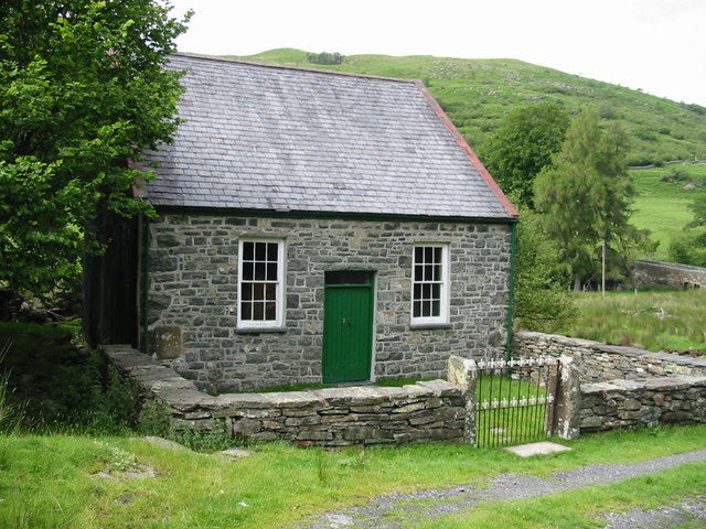
Abergeirw is a small village located in the historic county of Merionethshire, Wales. Situated in the heart of the picturesque Snowdonia National Park, Abergeirw offers stunning natural beauty and a tranquil atmosphere for residents and visitors alike.

The village is nestled between rolling hills and surrounded by lush greenery, providing an ideal setting for outdoor enthusiasts. With its close proximity to the scenic River Dwyryd, Abergeirw offers opportunities for fishing, boating, and leisurely walks along the riverbanks.

Although Abergeirw is a small village, it has a tight-knit community that takes pride in preserving its Welsh heritage. The local primary school, Ysgol Abergeirw, plays an integral role in the community, ensuring educational opportunities for the young residents.

The village is also home to a few amenities, including a local pub, The Red Lion, which serves as a social hub for residents and visitors alike. Additionally, a small convenience store provides essential groceries and goods to the local population.

For those seeking a more vibrant experience, Abergeirw is within easy reach of larger towns such as Porthmadog and Dolgellau, which offer a wider range of amenities, including shops, restaurants, and leisure facilities.

Overall, Abergeirw offers a peaceful, scenic retreat for those looking to escape the hustle and bustle of city life. Its natural beauty, community spirit, and proximity to Snowdonia National Park make it an attractive destination for nature lovers and outdoor enthusiasts.

If you have any feedback on the listing, please let us know in the comments section below.
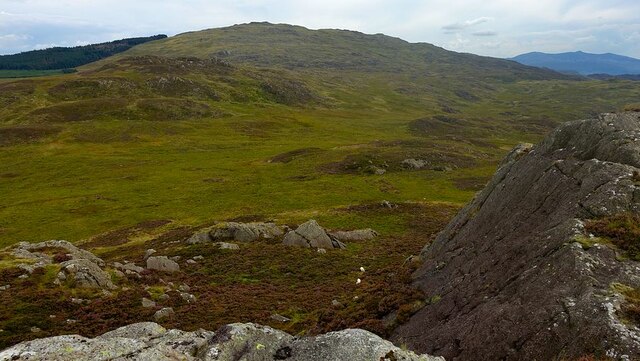
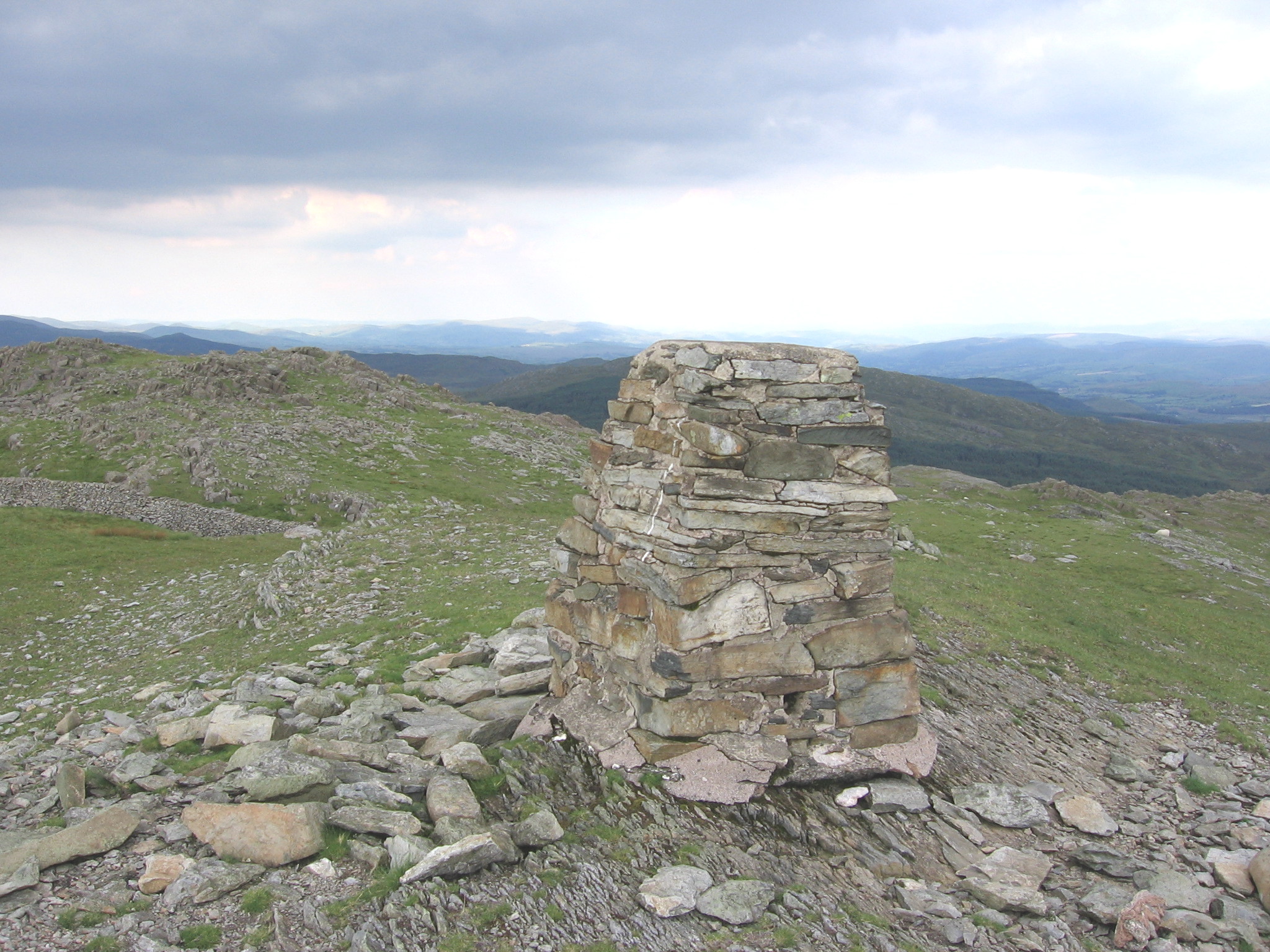
Abergeirw Images

Images are sourced within 2km of 52.838068/-3.8336554 or Grid Reference SH7628. Thanks to Geograph Open Source API. All images are credited.

Rhobell-y-big from the north Rhobell-y-big is a fine 500m rocky top.
From this northern approach, it rises out of the ocean of rampant knee-deep heather with tussocks, hidden rocks and holes seen in the foreground, extremely laborious and slow to walk through. It looks lovely in bloom though.
Rhobell-y-big from the north
Rhobell-y-big is a fine 500m rocky top. From this northern approach, it rises out of the ocean of rampant knee-deep heather with tussocks, hidden rocks and holes seen in the foreground, extremely laborious and slow to walk through. It looks lovely in bloom though.
Rhobell-y-big summit rocks The rocky pointed summit of Rhobell-y-big is among the finest in Wales, not all that high at 504m but, depending on the approach direction, reaching it is very arduous going and every metre is well earned.
The hill in the background id Dduallt.
Rhobell-y-big summit rocks
The rocky pointed summit of Rhobell-y-big is among the finest in Wales, not all that high at 504m but, depending on the approach direction, reaching it is very arduous going and every metre is well earned. The hill in the background id Dduallt.
Rhobell-y-big south descent The top of the descent southwards from the rocky top of Rhobell-y-big.
The descent is not as formidable as it looks, a short clamber down the rocks to the heathery lower slopes and thence onto the often wet typical grassy moorland.
Rhobell Ganol is in the mid-ground and Rhobell Fawr beyond.
Rhobell-y-big south descent
The top of the descent southwards from the rocky top of Rhobell-y-big. The descent is not as formidable as it looks, a short clamber down the rocks to the heathery lower slopes and thence onto the often wet typical grassy moorland. Rhobell Ganol is in the mid-ground and Rhobell Fawr beyond.
Ordnance Survey Cut Mark This OS cut mark can be found on a stone north side of the road. It marks a point 344.878m above mean sea level.
Ordnance Survey Cut Mark
This OS cut mark can be found on a stone north side of the road. It marks a point 344.878m above mean sea level.
Ordnance Survey Cut Mark This OS cut mark can be found on a stone NW side of the road. It marks a point 334.774m above mean sea level.
Ordnance Survey Cut Mark
This OS cut mark can be found on a stone NW side of the road. It marks a point 334.774m above mean sea level.
Ordnance Survey Cut Mark This OS cut mark can be found on the gatepost west side of the road. It marks a point 328.279m above mean sea level.
Ordnance Survey Cut Mark
This OS cut mark can be found on the gatepost west side of the road. It marks a point 328.279m above mean sea level.
Ordnance Survey Cut Mark This OS cut mark can be found on the gatepost south side of the road and NW side of track. It marks a point 311.932m above mean sea level.
Ordnance Survey Cut Mark
This OS cut mark can be found on the gatepost south side of the road and NW side of track. It marks a point 311.932m above mean sea level.
Ordnance Survey Cut Mark This OS cut mark can be found on the gatepost SW side of the road. It marks a point 299.426m above mean sea level.
Ordnance Survey Cut Mark
This OS cut mark can be found on the gatepost SW side of the road. It marks a point 299.426m above mean sea level.
Ordnance Survey Cut Mark This OS cut mark can be found on the wall east side of the road. It marks a point 251.402m above mean sea level.
Ordnance Survey Cut Mark
This OS cut mark can be found on the wall east side of the road. It marks a point 251.402m above mean sea level.
The Afon Bryn-llin-fawr below the ford
The bridge/ford across the Afon Bryn-llin-fawr When the water is low, it is a bridge. The OS map shows it as a ford, which it often is!
The bridge/ford across the Afon Bryn-llin-fawr
When the water is low, it is a bridge. The OS map shows it as a ford, which it often is!
Forestry track in Coed-y-Brenin
Looking across to Brin-llin-fawr farm
The Afon Mawddach from Pont Abergeirw There is much less water than when I took a similar photo 17 years ago! <a title="https://www.geograph.org.uk/photo/241433" href="https://www.geograph.org.uk/photo/241433">Link</a>
The Afon Mawddach from Pont Abergeirw
There is much less water than when I took a similar photo 17 years ago! Link
Low water in the Afon Mawddach With a dead tree stranded mid-stream.
Low water in the Afon Mawddach
With a dead tree stranded mid-stream.
Where the bridleway leaves the road There is no sign of the bridleway on the ground.
Where the bridleway leaves the road
There is no sign of the bridleway on the ground.
Looking across the Afon Brin-llin-fawr
A precarious gable end in the old barn
Show me another place!

Abergeirw is located at Grid Ref: SH7628 (Lat: 52.838068, Lng: -3.8336554)

Unitary Authority: Gwynedd

Police Authority: North Wales

What 3 Words

///squirted.vanish.smashes. Near Bronaber, Gwynedd

Nearby Locations

Abergeirw

Related Wikis

Nearby Amenities

Located within 500m of 52.838068,-3.8336554
Cyplau
Place: farm
Lat/Long: 52.834504/-3.8318156
The data included in this document is from www.openstreetmap.org. The data is made available under ODbL.

Have you been to Abergeirw?

Leave your review of Abergeirw below (or comments, questions and feedback).