Aber-Clydach

Settlement in Glamorgan

Wales

Aber-Clydach

Descent from Allt y Fanog
Descent from Allt y Fanog Credit: Alan Hughes

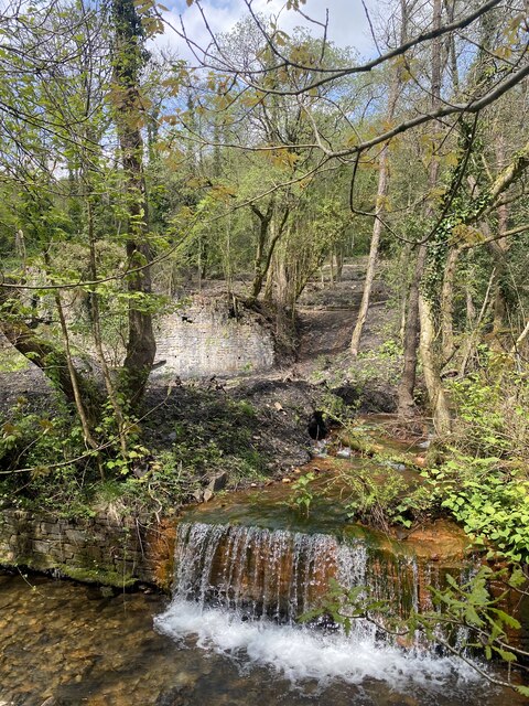
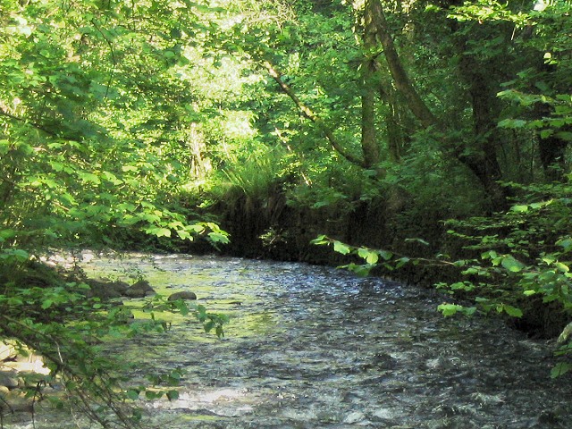
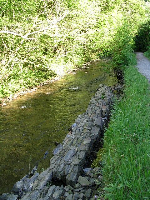
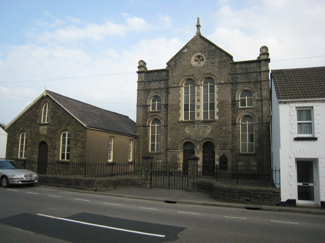
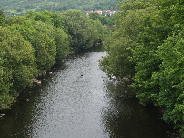
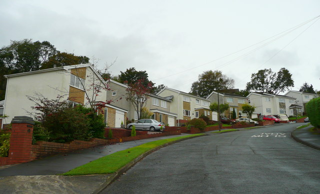
Aber-Clydach is a small village located in the county of Glamorgan, Wales. It is situated in the picturesque Swansea Valley and is surrounded by lush green hills and the scenic River Clydach. The village is part of the larger community of Clydach, which also includes the nearby village of Ynystawe.

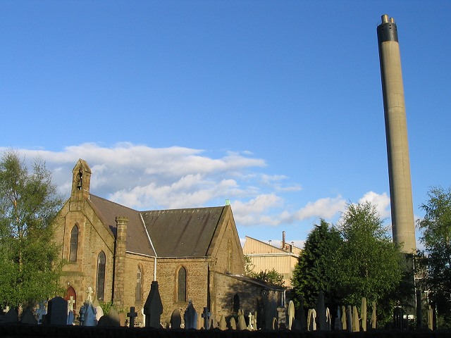
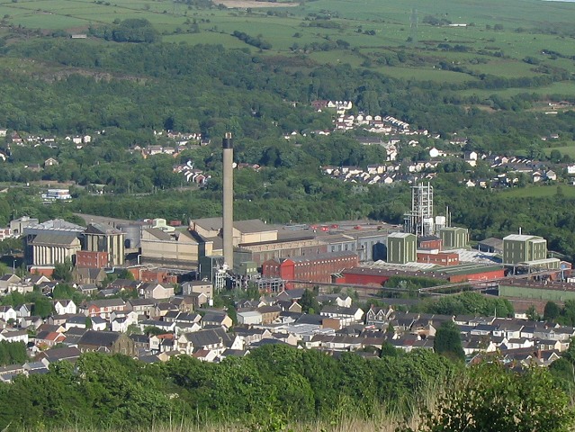
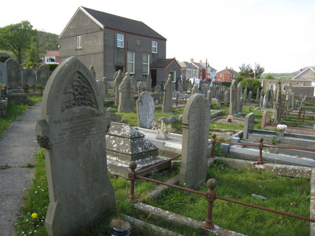
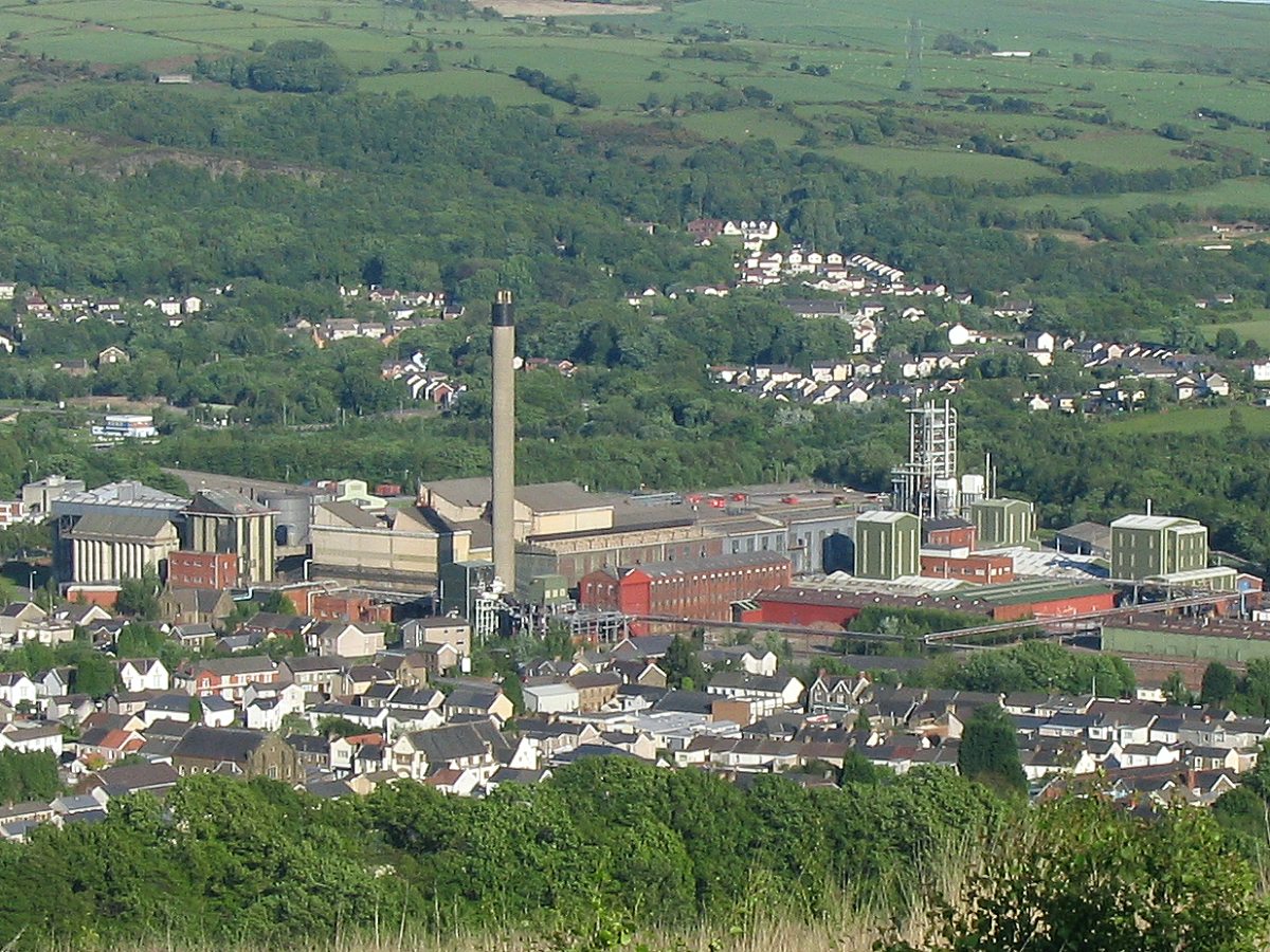
Historically, Aber-Clydach was a thriving industrial area during the 19th century. It was known for its coal mining and ironworks industries, which brought employment and prosperity to the community. However, as the demand for coal declined in the 20th century, the industries gradually diminished, and Aber-Clydach transformed into a more residential area.

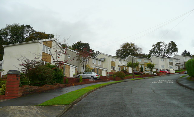
Today, Aber-Clydach retains its charm as a peaceful and close-knit community. It has a population of approximately 3,000 residents. The village offers a range of amenities, including a primary school, a community hall, and several local shops and pubs.

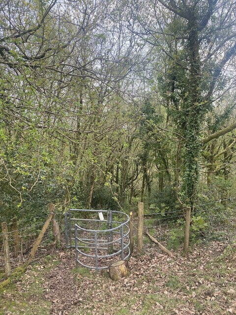
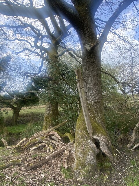
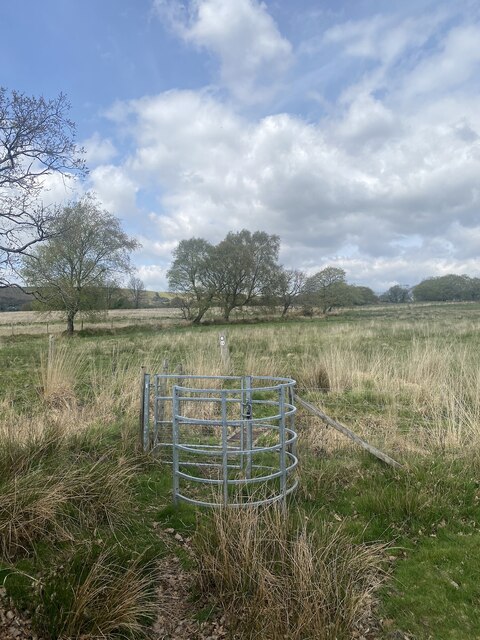
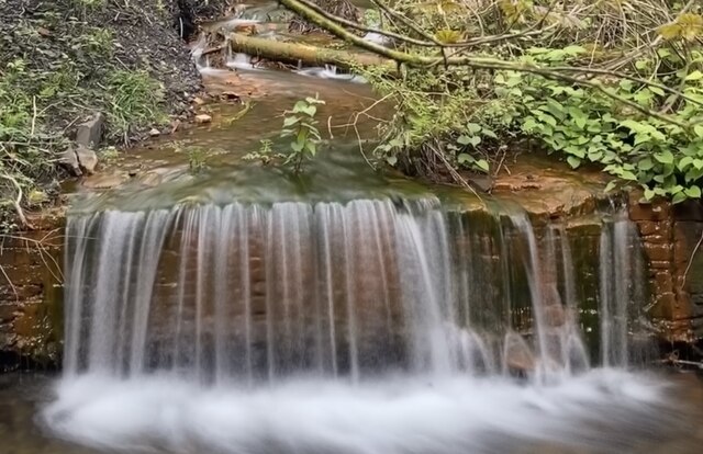
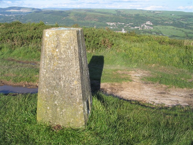
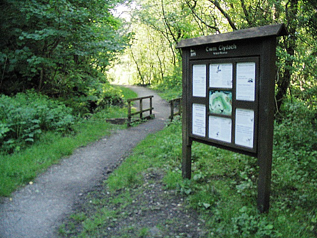
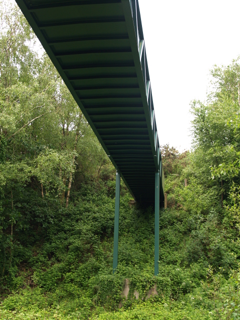
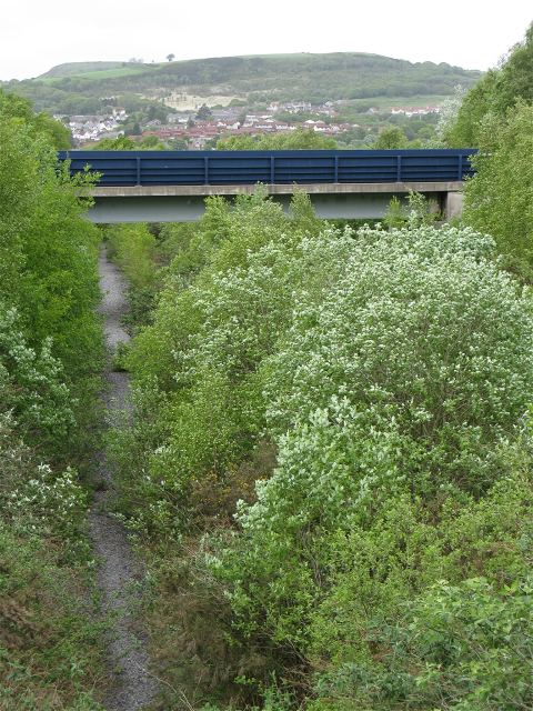
Nature enthusiasts are drawn to Aber-Clydach for its stunning landscapes and outdoor recreational opportunities. The nearby Clydach Gorge is a popular destination for hikers and nature lovers, offering beautiful woodland walks and breathtaking views of the surrounding area.

Overall, Aber-Clydach is a tranquil village that combines its rich industrial heritage with natural beauty, making it an attractive place to live or visit for those seeking a peaceful retreat in the heart of Glamorgan.

If you have any feedback on the listing, please let us know in the comments section below.

Aber-Clydach Images

Images are sourced within 2km of 51.694465/-3.8998443 or Grid Reference SN6801. Thanks to Geograph Open Source API. All images are credited.

Descent from Allt y Fanog
Trapped waymarker Tree roots have grown around the waymarker, gripping it tightly.
Trapped waymarker
Tree roots have grown around the waymarker, gripping it tightly.
Public footpath and stile Across Cathelyd towards Cwm Clydach.
Public footpath and stile
Across Cathelyd towards Cwm Clydach.
Waterfall on Lower Clydach River
Lower Clydach River Now a RSPB nature reserve, this beautiful valley belies its industrial past.  Old mine buildings lurk among the trees and the bronze discolouration of the water is due to mine seepage.
Lower Clydach River
Now a RSPB nature reserve, this beautiful valley belies its industrial past. Old mine buildings lurk among the trees and the bronze discolouration of the water is due to mine seepage.
Trig pillar on Mynydd Gelliwastad This trig pillar is right next to a rutted trail across the mountain. 
This is the view east towards Clydach below. 
If you look carefully, you can see the chimney from the Inco nickel refinery popping up above the bushes just a little to the right of the pillar top. Swansea, Port Talbot and much of the Swansea valley are also visible from this hill.
Trig pillar on Mynydd Gelliwastad
This trig pillar is right next to a rutted trail across the mountain. This is the view east towards Clydach below. If you look carefully, you can see the chimney from the Inco nickel refinery popping up above the bushes just a little to the right of the pillar top. Swansea, Port Talbot and much of the Swansea valley are also visible from this hill.
Church and Refinery at Clydach The chimney stack of the nickel refinery dominates the town of Clydach near Swansea. Here it can be seen to the south of a church in the middle of town.
Church and Refinery at Clydach
The chimney stack of the nickel refinery dominates the town of Clydach near Swansea. Here it can be seen to the south of a church in the middle of town.
Clydach Refinery seen from above Here is a view of the Inco nickel refinery as seen from the trail up Mynydd Gelliwastad.
Clydach Refinery seen from above
Here is a view of the Inco nickel refinery as seen from the trail up Mynydd Gelliwastad.
Information board in Cwm Clydach Nature Reserve The tree lined valley surrounding a crescent shaped portion of the Clydach river is designated as an RSPB Nature Reserve.
This information board is near the car park at the south end.
The trail and public footpath follow the river most of the way up to the next road bridge at Pont Llechart.
Information board in Cwm Clydach Nature Reserve
The tree lined valley surrounding a crescent shaped portion of the Clydach river is designated as an RSPB Nature Reserve. This information board is near the car park at the south end. The trail and public footpath follow the river most of the way up to the next road bridge at Pont Llechart.
Bend in the River Clydach This is the view southeast down the river. Although it is now a nature reserve and quite overgrown, there are numerous small signs of mining industry here: building foundations, buried steel ropes and the stone walled artificial bank of the river, visible on the curve in the distance.
Bend in the River Clydach
This is the view southeast down the river. Although it is now a nature reserve and quite overgrown, there are numerous small signs of mining industry here: building foundations, buried steel ropes and the stone walled artificial bank of the river, visible on the curve in the distance.
Fallen riverbank wall on river Clydach The river wall pictured in <a href="https://www.geograph.org.uk/photo/177772">SN6802 : Bend in the River Clydach</a> has collapsed a little further upstream here.
Fallen riverbank wall on river Clydach
The river wall pictured in SN6802 : Bend in the River Clydach has collapsed a little further upstream here.
Semi derelict stable Small shed used as a stable on side of single track road, with possible stile on side of building (no footpath sign though so probably private).
Semi derelict stable
Small shed used as a stable on side of single track road, with possible stile on side of building (no footpath sign though so probably private).
Moriah, Ynystawe. Capel y Bedyddwyr, mae'r garreg uwchben y drysau yn cofnodi 1892 fel blwyddyn yr adeiladu.  Helaethwyd yr  adeilad yn 1928.

A Baptist chapel, the stone above the doors gives 1892 as the year of construction.  The chapel was enlarged in 1928.
Moriah, Ynystawe.
Capel y Bedyddwyr, mae'r garreg uwchben y drysau yn cofnodi 1892 fel blwyddyn yr adeiladu. Helaethwyd yr adeilad yn 1928. A Baptist chapel, the stone above the doors gives 1892 as the year of construction. The chapel was enlarged in 1928.
Bethania, Clydach Mae'r garreg ar y wyneb yn dweud mai'r Parchedig Morgan Lewis adeiladodd y capel yn 1841 ac mai James Loid oedd y saer maen.

The stone between the upper windows commemorates the Rev. Morgan Lewis as the builder of the chapel and James Loid as the mason.
Bethania, Clydach
Mae'r garreg ar y wyneb yn dweud mai'r Parchedig Morgan Lewis adeiladodd y capel yn 1841 ac mai James Loid oedd y saer maen. The stone between the upper windows commemorates the Rev. Morgan Lewis as the builder of the chapel and James Loid as the mason.
Footbridge, Glais The footpath crosses the line of an old railway below.
Footbridge, Glais
The footpath crosses the line of an old railway below.
River Tawe, near Glais Looking upstream, taken from the A4067 bridge.
River Tawe, near Glais
Looking upstream, taken from the A4067 bridge.
Bryntawe, Ynystawe A very steep suburban road on the northern edge of the Swansea conurbation.
Bryntawe, Ynystawe
A very steep suburban road on the northern edge of the Swansea conurbation.
Dismantled railway to Clydach tinplate works As seen from <a href="https://www.geograph.org.uk/photo/831194">SN6900 : Footbridge, Glais</a>
The OS have recently updated their maps to remove the rails from this line but the tree growth suggests they have been gone for much longer. The cutting is wide enough for two tracks and there are now two worn paths side by side along the course.
The visible bridge is part of the more recently built A4067.
Dismantled railway to Clydach tinplate works
As seen from SN6900 : Footbridge, Glais The OS have recently updated their maps to remove the rails from this line but the tree growth suggests they have been gone for much longer. The cutting is wide enough for two tracks and there are now two worn paths side by side along the course. The visible bridge is part of the more recently built A4067.
Show me another place!

Aber-Clydach is located at Grid Ref: SN6801 (Lat: 51.694465, Lng: -3.8998443)

Unitary Authority: Swansea

Police Authority: South Wales

What 3 Words

///dressings.limitless.orchids. Near Clydach, Swansea

Related Wikis

Clydach War Memorial Hospital

Clydach War Memorial Hospital (Welsh: Ysbyty Coffa Clydach) was a community hospital in Clydach, Swansea, Wales. It was managed by the Abertawe Bro Morgannwg...

Lower Clydach River

The Lower Clydach River is a river in South Wales which rises on the slopes of Mynydd y Betws west of Cwmgors and flows for around 10 km through Cwm Clydach...

Calfaria Chapel, Penygroes

Calfaria is a Baptist chapel in the village of Penygroes in the community of Llandybie, near Ammanford, Carmarthenshire. Services at Calfaria were conducted...

Clydach-on-Tawe railway station

Clydach-on-Tawe railway station served the community of Clydach and Ynystawe in Swansea, Wales from 1885 to 1965 on the Swansea Vale Railway. == History... ==

Clydach (electoral ward)

Clydach is the name of an electoral ward (and a town) in the City and County of Swansea, Wales, UK. The electoral ward of Clydach consists of some or all...

Clydach, Swansea

Clydach is both a village and a community in Swansea, Wales, within the Clydach ward and the Llangyfelach parish. It is located 6 miles (9.7 km) northeast...

Craig-Cefn-Parc television relay station

The Craig-Cefn-Parc television relay station is sited on Mynydd Gelliwastad to the west of Clydach in the Swansea Valley. It was originally built in the...

Ynystawe

Ynystawe (also Ynysdawe in Welsh; Welsh pronunciation: [ənɨ̞s.taʊ.ɛ]) is a village in the City and County of Swansea, Wales, and in the electoral ward...

Nearby Amenities

Located within 500m of 51.694465,-3.8998443
Mini Roundabout
Direction: clockwise
Lat/Long: 51.6912325/-3.9034397
Dynamic Rock
Addr City: Clydach
Addr Housename: The Old Public Hall
Addr Postcode: SA6 5EJ
Addr Street: Hebron Road
Leisure: sports_centre
Phone: +44 1792 845 655
Sport: climbing
Website: https://www.dynamicrock.co.uk/
Lat/Long: 51.6942515/-3.8984646
Power: substation
Lat/Long: 51.6923436/-3.9037765
Mini Roundabout
Direction: clockwise
Lat/Long: 51.6904286/-3.9018101
Bus Stop
Bus: yes
Public Transport: platform
Lat/Long: 51.6925598/-3.9009856
Place Of Worship
Hebron
Religion: christian
Lat/Long: 51.6931846/-3.8994983
Barrier: bollard
Bollard: removable
Foot: yes
Lat/Long: 51.6953308/-3.9001013
Clydach War Memorial Hospital
Addr City: Clydach
Addr Postcode: SA6 5DT
Addr Street: Quarr Road
Disused Amenity: hospital
Name Cy: Ysbyty Coffa Clydach
Wikidata: Q65078004
Lat/Long: 51.6946654/-3.9014185
Turning Loop
Lat/Long: 51.6947141/-3.9042562
Turning Loop
Lat/Long: 51.6945929/-3.9052176
Post Box
Post Box Type: lamp
Lat/Long: 51.6977559/-3.9034298
Telephone
Booth: KX100
Covered: booth
Lat/Long: 51.6977926/-3.9034355
Bus Stop
Carpenters Arms
Bus: yes
Naptan AtcoCode: 5810AWC51354
Naptan Bearing: E
Naptan CommonName: Carpenters Arms
Naptan Crossing: St John`s Roas
Naptan Landmark: Carpentrers` Arms PH
Naptan NaptanCode: swadmpg
Naptan Street: High Street
Naptan Verified: no
Public Transport: platform
Source: naptan_import
Lat/Long: 51.6956695/-3.8938892
Bus Stop
Clydach PO
Bus: yes
Naptan AtcoCode: 5810AWC51355
Naptan Bearing: SW
Naptan CommonName: Clydach PO
Naptan Crossing: Heol-y-nant
Naptan NaptanCode: swadmpw
Naptan Street: High Street
Naptan Verified: no
Public Transport: platform
Source: naptan_import
Lat/Long: 51.6952858/-3.8953781
Bus Stop
Clydach Square (N)
Bus: yes
Naptan AtcoCode: 5810AWC51356
Naptan Bearing: N
Naptan CommonName: Clydach Square (N)
Naptan Landmark: Clydach Hall
Naptan NaptanCode: swadmta
Naptan Street: High Street
Naptan Verified: no
Public Transport: platform
Source: naptan_import
Lat/Long: 51.69443/-3.8988151
Bus Stop
Clydach Square (S)
Bus: yes
Naptan AtcoCode: 5810AWC51358
Naptan Bearing: S
Naptan CommonName: Clydach Square (S)
Naptan Crossing: Hebron Road
Naptan Landmark: Clydach Hall
Naptan NaptanCode: swadmtg
Naptan Street: High Street
Naptan Verified: no
Public Transport: platform
Source: naptan_import
Lat/Long: 51.6942625/-3.8986056
Bus Stop
Waverley Street (NE)
Bus: yes
Naptan AtcoCode: 5810AWC51359
Naptan Bearing: NE
Naptan CommonName: Waverley Street (NE)
Naptan Crossing: Waverley Street
Naptan NaptanCode: swaptgp
Naptan Street: Hebron Road
Naptan Verified: no
Public Transport: platform
Source: naptan_import
Lat/Long: 51.6926975/-3.9002909
Bus Stop
Waverley Street SW
Bus: yes
Naptan AtcoCode: 5810AWC51360
Naptan Bearing: SW
Naptan CommonName: Waverley Street SW
Naptan Crossing: Waverley Street
Naptan NaptanCode: swaptgt
Naptan Street: Hebron Road
Naptan Verified: no
Public Transport: platform
Source: naptan_import
Lat/Long: 51.6925379/-3.9007038
Bus Stop
Quarr Drive Bottom (SE)
Bus: yes
Naptan AtcoCode: 5810AWC51361
Naptan Bearing: SE
Naptan CommonName: Quarr Drive Bottom (SE)
Naptan Crossing: Western Road
Naptan NaptanCode: swaptdp
Naptan Street: Quarr Drive
Naptan Verified: no
Public Transport: platform
Source: naptan_import
Lat/Long: 51.6927259/-3.9018692
Bus Stop
Quarr Drive Nursing Home (SE)
Bus: yes
Naptan AtcoCode: 5810AWC51362
Naptan Bearing: SE
Naptan CommonName: Quarr Drive Nursing Home (SE)
Naptan Crossing: Brynteg
Naptan NaptanCode: swadmwd
Naptan Street: Quarr Drive
Naptan Verified: no
Public Transport: platform
Source: naptan_import
Lat/Long: 51.6936355/-3.9023415
Bus Stop
Quarr Rise
Bus: yes
Naptan AtcoCode: 5810AWC51363
Naptan Bearing: NW
Naptan CommonName: Quarr Rise
Naptan Crossing: Quarr Road
Naptan NaptanCode: swadmpa
Naptan Street: Brynteg
Naptan Verified: no
Public Transport: platform
Source: naptan_import
Lat/Long: 51.694148/-3.9028983
Bus Stop
Graigfelen Primary School (N)
Bus: yes
Naptan AtcoCode: 5810AWC51364
Naptan Bearing: N
Naptan CommonName: Graigfelen Primary School (N)
Naptan Crossing: Hillrise Park
Naptan Landmark: Graigfelen Primary School
Naptan NaptanCode: swadmtj
Naptan Street: Brynteg
Naptan Verified: no
Public Transport: platform
Source: naptan_import
Lat/Long: 51.6955649/-3.9036958
Bus Stop
Graigfelen Primary School (S)
Bus: yes
Naptan AtcoCode: 5810AWC51365
Naptan Bearing: S
Naptan CommonName: Graigfelen Primary School (S)
Naptan Crossing: Hillrise Park
Naptan Landmark: Graigfelen Primary School
Naptan NaptanCode: swadmtm
Naptan Street: Brynteg
Naptan Verified: no
Public Transport: platform
Source: naptan_import
Lat/Long: 51.6961441/-3.9034741
Bus Stop
Clydach Market (NW)
Bus: yes
Naptan AtcoCode: 5810AWC51368
Naptan Bearing: NE
Naptan CommonName: Clydach Market (NW)
Naptan NaptanCode: swaptgj
Naptan Street: Clydach Road
Naptan Verified: no
Public Transport: platform
Source: naptan_import
Lat/Long: 51.6918931/-3.9027603
Bus Stop
Quarr Drive Bottom (NW)
Bus: yes
Naptan AtcoCode: 5810AWO26197
Naptan Bearing: NW
Naptan CommonName: Quarr Drive Bottom (NW)
Naptan Crossing: Western Road
Naptan NaptanCode: swaptdt
Naptan Street: Quarr Drive
Naptan Verified: no
Public Transport: platform
Source: naptan_import
Lat/Long: 51.6927851/-3.9021032
Bus Stop
Quarr Drive Nursing Home (NW)
Bus: yes
Naptan AtcoCode: 5810AWO26199
Naptan Bearing: NW
Naptan CommonName: Quarr Drive Nursing Home (NW)
Naptan Crossing: Brynteg
Naptan NaptanCode: swadmwg
Naptan Street: Quarr Drive
Naptan Verified: no
Public Transport: platform
Source: naptan_import
Lat/Long: 51.6936509/-3.9025013
Clydach-on-Tawe
Abandoned Railway: station
Railway: site
Wikidata: Q107210180
Wikipedia: en:Clydach-on-Tawe railway station
Lat/Long: 51.6903219/-3.9002085
Mini Roundabout
Direction: clockwise
Lat/Long: 51.6940164/-3.9025474
Waterway: weir
Lat/Long: 51.6960117/-3.8999501
Spar
Addr City: Clydach
Addr Housenumber: 54-56
Addr Postcode: SA6 5LN
Addr Street: High Street
Brand: Spar
Brand Wikidata: Q610492
Brand Wikipedia: en:Spar (retailer)
Fhrs Id: 893693
Opening Hours: Mo-Sa 07:00-22:00; Su 08:00-22:00
Phone: +44 1792 843863
Shop: supermarket
Source Addr: FHRS Open Data
Website: https://www.spar.co.uk/store-locator/afb18063-spar-clydach
Lat/Long: 51.6956014/-3.8949288
Post Box
Collection Times: Mo-Fr 09:00; Sa 07:00
Post Box Type: lamp
Ref: SA6 395D
Royal Cypher: EIIR
Royal Cypher Wikidata: Q33102113
Lat/Long: 51.692462/-3.9018358
Post Box
Collection Times: Mo-Fr 16:30; Sa 12:15
Post Box Type: pillar
Ref: SA6 389
Royal Cypher: EIIR
Royal Cypher Wikidata: Q33102113
Lat/Long: 51.6953199/-3.895258
The Co-operative Food
Addr City: Clydach
Addr Housenumber: 77
Addr Postcode: SA6 5LJ
Addr Street: High Street
Brand: The Co-operative Food
Brand Wikidata: Q3277439
Brand Wikipedia: en:Co-op Food
Fhrs Id: 839437
Opening Hours: Mo-Sa 07:00-22:00; Su 10:00-16:00
Operator: The Co-operative Group
Operator Wikidata: Q117202
Phone: +44 1792 846 410
Shop: supermarket
Source: Bing
Website: https://www.coop.co.uk/store-finder/SA6-5LJ/high-street
Lat/Long: 51.6949279/-3.8937629
Childcare
Meithrinfa Ddydd Forge Fach
Addr City: Clydach
Addr Housename: Forge Fach Resource Centre
Addr Postcode: SA6 5EJ
Addr Street: Hebron Road
Email: forgefachdaynursery@hotmail.co.uk
Name Cy: Meithrinfa Ddydd Forge Fach
Name En: Forge Fach Day Nursery
Opening Hours: Mo-Sa 08:00-18:00
Phone: +44 1792 849 071
Website: http://www.forgefachdaynursery.co.uk/
Lat/Long: 51.695321/-3.8992357
Community Centre
Canolfan Adnoddau Cymunedol Forge Fach
Addr City: Clydach
Addr Housename: Forge Fach Community Resource Centre
Addr Postcode: SA6 5BX
Addr Street: Forge Fach
Name Cy: Canolfan Adnoddau Cymunedol Forge Fach
Name En: Forge Fach Community Resource Centre
Phone: +44 1792 845 566
Website: http://www.forgefach.com/
Lat/Long: 51.6951331/-3.8992648
Clwb Rygbi Vadre
Addr City: Clydach
Addr Housenumber: 3
Addr Postcode: SA6 5LF
Addr Street: High Street
Club: sport
Name Cy: Clwb Rygbi Vadre
Name En: Vadre RFC
Phone: +44 1792 845 596
Sport: rugby
Website: https://vardre.rfc.wales/
Lat/Long: 51.6947666/-3.8980361
Bar
the overdraft
Addr City: Clydach
Addr Housenumber: 41
Addr Postcode: SA6 5LQ
Addr Street: High Street
Brewery: coors;Peroni;carlong_black_fruits;strongbow
Min Age: 18
Outdoor Seating: yes
Lat/Long: 51.6952152/-3.8953841
Location Transition: yes
Power: pole
Lat/Long: 51.6913965/-3.9051086
Aber-Clydach
Place: suburb
Source: OS Open Names
Wikidata: Q107015022
Lat/Long: 51.6944702/-3.8998621
Location Transition: yes
Power: pole
Lat/Long: 51.6907689/-3.898057
Power: pole
Lat/Long: 51.6906791/-3.8973489
Direction: WSW
Generator Method: photovoltaic
Generator Output Electricity: yes
Generator Solar Modules: 10
Generator Source: solar
Generator Type: solar_photovoltaic_panel
Location: roof
Power: generator
Lat/Long: 51.6977983/-3.895112
Direction: SSE
Generator Method: photovoltaic
Generator Output Electricity: yes
Generator Solar Modules: 10
Generator Source: solar
Generator Type: solar_photovoltaic_panel
Location: roof
Power: generator
Lat/Long: 51.6967684/-3.8944092
Direction: SSE
Generator Method: photovoltaic
Generator Output Electricity: yes
Generator Solar Modules: 10
Generator Source: solar
Generator Type: solar_photovoltaic_panel
Location: roof
Power: generator
Lat/Long: 51.6952362/-3.8961178
Direction: 235
Generator Method: photovoltaic
Generator Output Electricity: yes
Generator Solar Modules: 16
Generator Source: solar
Generator Type: solar_photovoltaic_panel
Location: roof
Power: generator
Lat/Long: 51.6963578/-3.8999386
Direction: 185
Generator Method: photovoltaic
Generator Output Electricity: yes
Generator Solar Modules: 16
Generator Source: solar
Generator Type: solar_photovoltaic_panel
Location: roof
Power: generator
Lat/Long: 51.6981611/-3.8986582
Direction: 165
Generator Method: photovoltaic
Generator Output Electricity: yes
Generator Solar Modules: 5
Generator Source: solar
Generator Type: solar_photovoltaic_panel
Location: roof
Power: generator
Lat/Long: 51.6985447/-3.9019556
Direction: 165
Generator Method: photovoltaic
Generator Output Electricity: yes
Generator Solar Modules: 5
Generator Source: solar
Generator Type: solar_photovoltaic_panel
Location: roof
Power: generator
Lat/Long: 51.6984982/-3.9026289
Direction: 165
Generator Method: photovoltaic
Generator Output Electricity: yes
Generator Solar Modules: 5
Generator Source: solar
Generator Type: solar_photovoltaic_panel
Location: roof
Power: generator
Lat/Long: 51.6986686/-3.9021742
Direction: S
Generator Method: photovoltaic
Generator Output Electricity: yes
Generator Solar Modules: 5
Generator Source: solar
Generator Type: solar_photovoltaic_panel
Location: roof
Power: generator
Lat/Long: 51.6974459/-3.9036924
Direction: S
Generator Method: photovoltaic
Generator Output Electricity: yes
Generator Solar Modules: 5
Generator Source: solar
Generator Type: solar_photovoltaic_panel
Location: roof
Power: generator
Lat/Long: 51.6977227/-3.903974
Direction: E
Generator Method: photovoltaic
Generator Output Electricity: yes
Generator Solar Modules: 12
Generator Source: solar
Generator Type: solar_photovoltaic_panel
Location: roof
Power: generator
Lat/Long: 51.6951832/-3.9052366
Direction: S
Generator Method: photovoltaic
Generator Output Electricity: yes
Generator Solar Modules: 5
Generator Source: solar
Generator Type: solar_photovoltaic_panel
Location: roof
Power: generator
Lat/Long: 51.6977002/-3.9047277
Direction: S
Generator Method: photovoltaic
Generator Output Electricity: yes
Generator Solar Modules: 12
Generator Source: solar
Generator Type: solar_photovoltaic_panel
Location: roof
Power: generator
Lat/Long: 51.6976994/-3.9046432
Direction: W
Generator Method: photovoltaic
Generator Output Electricity: yes
Generator Solar Modules: 4
Generator Source: solar
Generator Type: solar_photovoltaic_panel
Location: roof
Power: generator
Lat/Long: 51.6952031/-3.905299
Direction: S
Generator Method: photovoltaic
Generator Output Electricity: yes
Generator Solar Modules: 5
Generator Source: solar
Generator Type: solar_photovoltaic_panel
Location: roof
Power: generator
Lat/Long: 51.6974417/-3.9039338
Direction: E
Generator Method: photovoltaic
Generator Output Electricity: yes
Generator Solar Modules: 12
Generator Source: solar
Generator Type: solar_photovoltaic_panel
Location: roof
Power: generator
Lat/Long: 51.6951375/-3.905236
Direction: S
Generator Method: photovoltaic
Generator Output Electricity: yes
Generator Solar Modules: 5
Generator Source: solar
Generator Type: solar_photovoltaic_panel
Location: roof
Power: generator
Lat/Long: 51.6977235/-3.9038828
Direction: S
Generator Method: photovoltaic
Generator Output Electricity: yes
Generator Solar Modules: 5
Generator Source: solar
Generator Type: solar_photovoltaic_panel
Location: roof
Power: generator
Lat/Long: 51.6977251/-3.903748
Direction: 215
Generator Method: photovoltaic
Generator Output Electricity: yes
Generator Solar Modules: 5
Generator Source: solar
Generator Type: solar_photovoltaic_panel
Location: roof
Power: generator
Lat/Long: 51.698095/-3.903797
Direction: S
Generator Method: photovoltaic
Generator Output Electricity: yes
Generator Solar Modules: 5
Generator Source: solar
Generator Type: solar_photovoltaic_panel
Location: roof
Power: generator
Lat/Long: 51.6977085/-3.9043361
Direction: W
Generator Method: photovoltaic
Generator Output Electricity: yes
Generator Solar Modules: 9
Generator Source: solar
Generator Type: solar_photovoltaic_panel
Location: roof
Power: generator
Lat/Long: 51.6954972/-3.9005398
Direction: S
Generator Method: photovoltaic
Generator Output Electricity: yes
Generator Solar Modules: 5
Generator Source: solar
Generator Type: solar_photovoltaic_panel
Location: roof
Power: generator
Lat/Long: 51.6977268/-3.9036682
Direction: 105
Generator Method: photovoltaic
Generator Output Electricity: yes
Generator Solar Modules: 6
Generator Source: solar
Generator Type: solar_photovoltaic_panel
Location: roof
Power: generator
Lat/Long: 51.6974326/-3.9024029
Direction: 175
Generator Method: photovoltaic
Generator Output Electricity: yes
Generator Solar Modules: 10
Generator Source: solar
Generator Type: solar_photovoltaic_panel
Location: roof
Power: generator
Lat/Long: 51.6974309/-3.9044581
Direction: 195
Generator Method: photovoltaic
Generator Output Electricity: yes
Generator Solar Modules: 8
Generator Source: solar
Generator Type: solar_photovoltaic_panel
Location: roof
Power: generator
Lat/Long: 51.6974163/-3.9024867
Direction: E
Generator Method: photovoltaic
Generator Output Electricity: yes
Generator Solar Modules: 5
Generator Source: solar
Generator Type: solar_photovoltaic_panel
Location: roof
Power: generator
Lat/Long: 51.6954858/-3.9004958
Direction: 125
Generator Method: photovoltaic
Generator Output Electricity: yes
Generator Solar Modules: 6
Generator Source: solar
Generator Type: solar_photovoltaic_panel
Location: roof
Power: generator
Lat/Long: 51.691054/-3.9003946
Direction: 125
Generator Method: photovoltaic
Generator Output Electricity: yes
Generator Solar Modules: 10
Generator Source: solar
Generator Type: solar_photovoltaic_panel
Location: roof
Power: generator
Lat/Long: 51.6911388/-3.9002967
Direction: 215
Generator Method: photovoltaic
Generator Output Electricity: yes
Generator Solar Modules: 50
Generator Source: solar
Generator Type: solar_photovoltaic_panel
Location: roof
Power: generator
Lat/Long: 51.6911929/-3.8997629
Direction: 235
Generator Method: photovoltaic
Generator Output Electricity: yes
Generator Solar Modules: 9
Generator Source: solar
Generator Type: solar_photovoltaic_panel
Location: roof
Note: module count approximate, landscape layout assumed
Power: generator
Lat/Long: 51.6924632/-3.902142
Crossing
Crossing: marked
Crossing Markings: yes
Lat/Long: 51.6958969/-3.9045877
Traffic Calming: hump
Lat/Long: 51.698773/-3.8980334
The data included in this document is from www.openstreetmap.org. The data is made available under ODbL.

Have you been to Aber-Clydach?

Leave your review of Aber-Clydach below (or comments, questions and feedback).