Black Stones
Island in Aberdeenshire
Scotland
Black Stones

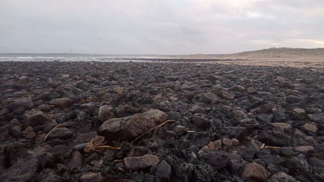
Black Stones is a small island located off the coast of Aberdeenshire, Scotland. It is situated in the North Sea, around 15 miles east of the mainland. The island is known for its rugged and rocky terrain, with steep cliffs and jagged rock formations that give it a dramatic and picturesque appearance.
With an area of approximately 0.25 square miles, Black Stones is relatively small in size. It is uninhabited and lacks any permanent structures or facilities. The island is primarily composed of granite, which has eroded over time to form unique shapes and patterns. This geological feature attracts nature enthusiasts and photographers who are drawn to the island's striking beauty.
Black Stones is also home to a diverse range of wildlife. Seabirds such as puffins, guillemots, and razorbills can be found nesting on the cliffs, while seals can often be seen basking on the rocky shores. The surrounding waters are rich in marine life, making it a popular spot for fishing and diving.
Access to Black Stones is limited and dependent on weather conditions, as the island is only accessible by boat. Visitors must take caution when exploring the island, as its rugged terrain can be challenging to navigate. However, for those seeking a unique and untouched natural experience, Black Stones offers a secluded and awe-inspiring destination.
If you have any feedback on the listing, please let us know in the comments section below.
Black Stones Images
Images are sourced within 2km of 57.54371/-1.7997715 or Grid Reference NK1250. Thanks to Geograph Open Source API. All images are credited.


Black Stones is located at Grid Ref: NK1250 (Lat: 57.54371, Lng: -1.7997715)
Unitary Authority: Aberdeenshire
Police Authority: North East
What 3 Words
///bills.others.blueberry. Near Peterhead, Aberdeenshire
Nearby Locations
Related Wikis
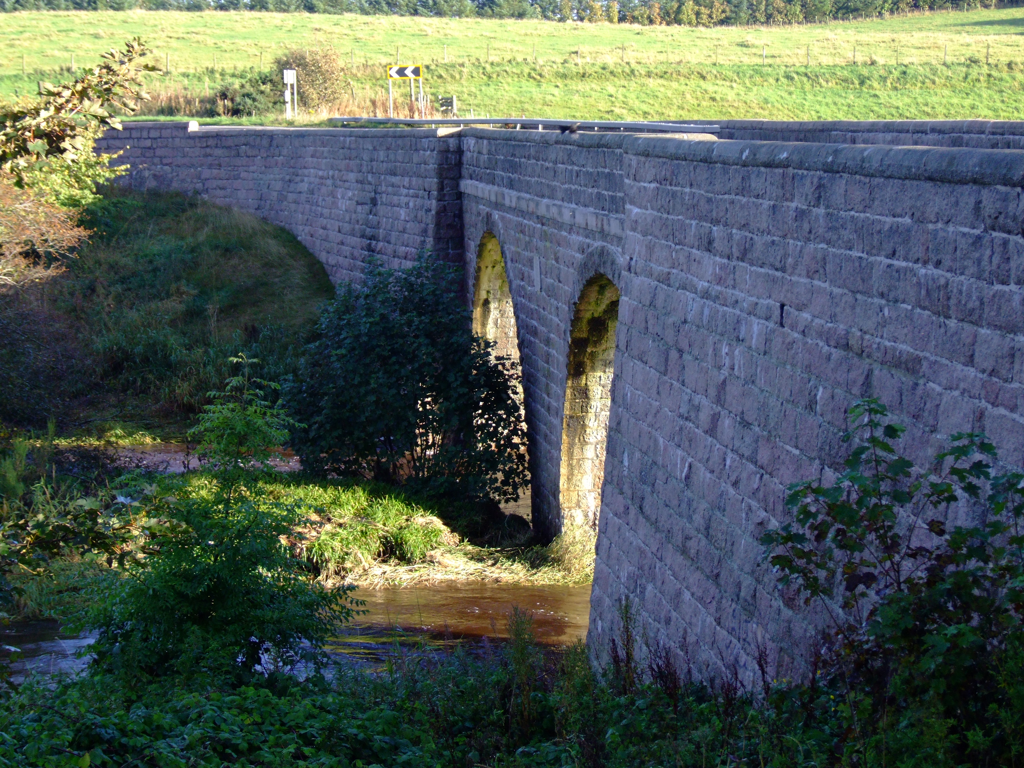
Balmoor Bridge
Balmoor Bridge is a toll-free, three-span bridge in Aberdeenshire, Scotland. A Category B listed structure, it spans the River Ugie, carrying the two lanes...
St Fergus
St Fergus is a village in the Buchan area of Aberdeenshire, Scotland. St Fergus lies 1 mile (1.6 km) from the North Sea coast and 3 miles (5 km) north...
Inverugie
Inverugie (Scottish Gaelic: Inbhir Ùigidh) is a small village in Aberdeenshire, Scotland, to the northwest of Peterhead. == Sources == Inverugie in the...
Peterhead Golf Club
Peterhead Golf Club, in Peterhead, Aberdeenshire, Scotland, was founded in 1841, making it, by its own claim, the 18th-oldest golf club in the world. Located...
Nearby Amenities
Located within 500m of 57.54371,-1.7997715Have you been to Black Stones?
Leave your review of Black Stones below (or comments, questions and feedback).