Skelly Rock

Island in Aberdeenshire

Scotland

Skelly Rock

Dune coast at Millden Links The beach and dunes at Blackdog are perfect for dog walking.
Dune coast at Millden Links Credit: Bill Harrison

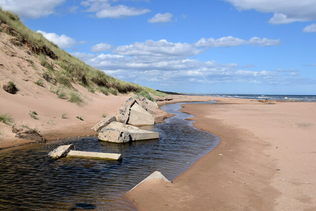
Skelly Rock, located off the coast of Aberdeenshire in Scotland, is a small uninhabited island that holds great historical and geological significance. Situated in the North Sea, this rocky outcrop measures approximately 400 meters in length and 100 meters in width, with its highest point reaching around 20 meters above sea level.

The island is composed of rugged cliffs and rocky formations, providing a breeding ground for various seabird species such as puffins, guillemots, and razorbills. These birds can be observed nesting on the sheer cliff faces during the breeding season, creating a vibrant and lively atmosphere.

In addition to its ecological importance, Skelly Rock also holds historical significance. It is believed to have been used as a lookout point during ancient times, providing a strategic location for monitoring maritime activities. The remnants of a small watchtower can still be seen on the island, serving as a testament to its past role.

Access to Skelly Rock is limited due to its remote location and rough sea conditions. However, visitors can catch a glimpse of the island from the mainland, particularly from coastal viewpoints such as the nearby village of Pennan. Boat trips are occasionally organized for those wishing to explore the island up close, offering an opportunity to witness its natural beauty and historical remnants.

Overall, Skelly Rock is a captivating island in Aberdeenshire, offering a haven for seabirds and a glimpse into Scotland's rich past.

If you have any feedback on the listing, please let us know in the comments section below.

Skelly Rock Images

Images are sourced within 2km of 57.220955/-2.0562517 or Grid Reference NJ9614. Thanks to Geograph Open Source API. All images are credited.

Dune coast at Millden Links The beach and dunes at Blackdog are perfect for dog walking.
Dune coast at Millden Links
The beach and dunes at Blackdog are perfect for dog walking.
Grassy dunes, Blackdog Rifle Range The dunes pictured are some 20 metres high.
Grassy dunes, Blackdog Rifle Range
The dunes pictured are some 20 metres high.
Waste management facility, Easter Hatton
Incoming tide, Blackdog beach
Offshore windfarm... ...as viewed from Blackdog dunes.
Offshore windfarm...
...as viewed from Blackdog dunes.
Edge of the range Boundary fence and warning signs at southern boundary of Blackdog rifle range.  Public access is allowed when the range is not in use.
Edge of the range
Boundary fence and warning signs at southern boundary of Blackdog rifle range. Public access is allowed when the range is not in use.
Blackdog Rifle Range (B Range) MOD land.  Public access allowed when range not in use.
Blackdog Rifle Range (B Range)
MOD land. Public access allowed when range not in use.
North Sea vista Blackdog rifle range and coastal dunes and in the distance part of the Aberdeen Bay offshore wind farm and oil service vessels awaiting their next voyage.
North Sea vista
Blackdog rifle range and coastal dunes and in the distance part of the Aberdeen Bay offshore wind farm and oil service vessels awaiting their next voyage.
Not such a black dog Black Dog rock has recently become encrusted with tiny barnacles with its true colour just showing on top of the head of the dog-shaped rock.   The prominent rock is part of the Belhelvie basic intrusion, being igneous bedrock formed between 485.4 and 443.8 million years ago during the Ordovician period.
Not such a black dog
Black Dog rock has recently become encrusted with tiny barnacles with its true colour just showing on top of the head of the dog-shaped rock. The prominent rock is part of the Belhelvie basic intrusion, being igneous bedrock formed between 485.4 and 443.8 million years ago during the Ordovician period.
Burn of Mundurno meets the sea The burn frequently changes course as it reaches the beach and it has recently cut into the adjacent sand dune and unearthed the remains of some buried tank traps.  The burn begins its journey to the sea at Corby Loch.  'Mundurno' means 'stony moor' according to Celtic Place-names in Aberdeenshire by John Milne.
Burn of Mundurno meets the sea
The burn frequently changes course as it reaches the beach and it has recently cut into the adjacent sand dune and unearthed the remains of some buried tank traps. The burn begins its journey to the sea at Corby Loch. 'Mundurno' means 'stony moor' according to Celtic Place-names in Aberdeenshire by John Milne.
Dune landscape with heather The dunes are MOD property but public access is permitted when the ranges are not in use.
Dune landscape with heather
The dunes are MOD property but public access is permitted when the ranges are not in use.
Black dog by Blackdog Burn
A92 near Blackdog
A92 near Blackdog
A92 near Blackdog
A92 near Blackdog
Grain Field by Potterton A ripening grain field by Potterton.
Grain Field by Potterton
A ripening grain field by Potterton.
Skelly Rock at low tide Taken during the low of a spring tide. Just visible in the distance is Blackdog Rock
Skelly Rock at low tide
Taken during the low of a spring tide. Just visible in the distance is Blackdog Rock
Bend... ...on the minor road connecting the A90 to the village of Potterton.  Typical Aberdeenshire gorse bushes at the roadside...
Bend...
...on the minor road connecting the A90 to the village of Potterton. Typical Aberdeenshire gorse bushes at the roadside...
Low spring tide at Blackdog Sands A chance to grab a few square metres on 10/3/2012 when the low tide prediction was 0.5m (with a full tidal range of about 4m)

My photo in the next square 
<a title="https://www.geograph.org.uk/photo/2841087" href="https://www.geograph.org.uk/photo/2841087">Link</a>
shows more fully the amount of beach  exposed.
Low spring tide at Blackdog Sands
A chance to grab a few square metres on 10/3/2012 when the low tide prediction was 0.5m (with a full tidal range of about 4m) My photo in the next square Link shows more fully the amount of beach exposed.
Show me another place!

Skelly Rock is located at Grid Ref: NJ9614 (Lat: 57.220955, Lng: -2.0562517)

Unitary Authority: Aberdeenshire

Police Authority: North East

What 3 Words

///waving.measures.conqueror. Near Balmedie, Aberdeenshire

Nearby Locations

Skelly Rock

Related Wikis

Blackdog

Blackdog is a hamlet approximately 2 miles north of the city limits of Aberdeen, Scotland. The nearby area serves as a shooting ground, and is used by...

Murcar Links Golf Club

Murcar Links Golf Club is a golf club in northern Aberdeen, Scotland, to the north of the Royal Aberdeen Golf Club. The 18-hole, par 71, 6,516 yard course...

Potterton

Potterton is a village north of Aberdeen, Scotland, in Aberdeenshire, west of Balmedie. Population in 1991 was 1159, falling by 2001 to 886. == References ==

Balmedie

Balmedie (Scottish Gaelic: Baile Mheadhain) is a large village in Aberdeenshire in Scotland. It lies north of the city of Aberdeen, in the civil parish...

Nearby Amenities

Located within 500m of 57.220955,-2.0562517
Source: PGS
Lat/Long: 57.2173844/-2.0583929
The data included in this document is from www.openstreetmap.org. The data is made available under ODbL.

Have you been to Skelly Rock?

Leave your review of Skelly Rock below (or comments, questions and feedback).