Clochindare

Island in Kincardineshire

Scotland

Clochindare

Fields and houses at Muchalls
Fields and houses at Muchalls Credit: Mike Pennington

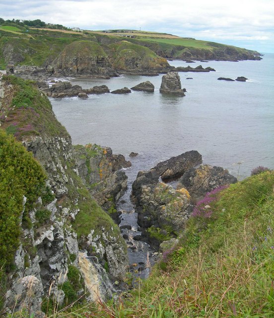
Clochindare is a small island located off the coast of Kincardineshire, Scotland. Situated in the North Sea, it is part of the larger group of islands known as the Scottish Isles. Clochindare covers a land area of approximately 1 square mile and is characterized by its rugged coastline and diverse wildlife.

The island boasts a rich history, with evidence of human occupation dating back thousands of years. It is believed that early settlers used Clochindare as a fishing and farming community, making use of the fertile soil and abundant marine resources. Ruins of ancient structures, including stone walls and dwellings, can still be found on the island.

Today, Clochindare is mainly a nature reserve, managed by local authorities to protect and preserve its unique ecosystem. The island is home to a wide variety of flora and fauna, including several species of seabirds, seals, and even occasional sightings of dolphins and whales. Visitors to the island can enjoy hiking along the picturesque coastal trails, birdwatching, and exploring the remains of ancient settlements.

Access to Clochindare is limited, with boat trips being the primary means of reaching the island. There are also a few self-catering cottages available for those seeking a more immersive experience. While there are no permanent residents on the island, it attracts a small number of tourists and nature enthusiasts, drawn to its untouched natural beauty and tranquil atmosphere.

Overall, Clochindare offers a secluded and serene getaway for those seeking to explore the rugged beauty of Scotland's coastline and observe its diverse wildlife in their natural habitat.

If you have any feedback on the listing, please let us know in the comments section below.

Clochindare Images

Images are sourced within 2km of 57.021804/-2.1505895 or Grid Reference NO9092. Thanks to Geograph Open Source API. All images are credited.

Fields and houses at Muchalls
Rocks at Grim Haven
Rocks at Grim Haven
Cliff girt coast at Muchalls
Windyedge, Newtonhill
Site of Newtonhill Station The station closed in 1956 although there is some talk of reopening it as Newtonhill has transformed from a fishing village to a commuter settlement.  Compare the photo from 2009 <a title="https://www.geograph.org.uk/photo/1454732" href="https://www.geograph.org.uk/photo/1454732">Link</a> for changes to track layout and signals.
Site of Newtonhill Station
The station closed in 1956 although there is some talk of reopening it as Newtonhill has transformed from a fishing village to a commuter settlement. Compare the photo from 2009 Link for changes to track layout and signals.
High Speed Train The 14:52 from Aberdeen to King's Cross passes the site of Newtonhill station.
High Speed Train
The 14:52 from Aberdeen to King's Cross passes the site of Newtonhill station.
Newtonhill parish church This modest structure dates from 1987.
Newtonhill parish church
This modest structure dates from 1987.
Newtonhill: walking to the harbour The cat was friendly...
Newtonhill: walking to the harbour
The cat was friendly...
Newtonhill Bay
Newtonhill Bay
Walking the coastal path The rugged Cran Hill (elev. 86 m) is in the background: could it be called a tor?
Walking the coastal path
The rugged Cran Hill (elev. 86 m) is in the background: could it be called a tor?
The Newton Arms, Newtonhill
A92, Nether Mains of Muchalls The A92 is a major highway that runs for 89 miles through Fife, Dundee, Angus, Aberdeenshire, and Aberdeen City in Scotland. From south to north, it runs from Dunfermline to Blackdog, just north of Aberdeen.
A92, Nether Mains of Muchalls
The A92 is a major highway that runs for 89 miles through Fife, Dundee, Angus, Aberdeenshire, and Aberdeen City in Scotland. From south to north, it runs from Dunfermline to Blackdog, just north of Aberdeen.
Northbound A92 at Muchalls The A92 is a major highway that runs for 89 miles through Fife, Dundee, Angus, Aberdeenshire, and Aberdeen City in Scotland. From south to north, it runs from Dunfermline to Blackdog, just north of Aberdeen.
Northbound A92 at Muchalls
The A92 is a major highway that runs for 89 miles through Fife, Dundee, Angus, Aberdeenshire, and Aberdeen City in Scotland. From south to north, it runs from Dunfermline to Blackdog, just north of Aberdeen.
Houses at Newtonhill Viewed from the A92.
Houses at Newtonhill
Viewed from the A92.
Plaxton Elite Coach on the A92 at Newtonhill Park's of Hamilton Volvo B11R/Plaxton Elite (LSK 873) heading south on the A92 at Newtonhill.
Plaxton Elite Coach on the A92 at Newtonhill
Park's of Hamilton Volvo B11R/Plaxton Elite (LSK 873) heading south on the A92 at Newtonhill.
Bridge over the A92 at Newtonhill The A92 is a major highway that runs for 89 miles through Fife, Dundee, Angus, Aberdeenshire, and Aberdeen City in Scotland. From south to north, it runs from Dunfermline to Blackdog, just north of Aberdeen.
Bridge over the A92 at Newtonhill
The A92 is a major highway that runs for 89 miles through Fife, Dundee, Angus, Aberdeenshire, and Aberdeen City in Scotland. From south to north, it runs from Dunfermline to Blackdog, just north of Aberdeen.
Northbound A92 near to Cammachmore The A92 is a major highway that runs for 89 miles through Fife, Dundee, Angus, Aberdeenshire, and Aberdeen City in Scotland. From south to north, it runs from Dunfermline to Blackdog, just north of Aberdeen.
Northbound A92 near to Cammachmore
The A92 is a major highway that runs for 89 miles through Fife, Dundee, Angus, Aberdeenshire, and Aberdeen City in Scotland. From south to north, it runs from Dunfermline to Blackdog, just north of Aberdeen.
View from Doonies Point In the foreground are some of the flat-lying rocks north of a zone of intense deformation known as the Steep Belt. Compare this with <a href="https://www.geograph.org.uk/photo/6279535">NO9090 : Folded Rock</a>.
View from Doonies Point
In the foreground are some of the flat-lying rocks north of a zone of intense deformation known as the Steep Belt. Compare this with NO9090 : Folded Rock.
Show me another place!

Clochindare is located at Grid Ref: NO9092 (Lat: 57.021804, Lng: -2.1505895)

Unitary Authority: Aberdeenshire

Police Authority: North East

What 3 Words

///rise.samplers.every. Near Newtonhill, Aberdeenshire

Related Wikis

Brown Jewel

The Brown Jewel is a sea stack on the North Sea coast of Scotland, north of the village of Muchalls in Aberdeenshire. == History == Brown Jewel is situated...

Burn of Pheppie

The Burn of Pheppie is an easterly flowing coastal stream in Aberdeenshire, Scotland that discharges to the North Sea immediately north of the village...

May Craig (island)

May Craig is a rocky island situated along the North Sea coast of Aberdeenshire, Scotland. May Craig lies about one half mile (0.8 km) south of Newtonhill...

Muchalls

Muchalls is a small coastal ex-fishing village in Kincardineshire, Scotland, south of Newtonhill and north of Stonehaven. Muchalls is situated slightly...

Grim Brigs

Grim Brigs (Grid reference NO9091) is a rocky headland on the North Sea at Muchalls, Scotland. Notable historic features in this vicinity include St....

Muchalls railway station

Muchalls railway station served the village of Muchalls, Kincardineshire, Scotland from 1849 to 1950 on the Aberdeen Railway. == History == The station...
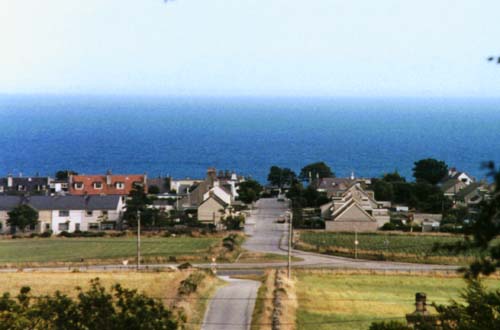
Newtonhill

Newtonhill is a commuter town in Kincardineshire, Scotland. It is popular due to its location, just six miles south of Aberdeen with easy reach of Stonehaven...

Newtonhill railway station

Newtonhill railway station served the town of Newtonhill in Aberdeenshire, Scotland, United Kingdom from its opening in 1851 to its closure in 1956. Newtonhill...

Nearby Amenities

Located within 500m of 57.021804,-2.1505895
Source: PGS
Lat/Long: 57.0199175/-2.156845
Source: PGS
Lat/Long: 57.020033/-2.156636
Source: PGS
Lat/Long: 57.020198/-2.1559571
Source: PGS
Lat/Long: 57.0200249/-2.1551004
Source: PGS
Lat/Long: 57.02015/-2.154991
Source: PGS
Lat/Long: 57.0204089/-2.1551031
Source: PGS
Lat/Long: 57.020664/-2.155213
Source: PGS
Lat/Long: 57.020779/-2.153333
Source: PGS
Lat/Long: 57.020905/-2.153096
Source: PGS
Lat/Long: 57.021403/-2.152234
Source: PGS
Lat/Long: 57.021925/-2.152368
Source: PGS
Lat/Long: 57.021918/-2.151429
Source: PGS
Lat/Long: 57.0223977/-2.1512711
Source: PGS
Lat/Long: 57.022548/-2.150007
Source: PGS
Lat/Long: 57.022798/-2.149062
Source: PGS
Lat/Long: 57.022925/-2.148825
Source: PGS
Lat/Long: 57.023051/-2.148587
Source: PGS
Lat/Long: 57.023178/-2.14835
Source: PGS
Lat/Long: 57.023506/-2.1484229
Source: PGS
Lat/Long: 57.0234833/-2.1479288
Source: PGS
Lat/Long: 57.0236924/-2.1477405
Source: PGS
Lat/Long: 57.0242128/-2.1479462
Source: PGS
Lat/Long: 57.0245042/-2.147264
Source: PGS
Lat/Long: 57.0246328/-2.1468322
Source: PGS
Lat/Long: 57.025469/-2.14642
Man Made: mast
Tower Type: communication
Lat/Long: 57.0257341/-2.153965
Power: pole
Lat/Long: 57.0245073/-2.15645
The data included in this document is from www.openstreetmap.org. The data is made available under ODbL.

Have you been to Clochindare?

Leave your review of Clochindare below (or comments, questions and feedback).