Carlin Craigs
Island in Kincardineshire
Scotland
Carlin Craigs

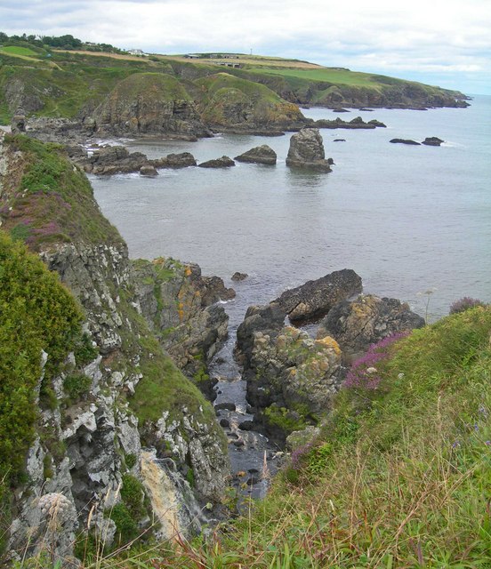
Carlin Craigs is a picturesque island located off the coast of Kincardineshire, Scotland. It is a small and rocky island, measuring approximately 0.2 square miles in area. The island is known for its stunning natural beauty and is a popular destination for nature enthusiasts and hikers.
Carlin Craigs is characterized by its dramatic cliffs, which rise up to 100 feet above sea level, offering breathtaking views of the surrounding coastline. The cliffs are home to a variety of seabirds, including puffins, gannets, and guillemots, making it a haven for birdwatchers.
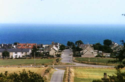
The island is uninhabited, with no permanent residents or facilities. Visitors can only access the island by boat, and there are no landing facilities available. However, the nearby town of Stonehaven offers boat trips to Carlin Craigs, allowing visitors to experience the island's beauty up close.
In addition to its natural wonders, Carlin Craigs also has a rich cultural history. The island has ancient ruins, including the remains of a chapel, which dates back to the 12th century. These historical sites attract history enthusiasts and provide a glimpse into the island's past.
Overall, Carlin Craigs is a hidden gem in Kincardineshire, offering visitors a chance to explore a rugged and untouched natural landscape. With its stunning cliffs, diverse birdlife, and historical sites, it is a must-visit destination for those seeking a unique and immersive island experience.
If you have any feedback on the listing, please let us know in the comments section below.
Carlin Craigs Images
Images are sourced within 2km of 57.014281/-2.1610323 or Grid Reference NO9091. Thanks to Geograph Open Source API. All images are credited.


Carlin Craigs is located at Grid Ref: NO9091 (Lat: 57.014281, Lng: -2.1610323)
Unitary Authority: Aberdeenshire
Police Authority: North East
What 3 Words
///copy.cute.punters. Near Newtonhill, Aberdeenshire
Nearby Locations
Related Wikis

Burn of Muchalls
The Burn of Muchalls is an easterly flowing stream in Aberdeenshire, Scotland that discharges to the North Sea. Its point of discharge is on a rocky beach...
Grim Brigs
Grim Brigs (Grid reference NO9091) is a rocky headland on the North Sea at Muchalls, Scotland. Notable historic features in this vicinity include St....
Burn of Monboys
Burn of Monboys is a stream that rises in the Mounth, or eastern range of the Grampian Mountains, northwest of Stonehaven and south of Netherley, Aberdeenshire...
Doonie Point
Doonie Point is a rocky headland situated approximately 1.5 kilometres south of the village of Muchalls in Aberdeenshire, Scotland. The clifftop of Doonie...
Mill of Muchalls
The Mill of Muchalls is an historic water-powered mill located along the Burn of Muchalls in Aberdeenshire, Scotland. This mill is situated near to the...
Muchalls railway station
Muchalls railway station served the village of Muchalls, Kincardineshire, Scotland from 1849 to 1950 on the Aberdeen Railway. == History == The station...
Muchalls
Muchalls is a small coastal ex-fishing village in Kincardineshire, Scotland, south of Newtonhill and north of Stonehaven. Muchalls is situated slightly...
Burn of Pheppie
The Burn of Pheppie is an easterly flowing coastal stream in Aberdeenshire, Scotland that discharges to the North Sea immediately north of the village...
Nearby Amenities
Located within 500m of 57.014281,-2.1610323Have you been to Carlin Craigs?
Leave your review of Carlin Craigs below (or comments, questions and feedback).