Muckle Wife

Island in Banffshire

Scotland

Muckle Wife

Looking down on Crovie The area at the bottom is the only part of the village that can be reached by motor vehicles and is reserved for local residents' use. This is the view from the public car park higher up the cliff. A feature of the village is that every single building bar one is Listed. (The local pronunciation is – more or less – Crivvy)
Looking down on Crovie Credit: Alan Murray-Rust

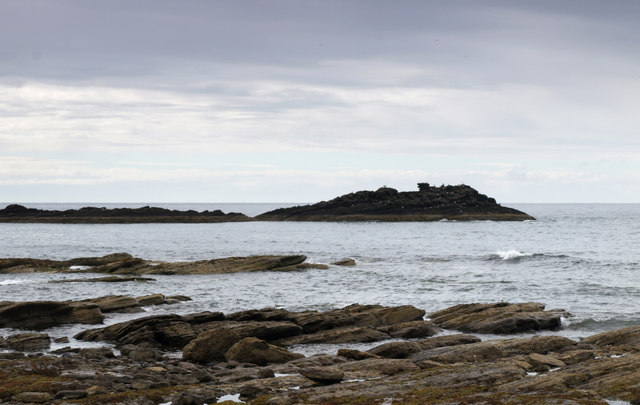
Muckle Wife is an uninhabited island located off the coast of Banffshire, Scotland. It is situated in the North Sea, approximately 10 kilometers northeast of the town of Banff. The island is part of the Banffshire Coast and Moray Firth Special Area of Conservation, known for its diverse marine life and important bird populations.

Muckle Wife covers an area of around 50 acres and is characterized by its rugged and rocky terrain. The island is mostly covered by low vegetation, including grasses, heather, and shrubs. It is surrounded by cliffs that reach heights of up to 30 meters, providing nesting sites for seabirds such as puffins, guillemots, and razorbills.

Although uninhabited, Muckle Wife has historical significance. The island's name is believed to come from the Old Norse term "mukka-vif," meaning "big woman." This suggests that the island may have been used as a place of refuge or as a lookout by Vikings during their occupation of the area.

Access to Muckle Wife is restricted due to its status as a protected nature reserve. It is a popular destination for birdwatchers and wildlife enthusiasts, who can observe the diverse range of species that inhabit the island. Boat trips and guided tours are available from nearby towns, allowing visitors to experience the natural beauty and tranquility of this remote and untouched island.

If you have any feedback on the listing, please let us know in the comments section below.
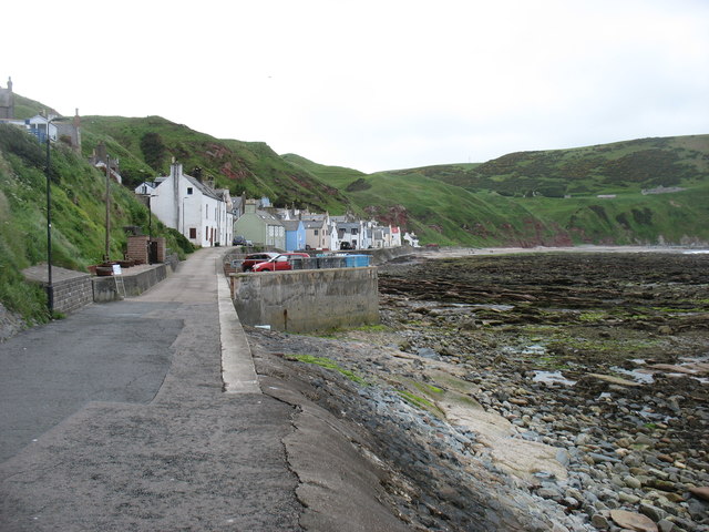
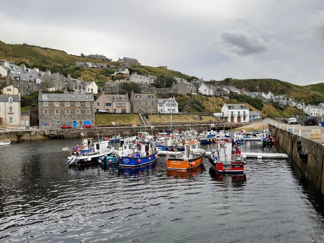
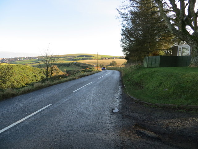
Muckle Wife Images

Images are sourced within 2km of 57.671594/-2.3512462 or Grid Reference NJ7964. Thanks to Geograph Open Source API. All images are credited.

Looking down on Crovie The area at the bottom is the only part of the village that can be reached by motor vehicles and is reserved for local residents' use. This is the view from the public car park higher up the cliff. A feature of the village is that every single building bar one is Listed. (The local pronunciation is – more or less – Crivvy)
Looking down on Crovie
The area at the bottom is the only part of the village that can be reached by motor vehicles and is reserved for local residents' use. This is the view from the public car park higher up the cliff. A feature of the village is that every single building bar one is Listed. (The local pronunciation is – more or less – Crivvy)
A general view of Crovie The Conservation Area Appraisal <span class="nowrap"><a title="https://tinyurl.com/yckhccvz" rel="nofollow ugc noopener" href="https://tinyurl.com/yckhccvz">Link</a><img style="margin-left:2px;" alt="External link" title="External link - shift click to open in new window" src="https://s1.geograph.org.uk/img/external.png" width="10" height="10"/></span> states that the village first became established in the early 18th century, either as a result of the clearances or simply as a new fishing village, although it is unclear which. Expansion came from 1718 when a government fishing bounty was introduced. By 1820 9 drifters and 28 smaller boats were in operation.

The photo shows the difficulties that must have arisen from rocky foreshore exposed at low tide, with only a small area of shingle beach for beaching boats. The jetty was not built until 1883 to afford some protection as well as easier landing of catch at lower tides. At this stage there were some 60 vessels of varying sizes! The Great Storm of 1953 caused severe damage with breaches of the sea wall and major damage to buildings, to the extent that in 1958 there was a Government order to abandon the village. Local opposition to this ensured its survival, although today many of the buildings are owned as holiday homes.
A general view of Crovie
The Conservation Area Appraisal LinkExternal link states that the village first became established in the early 18th century, either as a result of the clearances or simply as a new fishing village, although it is unclear which. Expansion came from 1718 when a government fishing bounty was introduced. By 1820 9 drifters and 28 smaller boats were in operation. The photo shows the difficulties that must have arisen from rocky foreshore exposed at low tide, with only a small area of shingle beach for beaching boats. The jetty was not built until 1883 to afford some protection as well as easier landing of catch at lower tides. At this stage there were some 60 vessels of varying sizes! The Great Storm of 1953 caused severe damage with breaches of the sea wall and major damage to buildings, to the extent that in 1958 there was a Government order to abandon the village. Local opposition to this ensured its survival, although today many of the buildings are owned as holiday homes.
Crovie, Aberdeenshire Taken from Crovie Viewpoint, south of the town at around 60m AOD
Crovie, Aberdeenshire
Taken from Crovie Viewpoint, south of the town at around 60m AOD
Crovie A view across Gamrie Bay towards the fishing village of Crovie
Crovie
A view across Gamrie Bay towards the fishing village of Crovie
Hanging out the washing Crovie village Centre with post box, phone box and the washing
Hanging out the washing
Crovie village Centre with post box, phone box and the washing
The Fishing village of Crovie
St John's Church A telephoto zoom shot of the remains of the church, surrounded by the churchyard, on the cliff opposite Gardenstown Harbour.
St John's Church
A telephoto zoom shot of the remains of the church, surrounded by the churchyard, on the cliff opposite Gardenstown Harbour.
Craigandargity, off Gardenstown Rocks in Gamrie Bay. There were cormorants visible on the rocks.
Craigandargity, off Gardenstown
Rocks in Gamrie Bay. There were cormorants visible on the rocks.
Gardenstown and harbour A view of the village from the harbour wall.
Gardenstown and harbour
A view of the village from the harbour wall.
Den of Afforsk Compare with <a href="https://www.geograph.org.uk/photo/1889194">NJ7863 : Bog of Minnonie</a>, taken nine years earlier when the whins were in similar bloom, but note that the pond has dried up.
Den of Afforsk
Compare with NJ7863 : Bog of Minnonie, taken nine years earlier when the whins were in similar bloom, but note that the pond has dried up.
Farmland at Dubford Above the steep gully of the Den of Findon.
Farmland at Dubford
Above the steep gully of the Den of Findon.
Gardenstown village Attractive though this is, I can see that there would be some disadvantages about living here. Fancy returning home late at night and finding someone coming the other way. One or both of you might end up in the sea!
Gardenstown village
Attractive though this is, I can see that there would be some disadvantages about living here. Fancy returning home late at night and finding someone coming the other way. One or both of you might end up in the sea!
Gardenstown harbour, Aberdeenshire
St John's Church This is the interior of the old parish kirk of Gamrie, which was founded in 1004. The present fabric dates mainly from the 16th century, but has become ruinous since the new parish kirk was built in 1829-1830.
St John's Church
This is the interior of the old parish kirk of Gamrie, which was founded in 1004. The present fabric dates mainly from the 16th century, but has become ruinous since the new parish kirk was built in 1829-1830.
Gardenstown and its Harbour Looking south-westward.
Gardenstown and its Harbour
Looking south-westward.
Road (B9031) at Greenskares Looking north-eastward
Road (B9031) at Greenskares
Looking north-eastward
Minor road between arable fields descending Hill of Greenskares Looking north-eastward.
Minor road between arable fields descending Hill of Greenskares
Looking north-eastward.
Gardenstown Gardenstown village.
Gardenstown
Gardenstown village.
Show me another place!

Muckle Wife is located at Grid Ref: NJ7964 (Lat: 57.671594, Lng: -2.3512462)

Unitary Authority: Aberdeenshire

Police Authority: North East

What 3 Words

///minus.enjoyable.materials. Near Macduff, Aberdeenshire

Related Wikis

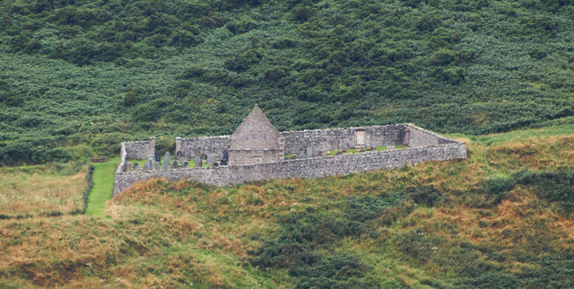
St John's Church, Gamrie

St John's Church is a ruined church and kirkyard in the parish of Gamrie, Aberdeenshire, Scotland. The church, dedicated to St John the Evangelist, was...
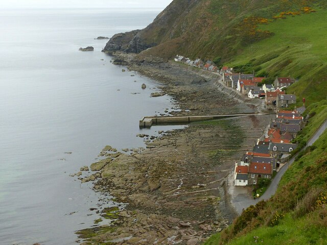
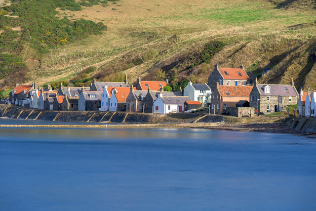
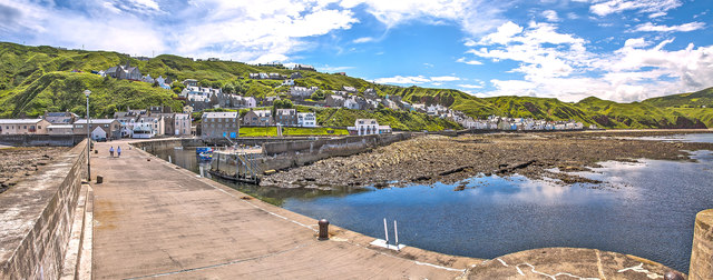
Gardenstown

Gardenstown (Scots: Gamrie) is a small coastal village, 8.7 miles (14.0 km) by road east of Banff in Aberdeenshire, northeastern Scotland. The village...
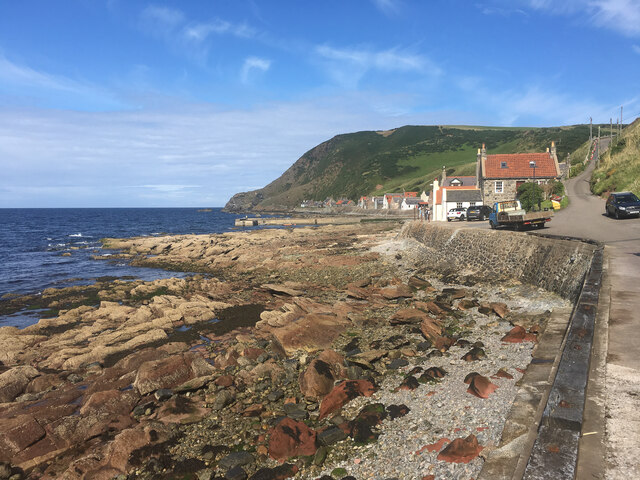
Gamrie Bay

Gamrie Bay is a bay in Aberdeenshire, Scotland. The bay is between Crovie Head and More Head. The villages of Gardenstown and Crovie are located within...

Dubford

Dubford is a small village in northern coastal Aberdeenshire, Scotland. Dubford is situated along the B9031 road approximately 6 kilometres (3.7 mi) east...

Nearby Amenities

Located within 500m of 57.671594,-2.3512462
Ford: yes
Lat/Long: 57.6691563/-2.3490968
Power: pole
Lat/Long: 57.6675142/-2.3519244
Power: pole
Lat/Long: 57.6681175/-2.3514056
The data included in this document is from www.openstreetmap.org. The data is made available under ODbL.

Have you been to Muckle Wife?

Leave your review of Muckle Wife below (or comments, questions and feedback).