Almond Rock

Island in Fife

Scotland

Almond Rock

Crail harbour Looking north east from the corner of West Braes Crescent. The flowers are poppies.
Crail harbour Credit: Richard Dorrell

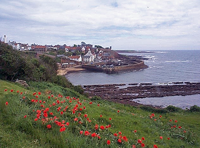
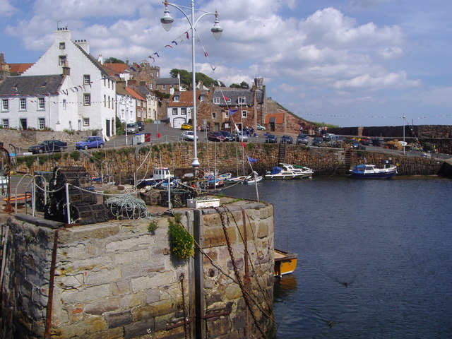
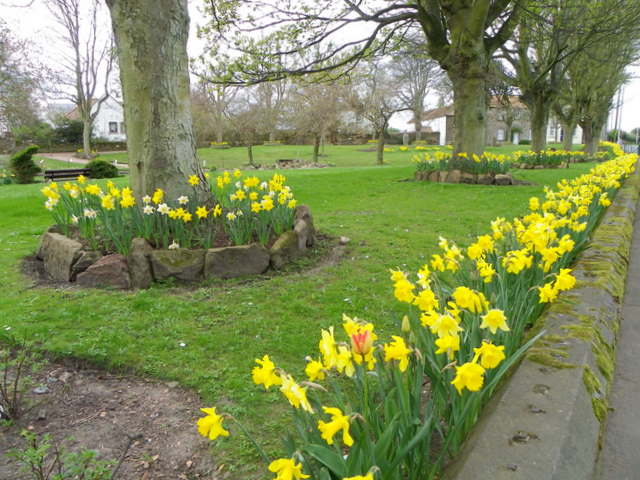
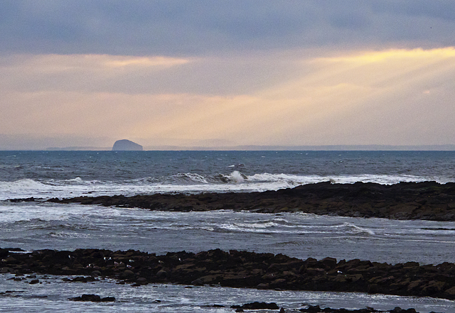
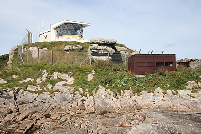
Almond Rock is a small island located off the coast of Fife, Scotland. It is situated in the Firth of Forth, approximately 1.5 kilometers northeast of the town of Aberdour. The island covers an area of around 0.1 hectares and is composed primarily of rocky terrain, with a few patches of grass and vegetation.

Almond Rock is known for its unique geological formations, including cliffs and sea stacks that have been shaped by years of erosion from the powerful waves of the North Sea. These formations provide a refuge for a variety of seabirds such as puffins, guillemots, and razorbills, making the island a popular spot for birdwatching enthusiasts.

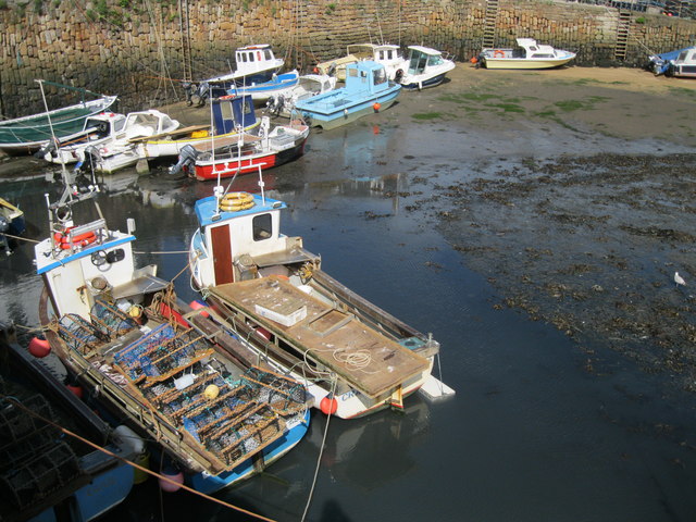
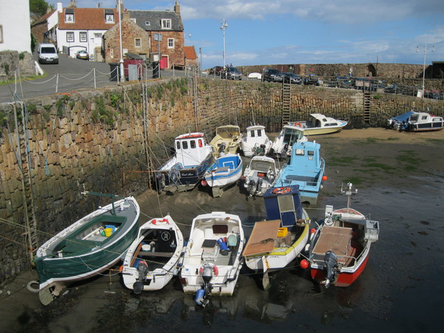
Access to Almond Rock is limited due to its remote location and lack of facilities. However, it can be reached by boat or kayak, making it a destination for adventurous explorers and nature lovers. Visitors are advised to check the tides and weather conditions before planning a trip to the island.

The island is surrounded by crystal-clear waters, making it an ideal spot for snorkeling and diving. Underwater, there is a diverse marine ecosystem with colorful fish, anemones, and kelp forests. It is important to note that diving around Almond Rock should only be attempted by experienced divers due to the strong currents and potentially hazardous conditions.

Overall, Almond Rock offers a unique opportunity to experience Scotland's natural beauty and wildlife in a secluded and picturesque setting.

If you have any feedback on the listing, please let us know in the comments section below.

Almond Rock Images

Images are sourced within 2km of 56.254191/-2.6285197 or Grid Reference NO6107. Thanks to Geograph Open Source API. All images are credited.

Crail harbour Looking north east from the corner of West Braes Crescent. The flowers are poppies.
Crail harbour
Looking north east from the corner of West Braes Crescent. The flowers are poppies.
Home from home This small caravan has an extension that doubles its size, and provides satellite TV.
Home from home
This small caravan has an extension that doubles its size, and provides satellite TV.
North-east of Crail Harbour A path along the coast gives a view of the harbour and the headland beyond. From this point the path turns inland.
North-east of Crail Harbour
A path along the coast gives a view of the harbour and the headland beyond. From this point the path turns inland.
The harbour at Crail in Fife
Crail harbour
Crail harbour
Crumbling Composer in Crail This amazing sand sculpture built in the High Street, Crail was beginning to crumble in the heat.
Crumbling Composer in Crail
This amazing sand sculpture built in the High Street, Crail was beginning to crumble in the heat.
Fishing boats in Crail Harbour The harbour dries out at low water and some of these boats are aground.
Fishing boats in Crail Harbour
The harbour dries out at low water and some of these boats are aground.
Crail Harbour Crail is still a working harbour, home to Fife's crab and lobster fleet, and though there are fewer boats than there used to be, visitors can still buy fresh lobster and shellfish from the harbourside.
Crail Harbour
Crail is still a working harbour, home to Fife's crab and lobster fleet, and though there are fewer boats than there used to be, visitors can still buy fresh lobster and shellfish from the harbourside.
Street in Crail This cobbled street leads uphill from the harbour.
Street in Crail
This cobbled street leads uphill from the harbour.
Sauchope Links Caravan Park Looking roughly SSE.
Sauchope Links Caravan Park
Looking roughly SSE.
Shop occupying an ancient building in Crail On Marketgate.
Shop occupying an ancient building in Crail
On Marketgate.
The Tolbooth and clock tower in Crail On Marketgate.
The Tolbooth and clock tower in Crail
On Marketgate.
Kissing gate, Crail The kissing gate allows people entry to the small park beside St Andrews Road.

The kissing gate is a traditional gate hung in a U or V shape that allows one person to pass at a time. In order for one person to pass fully through the gate they have to close it on the next person. Legend has it that at this point, when the two are on either side of the gate, the person in front ‘refuses’ entry to the second person until presented with a kiss.
Kissing gate, Crail
The kissing gate allows people entry to the small park beside St Andrews Road. The kissing gate is a traditional gate hung in a U or V shape that allows one person to pass at a time. In order for one person to pass fully through the gate they have to close it on the next person. Legend has it that at this point, when the two are on either side of the gate, the person in front ‘refuses’ entry to the second person until presented with a kiss.
Daffodils in the park, Crail A fine show of daffodils in a small park beside the A917, St Andrews Road.
Daffodils in the park, Crail
A fine show of daffodils in a small park beside the A917, St Andrews Road.
Westland Skelly Rocks at the Westland Skelly, viewed on a very overcast day, with the Bass Rock visible on the horizon.
Westland Skelly
Rocks at the Westland Skelly, viewed on a very overcast day, with the Bass Rock visible on the horizon.
Pillbox near Kirklands The pillbox guards the Fife coast.
Pillbox near Kirklands
The pillbox guards the Fife coast.
19 Nethergate North, Crail There is an Ordnance Survey bench mark on the corner of this pretty cottage.
19 Nethergate North, Crail
There is an Ordnance Survey bench mark on the corner of this pretty cottage.
Bench Mark, 19 Nethergate North The Ordnance Survey bench mark is to be found on the north east face of the building.  For a view of the building <a href="https://www.geograph.org.uk/photo/2793961">NO6107 : 19 Nethergate North, Crail</a> and for further information on the cut mark and others in the area <span class="nowrap"><a title="http://www.bench-marks.org.uk/bm41250" rel="nofollow ugc noopener" href="http://www.bench-marks.org.uk/bm41250">Link</a><img style="margin-left:2px;" alt="External link" title="External link - shift click to open in new window" src="https://s1.geograph.org.uk/img/external.png" width="10" height="10"/></span>
Bench Mark, 19 Nethergate North
The Ordnance Survey bench mark is to be found on the north east face of the building. For a view of the building NO6107 : 19 Nethergate North, Crail and for further information on the cut mark and others in the area LinkExternal link
Show me another place!

Almond Rock is located at Grid Ref: NO6107 (Lat: 56.254191, Lng: -2.6285197)

Unitary Authority: Fife

Police Authority: Fife

What 3 Words

///kidney.proposals.replying. Near Crail, Fife

Related Wikis

Crail Castle

Crail Castle was a castle that was located in Crail, Fife, Scotland. Crail became a Royal Burgh in the 12th century. The castle was frequented by King...

Golf Hotel

The Golf Hotel is a hotel and restaurant in Crail, Fife, Scotland. It is a Category A listed building dating to the early 18th century, although one source...

Crail

Crail (); Scottish Gaelic: Cathair Aile) is a former royal burgh, parish and community council area (Royal Burgh of Crail and District) in the East Neuk...

Crail Tolbooth and Town Hall

Crail Tolbooth and Town Hall is a municipal structure in Crail, Fife, Scotland. The building, which stands in Marketgate, at its junction with Tolbooth...

Crail railway station

Crail railway station served the burgh of Crail, Fife, Scotland from 1883 to 1966 on the Fife Coast Railway. == History == The station opened on 1 September...

Crail Parish Church

Crail Parish Church is an ancient church building in Crail, Fife, Scotland. It is Category A listed, its oldest part dating to the 12th century. The walls...

RNAS Crail (HMS Jackdaw)

Royal Naval Air Station Crail (RNAS Crail, also known as HMS Jackdaw) is a former Royal Naval Air Station of the Fleet Air Arm located 4.9 miles (7.9 km...

Fife Ness

Fife Ness (Scottish Gaelic: Rubha Fiobha) is a headland forming the most eastern point in Fife, Scotland. Anciently the area was called Muck Ross, which...

Nearby Amenities

Located within 500m of 56.254191,-2.6285197
Man Made: beacon
Seamark Information: Not shown when harbor is closed
Seamark Light Category: lower
Seamark Light Character: F
Seamark Light Colour: red
Seamark Light Height: 24
Seamark Light Range: 6
Seamark Light Reference: A 3100
Seamark Type: light_minor
Source: US NGA Pub. 114. 2011-05-26.
Lat/Long: 56.2574787/-2.6303558
Man Made: beacon
Seamark Light Category: upper
Seamark Light Character: F
Seamark Light Colour: red
Seamark Light Height: 30
Seamark Light Range: 6
Seamark Light Reference: A 3100.1
Seamark Type: light_minor
Source: US NGA Pub. 114. 2011-05-26.
Lat/Long: 56.257574/-2.6307527
Crail Pottery
Addr City: Crail
Addr Housenumber: 75
Addr Postcode: KY10 3TX
Addr Street: Nethergate
Craft: pottery
Shop: gift
Website: https://crailpottery.com/
Lat/Long: 56.2579712/-2.6275292
Post Box
Collection Times: Mo-Fr 09:00; Sa 07:00
Operator: Royal Mail
Operator Wikidata: Q638098
Post Box Mounting: wooden_post
Post Box Type: lamp
Ref: KY10 261D
Royal Cypher: scottish_crown
Lat/Long: 56.2578393/-2.6298728
Bench
Backrest: yes
Check Date: 2022-04-18
Lat/Long: 56.2581649/-2.6258177
Bench
Backrest: yes
Check Date: 2022-04-18
Lat/Long: 56.2583003/-2.6257009
Fulmars
Board Type: wildlife
Information: board
Tourism: information
Lat/Long: 56.258125/-2.6261339
Clock
Check Date: 2022-05-04
Display: sundial
Support: pole
Lat/Long: 56.2581391/-2.6260651
Bench
Backrest: no
Check Date: 2022-04-19
Lat/Long: 56.2581447/-2.6261574
Bench
Backrest: no
Check Date: 2022-04-19
Lat/Long: 56.2581839/-2.6263474
Bench
Backrest: no
Check Date: 2022-05-04
Lat/Long: 56.2581963/-2.6260457
Bench
Backrest: no
Check Date: 2022-04-19
Lat/Long: 56.258216/-2.6264579
Bench
Backrest: no
Check Date: 2022-05-04
Lat/Long: 56.2582581/-2.6259927
Bench
Backrest: no
Check Date: 2022-05-04
Lat/Long: 56.2583245/-2.6259368
Bench
Backrest: no
Check Date: 2022-05-04
Lat/Long: 56.2583584/-2.6259054
Bench
Backrest: no
Check Date: 2022-04-19
Lat/Long: 56.2583984/-2.6258732
Bench
Backrest: no
Check Date: 2022-04-19
Lat/Long: 56.2584342/-2.6258441
Tourism: picnic_site
Lat/Long: 56.2573295/-2.6272635
Tourism: picnic_site
Lat/Long: 56.2576171/-2.627119
Fast Food
The Lobster Hut
Cuisine: seafood
Lat/Long: 56.2577199/-2.6275252
Brodie's Grannie's
Addr City: Crail
Addr Housenumber: 32
Addr Postcode: KY10 3SU
Addr Street: Shoregate
Fhrs Id: 667160
Shop: ice_cream
Lat/Long: 56.2577672/-2.6272237
Drinking Water
Lat/Long: 56.2576452/-2.6282725
Give Way
Direction: backward
Lat/Long: 56.2579815/-2.6298362
Give Way
Direction: backward
Lat/Long: 56.257694/-2.6303753
Defibrillator
Defibrillator Location: On outside wall of public toilets
Emergency: defibrillator
Indoor: no
Opening Hours: 24/7
Lat/Long: 56.2586277/-2.628485
Bus Stop
Temple Crescent
Bench: no
Bin: no
Bus: yes
Lit: yes
Public Transport: platform
Shelter: no
Tactile Paving: no
Lat/Long: 56.2571859/-2.6310545
Bus Stop
Temple Crescent
Bench: no
Bin: yes
Bus: yes
Lit: no
Public Transport: platform
Shelter: yes
Tactile Paving: yes
Lat/Long: 56.2573647/-2.6309346
Cafe
Crail Harbour Gallery and Tearoom
Addr City: Crail
Addr Housenumber: 22
Addr Postcode: KY10 3SU
Addr Street: Shoregate
Fhrs Id: 14819
Opening Hours: Mo-Su 10:15-18:00+
Phone: +44 1333 451896
Source Addr: FHRS Open Data
Website: http://www.crailharbourgallery.co.uk
Lat/Long: 56.2579655/-2.627091
Isle of Maybe
Addr City: Crail
Addr Housename: Osborne Terrace
Addr Housenumber: 2a
Addr Place: Osborne Terrace
Addr Postcode: KY10 3RR
Entrance: yes
Level: 1
Lat/Long: 56.2550824/-2.631012
Addr City: Crail
Addr Housenumber: 2
Addr Postcode: KY10 3RR
Addr Street: Osborne Terrace
Entrance: yes
Level: 0
Lat/Long: 56.2551393/-2.6307414
West Braes sewage pumping station
Level: -1
Man Made: pumping_station
Operator: Scottish Water
Operator Wikidata: Q7438022
Source: survey
Lat/Long: 56.254278/-2.6299881
Addr City: Crail
Addr Housenumber: 1
Addr Postcode: KY10 3RQ
Addr Street: West Lane
Entrance: yes
Level: 0
Lat/Long: 56.2586664/-2.6283998
Crail Harbour Sewage Pumping Station
Level: -1
Man Made: pumping_station
Operator: Scottish Water
Operator Wikidata: Q7438022
Lat/Long: 56.2576697/-2.6271169
Material: wood
Power: pole
Lat/Long: 56.2549289/-2.6359657
Material: wood
Power: pole
Lat/Long: 56.2555618/-2.634894
Material: wood
Power: pole
Lat/Long: 56.256183/-2.6340506
Historic: milestone
Lat/Long: 56.2570753/-2.6312128
Information: guidepost
Operator: Fife Coast and Countryside Trust
Tourism: information
Lat/Long: 56.2581385/-2.6269601
Information: guidepost
Operator: Fife Coast and Countryside Trust
Tourism: information
Lat/Long: 56.2567021/-2.6317883
The data included in this document is from www.openstreetmap.org. The data is made available under ODbL.

Have you been to Almond Rock?

Leave your review of Almond Rock below (or comments, questions and feedback).