Macclesfield Forest

Settlement in Cheshire

England

Macclesfield Forest

Junction on Buxton New Road Taken from the northern end of Ankers Lane which heads for Wildboarclough.
Junction on Buxton New Road Credit: Trevor Harris

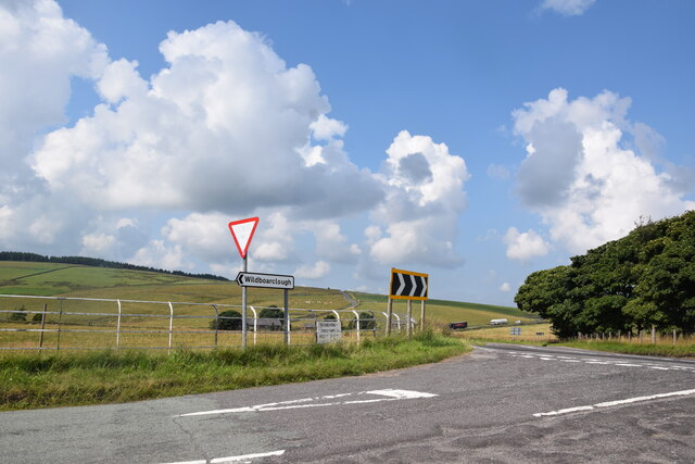
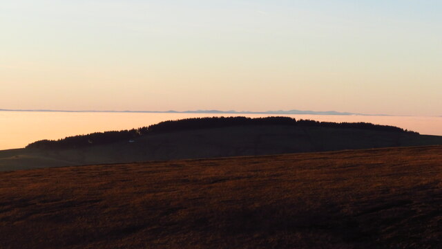
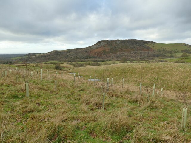
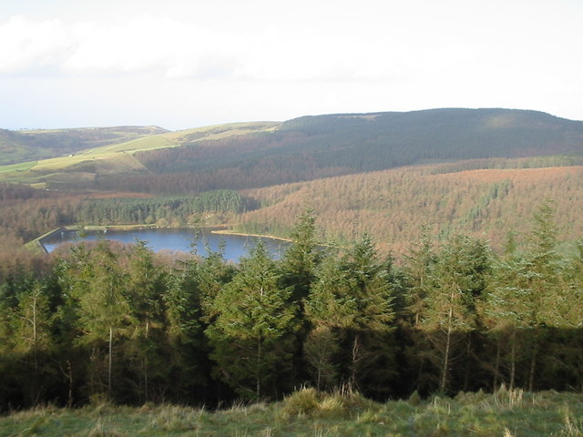
Macclesfield Forest is a large wooded area located in Cheshire, England. Covering approximately 4,000 acres, it is situated east of the town of Macclesfield and is part of the Peak District National Park. The forest is comprised mainly of coniferous trees, including spruce and pine, with some areas of deciduous woodland. It is surrounded by rolling hills and offers breathtaking views of the surrounding countryside.

The forest is a popular destination for outdoor enthusiasts, offering a range of recreational activities. There are numerous walking trails and footpaths, catering to all levels of ability. These trails provide opportunities to explore the diverse flora and fauna found within the forest, including various bird species and rare plants. The forest is also home to a number of small streams and ponds, adding to its natural beauty.

In addition to walking and hiking, Macclesfield Forest offers opportunities for cycling and horse riding. The area has a network of bridleways and cycle paths, allowing visitors to explore the forest on two wheels or on horseback. The forest is also a haven for wildlife, with deer, foxes, and badgers frequently spotted by visitors.

The forest is managed by the Peak District National Park Authority, which works to maintain the natural environment and protect the wildlife habitats within the area. Facilities within the forest include a car park, picnic areas, and public toilets. Additionally, there are several nearby villages and towns where visitors can find accommodation and amenities. Overall, Macclesfield Forest is a picturesque and idyllic location, offering a tranquil escape for nature lovers and outdoor enthusiasts alike.

If you have any feedback on the listing, please let us know in the comments section below.

Macclesfield Forest Images

Images are sourced within 2km of 53.24608/-2.037133 or Grid Reference SJ9772. Thanks to Geograph Open Source API. All images are credited.

Junction on Buxton New Road Taken from the northern end of Ankers Lane which heads for Wildboarclough.
Junction on Buxton New Road
Taken from the northern end of Ankers Lane which heads for Wildboarclough.
Trentabank Reservoir, Macclesfield Forest
View to Shutlingsloe & A537 from Shining Tor
Late afternoon sunlight Macclesfield Forest as seen from the path south of Stakeside The Cheshire Plain is choked by a cold air inversion. Beyond, the Berwyn Range of mountains is visible.
Late afternoon sunlight Macclesfield Forest as seen from the path south of Stakeside
The Cheshire Plain is choked by a cold air inversion. Beyond, the Berwyn Range of mountains is visible.
Macclesfield Forest & the Welsh mountains with cold air inversion over Cheshire Plain Snowdon and the Carneddau Range were clearly visible on the horizon and standing out as 'an island above the clouds' during this cold air inversion.  These mountains are some eighty miles away.
Macclesfield Forest & the Welsh mountains with cold air inversion over Cheshire Plain
Snowdon and the Carneddau Range were clearly visible on the horizon and standing out as 'an island above the clouds' during this cold air inversion. These mountains are some eighty miles away.
Young plantation above Higher Ridgegate These trees will eventually obscure the view over to Tegg's Nose.
Young plantation above Higher Ridgegate
These trees will eventually obscure the view over to Tegg's Nose.
Start of a track into Macclesfield Forest The track is shown on recent OS mapping as just a public footpath, but a sign on the gate says it is also a permissive bridleway.
Start of a track into Macclesfield Forest
The track is shown on recent OS mapping as just a public footpath, but a sign on the gate says it is also a permissive bridleway.
Cleared area of Macclesfield Forest A large area of conifer plantation has been cleared.
Cleared area of Macclesfield Forest
A large area of conifer plantation has been cleared.
Path into Macclesfield Forest The sign in the middle distance warns of 'unauthorised cycle trails', warning mountain bikers against using these trails but acknowledging that people will in practice continue to use them.
Path into Macclesfield Forest
The sign in the middle distance warns of 'unauthorised cycle trails', warning mountain bikers against using these trails but acknowledging that people will in practice continue to use them.
Pool in Macclesfield Forest The pool is on a running stream, where it meets a forest track. There is an iron pipe to take excess water under the track.
Pool in Macclesfield Forest
The pool is on a running stream, where it meets a forest track. There is an iron pipe to take excess water under the track.
Stream in Macclesfield Forest The stream feeds the pool in the foreground <a href="https://www.geograph.org.uk/photo/7374394">SJ9672 : Pool in Macclesfield Forest</a>.
Stream in Macclesfield Forest
The stream feeds the pool in the foreground SJ9672 : Pool in Macclesfield Forest.
Ruined building at Dimples The 1897 map shows four buildings comprising this farmstead, of which only one, now roofless, remains. See <a href="https://www.geograph.org.uk/photo/6555238">SJ9672 : Farm ruin in Macclesfield Forest</a> for more of the history. The presence of the stream in the foreground presumably dictated its location, and the surrounding area was not forested when it was built in the 19th century.
Ruined building at Dimples
The 1897 map shows four buildings comprising this farmstead, of which only one, now roofless, remains. See SJ9672 : Farm ruin in Macclesfield Forest for more of the history. The presence of the stream in the foreground presumably dictated its location, and the surrounding area was not forested when it was built in the 19th century.
Ruined building at Dimples - datestone The datestone has the initials JB and the date 1880. An interpretation board explains the initials as those of James Bullock who lived here until his death in 1892, after which the family moved away and the remote farm presumably became uninhabited thereafter. See <a href="https://www.geograph.org.uk/photo/7374399">SJ9672 : Ruined building at Dimples</a> for context.
Ruined building at Dimples - datestone
The datestone has the initials JB and the date 1880. An interpretation board explains the initials as those of James Bullock who lived here until his death in 1892, after which the family moved away and the remote farm presumably became uninhabited thereafter. See SJ9672 : Ruined building at Dimples for context.
On concessionary path leading up from Torgate Farm towards Cat & Fiddle PH A new concessionary path, not shown on mapping now continues up to join the A537 just west of the Cat & Fiddle PH.
On concessionary path leading up from Torgate Farm towards Cat & Fiddle PH
A new concessionary path, not shown on mapping now continues up to join the A537 just west of the Cat & Fiddle PH.
Cuckoo Rocks Farm Ruin
Cuckoo Rocks Cat & Fiddle in the background
Cuckoo Rocks
Cat & Fiddle in the background
Car park view, standing stone, Macclesfield Forest
St Stephen's Church Macclesfield Forest church.
St Stephen's Church
Macclesfield Forest church.
Show me another place!

Macclesfield Forest is located at Grid Ref: SJ9772 (Lat: 53.24608, Lng: -2.037133)

Unitary Authority: Cheshire East

Police Authority: Cheshire

What 3 Words

///silence.meanders.uniforms. Near Macclesfield, Cheshire

Related Wikis

Forest Chapel

Forest Chapel stands in an isolated position in the civil parish of Macclesfield Forest and Wildboarclough in Cheshire, England, within the Peak District...

Macclesfield Forest

Macclesfield Forest is an area of woodland, predominantly conifer plantation, around 3 mi (5 km) south east of Macclesfield in the civil parish of Macclesfield...

Macclesfield Forest and Wildboarclough

Macclesfield Forest and Wildboarclough is a civil parish in the unitary authority of Cheshire East and the ceremonial county of Cheshire, England. It...

Trentabank Reservoir

Trentabank Reservoir is within Macclesfield Forest, partly in the Peak District National Park, in England, and is home to rich unimproved uplands and...

Nearby Amenities

Located within 500m of 53.24608,-2.037133
Barrier: kissing_gate
Lat/Long: 53.247529/-2.0398314
Barrier: kissing_gate
Lat/Long: 53.2474615/-2.0398181
Post Box
Post Box Type: lamp
Ref: SK11 145
Royal Cypher: EIIR
Royal Cypher Wikidata: Q33102113
Lat/Long: 53.2484784/-2.0307811
Telephone
Booth: K6
Covered: booth
Phone: +44 1260 252284
Lat/Long: 53.2484789/-2.0308236
Barrier: entrance
Lat/Long: 53.2463911/-2.0394837
Bench
Backrest: no
Lat/Long: 53.2473703/-2.044286
Information: guidepost
Tourism: information
Lat/Long: 53.2433615/-2.0350803
Give Way
Direction: forward
Lat/Long: 53.2484653/-2.0311023
Barrier: stile
Lat/Long: 53.2425224/-2.0354312
Defibrillator
Emergency: defibrillator
Indoor: no
Lat/Long: 53.2457717/-2.0405393
The data included in this document is from www.openstreetmap.org. The data is made available under ODbL.

Have you been to Macclesfield Forest?

Leave your review of Macclesfield Forest below (or comments, questions and feedback).