Gibb's Craig

Island in Caithness

Scotland

Gibb's Craig

Duncansby Head from the air
Duncansby Head from the air Credit: Mike Pennington

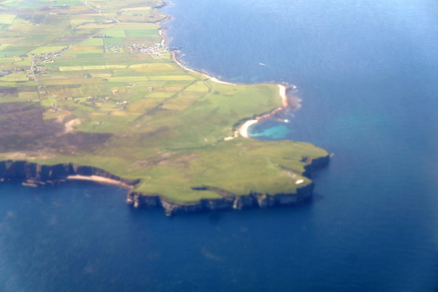
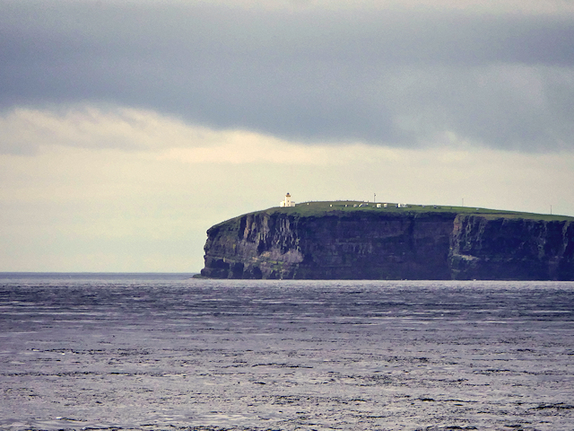
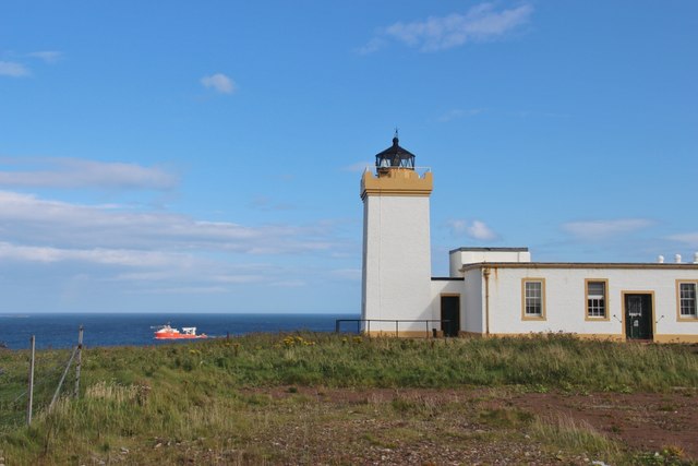
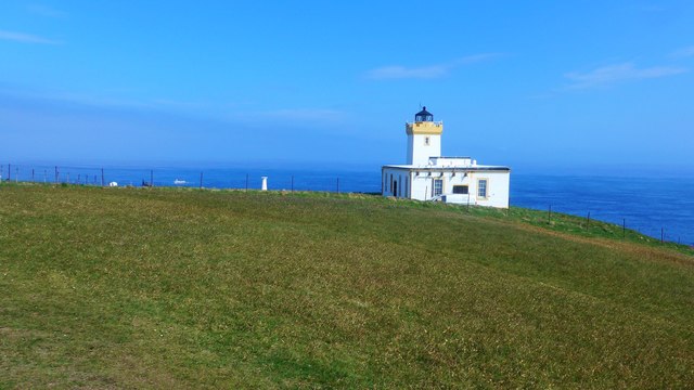
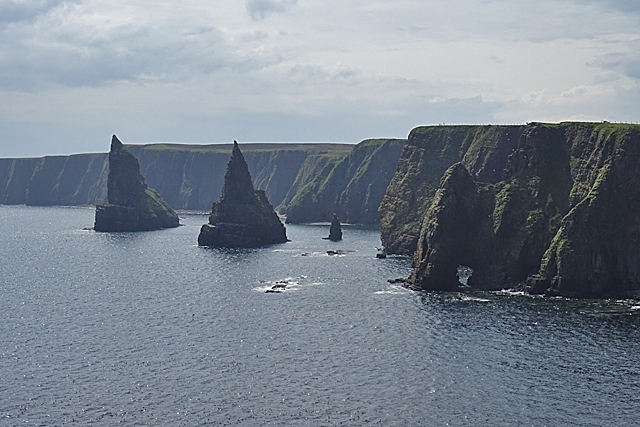
Gibb's Craig is a small island located off the coast of Caithness, in the northernmost part of mainland Scotland. It is situated in the Pentland Firth, a stretch of water known for its strong tidal currents and treacherous navigation. The island is privately owned and measures approximately 4 hectares in size.

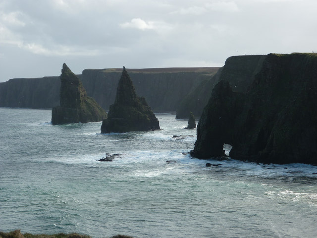
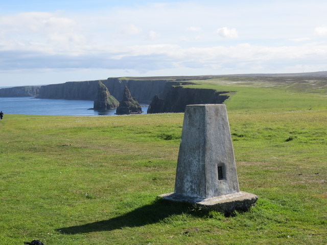
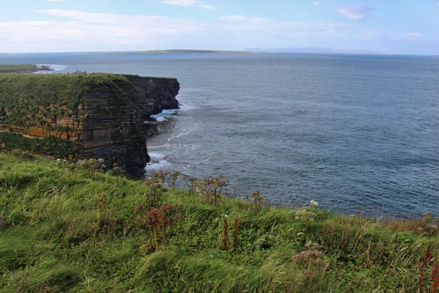
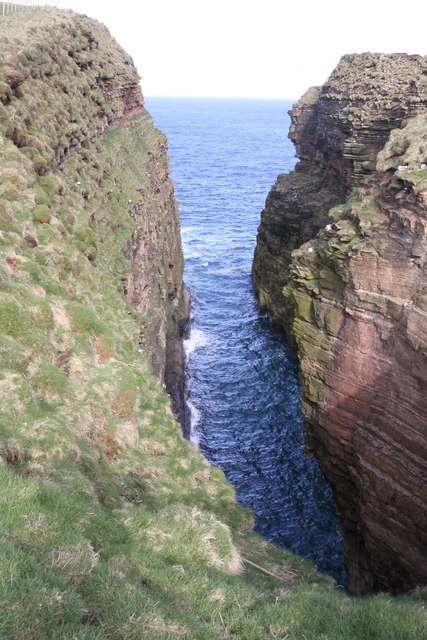
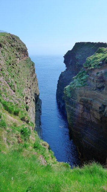
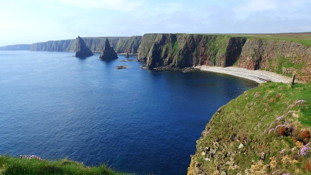
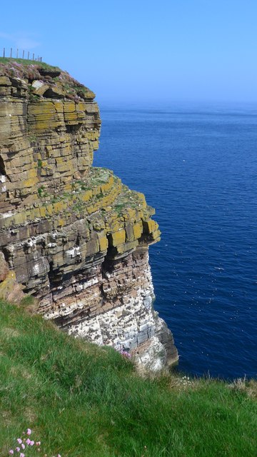
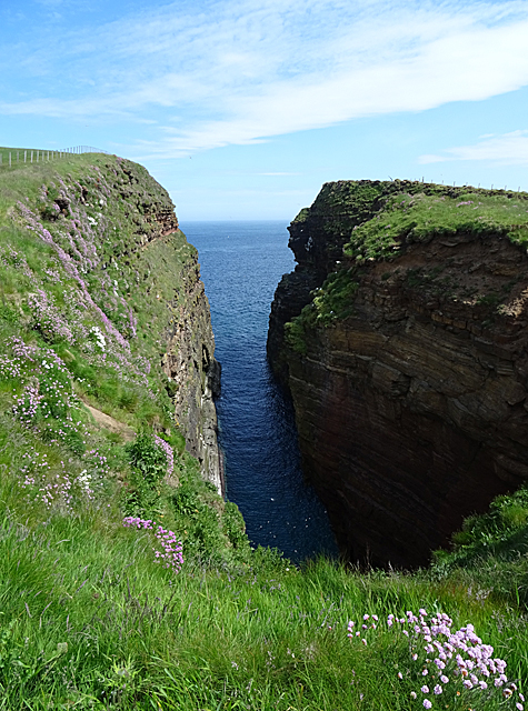
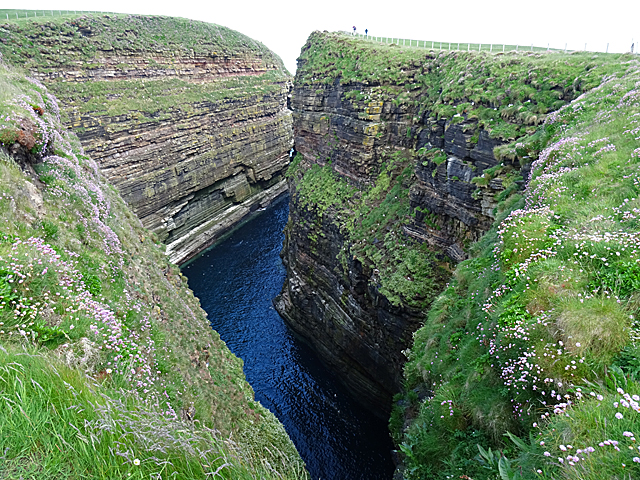
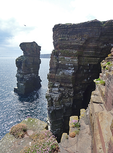
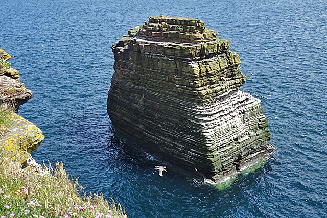
Gibb's Craig is characterized by its rugged and rocky terrain, with steep cliffs that rise dramatically from the sea. It is largely uninhabited, with no permanent residents or infrastructure. The island is covered in sparse vegetation, mainly consisting of grasses and hardy shrubs that have adapted to the harsh coastal conditions.

The island is renowned for its significant bird populations, serving as an important breeding ground and sanctuary for various seabird species. Visitors to Gibb's Craig may witness the impressive sight of nesting colonies, including puffins, guillemots, razorbills, and fulmars. The surrounding waters are also teeming with marine life, attracting seals, dolphins, and occasionally even whales.

Due to its remote location and challenging access, Gibb's Craig is not open to the general public. However, it is occasionally visited by wildlife enthusiasts, ornithologists, and researchers interested in studying the unique ecosystem and avian populations.

In summary, Gibb's Craig is a small, uninhabited island off the coast of Caithness, Scotland. It is known for its rugged terrain, diverse bird populations, and rich marine life.

If you have any feedback on the listing, please let us know in the comments section below.

Gibb's Craig Images

Images are sourced within 2km of 58.638402/-3.0261445 or Grid Reference ND4072. Thanks to Geograph Open Source API. All images are credited.

Duncansby Head from the air
Duncansby Stacks These impressive sea stacks are just south of Duncansby Head in the far North East of Scotland.
Duncansby Stacks
These impressive sea stacks are just south of Duncansby Head in the far North East of Scotland.
Dunscaby Head Duncansby Head is the most north-easterly part of the Scottish mainland. The headland juts into the North Sea, with the Pentland Firth to its north and west and the Moray Firth to its south. The Dunscaby Head lighthouse stands on the tip of the headland. The lighthouse, which was built in 1924 and automated in 1997, is unusual in that its lantern tower is square rather than the more traditional round design.
Dunscaby Head
Duncansby Head is the most north-easterly part of the Scottish mainland. The headland juts into the North Sea, with the Pentland Firth to its north and west and the Moray Firth to its south. The Dunscaby Head lighthouse stands on the tip of the headland. The lighthouse, which was built in 1924 and automated in 1997, is unusual in that its lantern tower is square rather than the more traditional round design.
Trig Point at Duncansby Head Stacks of Duncansby in the background
Trig Point at Duncansby Head
Stacks of Duncansby in the background
Duncansby Head Lighthouse
Sea cliffs at Duncansby Head Orkney Isles on the horizon.
Sea cliffs at Duncansby Head
Orkney Isles on the horizon.
Geo of Sclaites, a deep cleft in the cliffs Near Duncansby Head, this cleft has been cut by the sea as the tide rushes into it compressing air in rocky gaps via waves squeezing air splitting the rock. This is aided by boulders and pebbles also eroding the cleft as they are smashed into the cliff by incoming waves.
Geo of Sclaites, a deep cleft in the cliffs
Near Duncansby Head, this cleft has been cut by the sea as the tide rushes into it compressing air in rocky gaps via waves squeezing air splitting the rock. This is aided by boulders and pebbles also eroding the cleft as they are smashed into the cliff by incoming waves.
The lighthouse at Duncansby Head Unusually for this p.art of Scotland, there is a heat-haze
The lighthouse at Duncansby Head
Unusually for this p.art of Scotland, there is a heat-haze
The geo of Sclaites
The geo of Sclaites
Thirle Door and the Stacks of Duncansby
Cliff near the Geo of Sclaites The cliffs here are alive with nesting seabirds;  on this cliff, mainly guillemots.
Cliff near the Geo of Sclaites
The cliffs here are alive with nesting seabirds; on this cliff, mainly guillemots.
Trig point at Duncansby Head The lighthouse in the distance.
Trig point at Duncansby Head
The lighthouse in the distance.
Duncansby Head Lighthouse This is a comparatively recent lighthouse, built as recently as 1924. More information is available at <span class="nowrap"><a title="https://canmore.org.uk/site/9515/duncansby-head-lighthouse" rel="nofollow ugc noopener" href="https://canmore.org.uk/site/9515/duncansby-head-lighthouse">Link</a><img style="margin-left:2px;" alt="External link" title="External link - shift click to open in new window" src="https://s1.geograph.org.uk/img/external.png" width="10" height="10"/></span> and <span class="nowrap"><a title="https://www.nlb.org.uk/LighthouseLibrary/Lighthouse/Duncansby-Head/" rel="nofollow ugc noopener" href="https://www.nlb.org.uk/LighthouseLibrary/Lighthouse/Duncansby-Head/">Link</a><img style="margin-left:2px;" alt="External link" title="External link - shift click to open in new window" src="https://s1.geograph.org.uk/img/external.png" width="10" height="10"/></span>.
Duncansby Head Lighthouse
This is a comparatively recent lighthouse, built as recently as 1924. More information is available at LinkExternal link and LinkExternal link.
Geo of Sclaites This is one of many deep clefts in the cliffs, each one the site of a collapsed sea cave.
Geo of Sclaites
This is one of many deep clefts in the cliffs, each one the site of a collapsed sea cave.
Geo of Sclaites The head of this geo forks. There is a sea cave below the landward end of this branch.
Geo of Sclaites
The head of this geo forks. There is a sea cave below the landward end of this branch.
Stacks of Duncansby The nearer of the prominent twin sea stacks is in this square, as is the natural arch of Thirle Door on the right.
Stacks of Duncansby
The nearer of the prominent twin sea stacks is in this square, as is the natural arch of Thirle Door on the right.
Gibb's Craig Gibb's Craig is the sea stack, and the cliff beside it is Queenie Cliff. The nesting seabirds are mostly auks and fulmars.
Gibb's Craig
Gibb's Craig is the sea stack, and the cliff beside it is Queenie Cliff. The nesting seabirds are mostly auks and fulmars.
The Knee The sandstone ledges of this sea stack provide nesting sites for seabirds including fulmars and auks.
The Knee
The sandstone ledges of this sea stack provide nesting sites for seabirds including fulmars and auks.
Show me another place!

Gibb's Craig is located at Grid Ref: ND4072 (Lat: 58.638402, Lng: -3.0261445)

Unitary Authority: Highland

Police Authority: Highlands and Islands

What 3 Words

///kilowatt.crafts.lifeguard. Near John o' Groats, Highland

Related Wikis

Duncansby Head

Duncansby Head (Scottish Gaelic: Ceann Dhunngain or Dùn Gasbaith) is the most northeasterly part of both the Scottish and British mainlands, slightly...

John o' Groats

John o' Groats (Scottish Gaelic: Taigh Iain Ghròta) is a village 2.5 mi (4 km) northeast of Canisbay, Caithness, in the far north of Scotland. John o'...

Huna, Caithness

Huna is a small remote crofting township, located 1 mile northeast of Canisbay and 1.5 miles west of John o' Groats in Caithness, in Scotland. It is currently...

Huna House

Huna House is a Victorian building located in the small village of Huna in Canisbay, north of Caithness. Built in 1870 as the Huna Hotel, it is listed...

Nearby Amenities

Located within 500m of 58.638402,-3.0261445
Source: PGS
Lat/Long: 58.6356597/-3.0324456
Source: PGS
Lat/Long: 58.6364449/-3.033166
Source: PGS
Lat/Long: 58.6367047/-3.0330685
Source: PGS
Lat/Long: 58.6369798/-3.0328652
Source: PGS
Lat/Long: 58.6373575/-3.0325534
Source: PGS
Lat/Long: 58.6377772/-3.0319556
Source: PGS
Lat/Long: 58.6379896/-3.0314898
Source: PGS
Lat/Long: 58.6383549/-3.0308877
Source: PGS
Lat/Long: 58.6385177/-3.0303577
Source: PGS
Lat/Long: 58.6386154/-3.0299174
Source: PGS
Lat/Long: 58.638751/-3.0295069
Source: PGS
Lat/Long: 58.6382048/-3.0271615
Source: PGS
Lat/Long: 58.6385686/-3.0267081
Source: PGS
Lat/Long: 58.6390618/-3.0259117
Source: PGS
Lat/Long: 58.6393148/-3.0254396
Source: PGS
Lat/Long: 58.6394463/-3.0248544
Source: PGS
Lat/Long: 58.639729/-3.0244814
Source: PGS
Lat/Long: 58.6405213/-3.0243646
Source: PGS
Lat/Long: 58.6410886/-3.0241735
Source: PGS
Lat/Long: 58.6420051/-3.0243082
Source: PGS
Lat/Long: 58.6421397/-3.0247002
Source: PGS
Lat/Long: 58.6363474/-3.0331397
Direction: E
Tourism: viewpoint
Lat/Long: 58.6408705/-3.0273627
Stacks of Duncansby
Tourism: viewpoint
Lat/Long: 58.6387828/-3.0283286
Tourism: viewpoint
Lat/Long: 58.6410951/-3.0247701
The data included in this document is from www.openstreetmap.org. The data is made available under ODbL.

Have you been to Gibb's Craig?

Leave your review of Gibb's Craig below (or comments, questions and feedback).