Craigmore Rocks

Island in Fife

Scotland

Craigmore Rocks
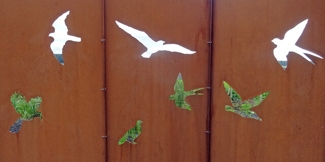
Torry Bay Bird Hide Part of an artistic bird hide on the edge of one of the ash lagoons of Torry Bay Nature Reserve near Culross in Fife.
Torry Bay Bird Hide Credit: Adam Ward

Craigmore Rocks is a small island located in the Firth of Forth, off the coast of Fife, Scotland. Also known as Craigmore Island, it is situated near the larger Isle of May and lies approximately 5 kilometers southeast of the town of Anstruther. The island is only accessible by boat and is uninhabited, making it a popular destination for wildlife enthusiasts and birdwatchers.

Covering an area of around 6 acres, Craigmore Rocks is primarily composed of rugged cliffs and rocky outcrops. The island is known for its unique geological formations, including caves and natural arches, which are a result of years of erosion by the sea. These formations provide nesting sites for various seabird species, such as puffins, guillemots, razorbills, and kittiwakes.

The island's surrounding waters are rich in marine life, attracting seals, dolphins, and porpoises. It also serves as a breeding ground for seals, with many hauling out on the rocky shores. Visitors to Craigmore Rocks can observe these marine mammals from a distance, as they bask in the sun or swim gracefully in the water.

Due to its significance as a nesting site for seabirds, Craigmore Rocks is protected as part of a designated Site of Special Scientific Interest (SSSI). The Scottish Wildlife Trust, in collaboration with other conservation organizations, works to preserve the island's fragile ecosystem and maintain its natural beauty.

In conclusion, Craigmore Rocks in Fife, Scotland, is a picturesque and ecologically important island characterized by its rugged cliffs, unique geological formations, and diverse wildlife. It provides a sanctuary for countless seabirds and marine mammals, making it a must-visit destination for nature enthusiasts.

If you have any feedback on the listing, please let us know in the comments section below.

Craigmore Rocks Images

Images are sourced within 2km of 56.042921/-3.6048083 or Grid Reference NT0084. Thanks to Geograph Open Source API. All images are credited.

Torry Bay Bird Hide Part of an artistic bird hide on the edge of one of the ash lagoons of Torry Bay Nature Reserve near Culross in Fife.
Torry Bay Bird Hide
Part of an artistic bird hide on the edge of one of the ash lagoons of Torry Bay Nature Reserve near Culross in Fife.
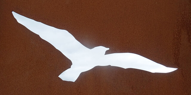
Bird Hide Detail Well this bird is not hiding very well! - One of the bird shaped openings for viewing on a bird hide at Torry Bay Nature Reserve near Culross Fife.
Bird Hide Detail
Well this bird is not hiding very well! - One of the bird shaped openings for viewing on a bird hide at Torry Bay Nature Reserve near Culross Fife.
Steps to the Forth Or, more accurately, steps to the outfall from the Valleyfield Ash lagoons. For a reciprocal view, at a lower tide, see <a href="https://www.geograph.org.uk/photo/3595342">NT0084 : Outfall Near Valleyfield Ash Lagoons Perimeter Track</a>.
Steps to the Forth
Or, more accurately, steps to the outfall from the Valleyfield Ash lagoons. For a reciprocal view, at a lower tide, see NT0084 : Outfall Near Valleyfield Ash Lagoons Perimeter Track.
The Firth of Forth from Torry Bay Looking east from the southern edge of the ash lagoons. The Queensferry Crossing and Rosyth Dockyard can just be made out on the horizon.
The Firth of Forth from Torry Bay
Looking east from the southern edge of the ash lagoons. The Queensferry Crossing and Rosyth Dockyard can just be made out on the horizon.
Perimeter fence and path at Torry Bay The southernmost extent of the ash lagoons. The distant chimney is that of Longannet Power Station, which provided the ash to fill the lagoons
Perimeter fence and path at Torry Bay
The southernmost extent of the ash lagoons. The distant chimney is that of Longannet Power Station, which provided the ash to fill the lagoons
Footpath in Torry Bay Nature Reserve Looking east along part of the circular walk around the ash lagoons that comprise the Torry Bay Nature Reserve,
Footpath in Torry Bay Nature Reserve
Looking east along part of the circular walk around the ash lagoons that comprise the Torry Bay Nature Reserve,
Preston Island at Torry Bay A high spot surrounded by ash lagoons. Looking south to a pond and willow scrub, with the Firth of Forth beyond.
Preston Island at Torry Bay
A high spot surrounded by ash lagoons. Looking south to a pond and willow scrub, with the Firth of Forth beyond.
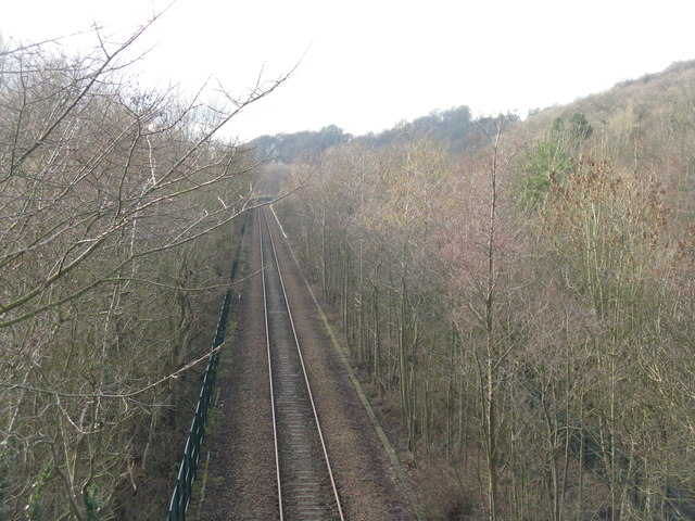
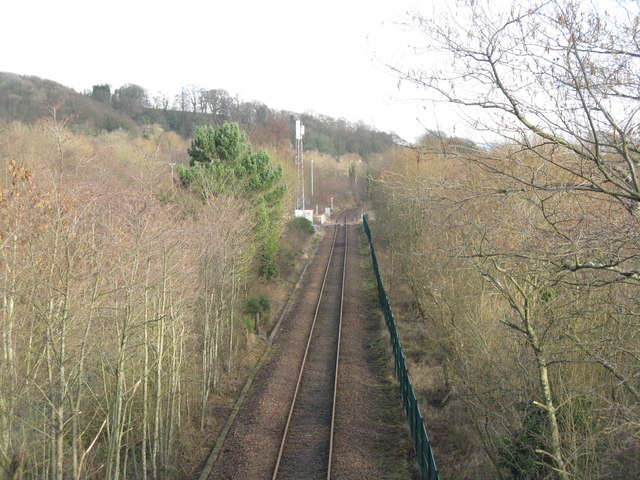
Railway at Low Valleyfield Looking east along the line that serves Longannet Power Station. For an autumn view from the same spot 6 years earlier see Richard Webb's <a href="https://www.geograph.org.uk/photo/1881034">NT0086 : Railway, Low Valleyfield</a>.
Railway at Low Valleyfield
Looking east along the line that serves Longannet Power Station. For an autumn view from the same spot 6 years earlier see Richard Webb's NT0086 : Railway, Low Valleyfield.
The railway to Longannet Looking west from the footbridge leading to the Torry Bay Nature Reserve - the path around the ash lagoons.
The railway to Longannet
Looking west from the footbridge leading to the Torry Bay Nature Reserve - the path around the ash lagoons.
Footpath and NCN sign at Valleyfield The Fife Coastal Path and NCN76 pass this way; Preston Island Circular goes round the perimeter [mostly] of the ash lagoons and Torry Bay Nature Reserve.
Footpath and NCN sign at Valleyfield
The Fife Coastal Path and NCN76 pass this way; Preston Island Circular goes round the perimeter [mostly] of the ash lagoons and Torry Bay Nature Reserve.
Torry Bay The marine part of the nature reserve. The fence is part of the ash lagoon boundary.
Torry Bay
The marine part of the nature reserve. The fence is part of the ash lagoon boundary.
Torry Pier The name on the map for the emergent rocks in Torry Bay, but I do not know if it has ever been part of such a structure.
Torry Pier
The name on the map for the emergent rocks in Torry Bay, but I do not know if it has ever been part of such a structure.
Torry Bay from near Preston Island Part of the complex of ash lagoons built up from the ash slurry from Longannet power station.
Torry Bay from near Preston Island
Part of the complex of ash lagoons built up from the ash slurry from Longannet power station.
Pan houses and Lady Pit at Preston Island Two of the salt pans, with the remains of Lady Pit beyond.
Pan houses and Lady Pit at Preston Island
Two of the salt pans, with the remains of Lady Pit beyond.
Preston Island The accommodation building and, to the right, the bonded store and George Pit.
Preston Island
The accommodation building and, to the right, the bonded store and George Pit.
George Pit at Preston Island One of the coal pits that provided fuel for the saltpans.
George Pit at Preston Island
One of the coal pits that provided fuel for the saltpans.
Preston Island salt pans The 'barracks' or accommodation building.
Preston Island salt pans
The 'barracks' or accommodation building.
Preston Island salt pans From the left, the remains of the accommodation building, George Pit and Lady Pit
Preston Island salt pans
From the left, the remains of the accommodation building, George Pit and Lady Pit
Show me another place!

Craigmore Rocks is located at Grid Ref: NT0084 (Lat: 56.042921, Lng: -3.6048083)

Unitary Authority: Fife

Police Authority: Fife

What 3 Words

///newsprint.tornado.contain. Near High Valleyfield, Fife

Nearby Locations

Craigmore Rocks Dog Rock

Related Wikis

Preston Island

Preston Island is a former artificial island in the Firth of Forth, Scotland. The reclaimed land was once used for salt production, using local coal. It...

Culross railway station

Culross railway station served the village of Culross, Fife, Scotland from 1906 to 1992 on the Kincardine Line. == History == The station opened on 2 July...

Valleyfield, Fife

Valleyfield consists of High Valleyfield and Low Valleyfield which are neighbouring villages in Fife, Scotland, midway between Dunfermline and Kincardine...

Townhill, Fife

Townhill is a small village that lies just north of Dunfermline, Fife, Scotland. The origin of the community is thought to be from the coal-mining industry...

Nearby Amenities

Located within 500m of 56.042921,-3.6048083
Bench
Lat/Long: 56.0458223/-3.6018419
Bench
Lat/Long: 56.0458407/-3.5997148
Bench
Lat/Long: 56.0458215/-3.6064543
The data included in this document is from www.openstreetmap.org. The data is made available under ODbL.

Have you been to Craigmore Rocks?

Leave your review of Craigmore Rocks below (or comments, questions and feedback).