Cerrig Bwich Glas

Island in Caernarfonshire

Wales

Cerrig Bwich Glas

Porth Dinllaen from the Lleyn Coastal Path
Porth Dinllaen from the Lleyn Coastal Path Credit: peter robinson

Cerrig Bwich Glas is a small, uninhabited island located off the coast of Caernarfonshire, Wales. Situated in the Irish Sea, it lies approximately 1.5 kilometers southwest of Porth Dinllaen, a popular seaside village. The island is part of the larger Bardsey Island group, which is a designated Special Area of Conservation due to its rich biodiversity.

Covering an area of about 5 hectares, Cerrig Bwich Glas is characterized by its rugged and rocky terrain. The island is mostly composed of slate and sandstone, with cliffs rising up to 30 meters in height on its western side. Its eastern side, however, features a more gentle slope leading down to the sea.

Due to its exposed location, Cerrig Bwich Glas experiences strong currents and is subject to the forces of the surrounding tides. Consequently, access to the island can be challenging and is generally only possible during low tide. The island is known for its diverse birdlife, providing an important breeding ground for various species including guillemots, razorbills, and puffins.

Historically, Cerrig Bwich Glas was used for grazing livestock, with evidence of old field systems still visible today. The island is also home to the ruins of a small chapel, believed to have been dedicated to St. Bwich Glas, a local saint. This adds to the cultural and historical significance of the island.

Overall, Cerrig Bwich Glas offers a unique and picturesque landscape, attracting nature enthusiasts and birdwatchers who appreciate its natural beauty and tranquility.

If you have any feedback on the listing, please let us know in the comments section below.

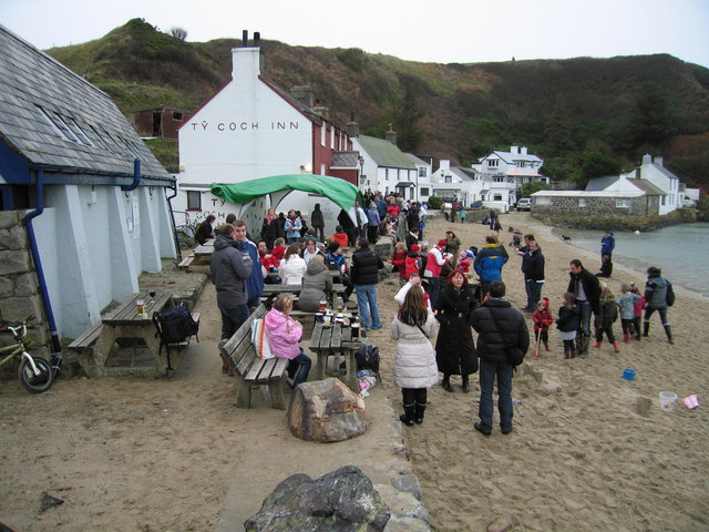
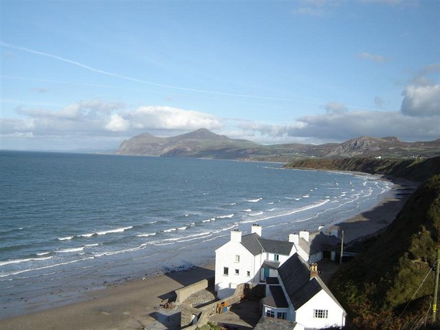
Cerrig Bwich Glas Images

Images are sourced within 2km of 52.938637/-4.5427462 or Grid Reference SH2940. Thanks to Geograph Open Source API. All images are credited.

Porth Dinllaen from the Lleyn Coastal Path
Triaglog coch / Red Valerian / Centranthus ruber
Cadwyn ar greigiau / Chain on the rocks
Cen ar y clogwyn / Lichen on the rocks The lichen may be sea ivory and yellow scales.   In the distant background, Yr Eifl rises above Nant Gwrtheyrn.
Cen ar y clogwyn / Lichen on the rocks
The lichen may be sea ivory and yellow scales. In the distant background, Yr Eifl rises above Nant Gwrtheyrn.
Cwch bychan ym Mhorth Dinllaen / A dinghy at Porth Dinllaen The cloud-topped mountain in the background is Yr Eifl.
Cwch bychan ym Mhorth Dinllaen / A dinghy at Porth Dinllaen
The cloud-topped mountain in the background is Yr Eifl.
Fishermen's huts at Porth Nefyn The small harbour at Porth Nefyn is used mainly by local fishermen. A number of huts in various colours and styles line the foreshore.
Fishermen's huts at Porth Nefyn
The small harbour at Porth Nefyn is used mainly by local fishermen. A number of huts in various colours and styles line the foreshore.
Fisherman's hut at Porth Nefyn One of a number of huts that line the foreshore behind the harbour.
Fisherman's hut at Porth Nefyn
One of a number of huts that line the foreshore behind the harbour.
Porth Nefyn harbour The small harbour at Porth Nefyn is used mainly by small fishing vessels.
Porth Nefyn harbour
The small harbour at Porth Nefyn is used mainly by small fishing vessels.
New year's eve at Ty Coch Inn Porth Dinllaen The New Year celebrations started early here, this was lunch time!
New year's eve at Ty Coch Inn Porth Dinllaen
The New Year celebrations started early here, this was lunch time!
Caffi Porth Dinllaen Cafe opposite the entrance of the National Trust car park for Porth Dinllaen.
Caffi Porth Dinllaen
Cafe opposite the entrance of the National Trust car park for Porth Dinllaen.
Field of sheep at Morfa Nefyn Taken from near the NLI House, looking across the field to the National Trust car park, the waters of Porth Dinllaen and, in the distance the peak of Yr Eifl.
Field of sheep at Morfa Nefyn
Taken from near the NLI House, looking across the field to the National Trust car park, the waters of Porth Dinllaen and, in the distance the peak of Yr Eifl.
Lifeboat station, Porth Dinllaen The station and old jetty beyond.
Lifeboat station, Porth Dinllaen
The station and old jetty beyond.
Northern tip of Trwyn Porthdinllaen Looking across the tip of the peninsula, more or less north west.
Northern tip of Trwyn Porthdinllaen
Looking across the tip of the peninsula, more or less north west.
Above Morfa Nefyn beach The view seen in <a href="https://www.geograph.org.uk/photo/1427465">SH2840 : Morfa Nefyn beach facing Yr Eifl</a>; today the mountain, Yr Eifl,and neighbouring hills    are glimpsed through the morning mist.
Above Morfa Nefyn beach
The view seen in SH2840 : Morfa Nefyn beach facing Yr Eifl; today the mountain, Yr Eifl,and neighbouring hills are glimpsed through the morning mist.
Hazy sunshine on Morfa Nefyn beach A view also seen in <a href="https://www.geograph.org.uk/photo/79216">SH2840 : Beach at Morfa Nefyn</a>.
Hazy sunshine on Morfa Nefyn beach
A view also seen in SH2840 : Beach at Morfa Nefyn.
Walkers on Morfa Nefyn Beach The hills across the bay, which lie to the north east of Nefyn, are still faintly seen in the morning haze.
Walkers on Morfa Nefyn Beach
The hills across the bay, which lie to the north east of Nefyn, are still faintly seen in the morning haze.
Rock pool explorer Near Porth Dinllaen, Morfa Nefyn.Nothing much to be seen in the pool.
Rock pool explorer
Near Porth Dinllaen, Morfa Nefyn.Nothing much to be seen in the pool.
Porth Dinllaen On the Llyn Coast Path.
Porth Dinllaen
On the Llyn Coast Path.
Show me another place!

Cerrig Bwich Glas is located at Grid Ref: SH2940 (Lat: 52.938637, Lng: -4.5427462)

Unitary Authority: Gwynedd

Police Authority: North Wales

What 3 Words

///restored.barrel.parked. Near Nefyn, Gwynedd

Related Wikis

Morfa Nefyn

Morfa Nefyn is a village on the northern coast of the Llŷn Peninsula in Gwynedd, Wales. It lies on the crossroads of the B4417 and B4412. The village has...

Nefyn

Nefyn (Welsh pronunciation: [ˈnɛvɨn], archaically anglicised as Nevin) is both a small town and a community on the northwest coast of the Llŷn Peninsula...

Porthdinllaen Lifeboat Station

Porthdinllaen Lifeboat Station (Welsh Gorsaf Bad Achub Porthdinllaen) is a Royal National Lifeboat Institution (RNLI) operated lifeboat station in the...

Porthdinllaen

Porthdinllaen (in English sometimes Porth Dinllaen) is a small coastal village on the Llŷn Peninsula in the Dwyfor area of Gwynedd, Wales, built on a small...

Edern, Gwynedd

Edern, formerly known as Edeyrn, is a village and until 1939 a civil parish, in the Welsh county of Gwynedd. It is about 1 km southwest of the larger village...

Garn Boduan

Garn Boduan is an Iron Age hillfort and hill near Nefyn, on the Llŷn Peninsula in Wales. In a survey in the 1950s the traces of over 170 round houses were...

Ceidio

Ceidio is a former civil parish in the Welsh county of Gwynedd. It was abolished in 1934, and incorporated into Buan. == References ==

Llandudwen

Llandudwen is a former civil parish in the Welsh county of Gwynedd. It was abolished in 1934, and divided between Buan and Tudweiliog. == References ==

Nearby Amenities

Located within 500m of 52.938637,-4.5427462
Source: PGS
Lat/Long: 52.9374556/-4.5356393
Source: PGS
Lat/Long: 52.9381942/-4.5370012
Source: PGS
Lat/Long: 52.9402385/-4.5361921
Source: PGS
Lat/Long: 52.9413315/-4.5373564
Source: PGS
Lat/Long: 52.9407403/-4.5382059
Source: PGS
Lat/Long: 52.940047/-4.5390184
Source: PGS
Lat/Long: 52.9396339/-4.5393418
Source: PGS
Lat/Long: 52.9392589/-4.5395197
Source: PGS
Lat/Long: 52.9388819/-4.5403748
Created By: dmgroom_coastlines
Source: PGS
Lat/Long: 52.93836/-4.541272
Created By: dmgroom_coastlines
Source: PGS
Lat/Long: 52.938222/-4.542116
Note: steps up and down doubled
Lat/Long: 52.9369858/-4.5359588
Source: PGS
Lat/Long: 52.9376884/-4.5357207
Source: PGS
Lat/Long: 52.9381909/-4.5367852
Barrier: kissing_gate
Lat/Long: 52.9378397/-4.541376
Barrier: block
Lat/Long: 52.9383152/-4.5380788
Barrier: kissing_gate
Lat/Long: 52.9373319/-4.5374512
Line Attachment: pin
Power: pole
Lat/Long: 52.9361396/-4.5431938
Line Attachment: anchor
Power: pole
Transformer: distribution
Lat/Long: 52.9368762/-4.5431413
Bench
Backrest: yes
Material: wood
Seats: 3
Lat/Long: 52.9383604/-4.5406192
Line Attachment: pin
Power: pole
Lat/Long: 52.9354276/-4.5431939
Bench
Backrest: yes
Material: wood
Seats: 3
Lat/Long: 52.9370071/-4.5360882
Bench
Backrest: yes
Material: wood
Seats: 3
Lat/Long: 52.9400099/-4.5372612
Man Made: utility_pole
Lat/Long: 52.9368645/-4.5432478
Bench
Backrest: yes
Material: wood
Seats: 3
Lat/Long: 52.9393713/-4.5383007
Man Made: utility_pole
Lat/Long: 52.9365325/-4.5422444
Man Made: utility_pole
Lat/Long: 52.9367607/-4.5425135
Bench
Backrest: yes
Colour: green
Material: wood
Seats: 4
Lat/Long: 52.9404295/-4.5372478
Bench
Backrest: yes
Material: wood
Seats: 3
Lat/Long: 52.9405262/-4.5372571
Bench
Backrest: yes
Material: wood
Seats: 3
Lat/Long: 52.9397232/-4.5380243
Bench
Backrest: yes
Material: wood
Seats: 3
Lat/Long: 52.938917/-4.5390082
Bench
Backrest: yes
Material: wood
Seats: 3
Lat/Long: 52.9373541/-4.5367036
Man Made: utility_pole
Lat/Long: 52.9367142/-4.5388019
Power: pole
Lat/Long: 52.9360498/-4.538708
Power: pole
Lat/Long: 52.9354759/-4.5417175
Power: pole
Lat/Long: 52.9358234/-4.5396173
Man Made: utility_pole
Lat/Long: 52.9383671/-4.5395181
Man Made: utility_pole
Lat/Long: 52.9376768/-4.5373428
Man Made: utility_pole
Lat/Long: 52.9379048/-4.5378189
Man Made: utility_pole
Lat/Long: 52.9382766/-4.5390071
Man Made: utility_pole
Lat/Long: 52.9382111/-4.5388757
Man Made: utility_pole
Lat/Long: 52.9380454/-4.5382883
Man Made: utility_pole
Lat/Long: 52.9376857/-4.5390943
Man Made: utility_pole
Lat/Long: 52.9370908/-4.5387335
Man Made: utility_pole
Lat/Long: 52.9368104/-4.537611
Man Made: utility_pole
Lat/Long: 52.9364103/-4.5372623
Power: pole
Lat/Long: 52.9363795/-4.5372301
Line Attachment: pin
Power: pole
Lat/Long: 52.9342456/-4.5442763
Line Attachment: pin
Power: pole
Lat/Long: 52.9350507/-4.5439357
Man Made: utility_pole
Lat/Long: 52.9362357/-4.5386973
Man Made: utility_pole
Lat/Long: 52.9358364/-4.5386598
Man Made: utility_pole
Lat/Long: 52.9354322/-4.5394805
Man Made: utility_pole
Lat/Long: 52.9349731/-4.5408163
Man Made: utility_pole
Lat/Long: 52.9349521/-4.5402691
Man Made: utility_pole
Lat/Long: 52.9369906/-4.5438337
Bench
Backrest: yes
Material: wood
Seats: 3
Lat/Long: 52.9398348/-4.537324
Bench
Backrest: yes
Material: wood
Seats: 3
Lat/Long: 52.9400838/-4.5377894
Bench
Backrest: yes
Material: wood
Seats: 3
Lat/Long: 52.9395414/-4.5374018
Note: steps up and down doubled
Lat/Long: 52.9370128/-4.5359568
Barrier: kissing_gate
Lat/Long: 52.9369457/-4.535944
The data included in this document is from www.openstreetmap.org. The data is made available under ODbL.

Have you been to Cerrig Bwich Glas?

Leave your review of Cerrig Bwich Glas below (or comments, questions and feedback).