High Rock

Island in Ayrshire

Scotland

High Rock

Ardrossan Castle Construction of the castle as we know it began in the 13th century. However little is known of any buildings at the site before the Lands of Ardrossan were gifted to Richard de Barclay by the local feudal lords of the de Morvilles in the 12th century.
The lands passed into the hands of the Eglinton family following the death of the last Barclay Baron of Ardrossan without heirs.
Thereafter it transferred to John de Montgomerie through his marriage to Elizabeth, daughter of Sir Hugh Eglinton sometime after 1736.
The Montgomeries were responsible for a huge programme of reconstruction at Ardrossan Castle, which carried on well into the 15th century. It was the chief seat of the family until the time of Alexander, the first Lord Montgomery, who made Eglinton his principal residence.
Ardrossan remained a stronghold until it was finally destroyed in the 17th century, allegedly at the hands of Oliver Cromwell.
Ardrossan Castle Credit: Raibeart MacAoidh

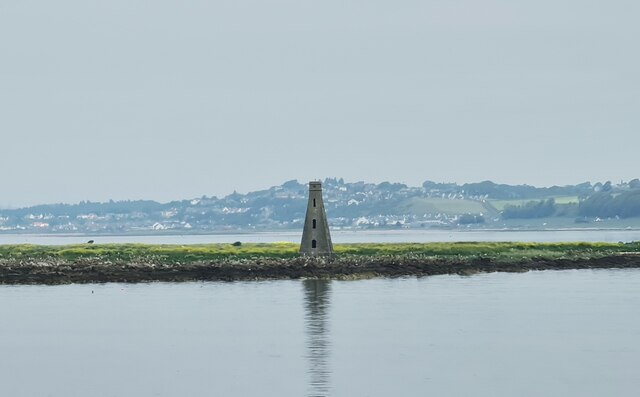
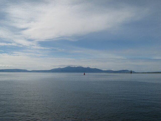
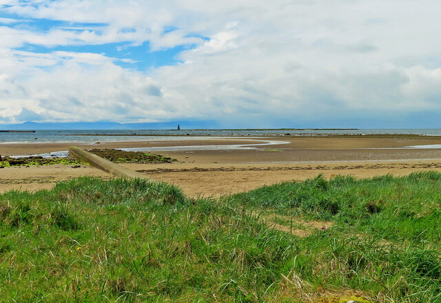
High Rock is a small island located off the coast of Ayrshire, Scotland. It is situated in the Firth of Clyde, approximately 3 miles southwest of the mainland. The island covers an area of around 10 acres and has a maximum elevation of 65 feet above sea level.

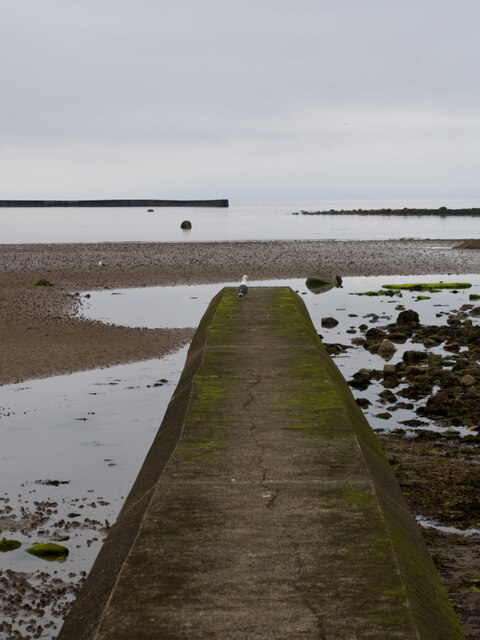
This uninhabited island is known for its rugged and rocky terrain, with steep cliffs and a jagged coastline. The vegetation on High Rock mainly consists of grasses, mosses, and hardy shrubs, as the harsh weather conditions make it difficult for larger plants to thrive. Seabirds, such as gulls, puffins, and cormorants, are abundant on the island, using its cliffs for nesting.

Access to High Rock is limited, as it is not served by regular ferry services. The island can, however, be reached by private boat or chartered tours. It is a popular destination for birdwatchers, nature enthusiasts, and photographers, who are drawn to its scenic beauty and diverse wildlife.

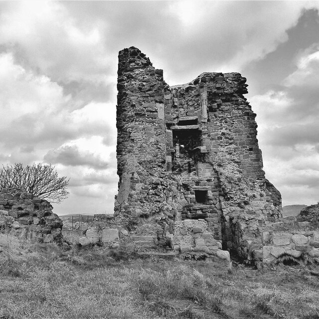
High Rock has historical significance as well. It is believed to have been used as a lookout point during various conflicts, including World War II. The remnants of old military structures, including a watchtower, can still be seen on the island.

Overall, High Rock offers visitors a unique opportunity to experience a remote and untouched natural environment, with stunning views and abundant wildlife.

If you have any feedback on the listing, please let us know in the comments section below.

High Rock Images

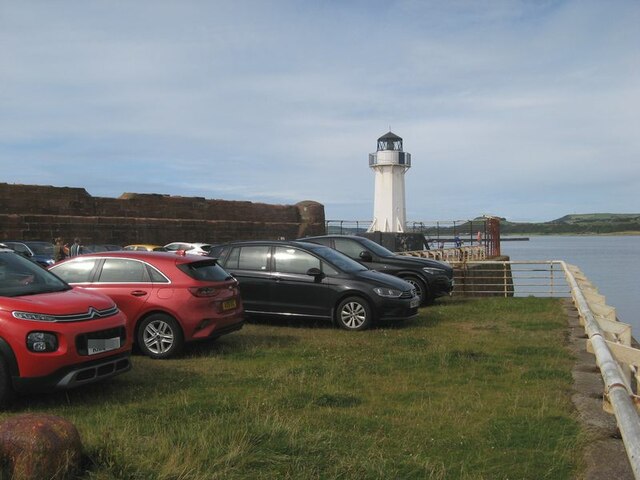
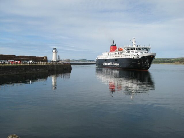
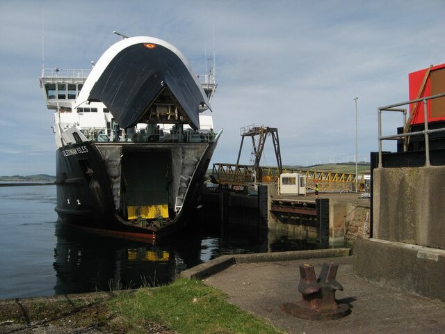
Images are sourced within 2km of 55.646005/-4.8376856 or Grid Reference NS2142. Thanks to Geograph Open Source API. All images are credited.

Ardrossan Castle Construction of the castle as we know it began in the 13th century. However little is known of any buildings at the site before the Lands of Ardrossan were gifted to Richard de Barclay by the local feudal lords of the de Morvilles in the 12th century.
The lands passed into the hands of the Eglinton family following the death of the last Barclay Baron of Ardrossan without heirs.
Thereafter it transferred to John de Montgomerie through his marriage to Elizabeth, daughter of Sir Hugh Eglinton sometime after 1736.
The Montgomeries were responsible for a huge programme of reconstruction at Ardrossan Castle, which carried on well into the 15th century. It was the chief seat of the family until the time of Alexander, the first Lord Montgomery, who made Eglinton his principal residence.
Ardrossan remained a stronghold until it was finally destroyed in the 17th century, allegedly at the hands of Oliver Cromwell.
Ardrossan Castle
Construction of the castle as we know it began in the 13th century. However little is known of any buildings at the site before the Lands of Ardrossan were gifted to Richard de Barclay by the local feudal lords of the de Morvilles in the 12th century. The lands passed into the hands of the Eglinton family following the death of the last Barclay Baron of Ardrossan without heirs. Thereafter it transferred to John de Montgomerie through his marriage to Elizabeth, daughter of Sir Hugh Eglinton sometime after 1736. The Montgomeries were responsible for a huge programme of reconstruction at Ardrossan Castle, which carried on well into the 15th century. It was the chief seat of the family until the time of Alexander, the first Lord Montgomery, who made Eglinton his principal residence. Ardrossan remained a stronghold until it was finally destroyed in the 17th century, allegedly at the hands of Oliver Cromwell.
All that remains of Montfode Castle See also <a title="https://www.geograph.org.uk/photo/5969420" href="https://www.geograph.org.uk/photo/5969420">Link</a>
All that remains of Montfode Castle
See also Link
Boydstone Shore The Firth of Clyde to the left and the busy A78 to the right.  This pavement is here part of the Ayrshire Coastal Path - and well walked.
Boydstone Shore
The Firth of Clyde to the left and the busy A78 to the right. This pavement is here part of the Ayrshire Coastal Path - and well walked.
Boat yard
Boat yard
Harbour entrance
Harbour entrance
Seagull on Outflow
Seagull on Outflow
Entrance for Arran Ferry at Ardrossan
Caledonian MacBrayne's Ardossan terminal
Beacon on Horse Isle
Lighthouse and long-stay parking A view of the harbour wall and parking area. The condition of the sea wall is a matter of concern, and is expected to form part of the works on upgrading the harbour facilities in readiness for the new vessel.
Lighthouse and long-stay parking
A view of the harbour wall and parking area. The condition of the sea wall is a matter of concern, and is expected to form part of the works on upgrading the harbour facilities in readiness for the new vessel.
Vehicle lanes and ferry terminal building Ferry facilities at Ardrossan harbour. This area is expected to be re-modelled for extra capacity and speed of loading when the new ferry takes up the service.
Vehicle lanes and ferry terminal building
Ferry facilities at Ardrossan harbour. This area is expected to be re-modelled for extra capacity and speed of loading when the new ferry takes up the service.
MV Caledonian Isles The ferry from Brodick on Arran enters the harbour at Ardrossan.
MV Caledonian Isles
The ferry from Brodick on Arran enters the harbour at Ardrossan.
MV Caledonian Isles docking The ferry on approach to the linkspan with bow-visor raised.
MV Caledonian Isles docking
The ferry on approach to the linkspan with bow-visor raised.
Arran view An atmospheric, afternoon view of Arran from the harbour lighthouse. Navigation markers and the Horse Isle Shelves can be seen near to the shore.
Arran view
An atmospheric, afternoon view of Arran from the harbour lighthouse. Navigation markers and the Horse Isle Shelves can be seen near to the shore.
Old milestone On North Bay on Montgomerie Road near the junction of Caledonia Road is this very eroded toll road milestone.   Until 2008 it was sited at the Shell Bridge.   After roadworks it was reset at its current position.   This right-hand face has a very eroded Largs 11/Greenock 25 although the bench mark is clear.   The left face has Irvine/9½/Kilwinning/5½/Saltcoats/2.
Old milestone
On North Bay on Montgomerie Road near the junction of Caledonia Road is this very eroded toll road milestone. Until 2008 it was sited at the Shell Bridge. After roadworks it was reset at its current position. This right-hand face has a very eroded Largs 11/Greenock 25 although the bench mark is clear. The left face has Irvine/9½/Kilwinning/5½/Saltcoats/2.
North Crescent Road Shoreline bungalows on the outskirts of Ardrossan.
North Crescent Road
Shoreline bungalows on the outskirts of Ardrossan.
Towards Horse Island Looking out across Ardrossan's North Bay towards Horse Isle and its Martello Tower.
Towards Horse Island
Looking out across Ardrossan's North Bay towards Horse Isle and its Martello Tower.
Pipe outflow, North Bay, Ardrossan
Show me another place!

High Rock is located at Grid Ref: NS2142 (Lat: 55.646005, Lng: -4.8376856)

Unitary Authority: North Ayrshire

Police Authority: Ayrshire

What 3 Words

///skill.pictured.consonant. Near Ardrossan, North Ayrshire

Related Wikis

Horse Isle

Horse Isle (Scottish Gaelic: Eilean nan Each) is an uninhabited island located in the Firth of Clyde, Scotland near the seaside town of Ardrossan. It is...

Ardrossan Winton Pier railway station

Ardrossan Winton Pier railway station served the town of Ardrossan and its harbour, North Ayrshire, Scotland. The station allowed train passengers to link...

Ardrossan Montgomerie Pier railway station

Ardrossan Montgomerie Pier railway station was a railway station serving the town of Ardrossan, North Ayrshire, Scotland as part of the Lanarkshire and...

Ardrossan Harbour railway station

Ardrossan Harbour railway station is one of three remaining railway stations in the town of Ardrossan, North Ayrshire, Scotland. The station is managed...

Ardrossan North railway station

Ardrossan North railway station was a railway station serving the town of Ardrossan, North Ayrshire, Scotland as part of the Lanarkshire and Ayrshire Railway...

Ardrossan Civic Centre

Ardrossan Civic Centre is a municipal building in Glasgow Street, Ardrossan, North Ayrshire, Scotland. The building, which is largely used as a community...
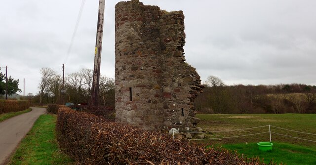
Montfode Castle

The remains of the old castle of Montfode or Monfode lie to the north-west of the town of Ardrossan and 1.5 miles (2.4 km) south-west of West Kilbride...

Ardrossan Town railway station

Ardrossan Town railway station is one of three remaining in the town of Ardrossan, North Ayrshire, Scotland. It is one of the oldest operational railway...

Have you been to High Rock?

Leave your review of High Rock below (or comments, questions and feedback).