Lyng

Settlement in Norfolk Breckland

England

Lyng

Collin Green Farm Vernacular farm buildings at Collin Green Farm
Collin Green Farm Credit: P Gaskell

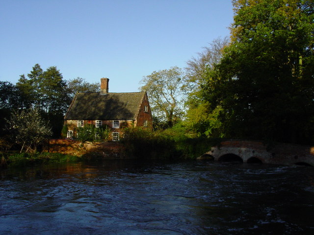
Lyng is a small village located in the county of Norfolk, England. Situated approximately 14 miles northwest of the city of Norwich, Lyng is nestled in the picturesque Wensum Valley, offering stunning countryside views and a tranquil atmosphere. The village is part of the Broadland district and falls within the parliamentary constituency of Broadland.

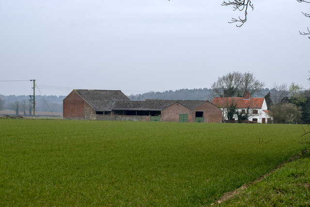
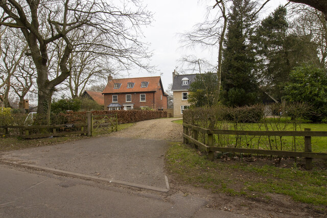
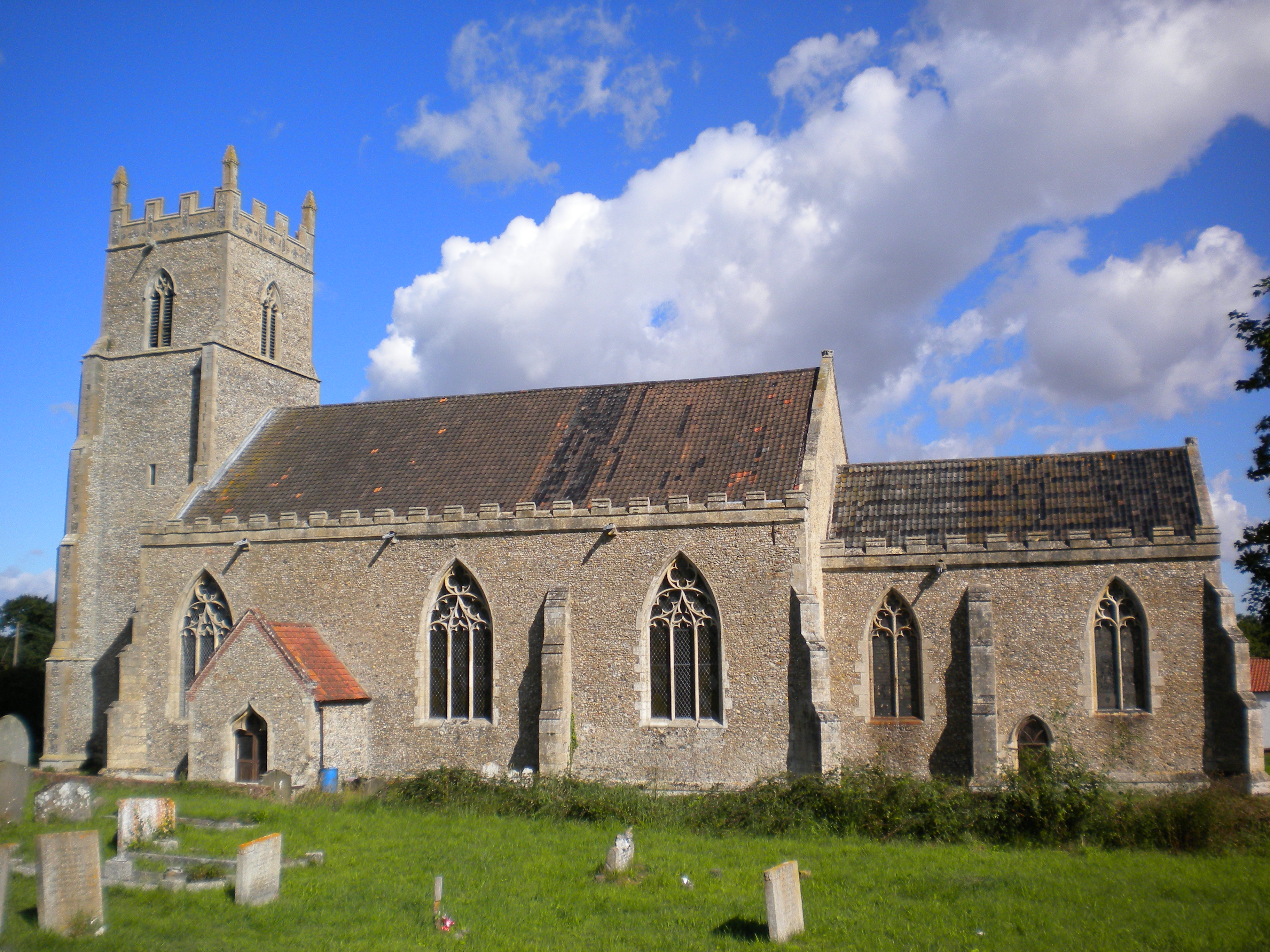
Lyng has a rich history that dates back centuries, with evidence of settlement in the area since the Roman times. The village is known for its charming thatched cottages and traditional architecture, giving it a timeless appeal. It is also renowned for its beautiful church, St. Margaret's, which serves as a focal point for the community.

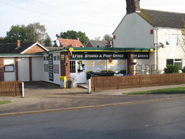
Despite its small size, Lyng offers a range of amenities and services for its residents. The village has a primary school, providing education to local children, and a village hall that acts as a hub for social gatherings and events. There is a local pub, The Fox, which serves as a meeting place for locals and visitors alike.

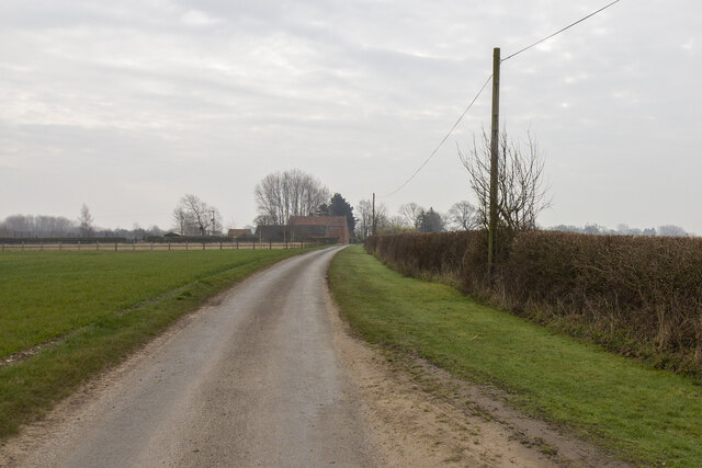
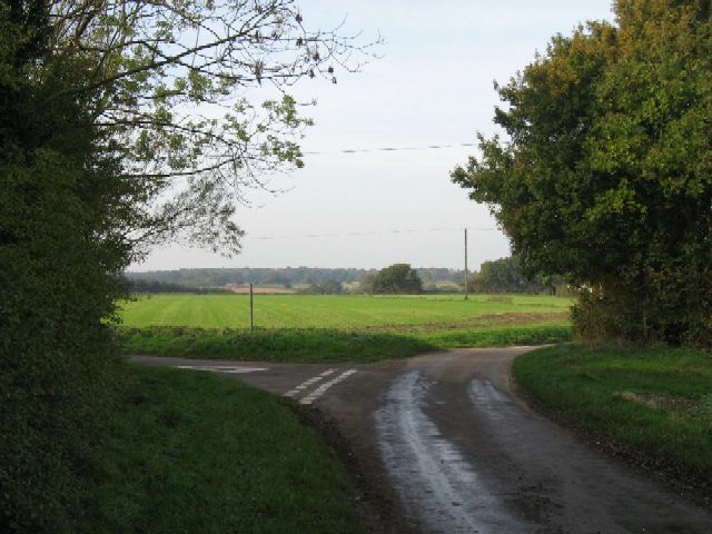
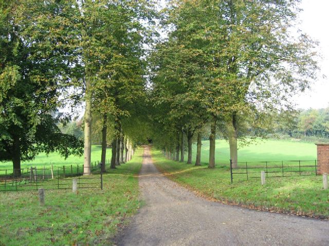
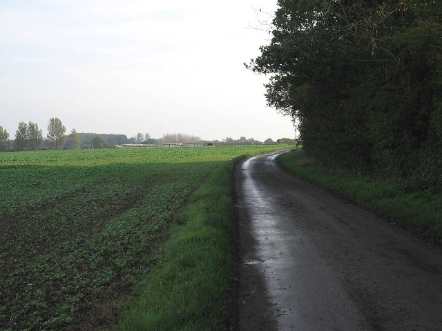
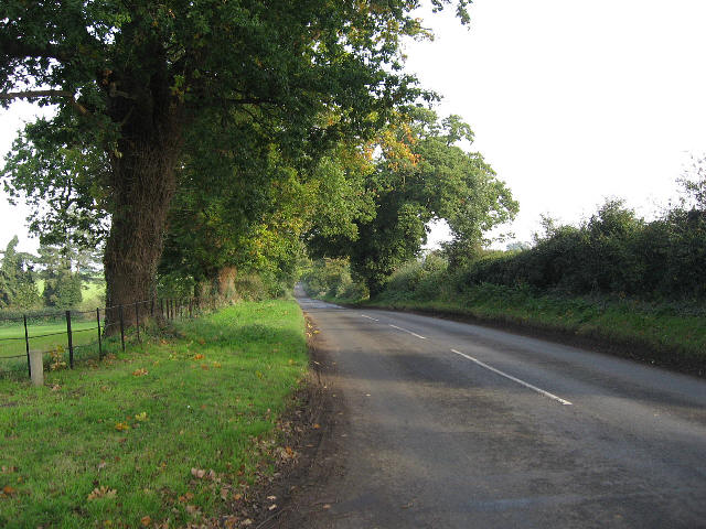
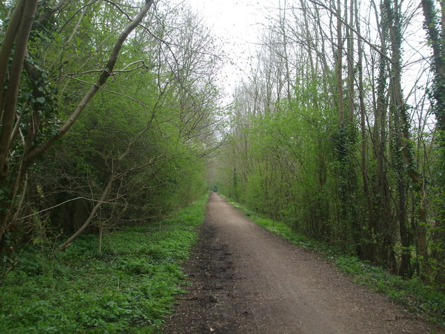
Lyng is surrounded by stunning natural landscapes, making it an ideal location for outdoor enthusiasts. The nearby Wensum River and surrounding countryside offer opportunities for fishing, walking, and exploring nature. The village is also close to the popular Pensthorpe Natural Park, which features diverse wildlife and beautiful gardens.

Overall, Lyng is a charming and idyllic village that offers a peaceful retreat from the hustle and bustle of city life. Its rich history, beautiful scenery, and sense of community make it a delightful place to visit or call home.

If you have any feedback on the listing, please let us know in the comments section below.

Lyng Images

Images are sourced within 2km of 52.718021/1.061501 or Grid Reference TG0617. Thanks to Geograph Open Source API. All images are credited.

Collin Green Farm Vernacular farm buildings at Collin Green Farm
Collin Green Farm
Vernacular farm buildings at Collin Green Farm
Bakers Farm Converted vernacular farm buildings at Bakers Farm
Bakers Farm
Converted vernacular farm buildings at Bakers Farm
Low Farm Vernacular farm buildings at Low Farm
Low Farm
Vernacular farm buildings at Low Farm
Three Bridges Farm Entrance to Three Bridges Farm
Three Bridges Farm
Entrance to Three Bridges Farm
Houses in Lyng Houses off Elsing Road
Houses in Lyng
Houses off Elsing Road
Lyng: Primrose Green
Lyng: Cereal crop
Lyng: Cereal crop
The River Wensum at Lyng The River Wensum runs through a mill race here at Lyng.
The River Wensum at Lyng
The River Wensum runs through a mill race here at Lyng.
Lyng Stores And Post Office Seemingly a thriving business when compared with some Post Offices in nearby villages.
Lyng Stores And Post Office
Seemingly a thriving business when compared with some Post Offices in nearby villages.
A Turning For Lyng On the road between Collin Green Farm and Primrose Green.
A Turning For Lyng
On the road between Collin Green Farm and Primrose Green.
The  Driveway To Sparham Hall Between Lyng and Sparham.
The Driveway To Sparham Hall
Between Lyng and Sparham.
They Won't Fit In The Barn Straw bales and a barn close to Easthaugh.
They Won't Fit In The Barn
Straw bales and a barn close to Easthaugh.
The Road To Elsing From Lyng.
The Road To Elsing
From Lyng.
Lives Up To Its Name Low Farm, on the road between Lyng and Whitford Bridge.
Lives Up To Its Name
Low Farm, on the road between Lyng and Whitford Bridge.
Broadland Fuels At Lyng garage.
Broadland Fuels
At Lyng garage.
The Road To Hockering From Lyng.
The Road To Hockering
From Lyng.
A View To A White House Just outside Lyng.
A View To A White House
Just outside Lyng.
The Road To Sparham From Pockthorpe.
The Road To Sparham
From Pockthorpe.
Show me another place!

Lyng is located at Grid Ref: TG0617 (Lat: 52.718021, Lng: 1.061501)

Administrative County: Norfolk

District: Breckland

Police Authority: Norfolk

What 3 Words

///broadcast.cuddled.wacky. Near Reepham, Norfolk

Related Wikis

Lyng, Norfolk

Lyng is a village and civil parish in the English county of Norfolk. It is situated on the River Wensum, some 10 km (6.2 mi) north-east of the town of...

Sparham Pools

Sparham Pools is a 12.2-hectare (30-acre) nature reserve south of Sparham in Norfolk. It is leased and managed by the Norfolk Wildlife Trust.These former...

A1067 road

The A1067 is an English A road entirely in the county of Norfolk. It runs from Fakenham Northern By-Pass (A148) to Norwich inner ring road (A147). �...

Sparham

Sparham is a village and civil parish in Norfolk, England. It covers an area of 7.22 km2 (2.79 sq mi) and had a population of 291 in 109 households at...

St Mary's Church, Elsing

St Mary's is an Anglican parish church in Elsing, a small village and civil parish in the Breckland district of Norfolk, England. The 14th-century church...

Elsing

Elsing is a village and civil parish in the English county of Norfolk. The village is located 4.2 miles (6.8 km) north-east of Dereham and 12 miles (19...

Whitwell Common SSSI

Whitwell Common is a 19.4-hectare (48-acre) biological Site of Special Scientific Interest north-east of Dereham in Norfolk.This common in the valley...

Lenwade

Lenwade is a village in the civil parish of Great Witchingham, Norfolk, situated in the Wensum Valley adjacent to the A1067 road 14 miles (23 km) south...

Nearby Amenities

Located within 500m of 52.718021,1.061501
Lyng
Is In: Norfolk
Place: village
Lat/Long: 52.7201272/1.0601189
Turning Circle
Lat/Long: 52.7181663/1.0573919
Port Row, adj
Naptan AtcoCode: 2900L141
Naptan Bearing: SE
Naptan BusStopType: CUS
Naptan CommonName: Port Row
Naptan Indicator: adj
Naptan Locality: Lyng
Naptan NaptanCode: nfodgagt
Naptan ShortCommonName: The Street
Naptan Street: The Street
Naptan Verified: no
Source: naptan_import
Lat/Long: 52.7194939/1.0597285
Port Row, opp
Naptan AtcoCode: 2900L142
Naptan Bearing: NW
Naptan BusStopType: CUS
Naptan CommonName: Port Row
Naptan Indicator: opp
Naptan Locality: Lyng
Naptan NaptanCode: nfodgagw
Naptan ShortCommonName: The Street
Naptan Street: The Street
Naptan Verified: no
Source: naptan_import
Lat/Long: 52.7193043/1.0597596
Quarry Lane, opp
Naptan AtcoCode: 2900L143
Naptan Bearing: NW
Naptan BusStopType: CUS
Naptan CommonName: Quarry Lane
Naptan Indicator: opp
Naptan Locality: Lyng
Naptan NaptanCode: nfodgaja
Naptan ShortCommonName: The Common
Naptan Street: The Common
Naptan Verified: no
Source: naptan_import
Lat/Long: 52.7203161/1.0574904
Quarry Lane, adj
Naptan AtcoCode: 2900L144
Naptan Bearing: SE
Naptan BusStopType: CUS
Naptan CommonName: Quarry Lane
Naptan Indicator: adj
Naptan Locality: Lyng
Naptan NaptanCode: nfodgajd
Naptan ShortCommonName: The Common
Naptan Street: The Common
Naptan Verified: no
Source: naptan_import
Lat/Long: 52.7203351/1.0578027
Post Box
Collection Times: Mo-Fr 16:00; Sa 10:30
Post Box Type: pillar
Ref: NR9 955
Royal Cypher: EIIR
Royal Cypher Wikidata: Q33102113
Lat/Long: 52.7194534/1.0596945
Entrance: main
Lat/Long: 52.7187187/1.0619719
Lyng
Inscription: 19 / WI / 80 / Lhinc / Ling / St. Edmunds / Benedictine Abbey / Sir Humphry Repton / St. Margarets
Man Made: village_sign
Material: metal
Start Date: 2011-05
Lat/Long: 52.7176826/1.0627957
Fuel
Lat/Long: 52.7199246/1.0581903
Cadder's Hill
Place: locality
Lat/Long: 52.7141957/1.0594894
Barrier: stile
Foot: yes
Material: wood
Stile: stepover
Lat/Long: 52.7158088/1.0611577
Grit Bin
Lat/Long: 52.7159241/1.0611935
Entrance: main
Lat/Long: 52.7179153/1.0587937
Board Type: notice
Information: board
Lat/Long: 52.7179314/1.061787
Waste Basket
Lat/Long: 52.717939/1.061744
Bench
Backrest: yes
Colour: black
Inscription: Golden Jubilee 1952 2002
Material: metal
Lat/Long: 52.7179476/1.0617063
Grit Bin
Lat/Long: 52.7180331/1.0588682
Bench
Backrest: yes
Colour: brown
Inscription: In loving memory of Herbert Leslie and Marcelle Marie Coulier-Clark who loved this village
Material: plastic
Lat/Long: 52.7182177/1.0614816
Entrance: main
Lat/Long: 52.7184245/1.0615247
Waste Basket
Waste: dog_excrement
Lat/Long: 52.7184966/1.0661866
Waste Basket
Waste: dog_excrement
Lat/Long: 52.7192615/1.0599791
Waste Basket
Lat/Long: 52.7194256/1.0598433
Entrance: main
Lat/Long: 52.7194446/1.059839
Utopia Paradise
Phone: +44 1603870812
Tourism: camp_site
Lat/Long: 52.7215852/1.059875
Passing Place
Lat/Long: 52.7150376/1.0659809
Post Office
Lyng Mobile Post Office Service
Addr City: Norwich
Addr Housename: The Fox and Hounds
Addr Postcode: NR9 5AL
Addr Street: The Street
Addr Village: Lyng
Brand: Post Office
Brand Wikidata: Q1783168
Contact Website: https://www.postoffice.co.uk/branch-finder/7221363/lyng-mobile-service
Fixme: Check location
Opening Hours: Mo,Th 09:00-11:00
Ref Pol Id: 136603
Source: pol_branch_list_2018-01
Lat/Long: 52.7183439/1.0614992
Barrier: cycle_barrier
Bicycle: no
Lat/Long: 52.7189159/1.0557047
Defibrillator
Access: yes
Defibrillator Location: outside Lyng Store - facing car park
Emergency: defibrillator
Indoor: no
Lat/Long: 52.7195405/1.0598407
Bicycle Parking
Covered: no
Lat/Long: 52.7195036/1.0598457
The data included in this document is from www.openstreetmap.org. The data is made available under ODbL.

Have you been to Lyng?

Leave your review of Lyng below (or comments, questions and feedback).