Black Isle of the Sheep Cove

Island in Wigtownshire

Scotland

Black Isle of the Sheep Cove

Craigoch Park With the Holiday Park beyond on the road to Portpatrick.
Craigoch Park Credit: Russel Wills

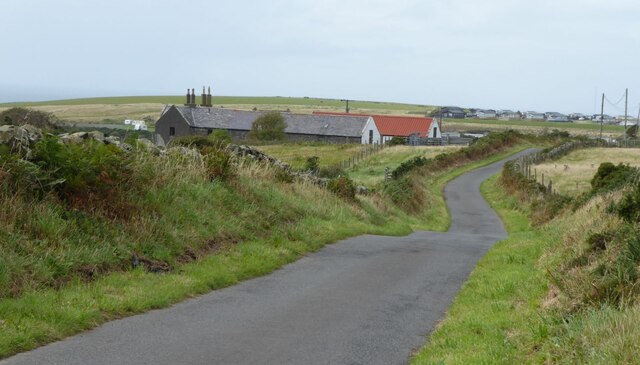
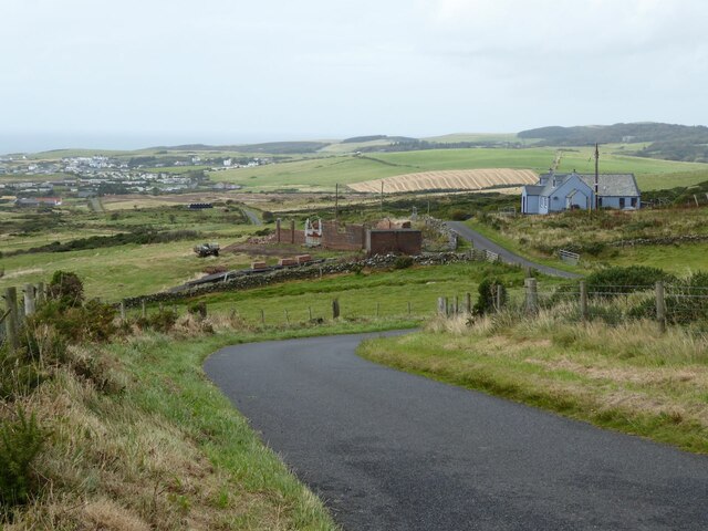
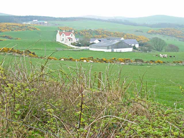
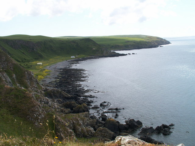
Black Isle of the Sheep Cove is a small island located off the coast of Wigtownshire in Scotland. It is situated in the North Channel, between the Irish Sea and the Atlantic Ocean. The island is approximately 1.5 miles long and half a mile wide, with a total area of around 300 acres.

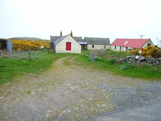
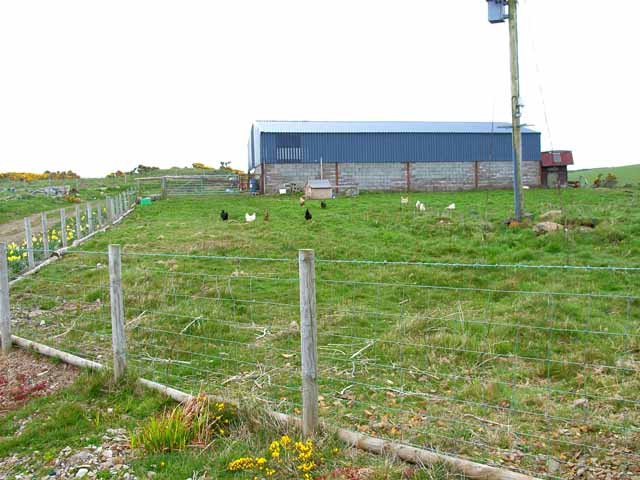
The island gets its name from the presence of a large population of black sheep that roam its grassy hills. These sheep have a distinct black coat, which is believed to be a result of crossbreeding with other breeds over the years. The island is privately owned and is primarily used for grazing these sheep.

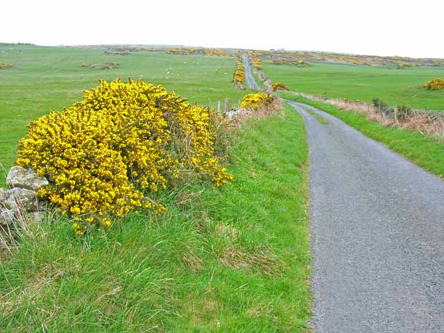
Black Isle of the Sheep Cove is a picturesque destination, with its rugged coastline, sandy beaches, and rolling green hills. It offers breathtaking views of the surrounding sea and is a haven for birdwatchers, as it is home to a variety of seabirds, including puffins, guillemots, and gannets.

Access to the island is limited, as there are no regular ferries or transportation services available. However, visitors can reach the island by private boat or by arranging a guided tour. Camping is permitted on the island, but visitors are advised to bring their own supplies and be mindful of the fragile ecosystem.

Overall, Black Isle of the Sheep Cove is a hidden gem in Wigtownshire, offering tranquility, natural beauty, and a unique glimpse into Scotland's rural life.

If you have any feedback on the listing, please let us know in the comments section below.

Black Isle of the Sheep Cove Images

Images are sourced within 2km of 54.821544/-5.0833877 or Grid Reference NX0251. Thanks to Geograph Open Source API. All images are credited.

Craigoch Park With the Holiday Park beyond on the road to Portpatrick.
Craigoch Park
With the Holiday Park beyond on the road to Portpatrick.
Not a tank on the lawn! But a Husqvarna Automower 435X AWD on the lawn at Knockinaam Lodge.
'Designed for rough terrain and steep hills, the Husqvarna Automower 435X AWD is loaded with features including all-wheel drive, Bluetooth, cellular, and GPS technologies, a pivoting rear end, and an ultra-quiet battery-powered motor.'
<span class="nowrap"><a title="https://uk.pcmag.com/home-security-products/127908/husqvarna-automower-435x-awd" rel="nofollow ugc noopener" href="https://uk.pcmag.com/home-security-products/127908/husqvarna-automower-435x-awd">Link</a><img style="margin-left:2px;" alt="External link" title="External link - shift click to open in new window" src="https://s1.geograph.org.uk/img/external.png" width="10" height="10"/></span>
Not a tank on the lawn!
But a Husqvarna Automower 435X AWD on the lawn at Knockinaam Lodge. 'Designed for rough terrain and steep hills, the Husqvarna Automower 435X AWD is loaded with features including all-wheel drive, Bluetooth, cellular, and GPS technologies, a pivoting rear end, and an ultra-quiet battery-powered motor.' LinkExternal link
Knockinaam Lodge Hotel '19th century country house hotel, fully restored to create a stylish and relaxed ambience for our guests as they enjoy stunning scenery and food served in our 3 AA rosette restaurant.'
<span class="nowrap"><a title="https://www.knockinaamlodge.com/" rel="nofollow ugc noopener" href="https://www.knockinaamlodge.com/">Link</a><img style="margin-left:2px;" alt="External link" title="External link - shift click to open in new window" src="https://s1.geograph.org.uk/img/external.png" width="10" height="10"/></span>
The odd 'box' on the lawn is in fact a mower! 
See <a title="https://www.geograph.org.uk/photo/7284516" href="https://www.geograph.org.uk/photo/7284516">Link</a>
Knockinaam Lodge Hotel
'19th century country house hotel, fully restored to create a stylish and relaxed ambience for our guests as they enjoy stunning scenery and food served in our 3 AA rosette restaurant.' LinkExternal link The odd 'box' on the lawn is in fact a mower! See Link
The winding road  to Eagle View And on to Portpatrick.
The winding road to Eagle View
And on to Portpatrick.
Spittal House Farm South east of the Port of Spittal Burn that flows into Port of Spittal Bay.
The Caledonian Cheese Company is based in Stranraer.
Spittal House Farm
South east of the Port of Spittal Burn that flows into Port of Spittal Bay. The Caledonian Cheese Company is based in Stranraer.
Croft on Craigoch Park Moor South of Portpatrick. Note the gorse infestation, a major problem in south-west Scotland.
Croft on Craigoch Park Moor
South of Portpatrick. Note the gorse infestation, a major problem in south-west Scotland.
Livestock transportation business, Port of Spittal
Barn on Craigoch Moor
Farm at North Port of Spittal
Morroch Bay
Morroch Bay
Road across Craigoch Park Moor
Roadside tank near Port Spittal
Spittal farmland and road bend
Port of Spittal & Knockinaam Lodge
Port of Spittal cliffs
The Swan
The Swan
Ratten Hole
Ratten Hole
Tandoo Point
Tandoo Point
Show me another place!

Black Isle of the Sheep Cove is located at Grid Ref: NX0251 (Lat: 54.821544, Lng: -5.0833877)

Unitary Authority: Dumfries and Galloway

Police Authority: Dumfries and Galloway

What 3 Words

///ascendant.firms.upwardly. Near Stranraer, Dumfries & Galloway

Related Wikis

Knockinaam Lodge

Knockinaam Lodge is a hotel and restaurant located about 3.5 miles South of Portpatrick, Dumfries & Galloway, Scotland. As of 2008, the restaurant holds...

Dunskey Castle

Dunskey Castle is a ruined, 12th-century tower house or castle, located 0.5 miles (0.80 km) south of the village of Portpatrick, Rhinns, Wigtownshire,...

Dunskey

Dunskey Estate (also known as Portree Estate) is north of Portpatrick on the west coast of Scotland. The B-listed mansion dates from the start of the twentieth...

Portpatrick railway station

Portpatrick railway station was a railway station serving the village of Portpatrick, Dumfries & Galloway, Scotland. Opened in 1862 the station served...

Colfin railway station

Colfin railway station, located in Wigtownshire, Scotland, between Portpatrick and Stranraer, was a station on the Portpatrick and Wigtownshire Joint Railway...

Portpatrick

Portpatrick is a village and civil parish in the historical county of Wigtownshire, Dumfries and Galloway, Scotland. It is located on the west coast of...

Rhins of Galloway

The Rhins of Galloway, otherwise known as the Rhins of Wigtownshire (or as The Rhins, also spelled The Rhinns; Scottish Gaelic: Na Rannaibh), is a hammer...

MV Craigantlet

MV Craigantlet was a German-owned, Cyprus-registered container ship operated on time-charter by Cawoods Containers Ltd of Belfast. She ran aground on 26...

Nearby Amenities

Located within 500m of 54.821544,-5.0833877
Created By: dmgroom_coastlines
Source: PGS
Lat/Long: 54.825495/-5.086604
Created By: dmgroom_coastlines
Source: PGS
Lat/Long: 54.825372/-5.086376
Created By: dmgroom_coastlines
Source: PGS
Lat/Long: 54.825247/-5.086147
Created By: dmgroom_coastlines
Source: PGS
Lat/Long: 54.825014/-5.084804
Created By: dmgroom_coastlines
Source: PGS
Lat/Long: 54.825021/-5.084361
Created By: dmgroom_coastlines
Source: PGS
Lat/Long: 54.825029/-5.083917
Created By: dmgroom_coastlines
Source: PGS
Lat/Long: 54.824905/-5.08369
Created By: dmgroom_coastlines
Source: PGS
Lat/Long: 54.824781/-5.083461
Created By: dmgroom_coastlines
Source: PGS
Lat/Long: 54.824657/-5.083234
Created By: dmgroom_coastlines
Source: PGS
Lat/Long: 54.823889/-5.083194
Created By: dmgroom_coastlines
Source: PGS
Lat/Long: 54.823377/-5.083168
Created By: dmgroom_coastlines
Source: PGS
Lat/Long: 54.823121/-5.083154
Created By: dmgroom_coastlines
Source: PGS
Lat/Long: 54.822609/-5.083128
Created By: dmgroom_coastlines
Source: PGS
Lat/Long: 54.822353/-5.083115
Created By: dmgroom_coastlines
Source: PGS
Lat/Long: 54.821838/-5.083309
Created By: dmgroom_coastlines
Source: PGS
Lat/Long: 54.821853/-5.082423
Created By: dmgroom_coastlines
Source: PGS
Lat/Long: 54.820577/-5.082136
Created By: dmgroom_coastlines
Source: PGS
Lat/Long: 54.820452/-5.081907
Created By: dmgroom_coastlines
Source: PGS
Lat/Long: 54.820348/-5.080571
Created By: dmgroom_coastlines
Source: PGS
Lat/Long: 54.81958/-5.080531
Created By: dmgroom_coastlines
Source: PGS
Lat/Long: 54.819595/-5.079645
Created By: dmgroom_coastlines
Source: PGS
Lat/Long: 54.818319/-5.079358
Knockinaam Lodge
Addr City: Portpatrick
Addr Housename: Knockinaam Lodge
Addr Postcode: DG9 9AD
Bar: yes
Check Date: 2023-08-06
Contact Facebook: https://www.facebook.com/knockinaamlodgehotel/
Contact Instagram: https://www.instagram.com/knockinaamlodgehotel/
Cuisine: British;Scottish
Diet Dairy Free: yes
Diet Gluten Free: yes
Diet Nut Free: yes
Diet Vegan: yes
Diet Vegetarian: yes
Email: reservations@knockinaamlodge.com
Internet Access: wlan
Payment American Express: yes
Payment Cash: yes
Payment Credit Cards: yes
Payment Debit Cards: yes
Pets: yes
Phone: +44 1776 810471
Reservation: required
Rooms: 10
Source: https://www.telegraph.co.uk/travel/destinations/europe/united-kingdom/scotland/southern-uplands/hotels/knockinaam-lodge-hotel/;https://scotlandstartshere.com/point-of-interest/knockinaam-lodge/
Tourism: hotel
Website: https://www.knockinaamlodge.com/
Wheelchair: limited
Wikidata: Q6422873
Wikipedia: en:Knockinaam Lodge
Lat/Long: 54.8252778/-5.081713
Power: pole
Lat/Long: 54.8252906/-5.0804906
Power: pole
Lat/Long: 54.8253609/-5.0812959
Power: pole
Lat/Long: 54.8252676/-5.0802113
Power: pole
Lat/Long: 54.8250411/-5.0798274
Power: pole
Lat/Long: 54.8249024/-5.0795833
Playground: structure
Lat/Long: 54.8253243/-5.0828814
The data included in this document is from www.openstreetmap.org. The data is made available under ODbL.

Have you been to Black Isle of the Sheep Cove?

Leave your review of Black Isle of the Sheep Cove below (or comments, questions and feedback).