Boatswain Hill

Hill, Mountain in Wigtownshire

Scotland

Boatswain Hill

Not a tank on the lawn! But a Husqvarna Automower 435X AWD on the lawn at Knockinaam Lodge.
'Designed for rough terrain and steep hills, the Husqvarna Automower 435X AWD is loaded with features including all-wheel drive, Bluetooth, cellular, and GPS technologies, a pivoting rear end, and an ultra-quiet battery-powered motor.'
<span class="nowrap"><a title="https://uk.pcmag.com/home-security-products/127908/husqvarna-automower-435x-awd" rel="nofollow ugc noopener" href="https://uk.pcmag.com/home-security-products/127908/husqvarna-automower-435x-awd">Link</a><img style="margin-left:2px;" alt="External link" title="External link - shift click to open in new window" src="https://s1.geograph.org.uk/img/external.png" width="10" height="10"/></span>
Not a tank on the lawn! Credit: Russel Wills

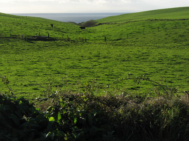
Boatswain Hill is a prominent hill located in Wigtownshire, a historic county in southwestern Scotland. Standing at an elevation of approximately 382 meters (1,253 feet), it is known for its stunning views and natural beauty. The hill is situated near the village of Kirkcolm, about 9 kilometers (5.6 miles) northeast of the town of Stranraer.

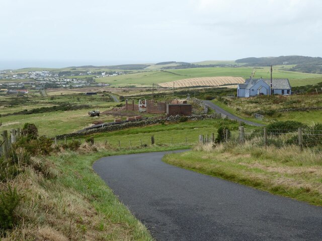
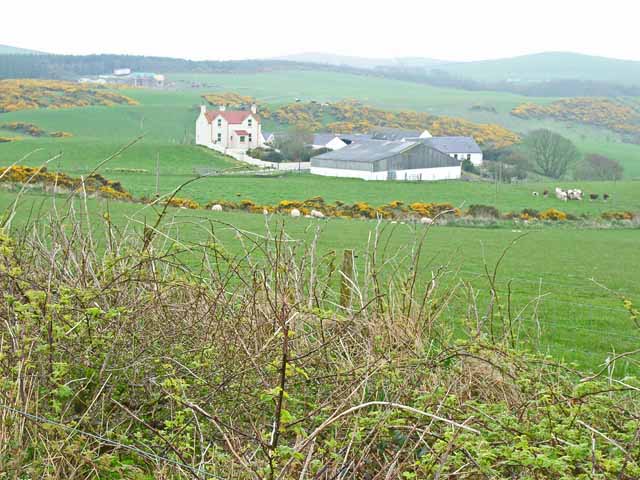
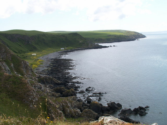
Boatswain Hill is a part of the Rhins of Galloway, a peninsula renowned for its picturesque landscapes and rugged coastline. The hill itself is characterized by its gently sloping sides and a distinct summit that offers panoramic vistas of the surrounding countryside, including Loch Ryan and the Irish Sea.

The name "Boatswain" is believed to be derived from the term used for a ship's officer responsible for the maintenance of the vessel. The hill's name suggests a connection to the maritime history of the area, which was once a bustling port known for its trade and fishing activities.

Hikers and nature enthusiasts are drawn to Boatswain Hill for its tranquil ambiance and opportunities for outdoor recreation. The hill is accessible via well-marked trails, which wind through lush greenery and heather-covered moorland. The ascent to the summit is moderately challenging, making it suitable for both experienced and novice climbers.

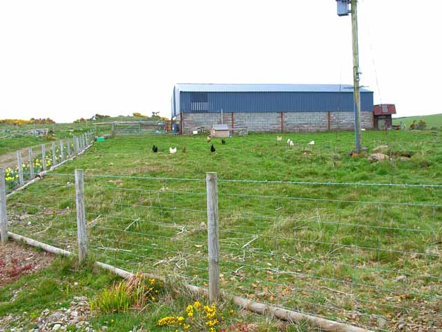
Boatswain Hill serves as a wonderful vantage point for birdwatching, as it attracts various species of birds, including raptors and seabirds. The hill is also home to a diverse range of flora and fauna, offering a chance for nature lovers to immerse themselves in the region's biodiversity.

Overall, Boatswain Hill is a captivating natural landmark within Wigtownshire, offering visitors a chance to explore the area's scenic beauty and connect with its rich maritime heritage.

If you have any feedback on the listing, please let us know in the comments section below.

Boatswain Hill Images

Images are sourced within 2km of 54.817319/-5.0731012 or Grid Reference NX0251. Thanks to Geograph Open Source API. All images are credited.

Not a tank on the lawn! But a Husqvarna Automower 435X AWD on the lawn at Knockinaam Lodge.
'Designed for rough terrain and steep hills, the Husqvarna Automower 435X AWD is loaded with features including all-wheel drive, Bluetooth, cellular, and GPS technologies, a pivoting rear end, and an ultra-quiet battery-powered motor.'
<span class="nowrap"><a title="https://uk.pcmag.com/home-security-products/127908/husqvarna-automower-435x-awd" rel="nofollow ugc noopener" href="https://uk.pcmag.com/home-security-products/127908/husqvarna-automower-435x-awd">Link</a><img style="margin-left:2px;" alt="External link" title="External link - shift click to open in new window" src="https://s1.geograph.org.uk/img/external.png" width="10" height="10"/></span>
Not a tank on the lawn!
But a Husqvarna Automower 435X AWD on the lawn at Knockinaam Lodge. 'Designed for rough terrain and steep hills, the Husqvarna Automower 435X AWD is loaded with features including all-wheel drive, Bluetooth, cellular, and GPS technologies, a pivoting rear end, and an ultra-quiet battery-powered motor.' LinkExternal link
Knockinaam Lodge Hotel '19th century country house hotel, fully restored to create a stylish and relaxed ambience for our guests as they enjoy stunning scenery and food served in our 3 AA rosette restaurant.'
<span class="nowrap"><a title="https://www.knockinaamlodge.com/" rel="nofollow ugc noopener" href="https://www.knockinaamlodge.com/">Link</a><img style="margin-left:2px;" alt="External link" title="External link - shift click to open in new window" src="https://s1.geograph.org.uk/img/external.png" width="10" height="10"/></span>
The odd 'box' on the lawn is in fact a mower! 
See <a title="https://www.geograph.org.uk/photo/7284516" href="https://www.geograph.org.uk/photo/7284516">Link</a>
Knockinaam Lodge Hotel
'19th century country house hotel, fully restored to create a stylish and relaxed ambience for our guests as they enjoy stunning scenery and food served in our 3 AA rosette restaurant.' LinkExternal link The odd 'box' on the lawn is in fact a mower! See Link
The winding road  to Eagle View And on to Portpatrick.
The winding road to Eagle View
And on to Portpatrick.
Spittal House Farm South east of the Port of Spittal Burn that flows into Port of Spittal Bay.
The Caledonian Cheese Company is based in Stranraer.
Spittal House Farm
South east of the Port of Spittal Burn that flows into Port of Spittal Bay. The Caledonian Cheese Company is based in Stranraer.
Livestock transportation business, Port of Spittal
Barn on Craigoch Moor
Farm at North Port of Spittal
Morroch Bay
Morroch Bay
Roadside tank near Port Spittal
Portayew bay
Portayew bay
Portayew Burn The Antrim Mountains (approxiamtely 60km) can be seen on the horizon.
Portayew Burn
The Antrim Mountains (approxiamtely 60km) can be seen on the horizon.
Spittal farmland and road bend
Port of Spittal & Knockinaam Lodge
Port of Spittal cliffs
Meoul Croft roadend
Meoul Croft roadend
Misty day in The Rhins Note:  also spelt 'Rhinns' but OS currently prefer one 'n'.
Misty day in The Rhins
Note: also spelt 'Rhinns' but OS currently prefer one 'n'.
Morroch Bay
Morroch Bay
Kissing gate on footpath
Show me another place!

Boatswain Hill is located at Grid Ref: NX0251 (Lat: 54.817319, Lng: -5.0731012)

Unitary Authority: Dumfries and Galloway

Police Authority: Dumfries and Galloway

What 3 Words

///exchanges.springing.circus. Near Stranraer, Dumfries & Galloway

Related Wikis

Knockinaam Lodge

Knockinaam Lodge is a hotel and restaurant located about 3.5 miles South of Portpatrick, Dumfries & Galloway, Scotland. As of 2008, the restaurant holds...

Dunskey Castle

Dunskey Castle is a ruined, 12th-century tower house or castle, located 0.5 miles (0.80 km) south of the village of Portpatrick, Rhinns, Wigtownshire,...

Colfin railway station

Colfin railway station, located in Wigtownshire, Scotland, between Portpatrick and Stranraer, was a station on the Portpatrick and Wigtownshire Joint Railway...

Dunskey

Dunskey Estate (also known as Portree Estate) is north of Portpatrick on the west coast of Scotland. The B-listed mansion dates from the start of the twentieth...

Portpatrick railway station

Portpatrick railway station was a railway station serving the village of Portpatrick, Dumfries & Galloway, Scotland. Opened in 1862 the station served...

Portpatrick

Portpatrick is a village and civil parish in the historical county of Wigtownshire, Dumfries and Galloway, Scotland. It is located on the west coast of...

Rhins of Galloway

The Rhins of Galloway, otherwise known as the Rhins of Wigtownshire (or as The Rhins, also spelled The Rhinns; Scottish Gaelic: Na Rannaibh), is a hammer...

Stoneykirk

Stoneykirk (Scottish Gaelic: Eaglais Steafain) is an area and a village in the heart of the Rhins of Galloway, Wigtownshire, in the administrative council...

Nearby Amenities

Located within 500m of 54.817319,-5.0731012
Created By: dmgroom_coastlines
Source: PGS
Lat/Long: 54.819595/-5.079645
Created By: dmgroom_coastlines
Source: PGS
Lat/Long: 54.818319/-5.079358
Created By: dmgroom_coastlines
Source: PGS
Lat/Long: 54.817559/-5.078875
Created By: dmgroom_coastlines
Source: PGS
Lat/Long: 54.817054/-5.078406
Created By: dmgroom_coastlines
Source: PGS
Lat/Long: 54.81693/-5.078177
Created By: dmgroom_coastlines
Source: PGS
Lat/Long: 54.816806/-5.07795
Created By: dmgroom_coastlines
Source: PGS
Lat/Long: 54.816046/-5.077467
Created By: dmgroom_coastlines
Source: PGS
Lat/Long: 54.815921/-5.077238
Created By: dmgroom_coastlines
Source: PGS
Lat/Long: 54.81568/-5.076339
Created By: dmgroom_coastlines
Source: PGS
Lat/Long: 54.815557/-5.076111
Created By: dmgroom_coastlines
Source: PGS
Lat/Long: 54.815432/-5.075882
Created By: dmgroom_coastlines
Source: PGS
Lat/Long: 54.815308/-5.075655
Created By: dmgroom_coastlines
Source: PGS
Lat/Long: 54.815184/-5.075426
Created By: dmgroom_coastlines
Source: PGS
Lat/Long: 54.815191/-5.074983
Created By: dmgroom_coastlines
Source: PGS
Lat/Long: 54.815214/-5.073653
Created By: dmgroom_coastlines
Source: PGS
Lat/Long: 54.81509/-5.073426
Created By: dmgroom_coastlines
Source: PGS
Lat/Long: 54.814586/-5.072956
Created By: dmgroom_coastlines
Source: PGS
Lat/Long: 54.814461/-5.072727
Created By: dmgroom_coastlines
Source: PGS
Lat/Long: 54.81422/-5.071828
Created By: dmgroom_coastlines
Source: PGS
Lat/Long: 54.814108/-5.070935
Created By: dmgroom_coastlines
Source: PGS
Lat/Long: 54.8136/-5.070688
Created By: dmgroom_coastlines
Source: PGS
Lat/Long: 54.813475/-5.070459
Created By: dmgroom_coastlines
Source: PGS
Lat/Long: 54.813363/-5.069566
The data included in this document is from www.openstreetmap.org. The data is made available under ODbL.

Have you been to Boatswain Hill?

Leave your review of Boatswain Hill below (or comments, questions and feedback).