Lynch Hill
Settlement in Hampshire Basingstoke and Deane
England
Lynch Hill

Lynch Hill is a small village located in the county of Hampshire, England. Situated in the South East of the country, Lynch Hill is part of the wider rural area known as the Hampshire Downs.
The village is characterized by its picturesque and idyllic surroundings, with rolling hills, lush green meadows, and charming countryside views. It is a popular destination for nature enthusiasts and those seeking a peaceful retreat away from the hustle and bustle of city life.
Lynch Hill has a small community, with a population of around 500 residents. The village predominantly consists of residential properties, including traditional thatched cottages and more modern houses. The village maintains a close-knit community spirit, with regular events and gatherings organized by the residents.
In terms of amenities, Lynch Hill has a few local shops and a village pub, providing essential services and a place for locals to socialize. For more extensive shopping, entertainment, and leisure facilities, residents often travel to nearby towns such as Winchester or Andover.
The surrounding countryside offers ample opportunities for outdoor activities, including hiking, cycling, and horse riding. Lynch Hill is also within close proximity to several Areas of Outstanding Natural Beauty, such as the South Downs National Park and the New Forest, making it an ideal location for exploring the natural beauty of Hampshire.
Overall, Lynch Hill is a charming rural village that offers a peaceful and scenic setting for residents and visitors alike.
If you have any feedback on the listing, please let us know in the comments section below.
Lynch Hill Images
Images are sourced within 2km of 51.231209/-1.332973 or Grid Reference SU4648. Thanks to Geograph Open Source API. All images are credited.


Lynch Hill is located at Grid Ref: SU4648 (Lat: 51.231209, Lng: -1.332973)
Administrative County: Hampshire
District: Basingstoke and Deane
Police Authority: Hampshire
What 3 Words
///unlisted.teaches.isolated. Near Overton, Hampshire
Nearby Locations
Related Wikis

Whitchurch Rural District, Hampshire
Whitchurch was a rural district in Hampshire, England from 1894 to 1932. It was formed under the Local Government Act 1894 based on the Whitchurch rural...
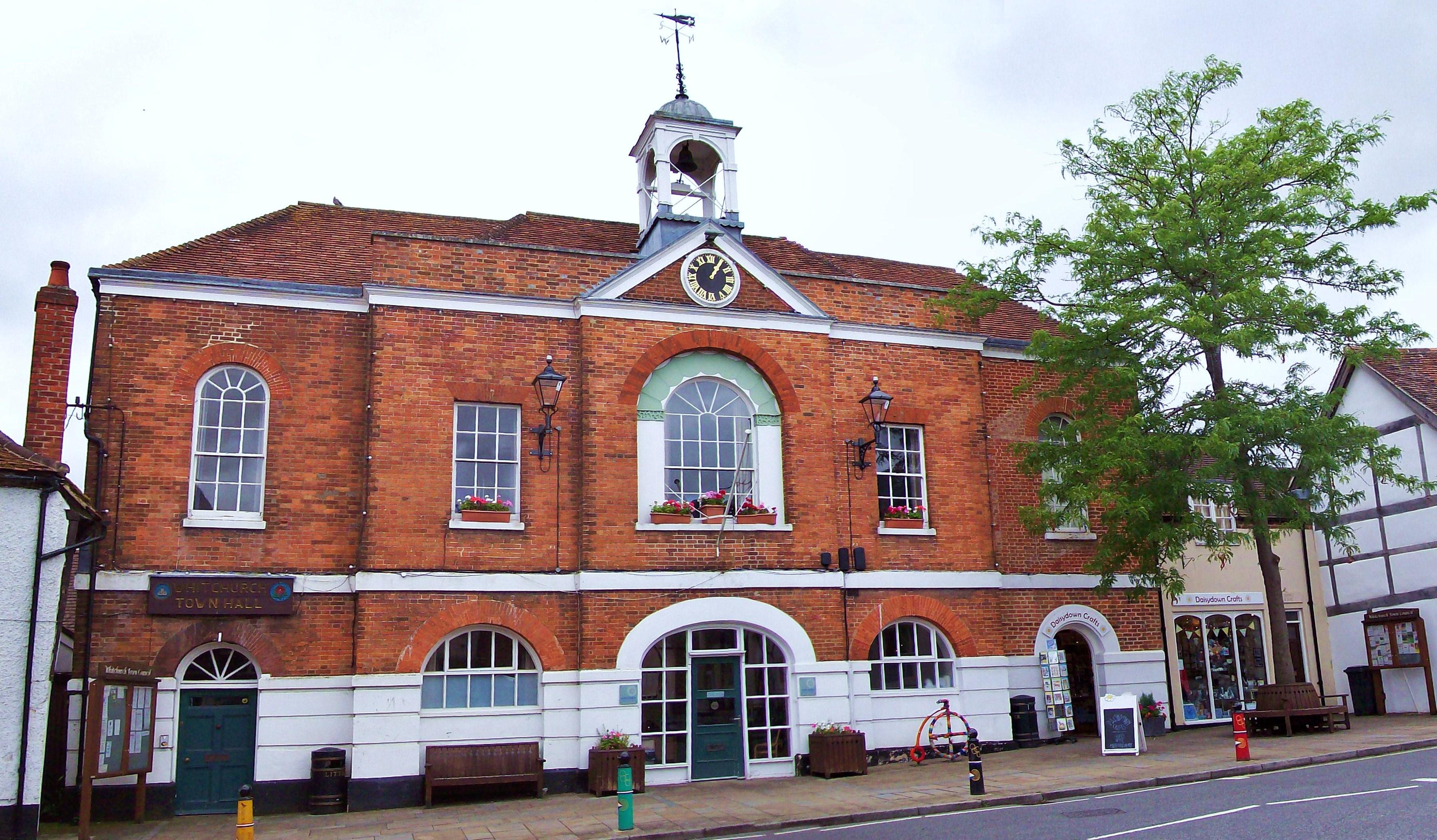
Whitchurch Town Hall
Whitchurch Town Hall is a municipal structure in Newbury Street, Whitchurch, Hampshire, England. The structure, which is the meeting place of Whitchurch...
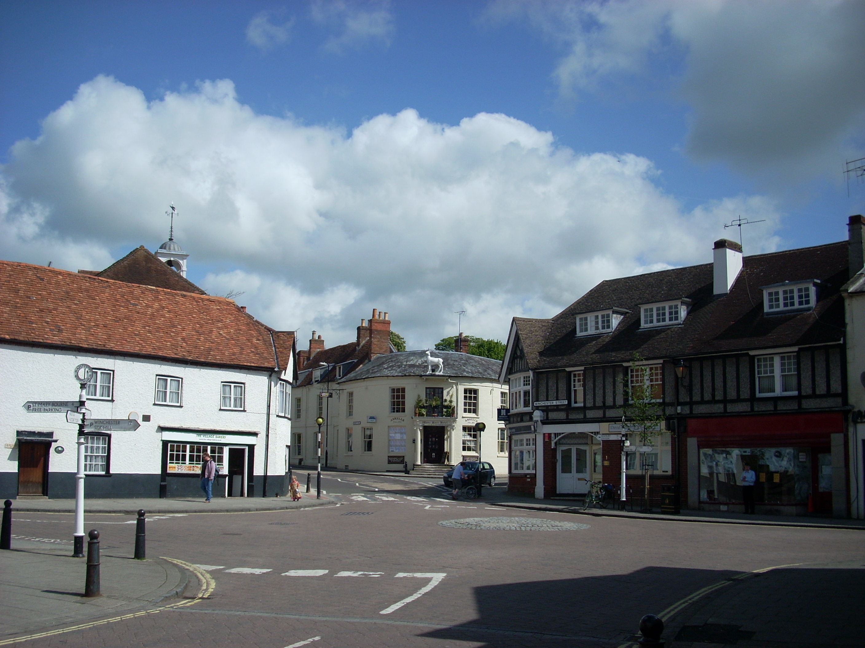
Whitchurch, Hampshire
Whitchurch is a town in the borough of Basingstoke and Deane in Hampshire, England. It is on the River Test, 13 miles (21 km) south of Newbury, Berkshire...
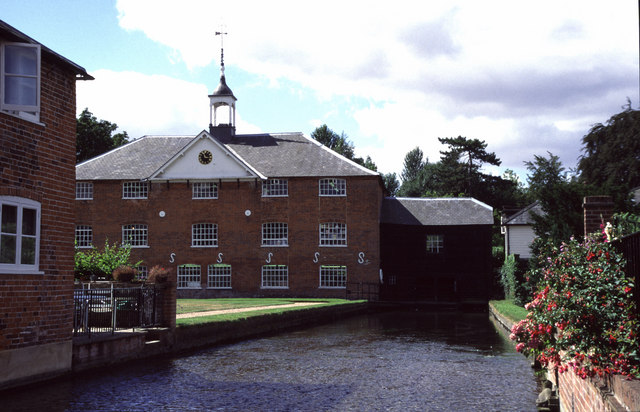
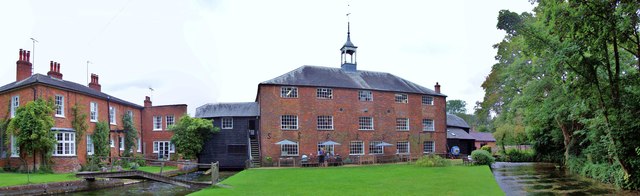
Whitchurch Silk Mill
Whitchurch Silk Mill is a watermill on the River Test, located in the town of Whitchurch, Hampshire, England. It is a Grade II* listed building == History... ==
Related Videos

🇬🇧 Whitchurch Silk Mill | 250 years later still running 🧵
19th century silk mill, still running today #hampshire #southeast #whitchurch #mill #uk #england #silk #whaterwheel ...

Bombay Sapphire Gin Distillery Tour #elgrand #gin #bombaysapphire #nissanelgrand #elgrandcamper
elgrand #nissanelgrand #vanlife #gin #gindistillery #ginandtonic #bombaysapphire Ellie and the family visited Bombay Sapphire ...


After lockdown visit Bombay Sapphire England #Gin #bombay-sapphire
click the link to subscribehttps://www.youtube.com/channel/UCi7gy4Vbug13j48Dpw82KvA to see more from me,and give thumbs ...
Nearby Amenities
Located within 500m of 51.231209,-1.332973Have you been to Lynch Hill?
Leave your review of Lynch Hill below (or comments, questions and feedback).