Lye Green

Settlement in Buckinghamshire

England

Lye Green

The Black Horse Inn
The Black Horse Inn Credit: Mark Percy

Lye Green is a small village located in the county of Buckinghamshire, England. Situated approximately 3 miles northwest of the town of Chesham, it is nestled within the picturesque Chiltern Hills. The village is surrounded by lush green countryside and offers a peaceful and idyllic setting for residents and visitors alike.

Lye Green has a rich history, dating back many centuries. It was once known for its agricultural heritage, with farming being the primary occupation of its inhabitants. Today, it retains its rural charm, with several traditional cottages and farmhouses still dotting the landscape.

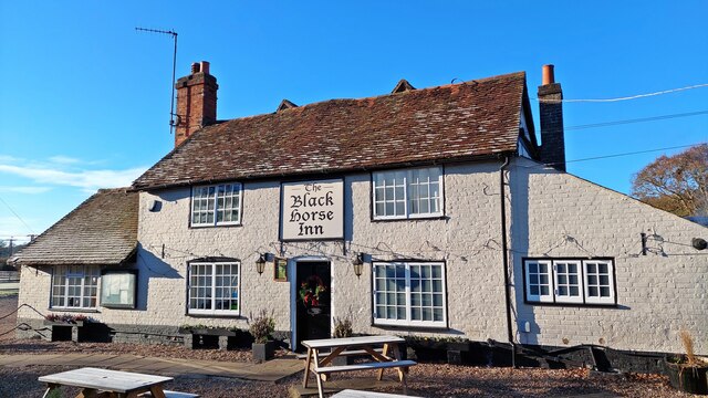
The village is home to a close-knit community, with a population of around 500 people. It boasts a range of amenities, including a local pub, a primary school, and a village hall. The pub, known as The Crown, serves as a popular gathering spot for residents to socialize and enjoy a drink or a meal.

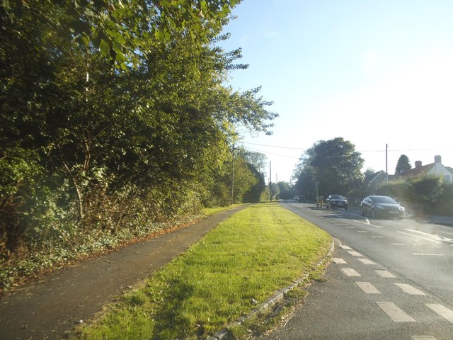
For outdoor enthusiasts, Lye Green offers ample opportunities for exploration. The surrounding countryside is crisscrossed by a network of footpaths and bridleways, making it ideal for leisurely walks and bike rides. The nearby Ashridge Estate and Wendover Woods also provide stunning natural environments, perfect for hiking, picnicking, and wildlife spotting.

Although Lye Green may be small in size, it offers a tranquil escape from the hustle and bustle of nearby urban areas. With its beautiful landscapes, strong community spirit, and convenient proximity to amenities, this charming Buckinghamshire village is a hidden gem for those seeking a peaceful rural retreat.

If you have any feedback on the listing, please let us know in the comments section below.
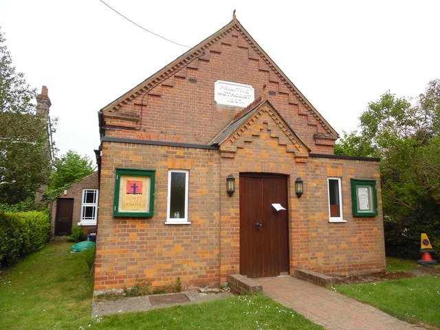
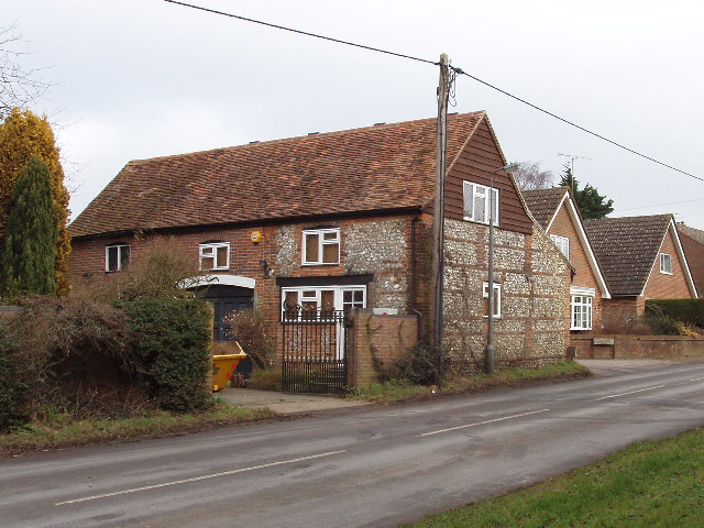
Lye Green Images

Images are sourced within 2km of 51.719778/-0.586335 or Grid Reference SP9703. Thanks to Geograph Open Source API. All images are credited.

The Black Horse Inn
The Black Horse Inn
Henry Mash Court, Lye Green This is a recent residential conversion of Lyegreen Farm
Henry Mash Court, Lye Green
This is a recent residential conversion of Lyegreen Farm
The entrance to Little Acre Farm, Ashley Green
Ashley Green Road
Ashley Green Road
Jasons Hill, Botley
Jasons Hill, Botley
A416 Broad Street, Chesham
A416 at Woodcroft Road
A416 at Ashley Green village boundary
The Swan Inn at Ley Hill
Hen & Chickens public house at Botley
Mini-roundabout on the A416, Chesham
The Black Horse Inn at Chesham Vale
Beacon and Village Sign at Ley Hill This beacon at the west end of Leyhill Common was erected to commemorate Her Majesty Queen Elizabeth's Golden Jubilee in 2002. The village sign which includes an owl perched on a branch, is suspended from the beacon.
Beacon and Village Sign at Ley Hill
This beacon at the west end of Leyhill Common was erected to commemorate Her Majesty Queen Elizabeth's Golden Jubilee in 2002. The village sign which includes an owl perched on a branch, is suspended from the beacon.
Display Board on Ley Hill Common This photo shows the display board at the West end of Leyhill Common and has the following wording on it:
           Welcome to Ley Hill Common

 Ley Hill Common, formerly owned by Lord Chesham and registered in 1899, covers some 32.4ha, is now the responsibility of Chiltern District Council. It is one of 200 commons in the Chilterns. Designated a "County Wildlife Site", the common is a wonderful mix of ancient grassland and recent deciduous woodland abundant with bluebells in spring and with varied native wild plants, flowers and fungi throughout the year.
 "Ley Hulle" meaning a fallow or unploughed hill, was first recorded in the 1337 Calendar Close Rolls. Early settlers extracted chalk and clay for pottery, tile and brick making, and used the land for grazing.
 Ley Hill grew up around its Common with the oldest recorded building dating from Tudor times (The Swan public house c.1520). The village Post Office and general store was to the right of The Crown, the local blacksmiths to the left of The Swan and, directly across the Common, is the "Old School House" where local children were educated until 1927.
 In Victorian times, Lord Chesham first gave permission for cricket to be played on the Common and subsequently golf and these are still played to the present day. It is amazing to think that if you had stood on this spot 100 years ago there would have been barely a tree in sight. Without the devotion of the cricket and golf enthusiasts and local volunteers, this area would not be as pretty as it is today.

The pictures on the left are from top to bottom: Gatekeeper butterfly, Bluebells, Fly Agaric mushroom and Tormentil perennial plant. In the middle is a picture of the beacon that was erected to commemorate Her Majesty Queen Elizabeth's Golden Jubilee in 2002. To the right is a photo of a horse and trap taxi service from The Swan to Boxmoor Station, early 20th century. A bus service to the village started in 1925, so before that it was walk or go by trap.
The bottom picture is a view of the pubs and blacksmiths forge c.1910.
 Incidentally, 32.4ha (or hectares) mentioned in the description above, corresponds to 80 acres.
Display Board on Ley Hill Common
This photo shows the display board at the West end of Leyhill Common and has the following wording on it: Welcome to Ley Hill Common Ley Hill Common, formerly owned by Lord Chesham and registered in 1899, covers some 32.4ha, is now the responsibility of Chiltern District Council. It is one of 200 commons in the Chilterns. Designated a "County Wildlife Site", the common is a wonderful mix of ancient grassland and recent deciduous woodland abundant with bluebells in spring and with varied native wild plants, flowers and fungi throughout the year. "Ley Hulle" meaning a fallow or unploughed hill, was first recorded in the 1337 Calendar Close Rolls. Early settlers extracted chalk and clay for pottery, tile and brick making, and used the land for grazing. Ley Hill grew up around its Common with the oldest recorded building dating from Tudor times (The Swan public house c.1520). The village Post Office and general store was to the right of The Crown, the local blacksmiths to the left of The Swan and, directly across the Common, is the "Old School House" where local children were educated until 1927. In Victorian times, Lord Chesham first gave permission for cricket to be played on the Common and subsequently golf and these are still played to the present day. It is amazing to think that if you had stood on this spot 100 years ago there would have been barely a tree in sight. Without the devotion of the cricket and golf enthusiasts and local volunteers, this area would not be as pretty as it is today. The pictures on the left are from top to bottom: Gatekeeper butterfly, Bluebells, Fly Agaric mushroom and Tormentil perennial plant. In the middle is a picture of the beacon that was erected to commemorate Her Majesty Queen Elizabeth's Golden Jubilee in 2002. To the right is a photo of a horse and trap taxi service from The Swan to Boxmoor Station, early 20th century. A bus service to the village started in 1925, so before that it was walk or go by trap. The bottom picture is a view of the pubs and blacksmiths forge c.1910. Incidentally, 32.4ha (or hectares) mentioned in the description above, corresponds to 80 acres.
Ley Hill Methodist Church, Bucks Situated in Ley Hill, this Primitive Methodist chapel dates from 1887. It is one of several churches in the West Hertfordshire & Borders Methodist Circuit and the only one in Buckinghamshire. Services are held here each Sunday at 11.00am and 6.00pm, with activities taking place during the week. For SatNav purposes, the postcode of this chapel is HP5 3QR.
Ley Hill Methodist Church, Bucks
Situated in Ley Hill, this Primitive Methodist chapel dates from 1887. It is one of several churches in the West Hertfordshire & Borders Methodist Circuit and the only one in Buckinghamshire. Services are held here each Sunday at 11.00am and 6.00pm, with activities taking place during the week. For SatNav purposes, the postcode of this chapel is HP5 3QR.
Emmanuel Church, Chesham
The Jolly Sportsman, Berkhampstead Road, Chesham
Chess Medical Centre, Chesham
Show me another place!

Lye Green is located at Grid Ref: SP9703 (Lat: 51.719778, Lng: -0.586335)

Unitary Authority: Buckinghamshire

Police Authority: Thames Valley

What 3 Words

///navy.tiger.vase. Near Chesham, Buckinghamshire

Nearby Locations

Lye Green

Related Wikis

Lye Green

Lye Green is a hamlet in the civil parish of Chesham in Buckinghamshire, England. It is located north east of Chesham. Lycrome Road runs through the centre...

Orchard Leigh

Orchard Leigh is a hamlet in the parish of Latimer in Buckinghamshire, England, located along the B4505 about 2 miles east of Chesham. It is in the civil...
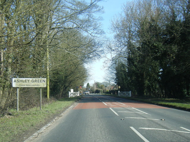
Ashley Green

Ashley Green is a village and civil parish in Buckinghamshire, England. The parish is on the boundary with Hertfordshire, midway between Chesham and Berkhamsted...

Botley, Buckinghamshire

Botley is a hamlet in the civil parish of Chesham, in Buckinghamshire, England. The hamlet name is Anglo Saxon in origin, and means Botta's Clearing. Botley...

Nearby Amenities

Located within 500m of 51.719778,-0.586335
Brockhurst Farm
Place: farm
Source: OS OpenData StreetView
Lat/Long: 51.7160439/-0.5883449
Lye Green
Is In: Buckinghamshire
Place: village
Wikidata: Q6707745
Lat/Long: 51.7204184/-0.5844982
Ele NPE: 532 ft
Source: npe
Lat/Long: 51.7200613/-0.5891082
Power: tower
Lat/Long: 51.7181208/-0.5837742
Power: tower
Lat/Long: 51.7197578/-0.5878677
Power: tower
Lat/Long: 51.7217401/-0.58837
Power: pole
Lat/Long: 51.7222592/-0.5907136
Power: pole
Lat/Long: 51.7222943/-0.5905301
Power: pole
Lat/Long: 51.7232256/-0.5909607
Design: barrel
Line Attachment: anchor
Line Management: termination
Material: steel
Power: tower
Ref: PCD66
Structure: lattice
Lat/Long: 51.722483/-0.588969
Pub
Black Cat
Addr City: Chesham
Addr County: Buckinghamshire
Addr Postcode: HP5 3LF
Addr Street: Lycrome Road
Fhrs Id: 355967
Source: OS 1:25k
Source Addr: FHRS Open Data
Lat/Long: 51.7204914/-0.5869447
Lye Green Farm
Place: farm
Source: OS OpenData StreetView
Lat/Long: 51.7193615/-0.5907642
Lye Green House
Place: residence
Source: OS OpenData StreetView
Lat/Long: 51.7207361/-0.582911
Little Copperskins
Place: residence
Source: OS OpenData StreetView
Lat/Long: 51.7225233/-0.5825299
Power: pole
Source: Bing
Lat/Long: 51.718408/-0.5899814
Power: pole
Source: Bing
Lat/Long: 51.7213508/-0.5898312
Power: pole
Lat/Long: 51.7241571/-0.585765
Power: pole
Lat/Long: 51.7233247/-0.5866474
Power: pole
Source: Bing
Lat/Long: 51.7213873/-0.5896676
Power: pole
Source: Bing
Lat/Long: 51.7207028/-0.5894369
Power: pole
Lat/Long: 51.7222264/-0.5878061
Power: pole
Lat/Long: 51.7216848/-0.5891928
Power: pole
Source: Bing
Lat/Long: 51.7188135/-0.5891767
Power: pole
Lat/Long: 51.7227681/-0.5872375
Power: pole
Source: Bing
Lat/Long: 51.7177284/-0.5913547
Power: pole
Source: Bing
Lat/Long: 51.7197606/-0.5890051
FIXME: bus Depot
Lat/Long: 51.7209142/-0.5873907
Barrier: unknown
Source: Bing
Lat/Long: 51.7159537/-0.589021
Power: portal
Lat/Long: 51.7221136/-0.5900486
Design: barrel
Line Attachment: anchor
Line Management: termination
Material: steel
Power: tower
Ref: PEB35
Lat/Long: 51.722253/-0.5902149
Power: portal
Lat/Long: 51.7223682/-0.589333
Power: switch
Lat/Long: 51.7222451/-0.5896782
Power: pole
Lat/Long: 51.7220437/-0.58768
Power: pole
Lat/Long: 51.722617/-0.5870041
Power: pole
Lat/Long: 51.723471/-0.5860439
Power: pole
Lat/Long: 51.7240741/-0.585081
Direction: 170
Generator Method: photovoltaic
Generator Output Electricity: yes
Generator Solar Modules: 6
Generator Source: solar
Generator Type: solar_photovoltaic_panel
Location: roof
Power: generator
Lat/Long: 51.7214427/-0.5845576
The data included in this document is from www.openstreetmap.org. The data is made available under ODbL.

Have you been to Lye Green?

Leave your review of Lye Green below (or comments, questions and feedback).