Sgeir Mhòr

Island in Ross-shire

Scotland

Sgeir Mhòr

Ripe for development Roofless cottage and tin roofed barn on the shore at Coillegillie, and the only two buildings which appear to be in this grid square. The cottage has a polite notice attached asking visitors to respect the property as there are plans to rebuild it. The view extends to the Red Cuillin on Skye and the southern end of Raasay.
Ripe for development Credit: Gordon Hatton

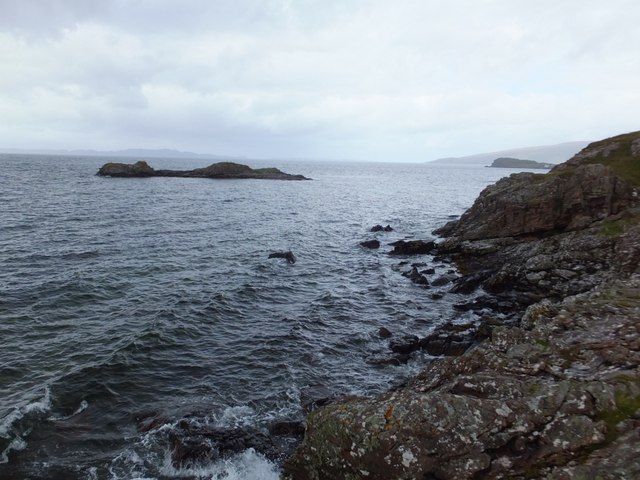
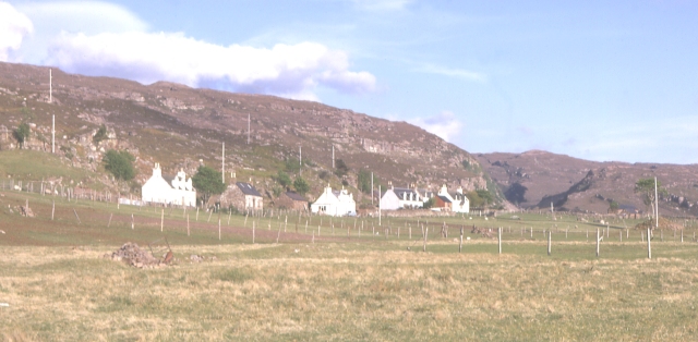
Sgeir Mhòr is a small uninhabited island located off the coast of Ross-shire, in the Scottish Highlands. It lies in the North Atlantic Ocean, approximately 1.5 kilometers east of the mainland. The island covers an area of about 0.6 hectares and is part of the larger Summer Isles archipelago.

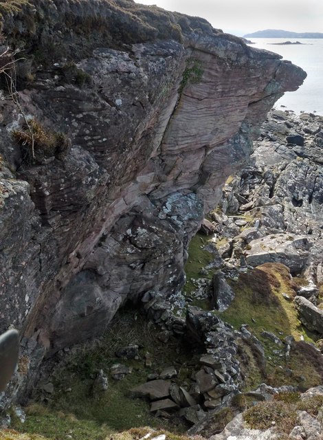
Sgeir Mhòr is primarily composed of rocky terrain, with its highest point reaching about 15 meters above sea level. The island is uninhabited and devoid of any infrastructure or human settlements. It is a protected nature reserve, managed by the Scottish Natural Heritage, and serves as an important breeding ground and sanctuary for a variety of seabirds, including guillemots, razorbills, and puffins.

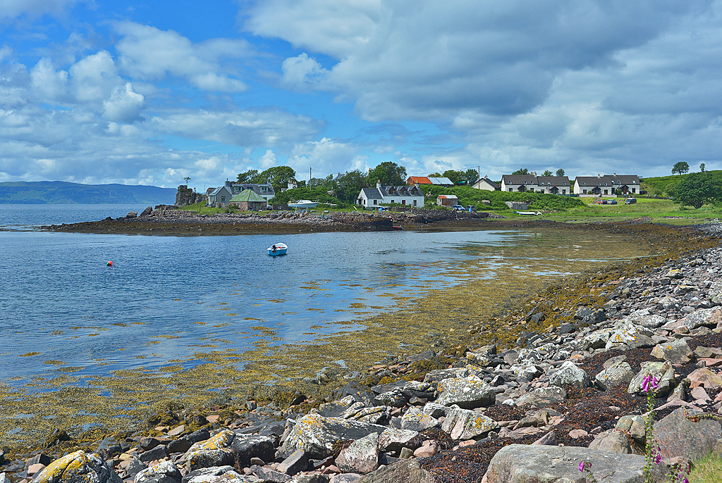
The island's remote location and lack of human activity make it an ideal habitat for wildlife. In addition to the abundant birdlife, visitors may also spot seals basking on the surrounding rocks or swimming in the surrounding waters. The crystal-clear waters surrounding Sgeir Mhòr are home to a diverse range of marine life, making it a popular spot for snorkeling and diving enthusiasts.

Access to Sgeir Mhòr is primarily by boat, with various local tour operators offering trips to the Summer Isles, including this uninhabited island. Visitors can enjoy the picturesque views of the rugged coastline, observe the nesting seabirds from a distance, or simply immerse themselves in the tranquil natural beauty of this remote island.

If you have any feedback on the listing, please let us know in the comments section below.

Sgeir Mhòr Images

Images are sourced within 2km of 57.391232/-5.8362064 or Grid Reference NG6939. Thanks to Geograph Open Source API. All images are credited.

Ripe for development Roofless cottage and tin roofed barn on the shore at Coillegillie, and the only two buildings which appear to be in this grid square. The cottage has a polite notice attached asking visitors to respect the property as there are plans to rebuild it. The view extends to the Red Cuillin on Skye and the southern end of Raasay.
Ripe for development
Roofless cottage and tin roofed barn on the shore at Coillegillie, and the only two buildings which appear to be in this grid square. The cottage has a polite notice attached asking visitors to respect the property as there are plans to rebuild it. The view extends to the Red Cuillin on Skye and the southern end of Raasay.
Thrift by the shore More commonly known wrongly as 'sea pinks', thrift is common along rocky shorelines around most of Britain.
Thrift by the shore
More commonly known wrongly as 'sea pinks', thrift is common along rocky shorelines around most of Britain.
Row of Cottages Ardban
An Ruard-Eilean Small island off the rocky coastline to the north of Coilliegillie
An Ruard-Eilean
Small island off the rocky coastline to the north of Coilliegillie
Houses at Ardban
Houses at Ardban
Coastline near Ardban, Ross and Cromarty Looking towards the Isle of Raasay.
Coastline near Ardban, Ross and Cromarty
Looking towards the Isle of Raasay.
Rock shelter, Ardban, Ross and Cromarty Historic Environment Scotland describes a rock shelter as, "the area beneath a natural overhang at the base of a cliff or crag. This may have been used for occupation, burial, etc".  This shelter was recorded during the Scotland's First Settlers Project: <span class="nowrap"><a title="https://canmore.org.uk/site/157931/ardban" rel="nofollow ugc noopener" href="https://canmore.org.uk/site/157931/ardban">Link</a><img style="margin-left:2px;" alt="External link" title="External link - shift click to open in new window" src="https://s1.geograph.org.uk/img/external.png" width="10" height="10"/></span>.
Rock shelter, Ardban, Ross and Cromarty
Historic Environment Scotland describes a rock shelter as, "the area beneath a natural overhang at the base of a cliff or crag. This may have been used for occupation, burial, etc". This shelter was recorded during the Scotland's First Settlers Project: LinkExternal link.
Ardban Two isolated houses on the coast with no road access. The only way to get to these houses is by boat or a well defined footpath from the Ard Dubh road. I presume they are used as holiday lets today. Grassland around houses grazed by sheep. Nearby beach in foreground of photo made up of shells.
Ardban
Two isolated houses on the coast with no road access. The only way to get to these houses is by boat or a well defined footpath from the Ard Dubh road. I presume they are used as holiday lets today. Grassland around houses grazed by sheep. Nearby beach in foreground of photo made up of shells.
Eilean na Ba (Island of the Cattle) The smaller island on the left. Managed to land on this when I canoed up the coast later on. No cattle spotted on it but seals, wild otters & many seabirds featured on the trip.
Eilean na Ba (Island of the Cattle)
The smaller island on the left. Managed to land on this when I canoed up the coast later on. No cattle spotted on it but seals, wild otters & many seabirds featured on the trip.
An Ruadh-eilean Rounding the rocky skerry heading towards the ruined settlement of Coillegillie. Raasay and then Skye in the background.
An Ruadh-eilean
Rounding the rocky skerry heading towards the ruined settlement of Coillegillie. Raasay and then Skye in the background.
Shore at Ardban
Shore at Ardban
Low tide at An Ruadh-eilean
Beach at An Ruadh-eilean
View of Ardban
View of Ardban
Rocks north of Ardban The headland of Ardban is exposed at low tide.  The mountains of Skye are shrouded in mist in the distance.
Rocks north of Ardban
The headland of Ardban is exposed at low tide. The mountains of Skye are shrouded in mist in the distance.
Triangulation pillar, Carn Donnachaidh, Ross and Cromarty Looking towards Skye.

The pillar is the cylindrical "Vanessa" type.
Triangulation pillar, Carn Donnachaidh, Ross and Cromarty
Looking towards Skye. The pillar is the cylindrical "Vanessa" type.
Rock shelter, Coille Ghillidh, Ross and Cromarty Historic Environment Scotland describes a rock shelter as, "the area beneath a natural overhang at the base of a cliff or crag. This may have been used for occupation, burial, etc". This shelter was recorded during the Scotland's First Settlers Project: <span class="nowrap"><a title="https://canmore.org.uk/site/317869/coilliegillie" rel="nofollow ugc noopener" href="https://canmore.org.uk/site/317869/coilliegillie">Link</a><img style="margin-left:2px;" alt="External link" title="External link - shift click to open in new window" src="https://s1.geograph.org.uk/img/external.png" width="10" height="10"/></span>.
Rock shelter, Coille Ghillidh, Ross and Cromarty
Historic Environment Scotland describes a rock shelter as, "the area beneath a natural overhang at the base of a cliff or crag. This may have been used for occupation, burial, etc". This shelter was recorded during the Scotland's First Settlers Project: LinkExternal link.
Poll Domhain Well off the beaten track.
Poll Domhain
Well off the beaten track.
Show me another place!

Sgeir Mhòr is located at Grid Ref: NG6939 (Lat: 57.391232, Lng: -5.8362064)

Unitary Authority: Highland

Police Authority: Highlands and Islands

What 3 Words

///melons.subplot.chefs. Near Kyleakin, Highland

Related Wikis

Culduie

Culduie (Scottish Gaelic: Cùil Duibh) is a small hamlet, located on the southwest corner on Applecross peninsula, which is south of Applecross Village...

Toscaig

Toscaig (Scottish Gaelic: Toghsgaig) is a small, remote village, at the southern end of the Applecross peninsula, in Wester Ross in the Highlands of Scotland...

Camusterrach

Camusterrach (Scottish Gaelic: Camas Tearach) is a remote hamlet, situated on the west coast of Scotland, on the Applecross peninsula, in Strathcarron...

Camusteel

Camusteel (Scottish Gaelic: Camas Teile) is a remote crofting and former fishing village in the Applecross peninsula, located less than 1 mile directly...

Nearby Amenities

Located within 500m of 57.391232,-5.8362064
Power: pole
Lat/Long: 57.3892669/-5.8288549
The data included in this document is from www.openstreetmap.org. The data is made available under ODbL.

Have you been to Sgeir Mhòr?

Leave your review of Sgeir Mhòr below (or comments, questions and feedback).