Eilean Toigal

Island in Inverness-shire

Scotland

Eilean Toigal

Bridges over the River Morar, Scottish Highlands Two of three bridges crossing the Morar near this location.  The smaller and nearer bridge is the route of the old A830 Fort William to Mallaig road, known as the Road to the Isles. The larger bridge carries the West Highland railway from Fort William to Mallaig.
Bridges over the River Morar, Scottish Highlands Credit: Andrew Tryon

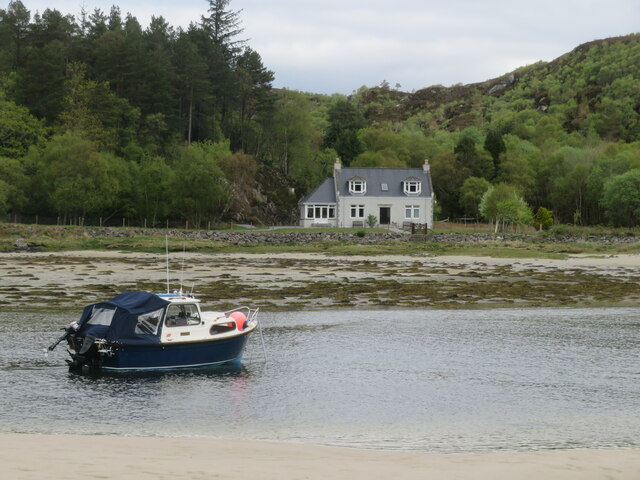
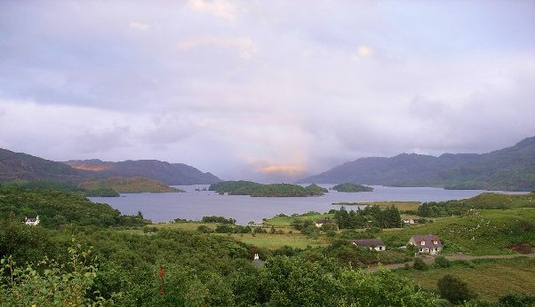
Eilean Toigal is a small island located off the coast of Inverness-shire in the Scottish Highlands. It is situated in the picturesque Loch a' Mhuilinn, surrounded by stunning natural beauty. The island spans approximately 1.5 acres and is accessible by boat.

Eilean Toigal is known for its rich history. It was once home to a small community of fishermen who relied on the abundant fish in the surrounding waters for their livelihood. Today, the island remains uninhabited, but visitors can still see the remnants of the old fishing huts and stone walls that once supported the community.

The island is covered in lush green vegetation, with a variety of trees and plants providing a habitat for numerous bird species. It is a popular destination for birdwatching enthusiasts, who come to observe the diverse range of avian life that calls the island home.

The island offers a tranquil and secluded retreat for those seeking a peaceful getaway. Visitors can take a leisurely stroll along the shoreline, enjoying the panoramic views of the loch and surrounding mountains. It is also an ideal spot for picnicking or simply unwinding in nature's embrace.

While Eilean Toigal may be small in size, it offers a big experience for nature lovers and history enthusiasts alike. Its untouched beauty and serene atmosphere make it a hidden gem in Inverness-shire, inviting visitors to immerse themselves in the tranquility of this idyllic island escape.

If you have any feedback on the listing, please let us know in the comments section below.

Eilean Toigal Images

Images are sourced within 2km of 56.964939/-5.8246867 or Grid Reference NM6792. Thanks to Geograph Open Source API. All images are credited.
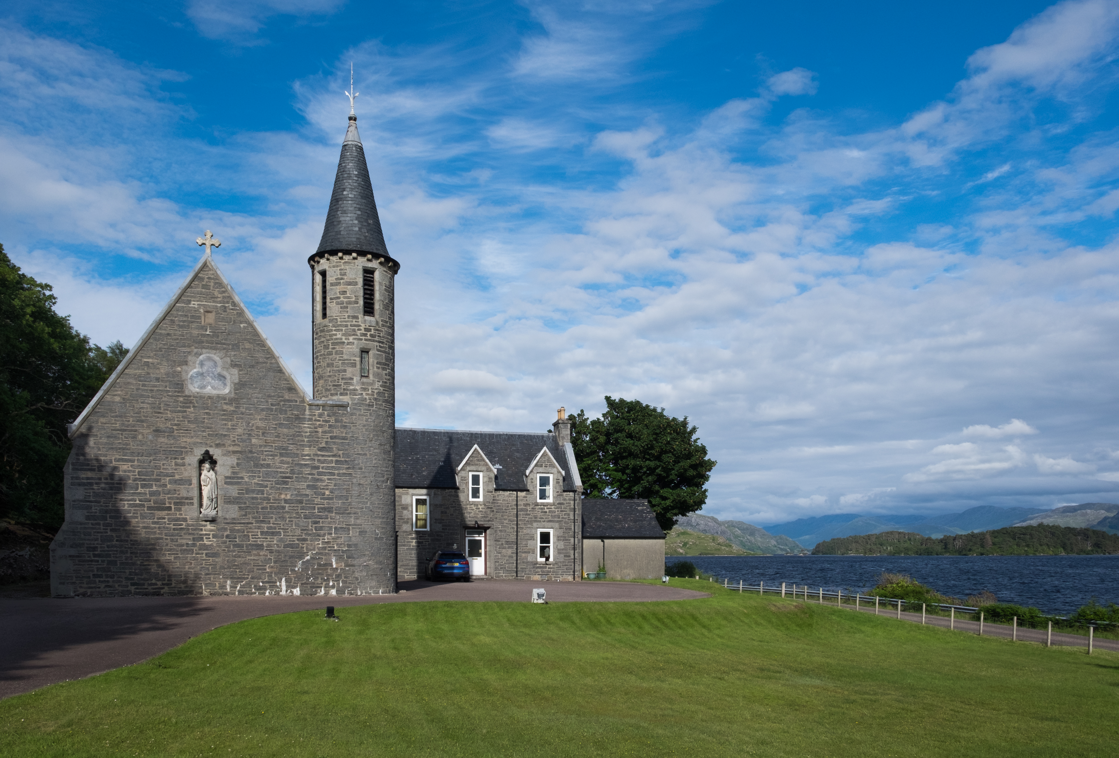
Bridges over the River Morar, Scottish Highlands Two of three bridges crossing the Morar near this location.  The smaller and nearer bridge is the route of the old A830 Fort William to Mallaig road, known as the Road to the Isles. The larger bridge carries the West Highland railway from Fort William to Mallaig.
Bridges over the River Morar, Scottish Highlands
Two of three bridges crossing the Morar near this location. The smaller and nearer bridge is the route of the old A830 Fort William to Mallaig road, known as the Road to the Isles. The larger bridge carries the West Highland railway from Fort William to Mallaig.
A830 Morar Bridge, Scottish Highlands The bridge carrying the modern A830 over Morar Bay on the west coast of Scotland.  The A830 Fort William to Mallaig road is also known as the Road to the Isles.
A830 Morar Bridge, Scottish Highlands
The bridge carrying the modern A830 over Morar Bay on the west coast of Scotland. The A830 Fort William to Mallaig road is also known as the Road to the Isles.
Tigh Beag at Beoraidbeg A house by the A830 at Morar, overlooking the Sound of Sleat. Viewed from the West Highland Line.
Tigh Beag at Beoraidbeg
A house by the A830 at Morar, overlooking the Sound of Sleat. Viewed from the West Highland Line.
Communications mast on Bourblach Hill Just north of Morar, as seen from the West Highland Line.
Communications mast on Bourblach Hill
Just north of Morar, as seen from the West Highland Line.
Morar estuary The River Morar claims to be the shortest in Scotland, running a very short way out of the western end of Loch Morar over rocky falls and into the sea. Personally I think the Scavaig River linking Loch Coruisk with the sea at Loch Scavaig on Skye is shorter.
Morar estuary
The River Morar claims to be the shortest in Scotland, running a very short way out of the western end of Loch Morar over rocky falls and into the sea. Personally I think the Scavaig River linking Loch Coruisk with the sea at Loch Scavaig on Skye is shorter.
A830 Morar Bridge The relatively new concrete bridge carrying the A830 over the River Morar. Through the bridge one can see the old road bridge further upstream with the railway viaduct beyond.
A830 Morar Bridge
The relatively new concrete bridge carrying the A830 over the River Morar. Through the bridge one can see the old road bridge further upstream with the railway viaduct beyond.
Riverside Cottage Looking across the estuary of the River Morar to Riverside Cottage on the far bank.
Riverside Cottage
Looking across the estuary of the River Morar to Riverside Cottage on the far bank.
A wee burn meets the sea A view of the beach at Camusdarach with Eigg and Rum almost touching each other out to sea.
A wee burn meets the sea
A view of the beach at Camusdarach with Eigg and Rum almost touching each other out to sea.
Shoreline at Camusdarach Tiny waves gently lap the shoreline here. The view is across the Sound of Sleat towards the Sleat peninsula on Skye, beyond which in the distance rise the jagged peaks of the main Cuillin range to the left and the more isolated and cloud capped Blaven to the right.
Shoreline at Camusdarach
Tiny waves gently lap the shoreline here. The view is across the Sound of Sleat towards the Sleat peninsula on Skye, beyond which in the distance rise the jagged peaks of the main Cuillin range to the left and the more isolated and cloud capped Blaven to the right.
RC Church and Presbytery, Morar Church of 1889, the full dedication being to 'Our Lady of Perpetual Succour and St Cumin', which is quite a lot to get on to the church noticeboard.
RC Church and Presbytery, Morar
Church of 1889, the full dedication being to 'Our Lady of Perpetual Succour and St Cumin', which is quite a lot to get on to the church noticeboard.
Western end of Loch Morar The deep freshwater loch is less than half a mile from the sea at this point.
Western end of Loch Morar
The deep freshwater loch is less than half a mile from the sea at this point.
Falls of Morar The short River Morar tumbles down to sea level at these waterfalls.
Falls of Morar
The short River Morar tumbles down to sea level at these waterfalls.
River Morar enters the sea During its very short course from the loch to the sea, the River Morar has to drop just 9 metres, almost all of which is via two sets of falls here. Looking west towards the A830 bridge, which is in the adjoining square.
River Morar enters the sea
During its very short course from the loch to the sea, the River Morar has to drop just 9 metres, almost all of which is via two sets of falls here. Looking west towards the A830 bridge, which is in the adjoining square.
Upstream along the River Morar Just above the main falls, which brings the river down to sea level, are these rapids, beyond which can be seen the old main road bridge [now the B8008] and the railway viaduct.
Upstream along the River Morar
Just above the main falls, which brings the river down to sea level, are these rapids, beyond which can be seen the old main road bridge [now the B8008] and the railway viaduct.
Loch Morar by Morar Lodge
Beach at Glenancross
Loch Morar by Morar Lodge
Inlet near Glenancross
Show me another place!

Eilean Toigal is located at Grid Ref: NM6792 (Lat: 56.964939, Lng: -5.8246867)

Unitary Authority: Highland

Police Authority: Highlands and Islands

What 3 Words

///edges.anyway.nicknames. Near Arisaig, Highland

Related Wikis

Morar railway station

Morar railway station is a railway station serving the village of Morar in the Highland region of Scotland. This station is on the West Highland Line,...

Battle of Morar

The Battle of Morar was a Scottish clan battle fought in 1602, near Loch Morar, in the Scottish Highlands. It was fought between the Clan MacDonell of...

Morar

Morar (; Scottish Gaelic: Mòrar) is a small village on the west coast of Scotland, 3 miles (5 km) south of Mallaig. The name Morar is also applied to the...

Morar Railway Viaduct

The Morar Railway Viaduct is a railway viaduct that carries the West Highland Line over the River Morar. == History == The West Highland Railway was built...

Nearby Amenities

Located within 500m of 56.964939,-5.8246867
Source: PGS
Lat/Long: 56.9689146/-5.8253868
Source: PGS
Lat/Long: 56.9687155/-5.8253015
Source: PGS
Lat/Long: 56.9685009/-5.8252221
Source: PGS
Lat/Long: 56.9683783/-5.8253809
Source: PGS
Lat/Long: 56.9682169/-5.8253546
Source: PGS
Lat/Long: 56.9680353/-5.8250092
Source: PGS
Lat/Long: 56.9678842/-5.8246868
Source: PGS
Lat/Long: 56.9676605/-5.8246068
Source: PGS
Lat/Long: 56.9670502/-5.8241782
Source: PGS
Lat/Long: 56.9669221/-5.8240001
Source: PGS
Lat/Long: 56.9662483/-5.8236616
Source: PGS
Lat/Long: 56.9659076/-5.823491
Source: PGS
Lat/Long: 56.9654664/-5.8233805
Source: PGS
Lat/Long: 56.9652821/-5.8234648
Source: PGS
Lat/Long: 56.965061/-5.8234379
Source: PGS
Lat/Long: 56.9648271/-5.8233741
Source: PGS
Lat/Long: 56.9645686/-5.8232244
Source: PGS
Lat/Long: 56.9643483/-5.8231375
Source: PGS
Lat/Long: 56.9640375/-5.8229584
Created By: dmgroom_coastlines
Source: PGS
Lat/Long: 56.963761/-5.822653
Source: PGS
Lat/Long: 56.9633131/-5.8221623
Source: PGS
Lat/Long: 56.9609687/-5.8230318
Source: PGS
Lat/Long: 56.9613112/-5.8236176
Source: PGS
Lat/Long: 56.961398/-5.8236573
Created By: dmgroom_coastlines
Source: PGS
Lat/Long: 56.961928/-5.824391
Source: PGS
Lat/Long: 56.9622368/-5.8246363
Source: PGS
Lat/Long: 56.9624158/-5.8253745
Source: PGS
Lat/Long: 56.962792/-5.8258608
Source: PGS
Lat/Long: 56.9634313/-5.8265052
Source: PGS
Lat/Long: 56.9636222/-5.8266861
Source: PGS
Lat/Long: 56.9641164/-5.8271406
Source: PGS
Lat/Long: 56.9647298/-5.8277889
Created By: dmgroom_coastlines
Source: PGS
Lat/Long: 56.964657/-5.828349
Source: PGS
Lat/Long: 56.9646383/-5.8291353
Source: PGS
Lat/Long: 56.9645929/-5.829673
Source: PGS
Lat/Long: 56.964678/-5.8306833
Source: PGS
Lat/Long: 56.9648144/-5.8310504
Source: PGS
Lat/Long: 56.9650719/-5.8313504
Source: PGS
Lat/Long: 56.9655883/-5.8318236
Source: PGS
Lat/Long: 56.9658649/-5.8322206
Source: PGS
Lat/Long: 56.9661433/-5.8325896
Morar
Public Transport: stop_position
Railway: stop
Lat/Long: 56.968939/-5.8220172
Bus Stop
Railway Station
Naptan AtcoCode: 670013008
Naptan Bearing: S
Naptan CommonName: Railway Station
Naptan Indicator: o/s
Naptan Landmark: Morar Railway Station
Naptan NaptanCode: 45326798
Naptan Street: A830
Naptan Verified: no
Source: naptan_import
Lat/Long: 56.9688579/-5.8224008
Crossing Barrier: half
Railway: level_crossing
Source: survey
Lat/Long: 56.9684487/-5.8217806
Telephone
Morar
Booth: KX100
Covered: booth
Phone: +44 1687 462 006
Lat/Long: 56.9686299/-5.8222217
Toigal
Name Gd: An Taobh Geal
Place: hamlet
Lat/Long: 56.9626201/-5.8281832
Crossing Barrier: no
Railway: level_crossing
Lat/Long: 56.9657803/-5.8165924
Morar Cross
Tourism: viewpoint
Lat/Long: 56.9679773/-5.8198362
Recycling
Recycling Glass: yes
Recycling Type: container
Lat/Long: 56.9687011/-5.8230943
Post Box
Brand: Royal Mail
Brand Wikidata: Q638098
Check Date: 2022-06-22
Collection Times: Mo-Sa 11:45; Su off
Drive Through: no
Operator: Royal Mail
Operator Wikidata: Q638098
Post Box Mounting: pier
Post Box Type: lamp
Ref: PH41 78
Royal Cypher: scottish_crown
Survey Date: 2022-03-11
Wikimedia Commons: File:Morar, postbox № PH41 78 - geograph.org.uk - 3298396.jpg
Lat/Long: 56.9688247/-5.8224779
Parking
Source: survey
Lat/Long: 56.9637492/-5.8196887
Parking
Source: survey
Lat/Long: 56.9673898/-5.8239624
Morar
Name Gd: Mòrar
Naptan AtcoCode: 9100MORAR
Network: National Rail
Network Website: https://www.nationalrail.co.uk/stations/mrr/
Network Wikidata: Q26334
Operator: ScotRail
Operator Website: https://www.scotrail.co.uk/plan-your-journey/stations-and-facilities/mrr
Operator Wikidata: Q18356161
Public Transport: station
Railway: station
Ref Crs: MRR
Train: yes
Wheelchair: limited
Wikidata: Q6909276
Wikipedia: en:Morar railway station
Lat/Long: 56.9689555/-5.8220885
Material: wood
Power: pole
Lat/Long: 56.9665471/-5.8199081
Material: wood
Power: pole
Lat/Long: 56.9669673/-5.8202915
Material: wood
Power: pole
Lat/Long: 56.967363/-5.8210963
Material: wood
Power: pole
Lat/Long: 56.9675414/-5.8214651
Generator Method: photovoltaic
Generator Output Electricity: yes
Generator Source: solar
Generator Type: solar_photovoltaic_panel
Location: roof
Power: generator
Lat/Long: 56.9693617/-5.8236659
Power: pole
Lat/Long: 56.9609818/-5.827893
Power: pole
Lat/Long: 56.961438/-5.8294407
Power: pole
Lat/Long: 56.9615477/-5.8300844
Material: wood
Power: pole
Lat/Long: 56.9660309/-5.8190449
Material: wood
Power: pole
Lat/Long: 56.9653513/-5.81848
Material: wood
Power: pole
Lat/Long: 56.9648979/-5.8180923
Material: wood
Power: pole
Lat/Long: 56.9678881/-5.8222099
Fair Winds B&B
Contact Email: fairwindsbandb@gmail.com
Tourism: guest_house
Lat/Long: 56.9626038/-5.8299953
Defibrillator
Emergency: defibrillator
Fixme: Check precise location and add description
Lat/Long: 56.9688667/-5.8224334
The data included in this document is from www.openstreetmap.org. The data is made available under ODbL.

Have you been to Eilean Toigal?

Leave your review of Eilean Toigal below (or comments, questions and feedback).