An Glas-eilean

Island in Inverness-shire

Scotland

An Glas-eilean

Lòn Liath - one of the Traigh beaches at Arisaig Never mind that Traigh is the Gaelic word for beach.
Lòn Liath - one of the Traigh beaches at Arisaig Credit: M J Richardson

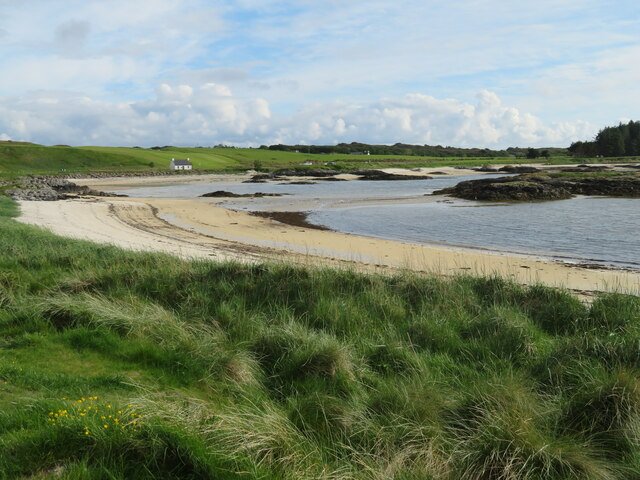
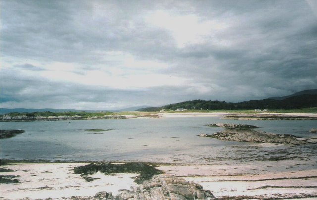
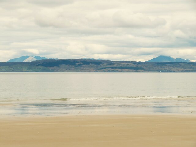
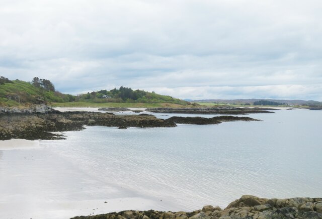
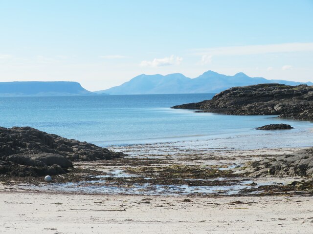
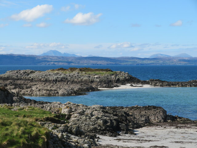
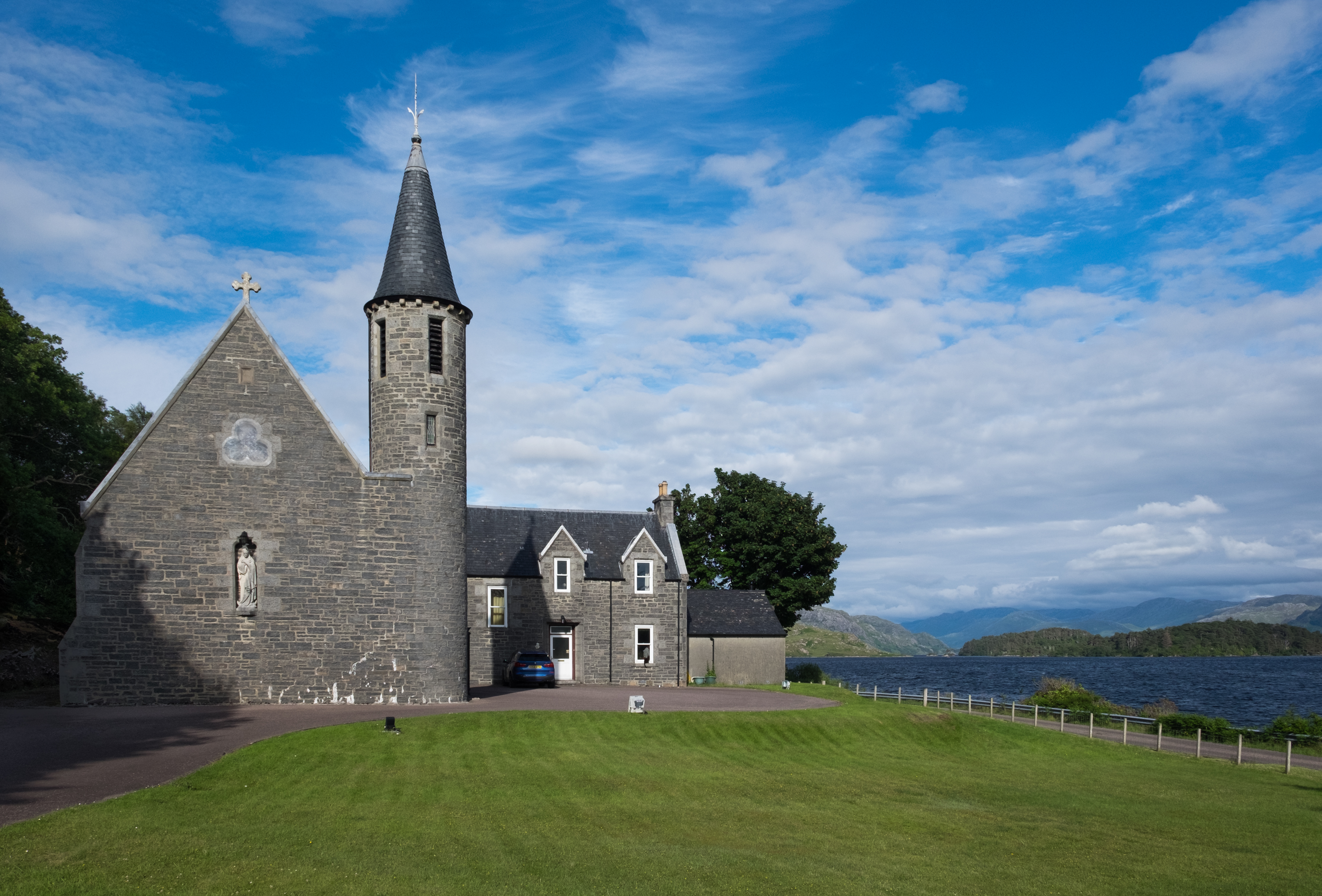
An Glas-eilean, also known as the Island, is a small island located in Inverness-shire, Scotland. Situated off the west coast of Scotland, this island is a hidden gem surrounded by breathtaking natural beauty. The island's name, which translates to "Green Island" in Gaelic, perfectly describes its lush landscapes and vibrant flora.

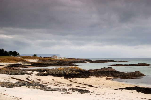
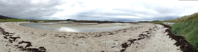
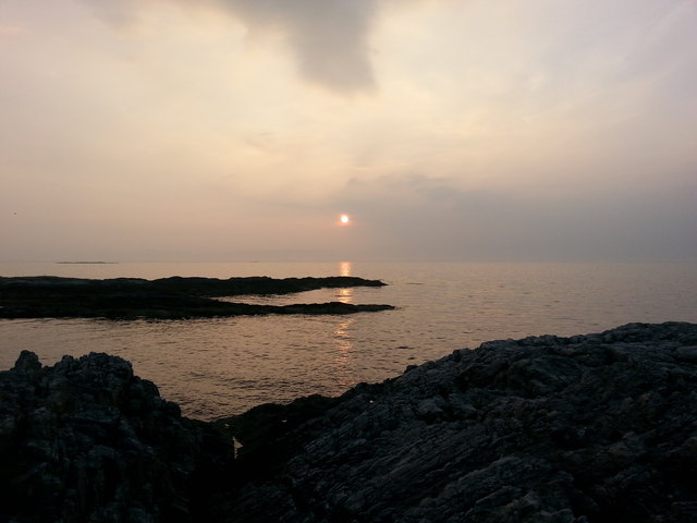
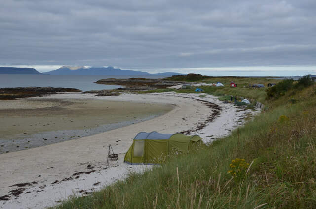
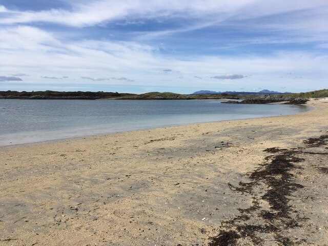
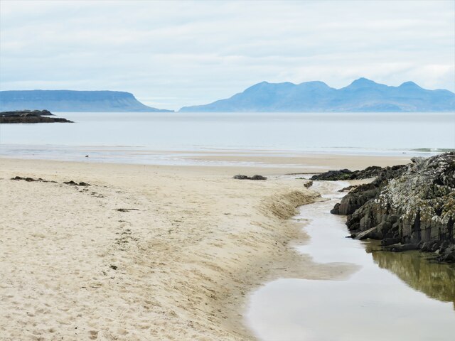
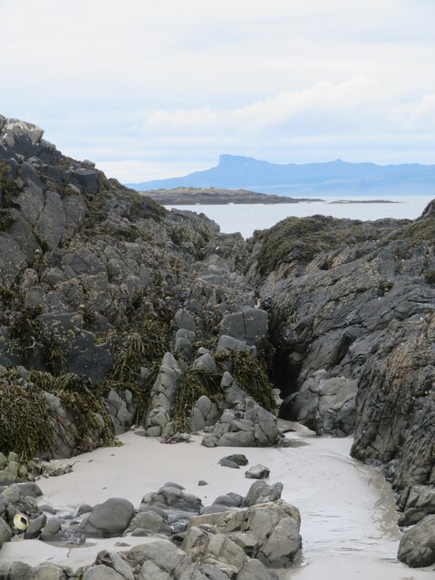
Covering an area of approximately 2 square miles, An Glas-eilean is mainly uninhabited, with only a few scattered cottages and a lighthouse. The island's rocky coastline is dotted with secluded sandy beaches, providing a haven for wildlife and nature enthusiasts. Visitors can explore the island's diverse wildlife, including seals, otters, and a variety of seabirds.

The island is a popular destination for outdoor activities such as hiking, birdwatching, and fishing. There are several walking trails that offer stunning views of the surrounding sea and the nearby mainland. The island's waters are also known for their rich marine life, attracting divers and snorkelers who can explore the underwater world.

An Glas-eilean's historical significance can be traced back to the Viking era, and remnants of ancient settlements can still be found on the island. Its picturesque ruins and ancient standing stones attract history enthusiasts and archaeology buffs.

To reach An Glas-eilean, visitors can take a short ferry ride from the mainland, which adds to the sense of adventure and seclusion. The island's untouched beauty and tranquil atmosphere make it a perfect escape from the hustle and bustle of modern life.

If you have any feedback on the listing, please let us know in the comments section below.

An Glas-eilean Images

Images are sourced within 2km of 56.951818/-5.871751 or Grid Reference NM6491. Thanks to Geograph Open Source API. All images are credited.

Lòn Liath - one of the Traigh beaches at Arisaig Never mind that Traigh is the Gaelic word for beach.
Lòn Liath - one of the Traigh beaches at Arisaig
Never mind that Traigh is the Gaelic word for beach.
Looking out to the Sound of Sleat from Sunnyside Croft Touring & Camping Site, 2 Bunacaimb
The silver sands near Portnaluchaig
Lon Liath The white sands of Lon Liath near Arisaig
Lon Liath
The white sands of Lon Liath near Arisaig
Silversands Caravan Park Silversands Caravan Park
Silversands Caravan Park
White Sands at Portnaluchaig, Morar
Beach at Portnaluchaig
Coastal road from Arisaig to Morar Silver sands fringe the Atlantic. Isle of Skye on the blue horizon
Coastal road from Arisaig to Morar
Silver sands fringe the Atlantic. Isle of Skye on the blue horizon
Silver Sands - Portnaluchaig A fine view of the Rocky shoreline just before sunset at Silver Sands at Portnaluchaig.
Silver Sands - Portnaluchaig
A fine view of the Rocky shoreline just before sunset at Silver Sands at Portnaluchaig.
White Sandy Beach near Arisaig, Scottish Highlands
Beach near Morar
Beach near Morar
A wee burn meets the sea A view of the beach at Camusdarach with Eigg and Rum almost touching each other out to sea.
A wee burn meets the sea
A view of the beach at Camusdarach with Eigg and Rum almost touching each other out to sea.
Shoreline at Camusdarach Tiny waves gently lap the shoreline here. The view is across the Sound of Sleat towards the Sleat peninsula on Skye, beyond which in the distance rise the jagged peaks of the main Cuillin range to the left and the more isolated and cloud capped Blaven to the right.
Shoreline at Camusdarach
Tiny waves gently lap the shoreline here. The view is across the Sound of Sleat towards the Sleat peninsula on Skye, beyond which in the distance rise the jagged peaks of the main Cuillin range to the left and the more isolated and cloud capped Blaven to the right.
Coastline at Camus an Daraich A series of rocky reefs separate areas of soft white sand along this delightful stretch of coastline.
Coastline at Camus an Daraich
A series of rocky reefs separate areas of soft white sand along this delightful stretch of coastline.
Sand, rocks, Eigg Ancient metamorphic rocks form reefs running out to sea here. Through the gap is the Sgurr on Eigg.
Sand, rocks, Eigg
Ancient metamorphic rocks form reefs running out to sea here. Through the gap is the Sgurr on Eigg.
A corner on the old road Cottage on a corner of the B8008, which until recent years was the main A830 from Fort William to Mallaig. This section was narrow and winding in places but afforded glorious views of the coastline. Now the A830 is a fast arterial road crossing the landscape further east.
A corner on the old road
Cottage on a corner of the B8008, which until recent years was the main A830 from Fort William to Mallaig. This section was narrow and winding in places but afforded glorious views of the coastline. Now the A830 is a fast arterial road crossing the landscape further east.
White sands, blue seas A small part of the beach facing out over Camus an Daraich and looking towards Eigg and Rum.
White sands, blue seas
A small part of the beach facing out over Camus an Daraich and looking towards Eigg and Rum.
View towards the Sound of Sleat Looking out from a mini peninsula across rocky reefs towards the distant shores of the Sleat peninsula on Skye. Blaven and its satellites on the left horizon with the Red Hills to the right.
View towards the Sound of Sleat
Looking out from a mini peninsula across rocky reefs towards the distant shores of the Sleat peninsula on Skye. Blaven and its satellites on the left horizon with the Red Hills to the right.
Show me another place!

An Glas-eilean is located at Grid Ref: NM6491 (Lat: 56.951818, Lng: -5.871751)

Unitary Authority: Highland

Police Authority: Highlands and Islands

What 3 Words

///moss.cursing.walls. Near Arisaig, Highland

Related Wikis

Glenancross

Glenancross is a settlement on the west coast of Scotland, overlooking the Sound of Sleat south of Mallaig, Lochaber, in the Scottish Highlands and is...

Portnaluchaig

Portnaluchaig is a coastal hamlet, located 2 miles north of Arisaig in the Highlands of Scotland and is also in the council area of Highland. The Small...

River Morar

The River Morar is a river that flows from Loch Morar in the west Highlands of Scotland. It flows from the western end of the loch to the estuary of Morar...

Back of Keppoch

Back of Keppoch (Gaelic: Cùl na Ceapaich) is a small coastal settlement in the northwest Scottish Highlands, 40 miles (65 kilometres) west of Fort William...

Eilean Ighe

Eilean Ighe is a small tidal island near Arisaig in the Inner Hebrides of Scotland. The area is popular for sea kayaking and a challenge for larger boats...

Morar railway station

Morar railway station is a railway station serving the village of Morar in the Highland region of Scotland. This station is on the West Highland Line,...

Morar Railway Viaduct

The Morar Railway Viaduct is a railway viaduct that carries the West Highland Line over the River Morar. == History == The West Highland Railway was built...

Morar

Morar (; Scottish Gaelic: Mòrar) is a small village on the west coast of Scotland, 3 miles (5 km) south of Mallaig. The name Morar is also applied to the...

Related Videos

Nearby Amenities

Located within 500m of 56.951818,-5.871751
Created By: dmgroom_coastlines
Source: PGS
Lat/Long: 56.951592/-5.873299
Source: PGS
Lat/Long: 56.9516798/-5.8737771
Created By: dmgroom_coastlines
Source: PGS
Lat/Long: 56.952604/-5.873845
Source: PGS
Lat/Long: 56.9524638/-5.8733479
Created By: dmgroom_coastlines
Source: PGS
Lat/Long: 56.953009/-5.872939
Created By: dmgroom_coastlines
Source: PGS
Lat/Long: 56.953159/-5.872013
Created By: dmgroom_coastlines
Source: PGS
Lat/Long: 56.952908/-5.87176
Created By: dmgroom_coastlines
Source: PGS
Lat/Long: 56.952663/-5.871273
Created By: dmgroom_coastlines
Source: PGS
Lat/Long: 56.952418/-5.870785
Source: PGS
Lat/Long: 56.9519021/-5.8704297
Source: PGS
Lat/Long: 56.9515628/-5.8709017
Created By: dmgroom_coastlines
Source: PGS
Lat/Long: 56.951752/-5.871905
Created By: dmgroom_coastlines
Source: PGS
Lat/Long: 56.951875/-5.872149
Created By: dmgroom_coastlines
Source: PGS
Lat/Long: 56.95213/-5.872169
Created By: dmgroom_coastlines
Source: PGS
Lat/Long: 56.952391/-5.871954
Created By: dmgroom_coastlines
Source: PGS
Lat/Long: 56.95237/-5.87289
Created By: dmgroom_coastlines
Source: PGS
Lat/Long: 56.952114/-5.87287
Created By: dmgroom_coastlines
Source: PGS
Lat/Long: 56.952104/-5.873338
Created By: dmgroom_coastlines
Source: PGS
Lat/Long: 56.950729/-5.871826
Created By: dmgroom_coastlines
Source: PGS
Lat/Long: 56.950707/-5.872762
Created By: dmgroom_coastlines
Source: PGS
Lat/Long: 56.950825/-5.87324
Created By: dmgroom_coastlines
Source: PGS
Lat/Long: 56.951081/-5.873259
Created By: dmgroom_coastlines
Source: PGS
Lat/Long: 56.951091/-5.872791
Created By: dmgroom_coastlines
Source: PGS
Lat/Long: 56.951603/-5.872831
Created By: dmgroom_coastlines
Source: PGS
Lat/Long: 56.951614/-5.872363
Created By: dmgroom_coastlines
Source: PGS
Lat/Long: 56.951363/-5.87211
Created By: dmgroom_coastlines
Source: PGS
Lat/Long: 56.951118/-5.871622
Created By: dmgroom_coastlines
Source: PGS
Lat/Long: 56.950863/-5.871603
Source: PGS
Lat/Long: 56.9500034/-5.8689877
Source: PGS
Lat/Long: 56.9502488/-5.8691738
Source: PGS
Lat/Long: 56.9503863/-5.8690504
Source: PGS
Lat/Long: 56.9498849/-5.8686921
The data included in this document is from www.openstreetmap.org. The data is made available under ODbL.

Have you been to An Glas-eilean?

Leave your review of An Glas-eilean below (or comments, questions and feedback).