Luton

Settlement in Devon Teignbridge

England

Luton

Luton (Devon) Village amenities - the old telephone contains a book library and the roadside cabinet contains eggs and vegetables ("hedge veg") for sale.
Luton (Devon) Credit: Colin Smith

Luton is a small village located in the county of Devon, England. Situated in the South Hams district, it is nestled in a picturesque countryside setting, surrounded by rolling hills and meandering rivers. Luton is approximately 8 miles northwest of the vibrant market town of Totnes and 20 miles southeast of Plymouth, the largest city in the region.

The village is known for its tranquil and idyllic atmosphere, making it a popular destination for those seeking a peaceful retreat away from the hustle and bustle of city life. Luton's charming character is reflected in its traditional thatched-roof cottages, quaint village green, and a 14th-century parish church, adding to its rustic charm.

Despite its small size, Luton offers a range of amenities to its residents and visitors. There is a local pub, The Elfordleigh, which serves classic pub food and ales, as well as a village shop and a post office. The community spirit in Luton is strong, with various events and activities organized throughout the year to bring locals together.

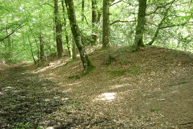
For outdoor enthusiasts, Luton offers ample opportunities for exploring the surrounding natural beauty. The village is situated near the Dartmoor National Park, providing access to stunning moorland landscapes, hiking trails, and wildlife spotting. Additionally, the nearby River Plym offers fishing and boating activities for those who enjoy water-based pursuits.

In summary, Luton is a charming village in Devon, offering a peaceful retreat in a picturesque countryside setting. Its traditional architecture, community spirit, and proximity to natural attractions make it an appealing destination for both residents and visitors.

If you have any feedback on the listing, please let us know in the comments section below.
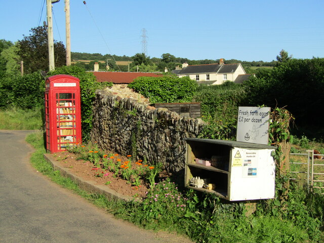
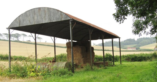
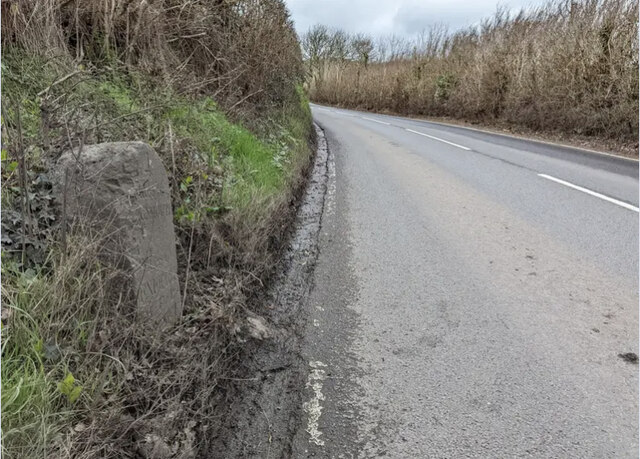
Luton Images

Images are sourced within 2km of 50.581408/-3.552979 or Grid Reference SX9076. Thanks to Geograph Open Source API. All images are credited.

Luton (Devon) Village amenities - the old telephone contains a book library and the roadside cabinet contains eggs and vegetables ("hedge veg") for sale.
Luton (Devon)
Village amenities - the old telephone contains a book library and the roadside cabinet contains eggs and vegetables ("hedge veg") for sale.
Luton (Devon) - Church Luton has a chapel of ease, dedicated to St John the Evangelist, built in the 19th century.
Luton (Devon) - Church
Luton has a chapel of ease, dedicated to St John the Evangelist, built in the 19th century.
Luton (Devon) Valley with grassland and woodland by Cherrycombe.
Luton (Devon)
Valley with grassland and woodland by Cherrycombe.
Luton - Lane Hedge-lined lane in deepest Devon, close to Westhayes Farm, a dairy farm.
Luton - Lane
Hedge-lined lane in deepest Devon, close to Westhayes Farm, a dairy farm.
Luton (Devon) - Dutch Barn A barrel roof but no walls. Dutch barns are a relatively recent feature in British farm architecture, most dating from the 19th century. Nowadays they are more commonly used to store hay and straw.
Luton (Devon) - Dutch Barn
A barrel roof but no walls. Dutch barns are a relatively recent feature in British farm architecture, most dating from the 19th century. Nowadays they are more commonly used to store hay and straw.
Humber - Humber Barn Patchwork of cereal fields lined by hedgerows with Humber Barn nestling in a valley on the hillside.
Humber - Humber Barn
Patchwork of cereal fields lined by hedgerows with Humber Barn nestling in a valley on the hillside.
Luton - Hayes Farm Farmhouse and holiday cottages surrounded by a patchwork of hedgerow-lined fields.
Luton - Hayes Farm
Farmhouse and holiday cottages surrounded by a patchwork of hedgerow-lined fields.
Luton - Hayes Farm Farmhouse and holiday cottages surrounded by a patchwork of hedgerow-lined fields.
Luton - Hayes Farm
Farmhouse and holiday cottages surrounded by a patchwork of hedgerow-lined fields.
Luton (Devon) - The Elizabethan A cosy Devon village pub which sources local food from the farming community.
<span class="nowrap"><a title="www.elizabethaninn.co.uk" rel="nofollow ugc noopener" href="http://www.elizabethaninn.co.uk">Link</a><img style="margin-left:2px;" alt="External link" title="External link - shift click to open in new window" src="https://s1.geograph.org.uk/img/external.png" width="10" height="10"/></span>
Luton (Devon) - The Elizabethan
A cosy Devon village pub which sources local food from the farming community. LinkExternal link
Old Milestone by the B3192, Colley Lane, Bishopsteignton Parish Carved stone post by the B3192, in parish of BISHOPSTEIGNTON (TEIGNBRIDGE District), Colley Lane; 450m North West of turn to Luton, 100m North of small Transco depot, on grass verge, near bend in road above ditch, on West side of road. Teignmouth detail tombstone, erected by the Teignmouth & Dawlish turnpike trust in the 19th century.

Inscription reads:-
4
MILES TO
TEIGNMOUTH
MILES TO
EXETER
M.F.P.
(9-5-4)
Carved benchmark on bottom of front face.

Devon & Dartmoor HER listed
HER Number: MDV23191 <span class="nowrap"><a title="https://historicengland.org.uk/listing/the-list/map-search?clearresults=true#?search=ST47776749" rel="nofollow ugc noopener" href="https://historicengland.org.uk/listing/the-list/map-search?clearresults=true#?search=ST47776749">Link</a><img style="margin-left:2px;" alt="External link" title="External link - shift click to open in new window" src="https://s1.geograph.org.uk/img/external.png" width="10" height="10"/></span>

Milestone Society National ID: DV_TGEX04
Old Milestone by the B3192, Colley Lane, Bishopsteignton Parish
Carved stone post by the B3192, in parish of BISHOPSTEIGNTON (TEIGNBRIDGE District), Colley Lane; 450m North West of turn to Luton, 100m North of small Transco depot, on grass verge, near bend in road above ditch, on West side of road. Teignmouth detail tombstone, erected by the Teignmouth & Dawlish turnpike trust in the 19th century. Inscription reads:- 4 MILES TO TEIGNMOUTH MILES TO EXETER M.F.P. (9-5-4) Carved benchmark on bottom of front face. Devon & Dartmoor HER listed HER Number: MDV23191 LinkExternal link Milestone Society National ID: DV_TGEX04
Luton - Hayes Farm Mews Entrance to holiday accommodation at Hayes Farm, a dairy farm.
Luton - Hayes Farm Mews
Entrance to holiday accommodation at Hayes Farm, a dairy farm.
Luton - Rocky Hill Path showing the underlying red rock - sandstone.
Luton - Rocky Hill
Path showing the underlying red rock - sandstone.
Lindridge Park Lodges flank the entrance to this historic and large country estate near Ideford.
Lindridge Park
Lodges flank the entrance to this historic and large country estate near Ideford.
Humber - Higher Humber Farm Beer garden at the Red Rock Microbrewery near Ideford. Red Rock is a family run brewery sited at Higher Humber Farm since 2006 and takes its name from the underlying Devonian bedrock.
<span class="nowrap"><a title="www.redrockbrewery.co.uk" rel="nofollow ugc noopener" href="http://www.redrockbrewery.co.uk">Link</a><img style="margin-left:2px;" alt="External link" title="External link - shift click to open in new window" src="https://s1.geograph.org.uk/img/external.png" width="10" height="10"/></span>
Humber - Higher Humber Farm
Beer garden at the Red Rock Microbrewery near Ideford. Red Rock is a family run brewery sited at Higher Humber Farm since 2006 and takes its name from the underlying Devonian bedrock. LinkExternal link
Luton (Devon) A patchwork of hedgerow-lined fields on a hillside near Luton. Dartmoor is on the skyline.
Luton (Devon)
A patchwork of hedgerow-lined fields on a hillside near Luton. Dartmoor is on the skyline.
Ideford - The Royal Oak The Royal Oak is an historic village pub, ca late 17th century building with a thatched roof.
Ideford - The Royal Oak
The Royal Oak is an historic village pub, ca late 17th century building with a thatched roof.
Luton - Westhayes Farm Newborn calves on the dairy farm.
Luton - Westhayes Farm
Newborn calves on the dairy farm.
Luton (Devon) Newborn calves tucking in at one of their first feeding times on the dairy farm.
Luton (Devon)
Newborn calves tucking in at one of their first feeding times on the dairy farm.
Show me another place!

Luton is located at Grid Ref: SX9076 (Lat: 50.581408, Lng: -3.552979)

Administrative County: Devon

District: Teignbridge

Police Authority: Devon and Cornwall

What 3 Words

///tour.haircuts.avocado. Near Bishopsteignton, Devon

Related Wikis

Luton, Teignbridge

Luton is a village in Devon, England, within Teignbridge local authority area. Historically Luton formed part of Ashcombe Hundred.The village is in the...

Ideford

Ideford (or Ideford Parish) is a village in the Teignbridge district of Devon, England. It is 5 miles (8 km) north of Newton Abbot. To the west is the...
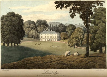
Lindridge House

Lindridge House was a large 17th-century mansion (with 20th-century alterations), one of the finest in the south-west situated about 1 mile south of Ideford...

Ideford Common

Ideford Common is a Site of Special Scientific Interest consisting of an area of lowland heath in Devon, England. The site is a habitat for nightjars and...

Haldon Aerodrome

Haldon Aerodrome was the first airfield in Devon. Established in the 1920s as a private flying field, it developed into an airport with scheduled airline...

Castle Dyke

Castle Dyke is an Iron Age hill fort situated between Chudleigh and Dawlish in Devon, England. The fort is situated on a hilltop at approximately 140 metres...

Ashcombe

Ashcombe is a village and civil parish in the Teignbridge district of Devon, England, about eight miles south of the city of Exeter. The parish is surrounded...
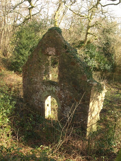
Lidwell Chapel

Lidwell Chapel, also known as St Mary's Chapel, is a medieval chapel, now in ruins, within the parish of Dawlish in Devon, England. The chapel is a Grade...

Nearby Amenities

Located within 500m of 50.581408,-3.552979
Pub
The Elizabethan Inn
Wikidata: Q80477330
Lat/Long: 50.5815992/-3.5519493
Luton
Place: village
Wikidata: Q6705865
Lat/Long: 50.5819112/-3.553292
Design: barrel
Power: tower
Lat/Long: 50.5782003/-3.5560574
Design: barrel
Power: tower
Lat/Long: 50.5793266/-3.5532493
Design: barrel
Power: tower
Lat/Long: 50.5807898/-3.5494886
Design: asymmetric
Power: tower
Lat/Long: 50.5848422/-3.5514273
Design: asymmetric
Power: tower
Lat/Long: 50.5835373/-3.5547466
Design: asymmetric
Power: tower
Lat/Long: 50.5828405/-3.5565394
Generator Method: photovoltaic
Generator Output Electricity: yes
Generator Source: solar
Generator Type: solar_photovoltaic_panel
Location: roof
Power: generator
Lat/Long: 50.5811869/-3.5532671
Generator Method: photovoltaic
Generator Output Electricity: yes
Generator Source: solar
Generator Type: solar_photovoltaic_panel
Location: roof
Power: generator
Lat/Long: 50.5823953/-3.5510945
Generator Method: photovoltaic
Generator Output Electricity: yes
Generator Source: solar
Generator Type: solar_photovoltaic_panel
Location: roof
Power: generator
Lat/Long: 50.5827061/-3.5506345
Post Box
Brand: Royal Mail
Brand Wikidata: Q638098
Brand Wikipedia: en:Royal Mail
Collection Times: Mo-Fr 16:00; Sa 11:30; Su off
Drive Through: no
Operator: Royal Mail
Operator Wikidata: Q638098
Post Box Design: type_c
Post Box Mounting: building
Post Box Type: wall
Ref: TQ13 61
Royal Cypher: VR
Royal Cypher Wikidata: Q33102356
Source: survey;streetlevel imagery;aerial imagery
Lat/Long: 50.58194/-3.5536131
Public Bookcase
Booth: K6
Disused Amenity: telephone
Man Made: telephone_box
Public Bookcase Type: phone_box
Lat/Long: 50.581885/-3.5536749
The data included in this document is from www.openstreetmap.org. The data is made available under ODbL.

Have you been to Luton?

Leave your review of Luton below (or comments, questions and feedback).