Sgeir Dhearg

Island in Argyllshire

Scotland

Sgeir Dhearg

Above Croig Beach We are just above Croig beach - a sandy beach with rocky outcrops.
Above Croig Beach Credit: Malcolm Neal

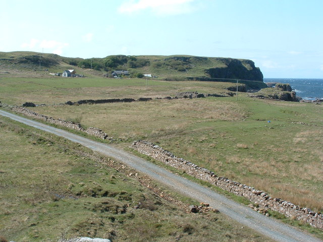
Sgeir Dhearg is a small uninhabited island located off the coast of Argyllshire, Scotland. It is situated in the Inner Hebrides, specifically within the Firth of Lorn, and is part of the Argyll and Bute council area. The island is approximately 1.5 kilometers long and 0.5 kilometers wide, with a total land area of around 0.4 square kilometers.

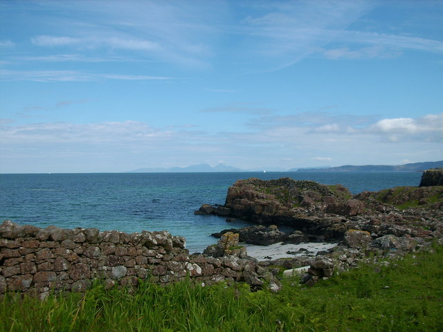
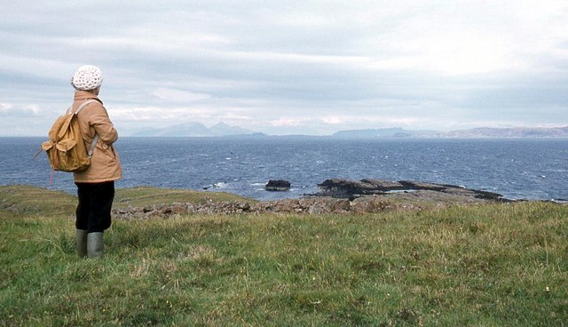
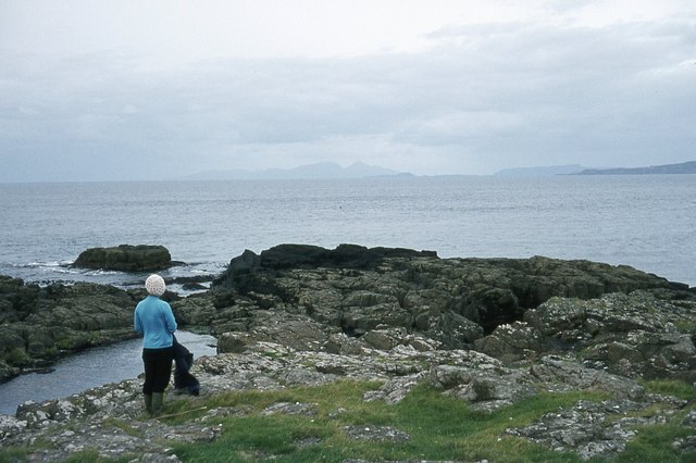
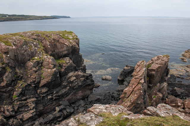
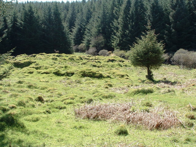
Sgeir Dhearg is characterized by its rugged and rocky terrain, with steep cliffs rising from the surrounding sea. The island's name, which translates to "Red Skerry" in English, is derived from the reddish hue of the rocks that make up its coastline. Its remote location and challenging topography make it difficult for humans to access and inhabit the island.

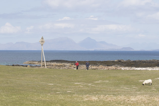
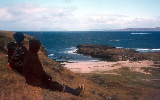
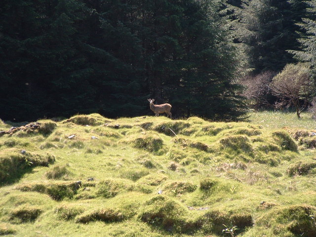
Despite its lack of human settlement, Sgeir Dhearg is home to a variety of wildlife. The surrounding waters are rich in marine life, making it a popular spot for fishing and diving enthusiasts. Seabirds, such as gulls and cormorants, can often be seen nesting on the cliffs, while seals and dolphins are frequent visitors to the area.

Due to its natural beauty and ecological importance, Sgeir Dhearg is often visited by tourists and nature enthusiasts. However, its fragile ecosystem is protected, and visitors are encouraged to respect the island's wildlife and refrain from disturbing its delicate balance.

If you have any feedback on the listing, please let us know in the comments section below.

Sgeir Dhearg Images

Images are sourced within 2km of 56.612803/-6.2289209 or Grid Reference NM4054. Thanks to Geograph Open Source API. All images are credited.

Above Croig Beach We are just above Croig beach - a sandy beach with rocky outcrops.
Above Croig Beach
We are just above Croig beach - a sandy beach with rocky outcrops.
Road towards B&B
Road towards B&B
Overlooking Beach near Croig, Mull Looking over lovely scheduled beach near Croig, Mull.  Rum in the far distance
Overlooking Beach near Croig, Mull
Looking over lovely scheduled beach near Croig, Mull. Rum in the far distance
Port na Bà, the port of the cattle Rum, Eigg and Ardnamurchan point in the distance
Port na Bà, the port of the cattle
Rum, Eigg and Ardnamurchan point in the distance
Rubha na h-Àirde The view is north to the Small Isles
Rubha na h-Àirde
The view is north to the Small Isles
Rubha na h-Àirde
Rubha na h-Àirde
Sea Cliffs at Rubha an h-Airde
House at Aird A quite new development which looks like a holiday let at Aird on the track to Rubha an h-Airde
House at Aird
A quite new development which looks like a holiday let at Aird on the track to Rubha an h-Airde
Kildavie Remains of settlement now surrounded by forestry. I'd wandered around for a bit then found a bit of higher ground to take the picture from, only then did I realise I wasn't alone.
Kildavie
Remains of settlement now surrounded by forestry. I'd wandered around for a bit then found a bit of higher ground to take the picture from, only then did I realise I wasn't alone.
My deer friend After a minute or so, long enough to get this shot, it turned and wandered off through the trees.
My deer friend
After a minute or so, long enough to get this shot, it turned and wandered off through the trees.
Houses by Sron Fhionn According to the sign on the gate back at Croig, one of these is a B&B.
Houses by Sron Fhionn
According to the sign on the gate back at Croig, one of these is a B&B.
Dun Guaidhre Remains of the fort NW of Croig.
Dun Guaidhre
Remains of the fort NW of Croig.
Rocky Inlet, Port na Ba With the mountains of Skye in the distance.
Rocky Inlet, Port na Ba
With the mountains of Skye in the distance.
Port na Ba Idyllic shell beach overlooking the Sound of Mull.
Port na Ba
Idyllic shell beach overlooking the Sound of Mull.
Coast Near Port na Ba In the distance are the mountains of Skye and the pont of Ardnamurchan.
Coast Near Port na Ba
In the distance are the mountains of Skye and the pont of Ardnamurchan.
View South From the Rocky Inlet, Port na Ba Looking towards the crofts of Rubha an Aird sited safely above the high water mark.
View South From the Rocky Inlet, Port na Ba
Looking towards the crofts of Rubha an Aird sited safely above the high water mark.
View Across the Fields Towards Rubha Mor And the Quinish peninsula beyond across the entrance to the approached to Croig.
View Across the Fields Towards Rubha Mor
And the Quinish peninsula beyond across the entrance to the approached to Croig.
Beach near Croig, Mull Lovely secluded beach, with views to Rum
Beach near Croig, Mull
Lovely secluded beach, with views to Rum
Show me another place!

Sgeir Dhearg is located at Grid Ref: NM4054 (Lat: 56.612803, Lng: -6.2289209)

Unitary Authority: Argyll and Bute

Police Authority: Argyll and West Dunbartonshire

What 3 Words

///bulge.surveyed.prospers. Near Dervaig, Argyll & Bute

Related Wikis

Dervaig

Dervaig (Scottish Gaelic: Dearbhaig) is a small village on the Isle of Mull off the west coast of Scotland. The village is within the parish of Kilninian...

Glengorm Castle

Glengorm Castle, also known as Castle Sorne, is a 19th-century country house on the Isle of Mull, Scotland. Located in Mishnish, 6 kilometres (4 mi) northwest...

Calgary, Mull

Calgary is a hamlet on the northwest coast of the Isle of Mull, in Argyll and Bute, Scotland, United Kingdom. The hamlet is within the parish of Kilninian...

Calgary Castle

Calgary Castle, also known as Calgary House, is a 19th-century castellated Gothic mansion at Calgary on the Isle of Mull, Scotland. The mansion faces Calgary...

Nearby Amenities

Located within 500m of 56.612803,-6.2289209
Alltantairbh
Place: hamlet
Lat/Long: 56.6156713/-6.2233301
The data included in this document is from www.openstreetmap.org. The data is made available under ODbL.

Have you been to Sgeir Dhearg?

Leave your review of Sgeir Dhearg below (or comments, questions and feedback).