Carraig Ghilliondrais

Island in Argyllshire

Scotland

Carraig Ghilliondrais

The A849 Near Ardfenaig.
The A849 Credit: Andrew Abbott

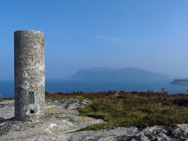
Carraig Ghilliondrais, also known as the Isle of Gigha, is a small island located off the west coast of Scotland in Argyllshire. Covering an area of approximately 15 square kilometers, it is home to a population of around 150 people.

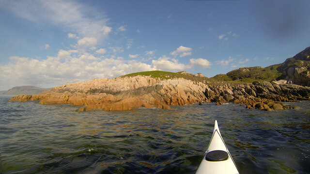
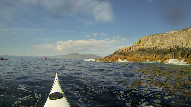
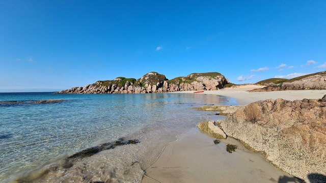
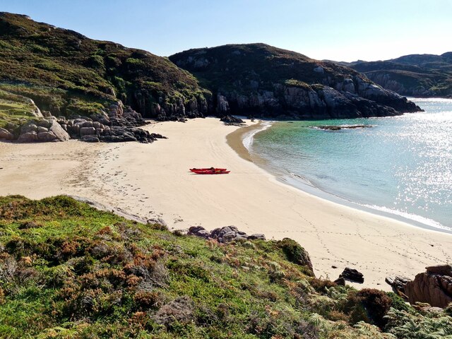
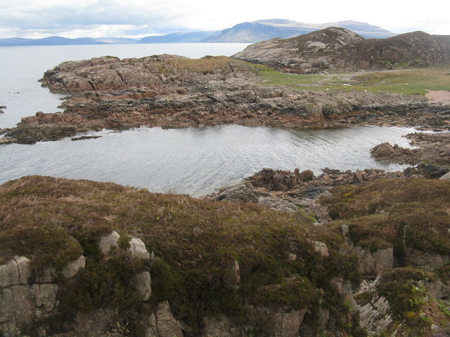
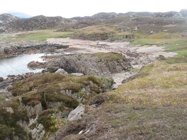
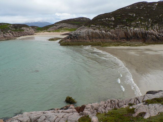
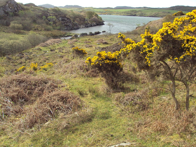
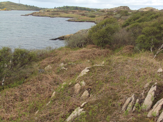
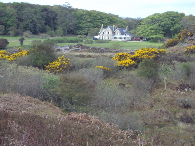
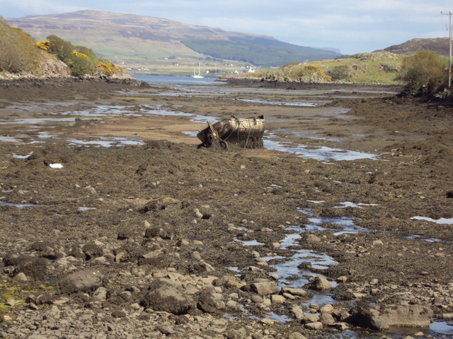
The island's landscape consists of picturesque sandy beaches, rugged cliffs, and rolling green hills. Gigha is renowned for its beautiful gardens, including the Achamore Gardens, which boasts a wide variety of exotic plants and a collection of rhododendrons. These gardens attract visitors from both Scotland and abroad.

The island has a rich history, with evidence of human settlement dating back thousands of years. Ruins of ancient forts and stone circles can be found, offering glimpses into Gigha's past. In more recent history, the island was under the ownership of the MacNeill family for several centuries until it was purchased by the Isle of Gigha Heritage Trust in 2002, becoming one of Scotland's first community-owned islands.

Carraig Ghilliondrais offers a peaceful and tranquil environment, making it an ideal destination for those seeking relaxation and nature. There are several walking trails, allowing visitors to explore the island's stunning landscapes and observe its diverse wildlife, including seals, otters, and a wide variety of bird species.

Facilities on the island include a hotel, a shop, and a post office, providing basic amenities for both residents and tourists. The island's small population contributes to its close-knit community, offering a warm and welcoming atmosphere to all who visit Carraig Ghilliondrais.

If you have any feedback on the listing, please let us know in the comments section below.

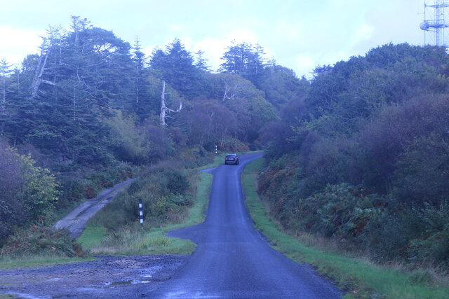
Carraig Ghilliondrais Images

Images are sourced within 2km of 56.340413/-6.2856922 or Grid Reference NM3524. Thanks to Geograph Open Source API. All images are credited.

The A849 Near Ardfenaig.
The A849
Near Ardfenaig.
Rubh' Eilean an t-Santachaidh from the west, evening Taken during a paddle from Bunessan round to Fidden Farm on the Ross of Mull, the evening sun made for sore eyes paddling west, but provided great lighting looking back. The Ross of Mull Granite is here part of the RM1 zone of equigranular biotite monzogranite, well outside the zone with diorite xenoliths seen so well to the SW (eg. in Erraid). Reference: BGS Scotland Sheet 43S, "Ross of Mull", provisional series 1:50000, 1999. The lovely pink feldspars catch the rays of the setting sun, but the quartz crystals provide a rough time for any rock-hopping sea kayaker who gets a bit too close. There was very little swell here this evening, but further west as we approached the Sound of Iona, conditions got more exciting.
Rubh' Eilean an t-Santachaidh from the west, evening
Taken during a paddle from Bunessan round to Fidden Farm on the Ross of Mull, the evening sun made for sore eyes paddling west, but provided great lighting looking back. The Ross of Mull Granite is here part of the RM1 zone of equigranular biotite monzogranite, well outside the zone with diorite xenoliths seen so well to the SW (eg. in Erraid). Reference: BGS Scotland Sheet 43S, "Ross of Mull", provisional series 1:50000, 1999. The lovely pink feldspars catch the rays of the setting sun, but the quartz crystals provide a rough time for any rock-hopping sea kayaker who gets a bit too close. There was very little swell here this evening, but further west as we approached the Sound of Iona, conditions got more exciting.
Passing Rubha na Reing, seen from the entrance of Garbh Phort Taken during a paddle from Bunessan round to Fidden Farm on the Ross of Mull, the evening sun made for sore eyes paddling west, but provided great lighting looking back. The Ross of Mull Granite is here part of the RM1 zone of equigranular biotite monzogranite, well outside the zone with diorite xenoliths seen so well to the SW (eg. in Erraid). Reference: BGS Scotland Sheet 43S, "Ross of Mull", provisional series 1:50000, 1999. The lovely pink feldspars catch the rays of the setting sun, but the quartz crystals provide a rough time for any rock-hopping sea kayaker who gets a bit too close. There had been little swell to the east, protected by this small headland, but as we pass to its west, the conditions are getting a bit more interesting and we would meet some quite big waves as we headed for the Sound of Iona.
Passing Rubha na Reing, seen from the entrance of Garbh Phort
Taken during a paddle from Bunessan round to Fidden Farm on the Ross of Mull, the evening sun made for sore eyes paddling west, but provided great lighting looking back. The Ross of Mull Granite is here part of the RM1 zone of equigranular biotite monzogranite, well outside the zone with diorite xenoliths seen so well to the SW (eg. in Erraid). Reference: BGS Scotland Sheet 43S, "Ross of Mull", provisional series 1:50000, 1999. The lovely pink feldspars catch the rays of the setting sun, but the quartz crystals provide a rough time for any rock-hopping sea kayaker who gets a bit too close. There had been little swell to the east, protected by this small headland, but as we pass to its west, the conditions are getting a bit more interesting and we would meet some quite big waves as we headed for the Sound of Iona.
Traigh Eilean an t-Santachaidh View along the beach called Traigh Eilean an t-Santachaidh
Traigh Eilean an t-Santachaidh
View along the beach called Traigh Eilean an t-Santachaidh
Traigh Eilean an t-Santachaidh View of Traigh Eilean an t-Santachaidh and the rocky promontory that separates it from Traigh na Margaidh
Traigh Eilean an t-Santachaidh
View of Traigh Eilean an t-Santachaidh and the rocky promontory that separates it from Traigh na Margaidh
Port Gart an Fhithrich Looking across to Ardmenach.
Port Gart an Fhithrich
Looking across to Ardmenach.
Port Gart an Fhithrich A small beach near Kintra on the Ross of Mull.
Port Gart an Fhithrich
A small beach near Kintra on the Ross of Mull.
Eastern lobe of the beach; Traigh na Margaidh Looking over the bay to the easternmost beach - Traigh na Margaidh
Eastern lobe of the beach; Traigh na Margaidh
Looking over the bay to the easternmost beach - Traigh na Margaidh
An t-Aird summit Rocks, heather & grass
An t-Aird summit
Rocks, heather & grass
Minor inlet on Loch Caol
Rocky beach on Loch na Lathaich, Isle of Mull
Along the shoreline of Loch Caol, Isle of Mull
Ardfenaig House, Isle of Mull
Loch Caol at low tide Sunken boatin this tidal loch
Loch Caol at low tide
Sunken boatin this tidal loch
Path to Camas Tuath, Isle of Mull The path runs between the A849 and the bay of Camas Tuath where there is an outdoor centre, run by the Iona Community, which is only accessible by the path or boat.  Long lengths of the path are boardwalks.

The centre's wind turbine can just be seen on Cnoc Mor ahead.
Path to Camas Tuath, Isle of Mull
The path runs between the A849 and the bay of Camas Tuath where there is an outdoor centre, run by the Iona Community, which is only accessible by the path or boat. Long lengths of the path are boardwalks. The centre's wind turbine can just be seen on Cnoc Mor ahead.
Coastline, Rubha na Tràighe-maoraich, Isle of Mull Looking towards Creach Bheinn and Bearraich on the Ardmeanach peninsula.
Coastline, Rubha na Tràighe-maoraich, Isle of Mull
Looking towards Creach Bheinn and Bearraich on the Ardmeanach peninsula.
Triangulation pillar, Beinn Liathanach, Isle of Mull Looking towards Creach Bheinn and Bearraich on the Ardmeanach peninsula.
Triangulation pillar, Beinn Liathanach, Isle of Mull
Looking towards Creach Bheinn and Bearraich on the Ardmeanach peninsula.
Ardfenaig, Ross of Mull
Show me another place!

Carraig Ghilliondrais is located at Grid Ref: NM3524 (Lat: 56.340413, Lng: -6.2856922)

Unitary Authority: Argyll and Bute

Police Authority: Argyll and West Dunbartonshire

What 3 Words

///initiates.hedgehog.villas. Near Fionnphort, Argyll & Bute

Related Wikis

Camas Tuath

Camas Tuath (Scottish Gaelic: north bay) is an inlet bay on the Ross of Mull. The bay has two small tidal islands and two Quarrymans' Cottages which the...

Suidhe

Suidhe (Scottish Gaelic: Suidhe) is a ruined township located on the southwestern peninsula of the Isle of Mull, Scotland. It lies just over 1 km to the...

Ross of Mull

The Ross of Mull (Scottish Gaelic: An Ros Mhuileach) is the largest peninsula of the Isle of Mull, about 28 kilometres (17 mi) long, and makes up the south...

Kintra

Kintra (Scottish Gaelic: Ceann na Tràgha), literally "country" in Scots is a settlement on the North-Western coast of the Ross of Mull, Scotland. The settlement...

Nearby Amenities

Located within 500m of 56.340413,-6.2856922
Camas Tuath
Natural: bay
Wikidata: Q3776721
Wikipedia: en:Camas Tuath
Lat/Long: 56.339/-6.2888382
The data included in this document is from www.openstreetmap.org. The data is made available under ODbL.

Have you been to Carraig Ghilliondrais?

Leave your review of Carraig Ghilliondrais below (or comments, questions and feedback).