Am Buachaille
Island in Argyllshire
Scotland
Am Buachaille

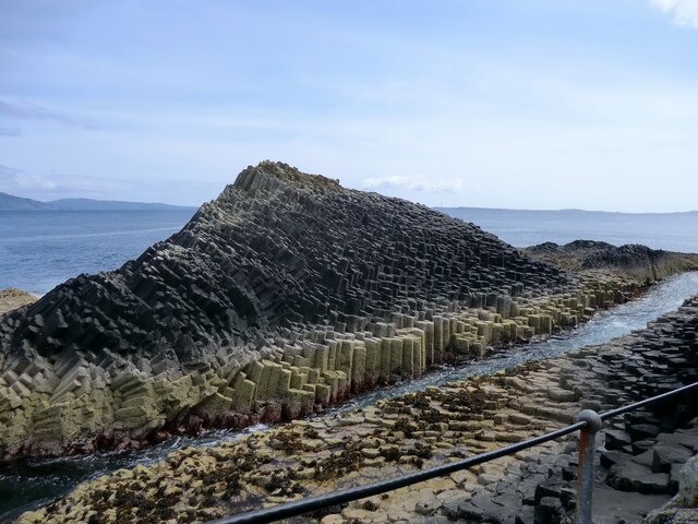
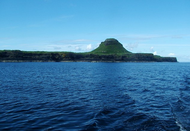
Am Buachaille is a small island located off the coast of Argyllshire in western Scotland. Situated in the Inner Hebrides, it is known for its scenic beauty and rich history. The island covers an area of approximately 1 square mile and is surrounded by the crystal-clear waters of the Atlantic Ocean.
The landscape of Am Buachaille is characterized by rolling hills, rugged cliffs, and stunning beaches. The island is predominantly covered in heather moorland, providing a vibrant display of colors during the summer months. On the eastern side, there is a small forested area, which adds to the diversity of the island's flora.
The island has a small population, with only a handful of residents who live in traditional stone cottages. These residents mainly rely on fishing and agriculture for their livelihoods. The island's economy is predominantly based on tourism, attracting visitors who are drawn to its unspoiled natural beauty and tranquility.
Am Buachaille has a rich history, with evidence of human habitation dating back thousands of years. Archaeological sites, such as ancient burial cairns and standing stones, provide glimpses into the island's past. The ruins of a medieval castle, perched on a cliff overlooking the sea, also add to its historical significance.
Visitors to Am Buachaille can enjoy activities such as hiking, birdwatching, and fishing. The island is home to a variety of bird species, including puffins, guillemots, and sea eagles, making it a haven for bird enthusiasts. The surrounding waters also offer opportunities for boat trips and water sports.
In summary, Am Buachaille is a picturesque island in Argyllshire, Scotland, boasting stunning landscapes, a rich history, and a peaceful atmosphere. It is an ideal destination for those seeking a remote and unspoiled natural retreat.
If you have any feedback on the listing, please let us know in the comments section below.
Am Buachaille Images
Images are sourced within 2km of 56.432268/-6.3391536 or Grid Reference NM3235. Thanks to Geograph Open Source API. All images are credited.


Am Buachaille is located at Grid Ref: NM3235 (Lat: 56.432268, Lng: -6.3391536)
Unitary Authority: Argyll and Bute
Police Authority: Argyll and West Dunbartonshire
What 3 Words
///volcano.keeps.column. Near Fionnphort, Argyll & Bute
Nearby Locations
Related Wikis
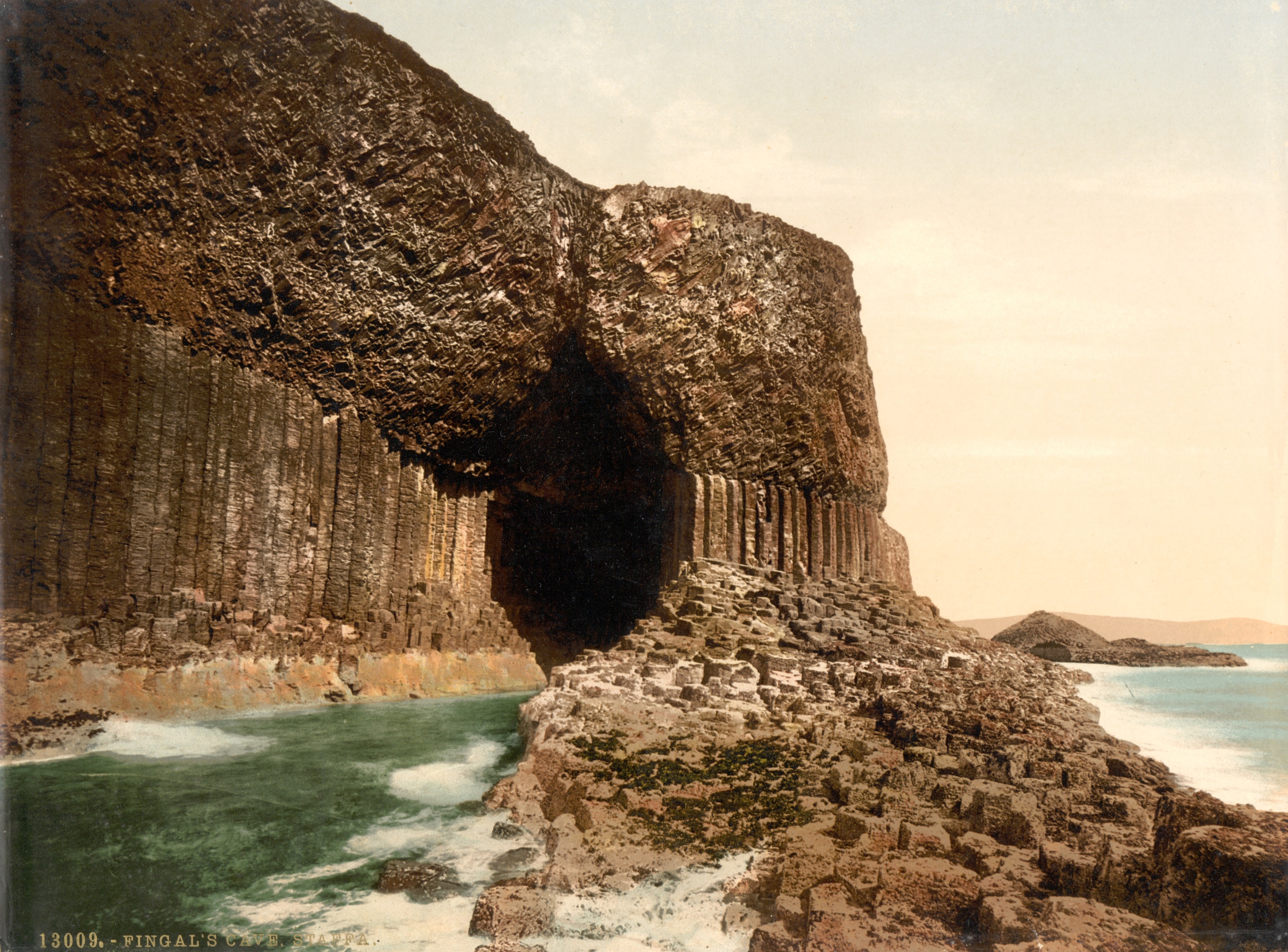
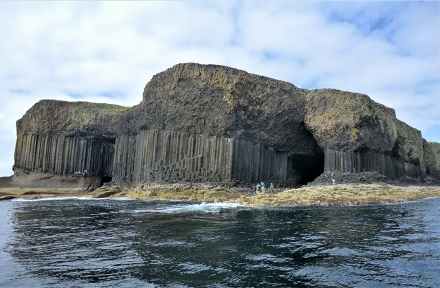
Fingal's Cave
Fingal's Cave is a sea cave on the uninhabited island of Staffa, in the Inner Hebrides of Scotland, known for its natural acoustics. The National Trust...

Staffa
Staffa (Scottish Gaelic: Stafa, pronounced [ˈs̪t̪afa], from the Old Norse for stave or pillar island) is an island of the Inner Hebrides in Argyll and...

Little Colonsay
Little Colonsay (Scottish Gaelic: Colbhasa Beag) is an uninhabited island west of the island of the Isle of Mull in Scotland. The geology of the island...
Gometra
Gometra (Scottish Gaelic: Gòmastra) is an island in the Inner Hebrides of Scotland, lying west of Mull. It lies immediately west of Ulva, to which it is...
Lunga, Treshnish Isles
The island of Lunga is the largest of the Treshnish Isles in Argyll and Bute, Scotland. The Isles are part of the Loch Na Keal National Scenic Area....
Treshnish Isles
The Treshnish Isles are an archipelago of small islands and skerries, lying west of the Isle of Mull, in Scotland. They are part of the Inner Hebrides...
Bac Mòr
Bac Mòr is a Scottish island, one of the Treshnish Isles, sometimes referred to as The Dutchman's Cap in English because of its shape. == Origin of... ==
Fladda, Treshnish Isles
Fladda is the northernmost of the Treshnish Isles. Its name comes from the Old Norse Flat-ey meaning "flat island". Fladda is owned by the Hebridean Trust...
Nearby Amenities
Located within 500m of 56.432268,-6.3391536Have you been to Am Buachaille?
Leave your review of Am Buachaille below (or comments, questions and feedback).