Lunning

Settlement in Shetland

Scotland

Lunning

Bonidale, Lunning, from Lunning Sound
Bonidale, Lunning, from Lunning Sound Credit: Mike Pennington

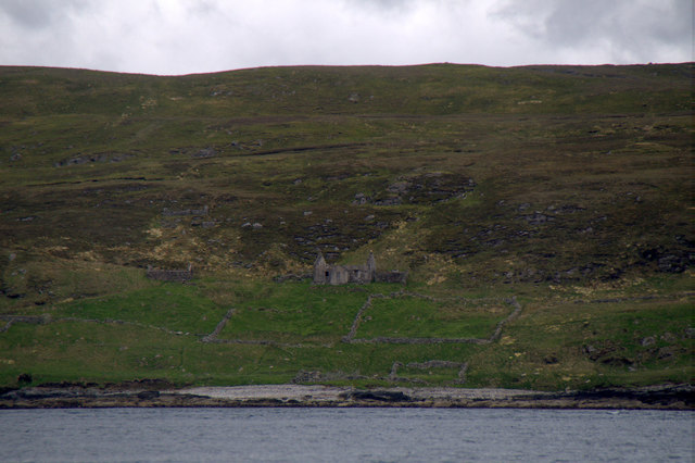
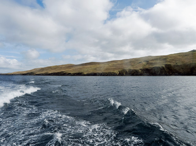
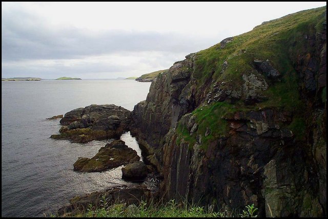
Lunning is a small township located in the Shetland Islands, which are part of Scotland. Situated on the mainland of Shetland, Lunning is a picturesque and tranquil place that offers breathtaking views of the surrounding landscapes.

The township is known for its rich history, with evidence of human activity dating back thousands of years. Archaeological sites within the vicinity of Lunning have revealed ancient structures and artifacts, providing insights into the lives of the early settlers in this region.

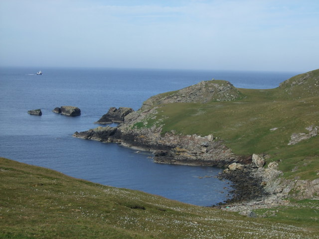
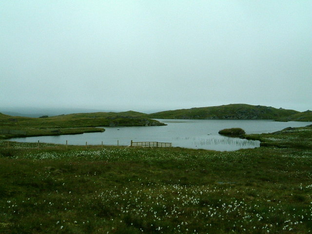
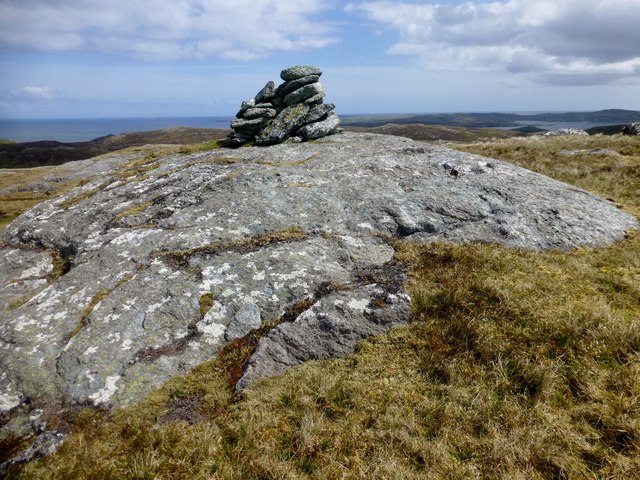
Lunning is blessed with natural beauty, as it is nestled between rolling hills and the rugged coastline of the North Sea. The landscape is characterized by dramatic cliffs, sandy beaches, and lush green fields. This makes it an ideal destination for nature enthusiasts and outdoor adventurers.

The township itself is small, with a tight-knit community that is known for its friendly and welcoming nature. Lunning is home to a few local amenities, including a small convenience store and a community center, which serves as a hub for social gatherings and events.

Visitors to Lunning can partake in a range of activities, such as hiking along the coastal trails, birdwatching, or simply enjoying the serenity of the surroundings. The area is also known for its diverse wildlife, with opportunities to spot seals, otters, and various bird species.

Overall, Lunning is a hidden gem within the Shetland Islands, offering a peaceful retreat in the midst of stunning natural landscapes and a warm community spirit.

If you have any feedback on the listing, please let us know in the comments section below.

Lunning Images

Images are sourced within 2km of 60.380583/-1.087837 or Grid Reference HU5066. Thanks to Geograph Open Source API. All images are credited.

Bonidale, Lunning, from Lunning Sound
Orra Wick Looking down on Orra Wick with the Whalsay ferry making her way in the background.
Orra Wick
Looking down on Orra Wick with the Whalsay ferry making her way in the background.
Starns Water
Starns Water
Hill of Gardin Parked near two burned out cars and a trailer before a quick ascent of this HuMP after a morning on Whalsay.
Name: Hill of Gardin
Hill number: 4916
Height: 140m / 459ft
Area: 22: Shetland Islands
Class: Hu
Grid ref: HU492653 (est)
Drop: 123m
Col: 17m  HU469641
Hill of Gardin
Parked near two burned out cars and a trailer before a quick ascent of this HuMP after a morning on Whalsay. Name: Hill of Gardin Hill number: 4916 Height: 140m / 459ft Area: 22: Shetland Islands Class: Hu Grid ref: HU492653 (est) Drop: 123m Col: 17m HU469641
Two Burnt Out Cars Parked by the cattle grid opposite these two burnt out cars and a trailer before quickly climbing the HuMP called Hill of Gardin.
Two Burnt Out Cars
Parked by the cattle grid opposite these two burnt out cars and a trailer before quickly climbing the HuMP called Hill of Gardin.
Bench Vird Bagged with Tricky Speirs after our Out Skerries trip.  Summit is large rock in the back middle of picture.
Name: Bench Vird
Hill number: 103859
Height: 128m / 420ft
Area: 22: Shetland Islands
Class: 1
Grid ref: HU495664 (est)
Drop: 30m
Col: 98m
Bench Vird
Bagged with Tricky Speirs after our Out Skerries trip. Summit is large rock in the back middle of picture. Name: Bench Vird Hill number: 103859 Height: 128m / 420ft Area: 22: Shetland Islands Class: 1 Grid ref: HU495664 (est) Drop: 30m Col: 98m
East side of Vidlin Voe Calm water after the open sea from Out Skerries towards the Mainland of Shetland.
East side of Vidlin Voe
Calm water after the open sea from Out Skerries towards the Mainland of Shetland.
Kirkabister on Vidlin Voe The croft's fields provide a good contrast the brown of the hillside.
Kirkabister on Vidlin Voe
The croft's fields provide a good contrast the brown of the hillside.
Fertile land and modern houses at Vidlin, Shetland On the final approach to the Vidlin ferry terminal on the Out Skerries ferry Filla.
Fertile land and modern houses at Vidlin, Shetland
On the final approach to the Vidlin ferry terminal on the Out Skerries ferry Filla.
Lunning Ruined crofthouse being taken over by Rosebay Willowherb.
Lunning
Ruined crofthouse being taken over by Rosebay Willowherb.
Mirka Water Mirka Water, Lunnasting, remote hill loch with spectacular views from surrounding hills. Mirka meaning dark water.
Mirka Water
Mirka Water, Lunnasting, remote hill loch with spectacular views from surrounding hills. Mirka meaning dark water.
Brei Water Bonidale Brei Water, Bonidale, Lunnasting, remote hill loch.
Brei Water Bonidale
Brei Water, Bonidale, Lunnasting, remote hill loch.
Lunning Cliffs Cliffs at Lunning point below trig point
Lunning Cliffs
Cliffs at Lunning point below trig point
Lunning Head Trig Point Triangulation point 10545 at Lunning Head
Lunning Head Trig Point
Triangulation point 10545 at Lunning Head
Cliff Face Cliffs just below Swevers Taing
Cliff Face
Cliffs just below Swevers Taing
Cliff Face Cliffs looking to the south
Cliff Face
Cliffs looking to the south
Cleva Water, Lunnasting. View east with the island of Whalsay in the distance.
Cleva Water, Lunnasting.
View east with the island of Whalsay in the distance.
Lunning, Vidlin
Lunning, Vidlin
Show me another place!

Lunning is located at Grid Ref: HU5066 (Lat: 60.380583, Lng: -1.087837)

Unitary Authority: Shetland Islands

Police Authority: Highlands and Islands

What 3 Words

///under.radiating.hillsides. Near Vidlin, Shetland Islands

Related Wikis

Little Linga

Little Linga is a small island in the Shetland Islands. It is near West Linga and Vidlin on Mainland, Shetland. It is 20 metres (66 ft) at its highest...

Vidlin

Vidlin (from Old Norse: VaĆ°ill meaning a ford) is a small village located on Mainland, Shetland, Scotland. The settlement is within the parish of Nesting...

Lunna House

Lunna House is a 17th-century laird's house on Lunna Ness in the Shetland Islands. Lunna House is noted for having "the best historic designed landscape...

West Linga

West Linga is an uninhabited island located between Mainland and Whalsay in Shetland, Scotland. == Geography and geology == West Linga is a long narrow...

Linga Sound, Shetland

Linga Sound is the strait between the islands of Whalsay and West Linga in the Shetland islands of Scotland. The sound has a depth of 11 to 12 fathoms...

Skate of Marrister

The Skate of Marrister is a flat ledge that extends about 300 yards (270 m) from the western shore of Whalsay, in the Shetland islands of Scotland. It...

Marrister

Marrister is a settlement on the west coast of Whalsay in the parish of Nesting in the Shetland islands of Scotland. It looks across Linga Sound to the...

Lunna Ness

Lunna Ness is a peninsula in the north east of Mainland, Shetland, Scotland , in the parish of Lunnasting near Vidlin. The island of Lunna Holm is nearby...

Nearby Amenities

Located within 500m of 60.380583,-1.087837
Lunning
Name Sco: Lunnin
Place: hamlet
Lat/Long: 60.3815984/-1.0846701
Barrier: cattle_grid
Lat/Long: 60.3805943/-1.0882769
Barrier: cattle_grid
Lat/Long: 60.3807189/-1.0856806
Power: pole
Lat/Long: 60.379326/-1.0962451
Power: pole
Lat/Long: 60.3796358/-1.0950969
Power: pole
Lat/Long: 60.3795729/-1.0939634
Power: pole
Lat/Long: 60.3795075/-1.0923794
Power: pole
Lat/Long: 60.3800617/-1.091596
Power: pole
Lat/Long: 60.380582/-1.0908762
Power: pole
Lat/Long: 60.3811447/-1.0900756
Power: pole
Lat/Long: 60.3815984/-1.0894171
Power: pole
Lat/Long: 60.3821223/-1.0886875
Power: pole
Lat/Long: 60.3821574/-1.0878453
Power: pole
Lat/Long: 60.3822094/-1.0867363
Power: pole
Lat/Long: 60.3822554/-1.0857203
Power: pole
Lat/Long: 60.382305/-1.0844154
Power: pole
Lat/Long: 60.3815561/-1.087767
Power: pole
Lat/Long: 60.3826873/-1.0919583
Power: pole
Lat/Long: 60.3824962/-1.0908664
Power: pole
Lat/Long: 60.382305/-1.0897207
The data included in this document is from www.openstreetmap.org. The data is made available under ODbL.

Have you been to Lunning?

Leave your review of Lunning below (or comments, questions and feedback).