Sgeirean Buidhe

Island in Argyllshire

Scotland

Sgeirean Buidhe

Low hill on rough grazing from path to American Monument A path runs from the RSPB reserve at The Oa to the American Monument passing the low hill at the centre of the image on its south side.
Low hill on rough grazing from path to American Monument Credit: Trevor Littlewood

Sgeirean Buidhe is a small island located off the west coast of Scotland in Argyllshire. It is situated in the Inner Hebrides, approximately 5 kilometers northwest of the Isle of Mull. With a total area of around 1.5 hectares, Sgeirean Buidhe is a rocky and uninhabited island.

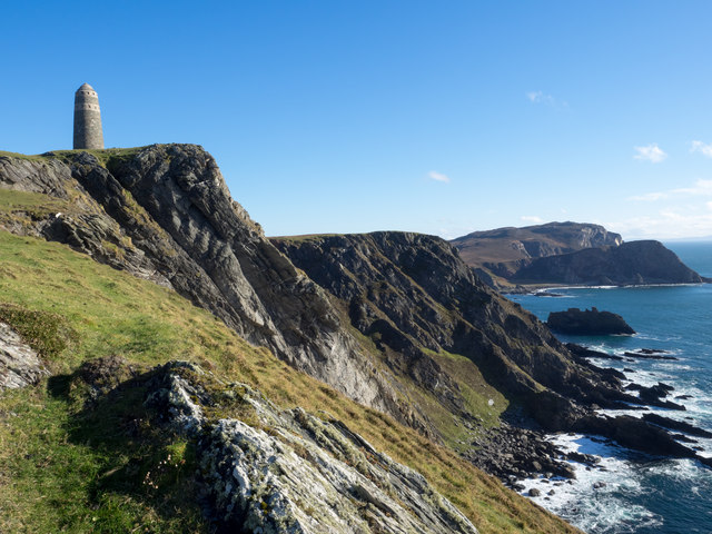
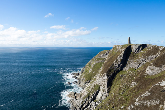
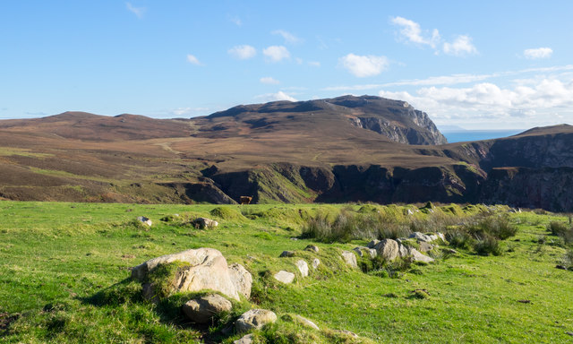
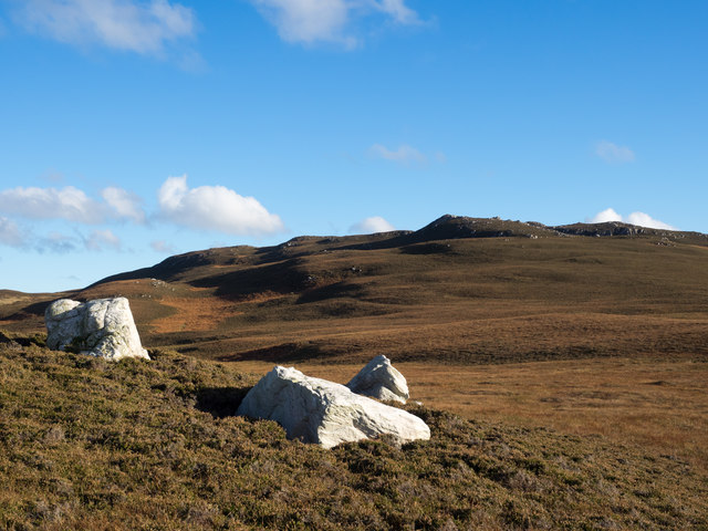
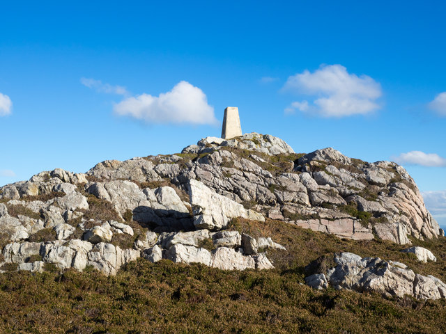
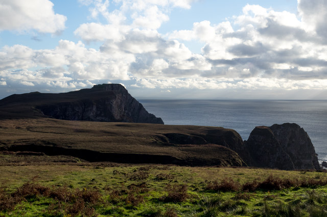
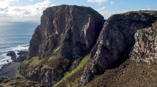
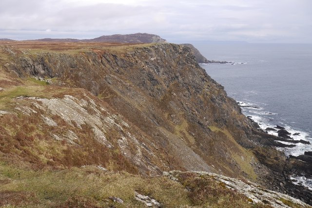
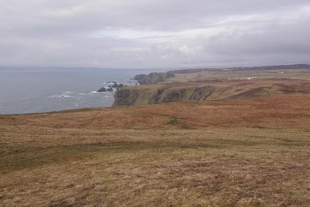
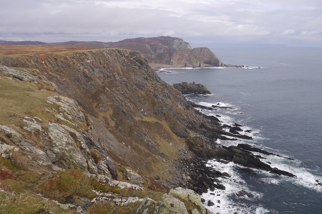
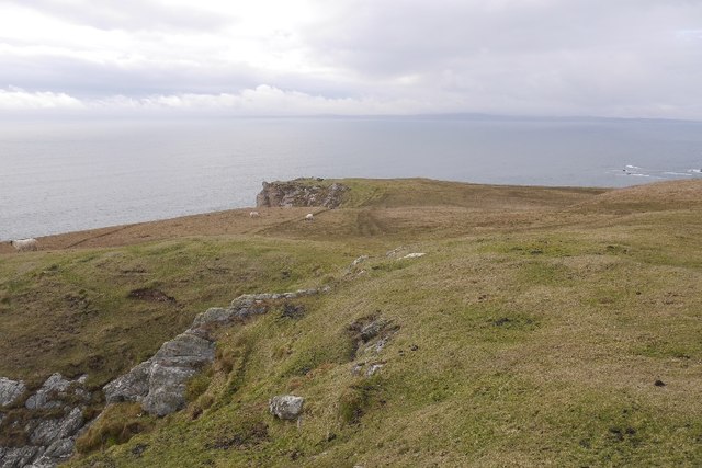
The island is characterized by its rugged terrain, consisting of cliffs and rocky outcrops. Its name, Sgeirean Buidhe, translates to "yellow skerries" in English, which refers to the yellowish color of the rock formations found on the island. These skerries provide nesting sites for various seabird species, including guillemots, razorbills, and puffins.

Access to Sgeirean Buidhe is limited due to its remote location and lack of infrastructure. The island is not open to visitors, as it is a designated nature reserve managed by the Scottish Wildlife Trust. The surrounding waters of the island are also protected, as they are part of a Special Area of Conservation, supporting a diverse range of marine life.

Sgeirean Buidhe is an important site for scientific research and conservation efforts. It offers a unique habitat for various plant species and provides a breeding ground for seabirds. The island's isolation and undisturbed nature make it an ideal location for studying ecological processes and monitoring wildlife populations.

In summary, Sgeirean Buidhe is a small, rocky island off the coast of Argyllshire, Scotland. It is known for its unique rock formations, seabird colonies, and protected nature reserve status.

If you have any feedback on the listing, please let us know in the comments section below.

Sgeirean Buidhe Images

Images are sourced within 2km of 55.58164/-6.3135886 or Grid Reference NR2840. Thanks to Geograph Open Source API. All images are credited.

Low hill on rough grazing from path to American Monument A path runs from the RSPB reserve at The Oa to the American Monument passing the low hill at the centre of the image on its south side.
Low hill on rough grazing from path to American Monument
A path runs from the RSPB reserve at The Oa to the American Monument passing the low hill at the centre of the image on its south side.
Rocks on ridge rising from Mull of Oa Beyond the foreground rock rib the ridge continues to rise to reach the American Monument, raised by the American Red Cross to the memory of those lost in two WWI shipwrecks. The distant high point is Beinn Mhòr.
Rocks on ridge rising from Mull of Oa
Beyond the foreground rock rib the ridge continues to rise to reach the American Monument, raised by the American Red Cross to the memory of those lost in two WWI shipwrecks. The distant high point is Beinn Mhòr.
The 'American Monument' The American Monument at the Mull of Oa was raised by the American Red Cross as a memorial to troops lost when in WWI two ships, The Otranto and The Tuscania separately, were lost.
The 'American Monument'
The American Monument at the Mull of Oa was raised by the American Red Cross as a memorial to troops lost when in WWI two ships, The Otranto and The Tuscania separately, were lost.
Lines of boulders on the Mull of Oa The boulder lines are indicated on OS maps, suggestive of walls but they're clearly not there as such now; perhaps they never were. If that's so it's hard to explain why effort would have been expended in their creation.
Lines of boulders on the Mull of Oa
The boulder lines are indicated on OS maps, suggestive of walls but they're clearly not there as such now; perhaps they never were. If that's so it's hard to explain why effort would have been expended in their creation.
Three white rocks on heather The rocks are on heather moorland north-west of Beinn Mhòr which is the distant hill.
Three white rocks on heather
The rocks are on heather moorland north-west of Beinn Mhòr which is the distant hill.
Trig point atop rock plinth The triangulation column is at the summit of Beinn Mhòr on The Oa peninsula, of Islay.
Trig point atop rock plinth
The triangulation column is at the summit of Beinn Mhòr on The Oa peninsula, of Islay.
Heather moorland beyond bracken Beyond the heather lies Beinn Mhòr and Dùn Athad is to the right of the notch against the sea.
Heather moorland beyond bracken
Beyond the heather lies Beinn Mhòr and Dùn Athad is to the right of the notch against the sea.
East face of Dùn Athad Dùn Athad is a striking feature of the south coast of The Oa.
It's attached to the bulk of the peninsula by a narrow neck of land which is possible, with care, to cross safely so to reach the summit; there's not the vertical rock step that might be suspected from the image.
East face of Dùn Athad
Dùn Athad is a striking feature of the south coast of The Oa. It's attached to the bulk of the peninsula by a narrow neck of land which is possible, with care, to cross safely so to reach the summit; there's not the vertical rock step that might be suspected from the image.
Old field boundary Grassed over dyke, Upper Killeyan.
Old field boundary
Grassed over dyke, Upper Killeyan.
Wetland, Upper Killeyan Beside the path to the American Monument.
Wetland, Upper Killeyan
Beside the path to the American Monument.
Path from the American Monument A waymarked path on the Mull of Oa.
Path from the American Monument
A waymarked path on the Mull of Oa.
Path to the American Monument The wet path at the Mull of Oa is being upgraded but there are still some very wet bits.
Path to the American Monument
The wet path at the Mull of Oa is being upgraded but there are still some very wet bits.
Tollacha Gleadhran Sea cliffs on the south side of  the Mull of Oa.
Tollacha Gleadhran
Sea cliffs on the south side of the Mull of Oa.
Coastal heath, Mull of Oa The west side of the Mull of Oa.
Coastal heath, Mull of Oa
The west side of the Mull of Oa.
Mull of Oa triangulation pillar Good viewpoint for the north coast of Ireland and Kintyre.
Mull of Oa triangulation pillar
Good viewpoint for the north coast of Ireland and Kintyre.
The American Monument, Mull of Oa The American Monument is on the tip of the Mull of Oa at the extreme southwest of the island of Islay. It commemorates the loss of two troop ships, The Tuscania and The Otranto in 1918. 
It actually overlooks the spot where the former of these sank on 5th February 1918 having been torpedoed by the German U-boat UB-77 while carrying American troops to Europe. She sank with the loss of 210 lives. 
The second tragedy struck eight months later, on 6th October, very near the end of WWI - when another troop ship the HMS Otranto collided with HMS Kashmir. This incident was even more costly in human lives, with the loss of 431 comprising 351 US servicemen and 80 British crew.
The monument was erected in 1920 by the American Red Cross to commemorate these disasters and the souls who perished. It was designed by the architect Robert Walker and stands about 20m (65') tall perched on cliffs that rise 132m (433') above the sea. (The nearby trig pillar being recorded as at 131m) It resembles a lighthouse but has two bands of lighter coloured stones near its domed top. These bands have regular blank window-like niches around them. There is a large plaque set into the base of the monument on the landward side and above it is the head and wings of an American Eagle clutching a wreath in its talons.
The plaque reads:
Sacred to the Immortal Memory of those American Soldiers and Sailors who gave their lives for their country in the Wrecks of the Transports "Tuscania" and "Otranto" --- February 5th 1918 *** October 6th 1918
This Monument was Erected by The American Red Cross near to the spot where so many of The Victims of The Disasters Sleep in Everlasting Peace
.... (in italics there follows this verse) ....
On Fame's Eternal camping ground
Their silent tents are spread
While Glory keeps with solemn round
The bivouac of the dead
-----------------------------------------
On the seaward side is another smaller plaque encircled by a wreath - this reads:
A Tribute from Woodrow Wilson
President of
The United States of America
To the memory of his fellow citizens who gave their lives for their country in nearby waters
1918
The American Monument, Mull of Oa
The American Monument is on the tip of the Mull of Oa at the extreme southwest of the island of Islay. It commemorates the loss of two troop ships, The Tuscania and The Otranto in 1918. It actually overlooks the spot where the former of these sank on 5th February 1918 having been torpedoed by the German U-boat UB-77 while carrying American troops to Europe. She sank with the loss of 210 lives. The second tragedy struck eight months later, on 6th October, very near the end of WWI - when another troop ship the HMS Otranto collided with HMS Kashmir. This incident was even more costly in human lives, with the loss of 431 comprising 351 US servicemen and 80 British crew. The monument was erected in 1920 by the American Red Cross to commemorate these disasters and the souls who perished. It was designed by the architect Robert Walker and stands about 20m (65') tall perched on cliffs that rise 132m (433') above the sea. (The nearby trig pillar being recorded as at 131m) It resembles a lighthouse but has two bands of lighter coloured stones near its domed top. These bands have regular blank window-like niches around them. There is a large plaque set into the base of the monument on the landward side and above it is the head and wings of an American Eagle clutching a wreath in its talons. The plaque reads: Sacred to the Immortal Memory of those American Soldiers and Sailors who gave their lives for their country in the Wrecks of the Transports "Tuscania" and "Otranto" --- February 5th 1918 *** October 6th 1918 This Monument was Erected by The American Red Cross near to the spot where so many of The Victims of The Disasters Sleep in Everlasting Peace .... (in italics there follows this verse) .... On Fame's Eternal camping ground Their silent tents are spread While Glory keeps with solemn round The bivouac of the dead ----------------------------------------- On the seaward side is another smaller plaque encircled by a wreath - this reads: A Tribute from Woodrow Wilson President of The United States of America To the memory of his fellow citizens who gave their lives for their country in nearby waters 1918
The south side of the Mull of Oa View along the coast towards Beinn Mhòr from near the American Monument.
The south side of the Mull of Oa
View along the coast towards Beinn Mhòr from near the American Monument.
Coastal heath, Mull of Oa The west side of the headland with a view  towards the Rhinos.
Coastal heath, Mull of Oa
The west side of the headland with a view towards the Rhinos.
Show me another place!

Sgeirean Buidhe is located at Grid Ref: NR2840 (Lat: 55.58164, Lng: -6.3135886)

Unitary Authority: Argyll and Bute

Police Authority: Argyll and West Dunbartonshire

What 3 Words

///fuses.oath.airbag. Near Port Ellen, Argyll & Bute

Related Wikis

Eas Mòr, upper

Eas Mor is a waterfall is a waterfall on the Abhainn Ghil on the island of Islay in Scotland. It lies on The Oa peninsula south of Giol and west of Lenavore...

Eas Mòr, lower

Eas Mor (lower) is a waterfall on the Abhainn Ghil on the island of Islay, in Scotland. It lies on the west coast of The Oa peninsula north of Lower Killeyan...

The Oa

The Oa ( OH) (Scottish Gaelic: An Obha) is a rocky peninsula in the southwest of the island of Islay, in Argyll, Scotland. It is an RSPB nature reserve...

Port Ellen distillery

Port Ellen distillery is located in Port Ellen on the isle of Islay, Scotland. It initially operated between 1825 and 1983 when production shut down....

Nearby Amenities

Located within 500m of 55.58164,-6.3135886
Dun Athad
Ele: 108
Natural: peak
Lat/Long: 55.5847938/-6.3092065
The data included in this document is from www.openstreetmap.org. The data is made available under ODbL.

Have you been to Sgeirean Buidhe?

Leave your review of Sgeirean Buidhe below (or comments, questions and feedback).