Sgeir an Leum Bhig

Island in Inverness-shire

Scotland

Sgeir an Leum Bhig

Thamarasaigh A small island south of Scalpay (Harris).
Thamarasaigh Credit: John Allan

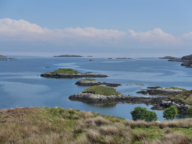
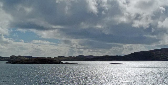
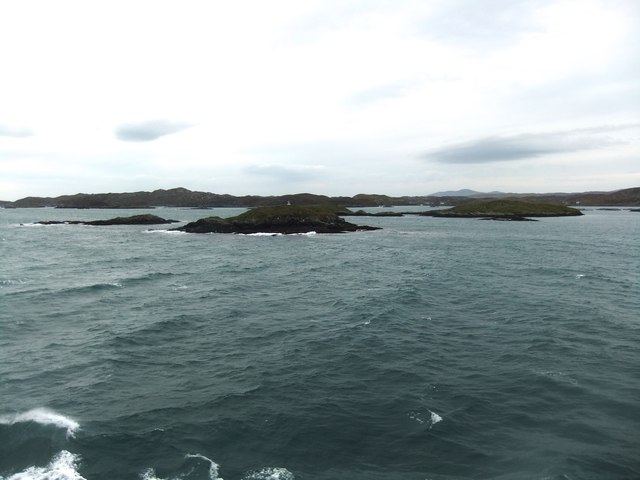
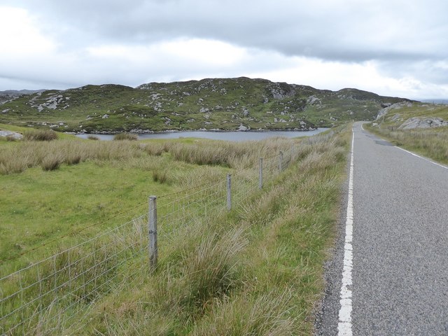
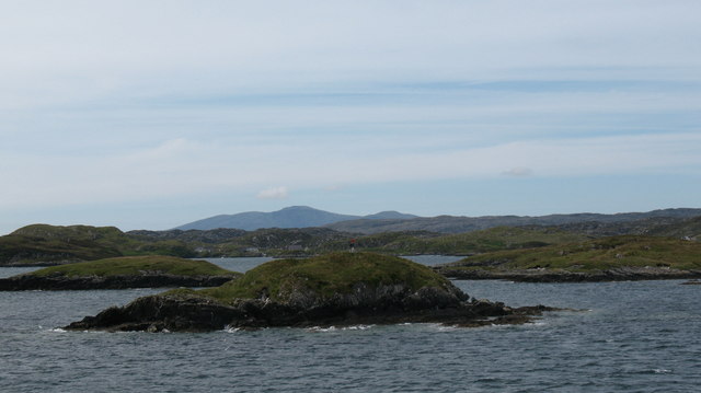
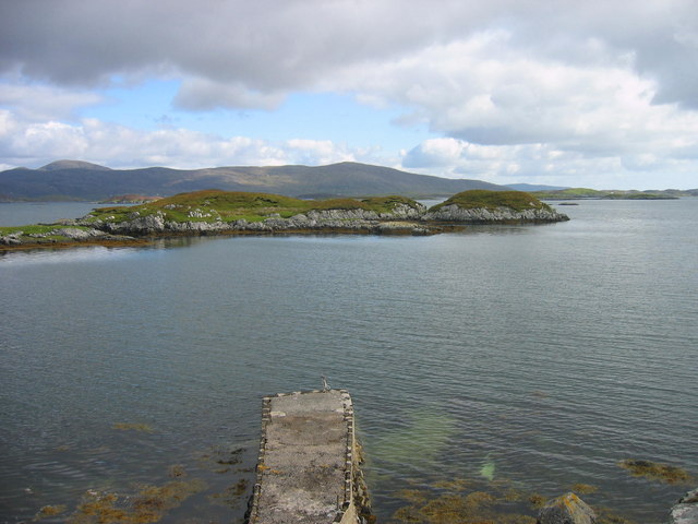
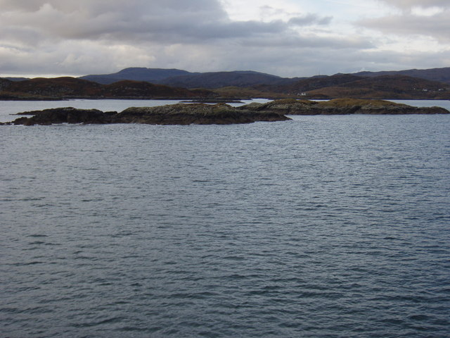
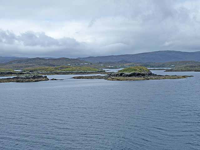
Sgeir an Leum Bhig is a small uninhabited island located off the coast of Inverness-shire, Scotland. With a size of approximately 0.4 hectares, it is one of the many islets that dot the rugged coastline of the region. The island is situated in the Inner Hebrides, near the entrance to Loch Hourn, and is accessible only by boat.

Sgeir an Leum Bhig is characterized by its rocky terrain, with steep cliffs rising from the sea on all sides. The island's name translates to "the small leaping skerry" in English, which reflects the abundance of marine life found in the surrounding waters. Seabirds, including gulls and fulmars, can often be seen nesting on the cliffs, and seals are known to frequent the area.

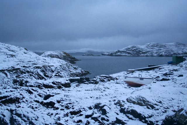
Due to its remote location and lack of amenities, Sgeir an Leum Bhig is primarily visited by wildlife enthusiasts, birdwatchers, and those seeking solitude in nature. The island offers a peaceful and pristine environment, providing a unique opportunity to escape the hustle and bustle of everyday life.

Visitors to Sgeir an Leum Bhig should be aware that there are no facilities or accommodations on the island. Therefore, it is advisable to bring any necessary supplies and plan for a day trip. Additionally, as the island is uninhabited, it is important to leave no trace and respect the natural environment when visiting.

If you have any feedback on the listing, please let us know in the comments section below.

Sgeir an Leum Bhig Images

Images are sourced within 2km of 57.844751/-6.7284604 or Grid Reference NG1993. Thanks to Geograph Open Source API. All images are credited.

Thamarasaigh A small island south of Scalpay (Harris).
Thamarasaigh
A small island south of Scalpay (Harris).
Islands and skerries off Drinishader Not quite a painted ship on a painted ocean, but close;  there is a fishing boat dead-centre in this image.
Islands and skerries off Drinishader
Not quite a painted ship on a painted ocean, but close; there is a fishing boat dead-centre in this image.
Gloraig Dhubh, Loch an Tairbeairt, Harris The northern (right hand) tip of Gloraig Dhubh, the larger skerry, and the whole of the smaller skerry lie within the grid square.
Gloraig Dhubh, Loch an Tairbeairt, Harris
The northern (right hand) tip of Gloraig Dhubh, the larger skerry, and the whole of the smaller skerry lie within the grid square.
Dun Corr Mor
Dun Corr Mor
Cattle grid on the Golden Road
Minor road approaching Plocrapool
Dun Corr Mor The islet of Dun Corr Mor with the navigation beacon on the top.
Dun Corr Mor
The islet of Dun Corr Mor with the navigation beacon on the top.
Plocrapol, Harris Tweed weaving
Plocrapol Bay
Plocrapol Bay
Sgeir an Leum Mhòir A host of skerries are off the coast of Harris.
Sgeir an Leum Mhòir
A host of skerries are off the coast of Harris.
Snow at Plocrapol Snow very rarely settles in Harris, due to the warm Atlantic. This view of Plocrapol Bay is therefore most unusual.
Snow at Plocrapol
Snow very rarely settles in Harris, due to the warm Atlantic. This view of Plocrapol Bay is therefore most unusual.
Loch Plocropol, Plocropol, & Plocropol Bay Calmac ferry "Clansman" heading down East Loch Tarbert to Uig (Skye).
Loch Plocropol, Plocropol, & Plocropol Bay
Calmac ferry "Clansman" heading down East Loch Tarbert to Uig (Skye).
The slopes of Cleit a Bhraigh Looking over the gneiss landscape of South Harris, across the mouth of East Loch Tarbert towards Scalpay & Eilean Glas lighthouse.
The slopes of Cleit a Bhraigh
Looking over the gneiss landscape of South Harris, across the mouth of East Loch Tarbert towards Scalpay & Eilean Glas lighthouse.
Bràigh Mòr A buoy and a hint of a drying rock in the straight leading into Loch Tarbert.
Bràigh Mòr
A buoy and a hint of a drying rock in the straight leading into Loch Tarbert.
Dùn Corr Mòr and Gloraig a' Chaimbeulaich Dùn Corr Mòr is the nearby island with a beacon on its summit. The tip of Gloraig a' Chaimbeulaich is visible to the right.
Dùn Corr Mòr and Gloraig a' Chaimbeulaich
Dùn Corr Mòr is the nearby island with a beacon on its summit. The tip of Gloraig a' Chaimbeulaich is visible to the right.
Sgeir an Leum Mhòir A group of skerries off the Bays coast of Harris.
Sgeir an Leum Mhòir
A group of skerries off the Bays coast of Harris.
Sgeir an Lèim Mhòir Detail of one of the many skerries in Loch an Tairbeart on the ferry approach.
Sgeir an Lèim Mhòir
Detail of one of the many skerries in Loch an Tairbeart on the ferry approach.
Dùn Corr Mòr Skerry in Loch an Tairbeart on the ferry approach with navigation beacon on top. The low rock to the left is Dùn Corr Beag. The island of Gloraig a'Chaimbeulaich lies behind with Gloraig Iosal <a href="https://www.geograph.org.uk/gridref/NG1894">NG1894</a> to the right.
Dùn Corr Mòr
Skerry in Loch an Tairbeart on the ferry approach with navigation beacon on top. The low rock to the left is Dùn Corr Beag. The island of Gloraig a'Chaimbeulaich lies behind with Gloraig Iosal NG1894 to the right.
Show me another place!

Sgeir an Leum Bhig is located at Grid Ref: NG1993 (Lat: 57.844751, Lng: -6.7284604)

Unitary Authority: Na h-Eileanan an Iar

Police Authority: Highlands and Islands

What 3 Words

///jars.admiral.preparing. Near Tarbert, Na h-Eileanan Siar

Related Wikis

East Loch Tarbert

East Loch Tarbert (Scottish Gaelic: Loch an Tairbeairt) is a sea loch that lies to the east of Harris in the Outer Hebrides of Scotland. The loch contains...

Scalpay, Outer Hebrides

Scalpay (; Scottish Gaelic: Sgalpaigh or Sgalpaigh na Hearadh; i.e. "Scalpay of Harris" to distinguish it from Scalpay off Skye) is an island in the Outer...

Sgeotasaigh

Scotasay (Scottish Gaelic: Sgeotasaigh) is small island in the Outer Hebrides of Scotland. It lies 1 kilometre (0.6 miles) off the east coast of Harris...

Eilean Glas, Scalpay

Eilean Glas is a peninsula of Scalpay in the Outer Hebrides, Scotland. Eilean Glas is home to a historic lighthouse. Eilean Glas means Grey/Green Island...

Nearby Amenities

Located within 500m of 57.844751,-6.7284604
Source: PGS
Lat/Long: 57.8453531/-6.7318916
Source: PGS
Lat/Long: 57.8456517/-6.7318841
Source: PGS
Lat/Long: 57.845748/-6.7319558
Source: PGS
Lat/Long: 57.8458248/-6.7319508
Source: PGS
Lat/Long: 57.8459162/-6.7319091
Source: PGS
Lat/Long: 57.8459231/-6.7315737
Source: PGS
Lat/Long: 57.8460581/-6.7316266
Source: PGS
Lat/Long: 57.8460776/-6.7313366
Source: PGS
Lat/Long: 57.8460178/-6.7311443
Source: PGS
Lat/Long: 57.8456347/-6.73073
Source: PGS
Lat/Long: 57.8453338/-6.7314007
Source: PGS
Lat/Long: 57.8445647/-6.7280846
Source: PGS
Lat/Long: 57.8445076/-6.7282064
Source: PGS
Lat/Long: 57.8444497/-6.7284124
Source: PGS
Lat/Long: 57.8444697/-6.7284901
Source: PGS
Lat/Long: 57.8447093/-6.728776
Source: PGS
Lat/Long: 57.8448053/-6.7290524
Source: PGS
Lat/Long: 57.8450002/-6.7289429
Source: PGS
Lat/Long: 57.8450568/-6.728586
Source: PGS
Lat/Long: 57.8449672/-6.7284528
Source: PGS
Lat/Long: 57.8449/-6.7280196
Source: PGS
Lat/Long: 57.8448461/-6.7278988
Source: PGS
Lat/Long: 57.8446787/-6.7278911
The data included in this document is from www.openstreetmap.org. The data is made available under ODbL.

Have you been to Sgeir an Leum Bhig?

Leave your review of Sgeir an Leum Bhig below (or comments, questions and feedback).