Sgeir a' Sruth

Island in Ross-shire

Scotland

Sgeir a' Sruth

Old hardstandings at Tob Blar Meadha Abandoned lobster loading hardstandings at the lobster pond.
Old hardstandings at Tob Blar Meadha Credit: Gus Macdonald

Sgeir a' Sruth is a small uninhabited island located off the coast of Ross-shire in the Scottish Highlands. Situated in the Inner Sound, between the mainland and the Isle of Skye, the island is part of the Inner Hebrides archipelago. Sgeir a' Sruth is characterized by its rugged and rocky landscape, with steep cliffs and a prominent sea stack known as "The Pinnacle."

Covering an area of approximately 5 hectares, the island is mostly composed of basalt and has been shaped by the forces of erosion over thousands of years. It is a haven for various species of seabirds, including puffins, razorbills, and guillemots, which nest on the cliffs and can be observed during the breeding season.

Access to Sgeir a' Sruth is challenging due to the absence of landing facilities and the strong currents surrounding the island. However, the island can be admired from boat trips or by using binoculars from the mainland. The nearby coastal village of Gairloch offers the best viewpoints to observe Sgeir a' Sruth.

The island's isolation and wild environment make it an ideal location for nature enthusiasts and birdwatchers. Its geological formations and the abundance of birdlife contribute to the unique charm of Sgeir a' Sruth, attracting visitors who seek tranquility and a connection with nature in the heart of the Scottish Highlands.

If you have any feedback on the listing, please let us know in the comments section below.

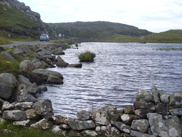
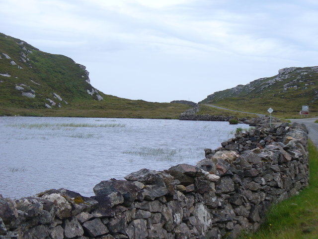
Sgeir a' Sruth Images

Images are sourced within 2km of 58.236736/-6.8377804 or Grid Reference NB1637. Thanks to Geograph Open Source API. All images are credited.

Old hardstandings at Tob Blar Meadha Abandoned lobster loading hardstandings at the lobster pond.
Old hardstandings at Tob Blar Meadha
Abandoned lobster loading hardstandings at the lobster pond.
Beach north of Bhalasaigh
Moorland and loch on Great Bernera The loch is unnamed on the map, but the Allt Loch an Fheoir flows into it, so this must be Loch an Fheoir.

The houses in the distance are on the road south of Bhalasaigh.
Moorland and loch on Great Bernera
The loch is unnamed on the map, but the Allt Loch an Fheoir flows into it, so this must be Loch an Fheoir. The houses in the distance are on the road south of Bhalasaigh.
Bridge at Bhalasaigh Looking back to the road end on the main island of Great Bernera.
Bridge at Bhalasaigh
Looking back to the road end on the main island of Great Bernera.
War Memorial, Breacleit The memorial stands on a mound at the crossroads in the centre of Breacleit / Breaclete, the capital of Great Bernera / Bearnaraigh. On the skyline is the Bernera Community Centre.
<span class="nowrap"><a title="http://www.uigandbernera.com/" rel="nofollow ugc noopener" href="http://www.uigandbernera.com/">Link</a><img style="margin-left:2px;" alt="External link" title="External link - shift click to open in new window" src="https://s1.geograph.org.uk/img/external.png" width="10" height="10"/></span>
War Memorial, Breacleit
The memorial stands on a mound at the crossroads in the centre of Breacleit / Breaclete, the capital of Great Bernera / Bearnaraigh. On the skyline is the Bernera Community Centre. LinkExternal link
Breacleit, Bernera Summer flowers, church and school in the village centre.
<span class="nowrap"><a title="http://www.uigandbernera.com/" rel="nofollow ugc noopener" href="http://www.uigandbernera.com/">Link</a><img style="margin-left:2px;" alt="External link" title="External link - shift click to open in new window" src="https://s1.geograph.org.uk/img/external.png" width="10" height="10"/></span>
Breacleit, Bernera
Summer flowers, church and school in the village centre. LinkExternal link
Loch Ionail Freshwater loch on the island of Great Bernera / Bearnaraigh.
<span class="nowrap"><a title="http://www.uigandbernera.com/" rel="nofollow ugc noopener" href="http://www.uigandbernera.com/">Link</a><img style="margin-left:2px;" alt="External link" title="External link - shift click to open in new window" src="https://s1.geograph.org.uk/img/external.png" width="10" height="10"/></span>
Loch Ionail
Freshwater loch on the island of Great Bernera / Bearnaraigh. LinkExternal link
Tob Bhalasaigh Tidal lagoon with a mix of rare seaweeds on Great Bernera / Bearnaraigh.
<span class="nowrap"><a title="http://www.uigandbernera.com/" rel="nofollow ugc noopener" href="http://www.uigandbernera.com/">Link</a><img style="margin-left:2px;" alt="External link" title="External link - shift click to open in new window" src="https://s1.geograph.org.uk/img/external.png" width="10" height="10"/></span>
Tob Bhalasaigh
Tidal lagoon with a mix of rare seaweeds on Great Bernera / Bearnaraigh. LinkExternal link
Valasay Bridge Carrying the single track road across an outlet of the tidal lagoon, Tob Bhalasaigh on Great Bernera / Bearnaraigh.
<span class="nowrap"><a title="http://www.uigandbernera.com/" rel="nofollow ugc noopener" href="http://www.uigandbernera.com/">Link</a><img style="margin-left:2px;" alt="External link" title="External link - shift click to open in new window" src="https://s1.geograph.org.uk/img/external.png" width="10" height="10"/></span>
Valasay Bridge
Carrying the single track road across an outlet of the tidal lagoon, Tob Bhalasaigh on Great Bernera / Bearnaraigh. LinkExternal link
Shoreline at Tob Bhalasaigh Rocks and heather at the edge of the tidal lagoon in Valasay.
<span class="nowrap"><a title="http://www.uigandbernera.com/" rel="nofollow ugc noopener" href="http://www.uigandbernera.com/">Link</a><img style="margin-left:2px;" alt="External link" title="External link - shift click to open in new window" src="https://s1.geograph.org.uk/img/external.png" width="10" height="10"/></span>
Shoreline at Tob Bhalasaigh
Rocks and heather at the edge of the tidal lagoon in Valasay. LinkExternal link
Valasay Footbridge The bridge across the tidal Tob Bhalasaigh was built in 1898.
<span class="nowrap"><a title="http://www.uigandbernera.com/" rel="nofollow ugc noopener" href="http://www.uigandbernera.com/">Link</a><img style="margin-left:2px;" alt="External link" title="External link - shift click to open in new window" src="https://s1.geograph.org.uk/img/external.png" width="10" height="10"/></span>
Valasay Footbridge
The bridge across the tidal Tob Bhalasaigh was built in 1898. LinkExternal link
Tidal Lagoon, Valasay Tob Bhalasaigh, on the island of Great Bernera / Bearnaraigh.
<span class="nowrap"><a title="http://www.uigandbernera.com/" rel="nofollow ugc noopener" href="http://www.uigandbernera.com/">Link</a><img style="margin-left:2px;" alt="External link" title="External link - shift click to open in new window" src="https://s1.geograph.org.uk/img/external.png" width="10" height="10"/></span>
Tidal Lagoon, Valasay
Tob Bhalasaigh, on the island of Great Bernera / Bearnaraigh. LinkExternal link
Tob Bhalasaigh from the Footbridge View northwards, along the narrow tidal lagoon, to Tobson 2 kilometres away in the distance.
Tob Bhalasaigh from the Footbridge
View northwards, along the narrow tidal lagoon, to Tobson 2 kilometres away in the distance.
Loch Geal Freshwater loch in the north of Great Bernera / Bearnaraigh.
<span class="nowrap"><a title="http://www.uigandbernera.com/" rel="nofollow ugc noopener" href="http://www.uigandbernera.com/">Link</a><img style="margin-left:2px;" alt="External link" title="External link - shift click to open in new window" src="https://s1.geograph.org.uk/img/external.png" width="10" height="10"/></span>
Loch Geal
Freshwater loch in the north of Great Bernera / Bearnaraigh. LinkExternal link
Loch Geal, South End A wall has been built at the end of this small freshwater loch on Great Bernera / Bearnaraigh.
<span class="nowrap"><a title="http://www.uigandbernera.com/" rel="nofollow ugc noopener" href="http://www.uigandbernera.com/">Link</a><img style="margin-left:2px;" alt="External link" title="External link - shift click to open in new window" src="https://s1.geograph.org.uk/img/external.png" width="10" height="10"/></span>
Loch Geal, South End
A wall has been built at the end of this small freshwater loch on Great Bernera / Bearnaraigh. LinkExternal link
Loch Tana Small freshwater loch on Great Bernera / Bearnaraigh with a single track road running alongside it.
<span class="nowrap"><a title="http://www.uigandbernera.com/" rel="nofollow ugc noopener" href="http://www.uigandbernera.com/">Link</a><img style="margin-left:2px;" alt="External link" title="External link - shift click to open in new window" src="https://s1.geograph.org.uk/img/external.png" width="10" height="10"/></span>
Loch Tana
Small freshwater loch on Great Bernera / Bearnaraigh with a single track road running alongside it. LinkExternal link
Loch Tana from the South Freshwater loch with drystane dyke and single track road, Great Bernera / Bearnaraigh.
<span class="nowrap"><a title="http://www.uigandbernera.com/" rel="nofollow ugc noopener" href="http://www.uigandbernera.com/">Link</a><img style="margin-left:2px;" alt="External link" title="External link - shift click to open in new window" src="https://s1.geograph.org.uk/img/external.png" width="10" height="10"/></span>
Loch Tana from the South
Freshwater loch with drystane dyke and single track road, Great Bernera / Bearnaraigh. LinkExternal link
Loch Ruig Sanndabhat Small and reedy freshwater loch below the slopes of Beinn Breacleit, Great Bernera / Bearnaraigh.
<span class="nowrap"><a title="http://www.uigandbernera.com/" rel="nofollow ugc noopener" href="http://www.uigandbernera.com/">Link</a><img style="margin-left:2px;" alt="External link" title="External link - shift click to open in new window" src="https://s1.geograph.org.uk/img/external.png" width="10" height="10"/></span>
Loch Ruig Sanndabhat
Small and reedy freshwater loch below the slopes of Beinn Breacleit, Great Bernera / Bearnaraigh. LinkExternal link
Show me another place!

Sgeir a' Sruth is located at Grid Ref: NB1637 (Lat: 58.236736, Lng: -6.8377804)

Unitary Authority: Na h-Eileanan an Iar

Police Authority: Highlands and Islands

What 3 Words

///conclude.kept.juggled. Near Carloway, Na h-Eileanan Siar

Related Wikis

Breaclete

Breacleit (or Roulanish; Scottish Gaelic: Breacleit; Old Norse: Breiðiklettr) is the central village on Great Bernera in the Outer Hebrides, Scotland....

Great Bernera

Great Bernera (; Scottish Gaelic: Beàrnaraigh Mòr), often known just as Bernera (Scottish Gaelic: Beàrnaraigh), is an island and community in the Outer...

Bernera Riot

The Bernera Riot occurred in 1874, on the island of Great Bernera, in Scotland in response to the Highland Clearances. The use of the term 'Bernera Riot...

Dun Bharabhat, Great Bernera

Dun Bharabhat (or Dun Baravat) is an Iron Age galleried dun or "semi-broch" situated on the island of Great Bernera near Lewis in Scotland (grid reference...

Nearby Amenities

Located within 500m of 58.236736,-6.8377804
Turning Circle
Lat/Long: 58.2349279/-6.8393062
Passing Place
Lat/Long: 58.2330748/-6.8385093
Power: pole
Lat/Long: 58.2342772/-6.8388952
Power: pole
Lat/Long: 58.2337057/-6.8388162
Power: pole
Lat/Long: 58.2332387/-6.8387485
Power: pole
Lat/Long: 58.2327397/-6.8385905
Power: pole
Lat/Long: 58.2323261/-6.83827
Power: pole
Lat/Long: 58.2327836/-6.838419
The data included in this document is from www.openstreetmap.org. The data is made available under ODbL.

Have you been to Sgeir a' Sruth?

Leave your review of Sgeir a' Sruth below (or comments, questions and feedback).