Sgeir na h-loladh

Island in Inverness-shire

Scotland

Sgeir na h-loladh

Wet view towards Leverburgh Looking north west down Gleann Shranndabhal on a very wet November morning.
Wet view towards Leverburgh Credit: Richard Dorrell

Sgeir na h-Loladh is a small uninhabited island located off the coast of Inverness-shire in the Scottish Highlands. The name translates to "island of the skulls" in Gaelic, which reflects the island's historical significance and intriguing past.

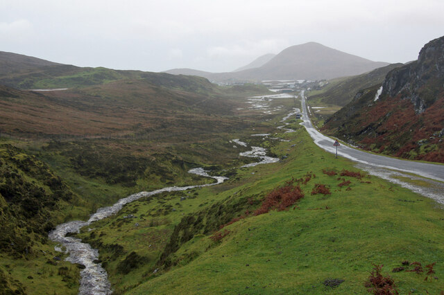
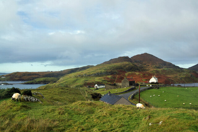
Situated in the Moray Firth, Sgeir na h-Loladh is a rocky outcrop that measures approximately 200 meters in length and 50 meters in width. The island is known for its rough and rugged terrain, with sheer cliffs rising from the sea and providing a dramatic backdrop. It is primarily composed of basalt and is home to various seabird colonies, including puffins, guillemots, and razorbills.

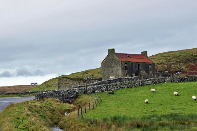
In terms of human history, Sgeir na h-Loladh has long been associated with fishing and maritime activities. It is believed that the island served as a lookout point for fishermen, who would set sail from nearby towns and villages. Over the years, many fishing boats have been wrecked in the treacherous waters surrounding the island, adding to its mystique.

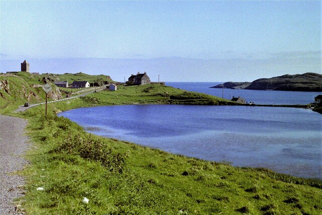
Today, Sgeir na h-Loladh is a popular destination for nature enthusiasts and birdwatchers. Access to the island is limited due to its remote location and rugged terrain. Visitors can admire the impressive cliffs and observe the diverse birdlife from a distance, but landing on the island is not recommended due to safety concerns.

In summary, Sgeir na h-Loladh is a small, uninhabited island off the coast of Inverness-shire known for its rugged beauty and historical significance. It offers a glimpse into Scotland's maritime heritage and provides a haven for various seabird colonies.

If you have any feedback on the listing, please let us know in the comments section below.

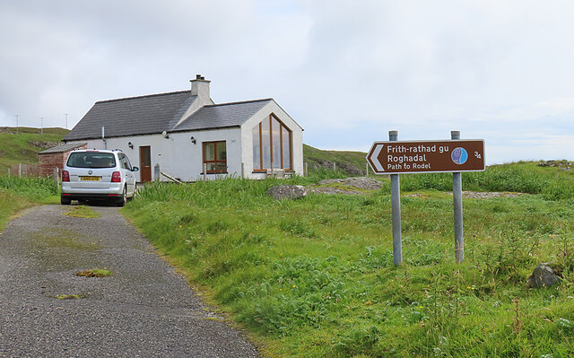
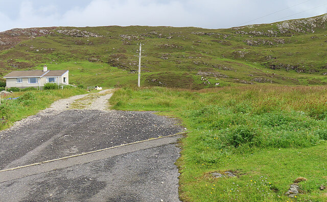
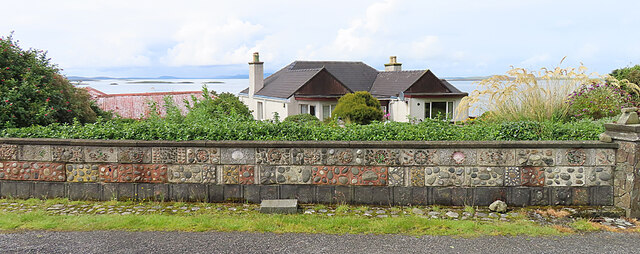
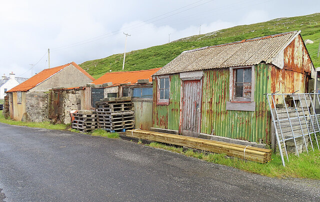
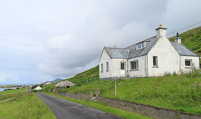
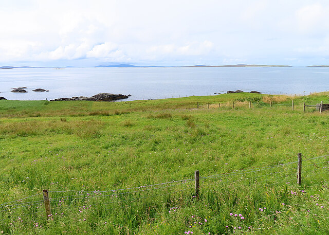
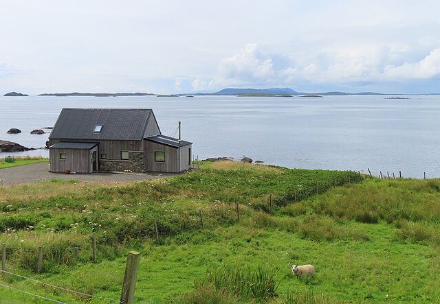
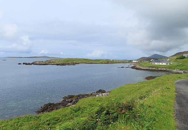
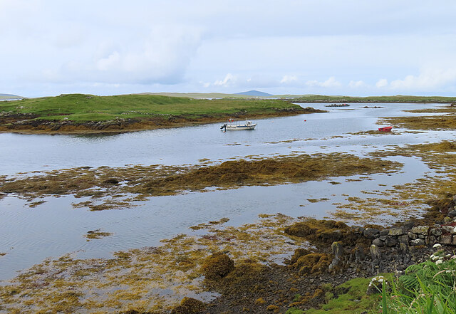
Sgeir na h-loladh Images

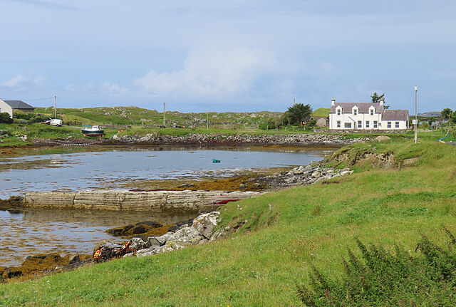
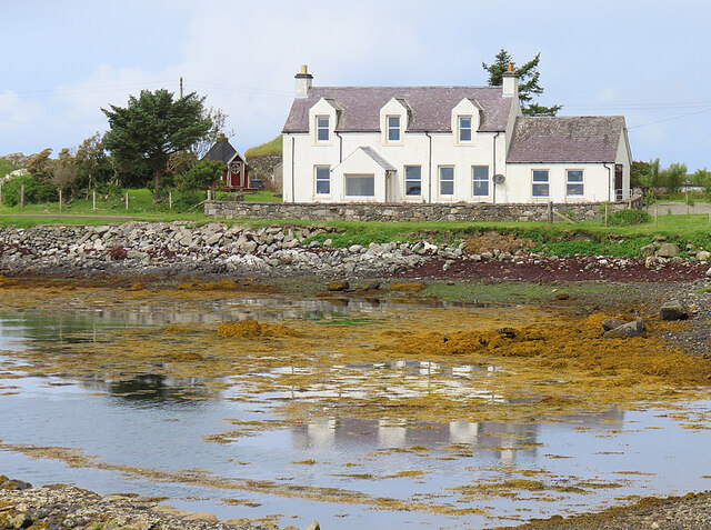
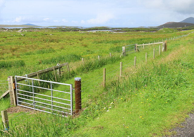
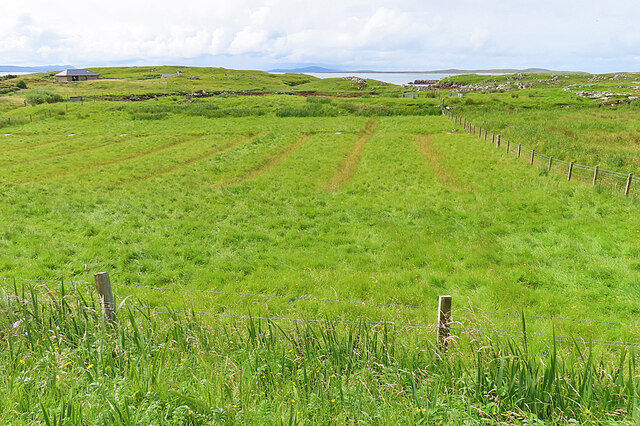
Images are sourced within 2km of 57.74668/-6.9956399 or Grid Reference NG0283. Thanks to Geograph Open Source API. All images are credited.

Wet view towards Leverburgh Looking north west down Gleann Shranndabhal on a very wet November morning.
Wet view towards Leverburgh
Looking north west down Gleann Shranndabhal on a very wet November morning.
Roghadal  Looking north west over the wall of the churchyard.
Roghadal
Looking north west over the wall of the churchyard.
Derelict building, Roghadal The building is Category B listed. There is a staircase on the front to a first floor door, while access to the ground floor is from the rear. Most recently in use for storage or as a byre, the presence of chimneys suggest that at least part of the building may at one time have been residential. 
See also: <a href="https://www.geograph.org.uk/photo/1349347">NG0483 : Derelict House at Roghadal</a>.
Derelict building, Roghadal
The building is Category B listed. There is a staircase on the front to a first floor door, while access to the ground floor is from the rear. Most recently in use for storage or as a byre, the presence of chimneys suggest that at least part of the building may at one time have been residential. See also: NG0483 : Derelict House at Roghadal.
Looking south towards Rodel, Harris, 1989
Signpost at Borghasdal The motorable road ends here, but a track allows pedestrians to carry on to Rogahadal (Rodel).
Signpost at Borghasdal
The motorable road ends here, but a track allows pedestrians to carry on to Rogahadal (Rodel).
Borghasdal A newish house stands alone beside the track to Roghadal.
Borghasdal
A newish house stands alone beside the track to Roghadal.
Garden Wall The dyke around the garden of this house at Borghasdal has been elaborately decorated with shells, pebbles and rock fragments.
Garden Wall
The dyke around the garden of this house at Borghasdal has been elaborately decorated with shells, pebbles and rock fragments.
Corrugated Iron Sheds Colourful if somewhat dilapidated. The closest one was the local Post Office for half a century. See <a href="https://www.geograph.org.uk/photo/5873968">NG0383 : Strond: the old post office</a>.
Corrugated Iron Sheds
Colourful if somewhat dilapidated. The closest one was the local Post Office for half a century. See NG0383 : Strond: the old post office.
House at Borghasdal Looking north-west along the road towards Srannda (Strond).
House at Borghasdal
Looking north-west along the road towards Srannda (Strond).
Srannda (Strond) Looking down over small rough fields to the sea, with a distant glimpse of Berneray and North Uist beyond.
Srannda (Strond)
Looking down over small rough fields to the sea, with a distant glimpse of Berneray and North Uist beyond.
Wooden House at Srannda Wooden houses are unusual in the Hebrides, but this one looks quite in harmony with its surroundings. In the distance is a glimpse of North Uist.
Wooden House at Srannda
Wooden houses are unusual in the Hebrides, but this one looks quite in harmony with its surroundings. In the distance is a glimpse of North Uist.
Cairminis (Carminish) Bagh Cairminis (Carminish Bay) is well sheltered by Eilean nan Bridianach, which is actually a peninsula rather than an island.
Cairminis (Carminish)
Bagh Cairminis (Carminish Bay) is well sheltered by Eilean nan Bridianach, which is actually a peninsula rather than an island.
Bàgh Chàirminis Carminish Bay is a sheltered tidal inlet, but too shallow to offer safe anchorage to more than a very small boat.
Bàgh Chàirminis
Carminish Bay is a sheltered tidal inlet, but too shallow to offer safe anchorage to more than a very small boat.
Reflections The house at the head of Bàgh Chàirminis (Carminish Bay) is reflected in the mirror-like water.
Reflections
The house at the head of Bàgh Chàirminis (Carminish Bay) is reflected in the mirror-like water.
Field Access It may be that the end of the access road here is sometimes used to pen livestock.
Field Access
It may be that the end of the access road here is sometimes used to pen livestock.
Old Lazybeds The parallel lines in this field are the remains of lazybeds. These are raised beds which are separated by ditches to assist in draining the land. They can be found all over the Hebrides, but few are still in regular cultivation.
Old Lazybeds
The parallel lines in this field are the remains of lazybeds. These are raised beds which are separated by ditches to assist in draining the land. They can be found all over the Hebrides, but few are still in regular cultivation.
Near Càirminis I think the nearest island is Eilean Chàirminis (Carminish Island).
Near Càirminis
I think the nearest island is Eilean Chàirminis (Carminish Island).
Grocis North Buoy The buoy is red, indicating that it is a port hand buoy, so of you are sailing in the direction of buoyage you leave it to your left as you pass. Beyond it is the beacon on Grocis Sgeir.
Grocis North Buoy
The buoy is red, indicating that it is a port hand buoy, so of you are sailing in the direction of buoyage you leave it to your left as you pass. Beyond it is the beacon on Grocis Sgeir.
Show me another place!

Sgeir na h-loladh is located at Grid Ref: NG0283 (Lat: 57.74668, Lng: -6.9956399)

Unitary Authority: Na h-Eileanan an Iar

Police Authority: Highlands and Islands

What 3 Words

///delight.lifelong.crossword. Near Leverburgh, Na h-Eileanan Siar

Nearby Locations

Sgeir na h-loladh Borriga

Related Wikis

Outer Hebrides

The Outer Hebrides ( HEB-rid-eez) or Western Isles (Scottish Gaelic: na h-Eileanan Siar [nə ˈhelanən ˈʃiəɾ] , na h-Eileanan an Iar [nə ˈhelanən əɲ ˈiəɾ...

Rodel

Rodel (Scottish Gaelic: Roghadal) is a village on the south-eastern coast of Harris, an island in the Scottish Outer Hebrides. Rodel is situated in the...

St Clement's Church, Rodel

St Clement's Church (Scottish Gaelic: Tùr Chliamhainn, meaning Clement's Tower) is a late fifteenth-century or early sixteenth-century church in Rodel...

Roineabhal

Roineabhal is a hill in Harris, in the Western Isles of Scotland. The granite on the summit plateau of the mountain is anorthosite, and is similar in composition...

Nearby Amenities

Located within 500m of 57.74668,-6.9956399
Srannda
Is In: An Hearach
Name En: Strond
Name Gd: Srannda
Place: village
Lat/Long: 57.7481797/-6.9932484
Bus Stop
Strond
Naptan AtcoCode: 6010731845
Naptan Bearing: NE
Naptan CommonName: Strond
Naptan Indicator: Strond
Naptan Landmark: Strond
Naptan NaptanCode: 94723596
Naptan Street: Strond
Naptan Verified: no
Source: naptan_import
Lat/Long: 57.7459731/-6.989063
Barrier: cattle_grid
Lat/Long: 57.7507351/-6.9968918
Barrier: cattle_grid
Lat/Long: 57.750363/-6.9976804
Material: wood
Power: pole
Lat/Long: 57.7509032/-6.9983159
Material: wood
Power: pole
Lat/Long: 57.7503364/-6.9970016
Material: wood
Power: pole
Lat/Long: 57.750365/-6.9973302
Material: wood
Power: pole
Lat/Long: 57.7497775/-6.9958644
Material: wood
Power: pole
Lat/Long: 57.7491942/-6.9947057
Material: wood
Power: pole
Lat/Long: 57.7486203/-6.9935631
Material: wood
Power: pole
Lat/Long: 57.7479647/-6.992281
Material: wood
Power: pole
Lat/Long: 57.7473922/-6.9911437
Material: wood
Power: pole
Lat/Long: 57.7472018/-6.990736
Material: wood
Power: pole
Lat/Long: 57.7468354/-6.9900172
Material: wood
Power: pole
Lat/Long: 57.7463745/-6.9889416
Material: wood
Power: pole
Lat/Long: 57.7458935/-6.9878151
Barrier: cattle_grid
Lat/Long: 57.7506634/-6.9981592
Passing Place
Lat/Long: 57.7494988/-6.9962279
Passing Place
Lat/Long: 57.7486542/-6.9947471
Passing Place
Lat/Long: 57.7483347/-6.9942999
Barrier: cattle_grid
Lat/Long: 57.7480474/-6.9936011
Barrier: cattle_grid
Lat/Long: 57.7479197/-6.9929865
Generator Method: wind_turbine
Generator Source: wind
Generator Type: horizontal_axis
Power: generator
Lat/Long: 57.7482823/-6.9885221
Generator Method: wind_turbine
Generator Source: wind
Generator Type: horizontal_axis
Power: generator
Lat/Long: 57.7485413/-6.9891283
Passing Place
Lat/Long: 57.7465177/-6.9902731
Passing Place
Lat/Long: 57.7459507/-6.9890466
Material: wood
Power: pole
Lat/Long: 57.7455535/-6.9877764
Material: wood
Power: pole
Lat/Long: 57.7460803/-6.9890209
Material: wood
Power: pole
Lat/Long: 57.7460935/-6.9895319
Power: pole
Lat/Long: 57.7472033/-6.9927421
Power: pole
Lat/Long: 57.7479144/-6.9928559
Power: pole
Lat/Long: 57.7480382/-6.9933023
Power: pole
Lat/Long: 57.7496788/-6.9961534
Power: pole
Lat/Long: 57.7496227/-6.9966069
Barrier: cattle_grid
Lat/Long: 57.7486472/-6.9948959
Power: pole
Lat/Long: 57.7506662/-6.9978818
The data included in this document is from www.openstreetmap.org. The data is made available under ODbL.

Have you been to Sgeir na h-loladh?

Leave your review of Sgeir na h-loladh below (or comments, questions and feedback).